
-
 692 Hits
-
 79.04% Score
-
 10 Votes
|
|
Route |
|---|---|
|
|
45.79397°N / 7.74632°E |
|
|
Mountaineering |
|
|
E |
|
|
Overview
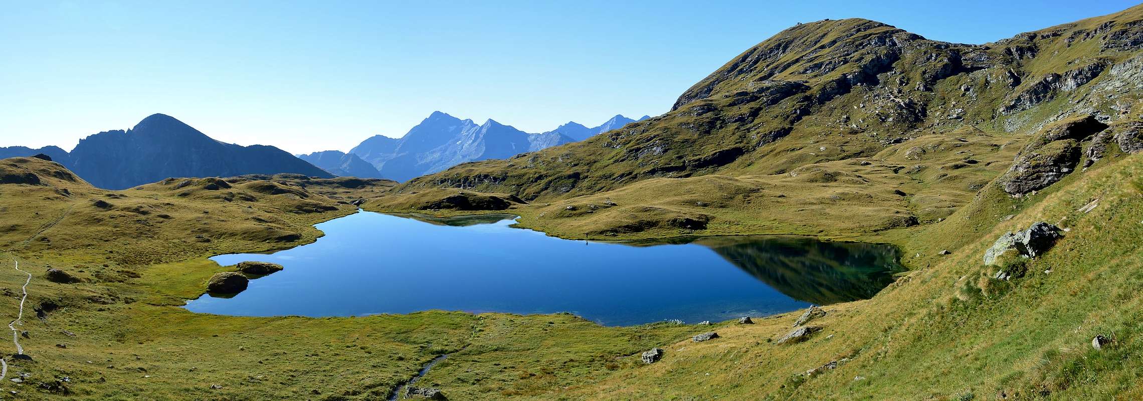
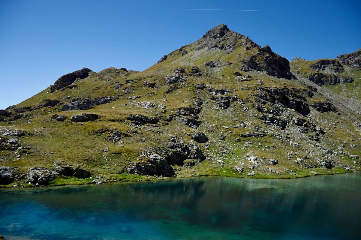
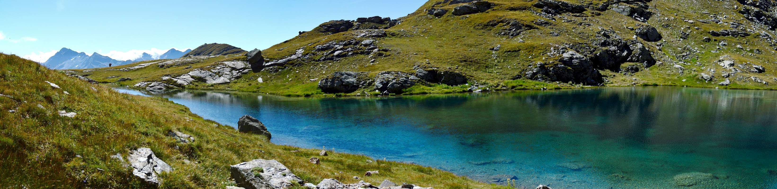
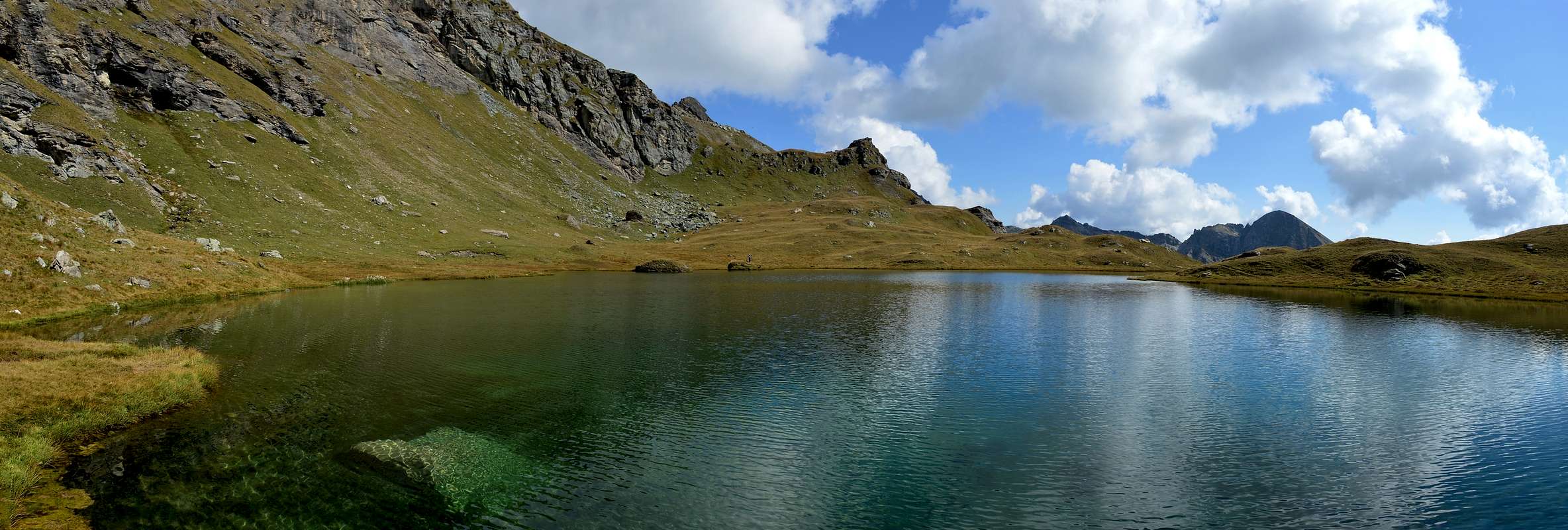
Also these two magnificent lakes located in the Ayas Valley, the Pocia located at (2.518m) on a plateau just above the two lakes Verde and that of the Battle, are undoubtedly worth visiting in particular the Long Lake (2.632m) which boasts clear waters of an intense blue color. From the lake you can enjoy a spectacular view of all the Battaglia lakes and the Ayas Valley below.
Anche questi due magnifici Laghi siti nella Valle d’Ayas, il Pocia posto a (2.518 m) su un pianoro appena al disopra dei due laghi Verde e quello della Battaglia, sono senza dubbio da visitare in particolare il Lago Lungo (2.632 m) che vanta delle limpidissime acque di una colorazione blu intenso. Dal lago si gode di un spettacolare panorama su tutti i laghi della Battaglia e sulla sottostante Valle d’Ayas.
Getting There
- From TORINO, MILANO, etc: Motorway A5. Exit at IVREA or Quincinetto (PIEDMONT).
- From IVREA Town: in West (Southern side) to Pont Saint Martin, Verrès Municipalities in East from Aosta Town. From Verrès to Val d'Ayas Valley From Verrès (549m), with Regional Road, to Challant Saint Victor (765m), Challant Saint Anselme (1.060m), Brusson (1.332m) Municipalities; wanting, continuing to Northwest toAntagnod-Ayas (1.709m) Commune, below Mounts Tantané and Zerbion also in North towards Champoluc (1.570m) and Saint Jacques (1.670m) Communes at the end of Evançon or Ayas Valley and under the Western side of Monte Rosa (Rollin Hump, Breithorns, Pollux and Castor).
- From Courmayeur Resort: in East-southeast to Aosta, Nus, Chatillon, Saint Vincent, Verrès Municipalities.
- From FRANCE: through the Mont Blanc Tunnel to Entrèves/Courmayeur. By Little Saint Bernard Pass, closed since November until half May to La Thuile Valley - Pré Saint Didier - Aosta - Verrès Municipalities. It is not necessary to take Motorway A5: you can drive on SS.26, in the direction of AOSTA - IVREA - TURIN.
Approach and Route
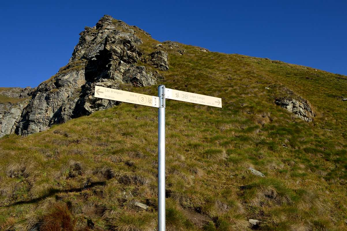
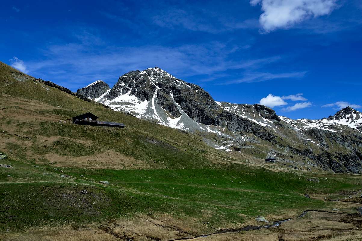
Approach from Vallone di Palasina: from the Village of Estoul (1.818 meters; large parking lot with various signposts) first towards the Northwest then North via the Regional Road; from the village, with direction to the north by means of the farm road concomitant with path n° 5, up to the Chavanne mountain pasture (2.107m), continue along the farm road to the junction that leads to the Arp Refuge (2.439m), hence the choice whether to go to the refuge or directly to the lakes, in this case continue on the left along the path that at times crosses the farm road n° 5, after a traverse you reach the Chavanne Alp (2.347m) from this point continue until you reach a new hut at (2.435m), after passing a short valley and a characteristic stone bridge, you reach Lago della Battaglia (2.487m) and after 0h'05, keeping to the east shore of the lake, the small Green Lake (2.488m) and after crossing a small wooden bridge, continue on path n° 3C for about 0h'10/0h'15 and you will be at lake Pocia (2.518m). From the lake continue on the same path which immediately becomes very steep, paying particular attention to any children, and after 0h'30/0h'35 you will reach Lago Lungo (2.632m). It is also possible to reach the lake from the Bringuez pass (2.661m).
Times: For the Battle Lake from the Estoul parking lot: 1h'50/2h'10. From Lake Battaglia to Lake Verde 0h'05, from Lake Verde to Lake Pocia 0h'10/0h'15, from Lake Pocia to Lake Lungo 0h'30/0h'35.
 |
 |
 |
 |
 |
Avvicinamento dal Vallone di Palasina: dal Villaggio di Estoul (1.818 metri; grande parcheggio con pannelli con segnalazioni varie) dapprima verso Nordovest poi Nord tramite la Strada Regionale; dal villaggio, con direzione a Settentrione per mezzo della poderale concomitante al sentiero n° 5, sino all’Alpeggio Chavanne (2.107 m), continuare lungo la strada poderale fino al bivio che porta al Rifugio Arp (2.439 m), da qui la scelta se andare al rifugio o direttamente ai laghi, in questo caso continuare sulla sinistra lungo il sentiero che a tratti attraversa la strada poderale n° 5, dopo un traverso si raggiuge l’Alpeggio Chavanne (2.347 m) da questo punto continuare fino a raggiungere una nuova baita a (2.435 m), superato un corto valloncello e un caratteristico ponte in pietra si raggiunge il Lago della Battaglia (2.487 m) e dopo 0h’05, tenendosi sulla sponda est del lago, il piccolo Lago Verde (2.488 m) e oltrepassato un piccolo ponte in legno si prosegue sul sentiero n° 3C per circa 0h’10/0h’15 e sarete al lago Pocia (2.518m). Da lago continuare sullo stesso sentiero che da subito diventa molto ripido, prestando particolare attenzione a eventuali bambini, e dopo atri 0h’30/0h’35 raggiungerete il Lago Lungo (2.632 m). E’ anche possibile raggiungere il lago dal colle di Bringuez (2.661 m).
Tempi: Per il Lago Battaglia dal parcheggio di Estoul 1h’50/2h’10. Dal Lago Battaglia al Lago Verde 0h’05, dal Lago Verde al Lago Pocia 0h’10/0h’15, dal Lago Pocia al Lago Lungo 0h’30/0h’35.
 |
Difficulty
The route can be classified as E.
L'itinerario è classificato E.
Equipment
For Hikings.
Da Escursionismo.
 |
External Links
- REGIONE AUTONOMA VALLE D'AOSTA the official site.
- FONDAZIONE MONTAGNA SICURA Villa Cameron, località Villard de la Palud n° 1 Courmayeur (AO) Tel: 39 0165 897602 - Fax: 39 0165 897647.
- A.I.NE.VA. (Associazione Interregionale Neve e Valanghe).
Useful Numbers
- Protezione Civile Valdostana località Aeroporto n° 7/A Saint Christophe (Ao) Tel. 0165-238222.
- Bollettino Meteo (weather info) Tel. 0165-44113.
- Unità Operativa di Soccorso Sanitario Tel. 118.
 |