
-
 1664 Hits
-
 81.18% Score
-
 13 Votes
|
|
Route |
|---|---|
|
|
45.90697°N / 7.35164°E |
|
|
Hiking |
|
|
Spring, Summer |
|
|
F |
|
|
Overview
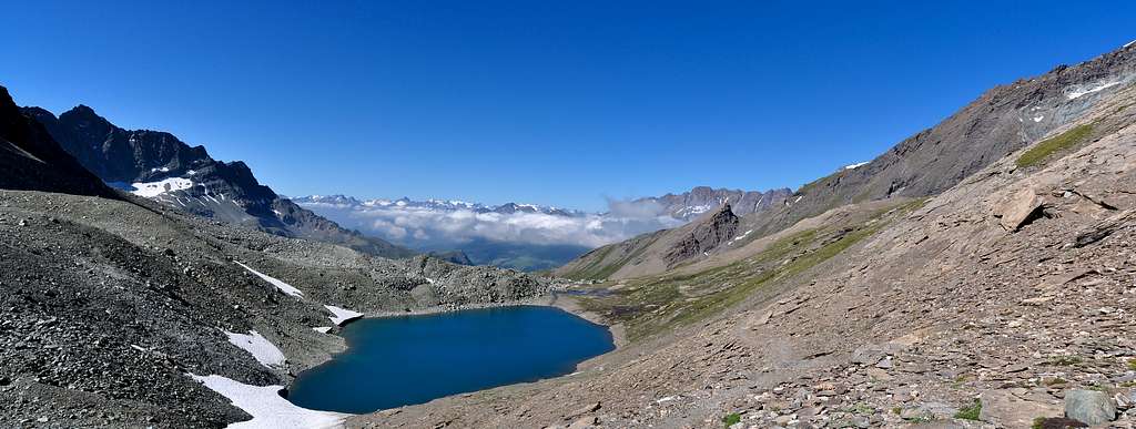
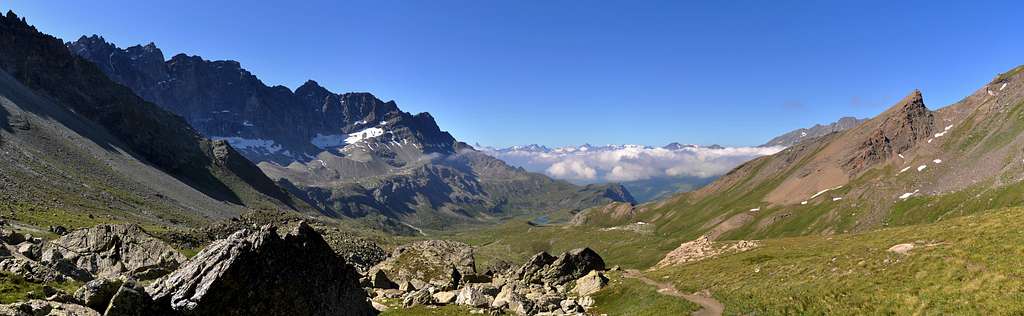
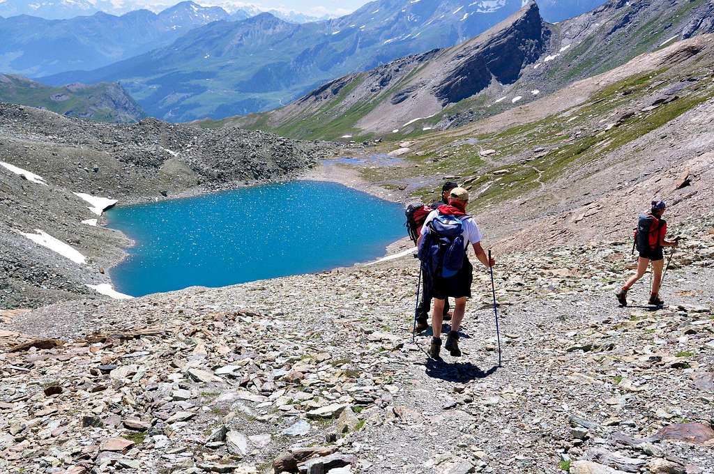
After the two next "Laghetti" di Thoules (Thoules's Ponds; 2.318, 2.326 meters), still in the Conca di By (By's Basin) after the elongated "Vallone dell'Acqua Bianca" or "White Water Vallon or small Valley", we find Lac Fenêtre (2.711m). Located at the base of the untouched West Face of Mont Gelé (3.518m) as well as enclosed between it and the Southeast Slope of the nearby and opposite Mont Avril (3.347m), it appears at last moment in the beautiful hike to Fenêtre Durand (2.805m), right on the border with Val des Bagnes in Switzerland, which, having climbed over the hill, can be reached in a short time with the possibility, moreover, of going back to the Cabane de Chanrion.
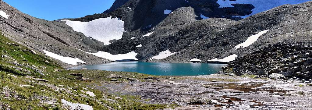
Dopo i due vicini Laghetti di Thoules (2.318, 2.326 metri), sempre nella Conca di By dopo l'allungato "Vallone dell'Acqua Bianca", troviamo il Lac Fenêtre (2.711 m). Collocato alla base dell'inviolata Parete Ovest del Mont Gelé (3.518m) nonché racchiuso tra questa ed il Versante Sudorientale del vicino ed opposto Mont Avril (3.347m), appare all'ultimo momento nella bella escursione verso la Fenêtre Durand (2.805m), proprio al confine con la Val des Bagnes in Svizzera, che, scavalcato il colle, in non molto tempo si raggiunge con possibilità, inoltre, di risalire alla Cabane de Chanrion.
Getting There
From Torino, Milano, etc: Motorway A5. Exit at Aosta Est. From Switzerland: through the Grand Saint Bernard Tunnel or the namesake pass. From France: through the Mont Blanc Tunnel or Petit Saint Bernard Pass. It is not necessary to take Motorway A5: you can drive on SS.26, in the direction of Aosta. Specific Road from Aosta Town: From Aosta East exit of the motorway, follow along the SS.27 for the Gran San Bernardo Tunnel After about ten KM turn to the right toward Valpelline (964m), it and turn to the left to get Ollomont (1.335m) and the small built area of Glacier (1.549m), where you must start walking.
Dall'uscita del Casello Autostradale di Aosta Est, proseguire sulla SS.27 in direzione del tunnel del Gran San Bernardo; dopo circa un decina di chilometri svoltare sulla destra verso il Paese di Valpelline (964 m). Dopo averlo superato svoltare sulla sinistra e raggiungere il Paese di Ollomont (1.335 m); proseguire sino alla Frazione di Glacier (1.549 m), dove inizia l'itinerario a piedi.
Route Description
Starting with approach from Glacier Hamlet: with the previous route from "Farinet House" (2.010 meters about) continue Eastward through the trail n° 5 until it reaches the farm dirt private road from the Alpage Commune de By into the homonym Basin inserting the same reaching Balme de Bal Pasture (2.128m). From this continues independently as route n° 5/TdC to overlying Alpage of Lombardin (2.309m), where returns and concomitant flexing most at Northeast, get to that Thoules, where it ends (2.381meters; T/E; 2h'20/2h'30). Continuing further North, initially along the Torrent Fenêtre wade twice the same after 2.620 meters of altitude passes a secondary semi dry torrent lead to the opposite side (West). A long diagonal to the North-northeast leads just above the Lac Fenêtre (2.711m; small springs almost everywhere) with stunning views of the West Face of the Mont Gelé and immediately after the Fenêtre de Durand (2.805 meters; E/F; 3h'30/3h'40).
Partendo con avvicinamento dal Villaggio-Frazione di Glacier: con l'itinerario precedente dalla "Casa Farinet" (2.010 metri circa) continuare verso Est tramite il sentiero n° 5 sin a che questo raggiunge la strada poderale dalla Commune de By inserendosi sulla medesima raggiungendo l'Alpe Balme de Bal (2.128 m). Da questa continua autonomamente come sentiero n° 5/TdC sino alla soprastante Alpe Lombardin (2.309 m), dove ritorna concomitante e, flettendo maggiormente a Nordest, arriva a quella di Thoules (2.381 metri; T/E; 2h'20/2h'30). Continuando più a Settentrione, dapprima lungo il Torrent Fenêtre poi guadando due volte il medesimo, dopo la quota 2.620 metri oltrepassa un torrentello secondario portandosi sul versante opposto (Ovest). Un lungo diagonale a Nord-nordest conduce appena sopra il Lac Fenêtre (2.711 metri; piccole sorgenti un pò ovunque) con splendida vista sulla Parete Ovest del Mont Gelé e subito dopo alla Fenêtre de Durand (2.805 metri; E/F; 3h'30/3h'40).
Difficulty
The route can be classified as E/F.
L'itinerario è classificato E/F.
Essential Gear
Hiking gear.
Da escursionismo.
External Links
- REGIONE AUTONOMA VALLE D'AOSTA the official site.
- FONDAZIONE MONTAGNA SICURA Villa Cameron, località Villard de la Palud n° 1 Courmayeur (AO) Tel: 39 0165 897602 - Fax: 39 0165 897647.
- SOCIETA' DELLE GUIDE DELLA VALPELLINE Etroubles-Strada Nazionale, n° 13 - Tel +39 0165 78559 - Valpelline-Loc Capoluogo, n° 1 - Tel +39 0165 713502 (AO) Italia.
- A.I.NE.VA. (Associazione Interregionale Neve e Valanghe).