-
 1045 Hits
-
 80.49% Score
-
 12 Votes
|
|
Route |
|---|---|
|
|
45.78595°N / 7.74261°E |
|
|
Hiking |
|
|
E/EE |
|
|
Overview
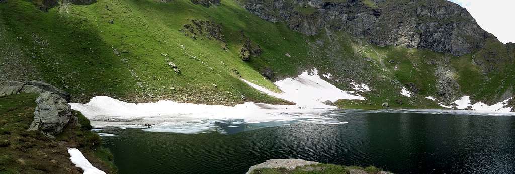
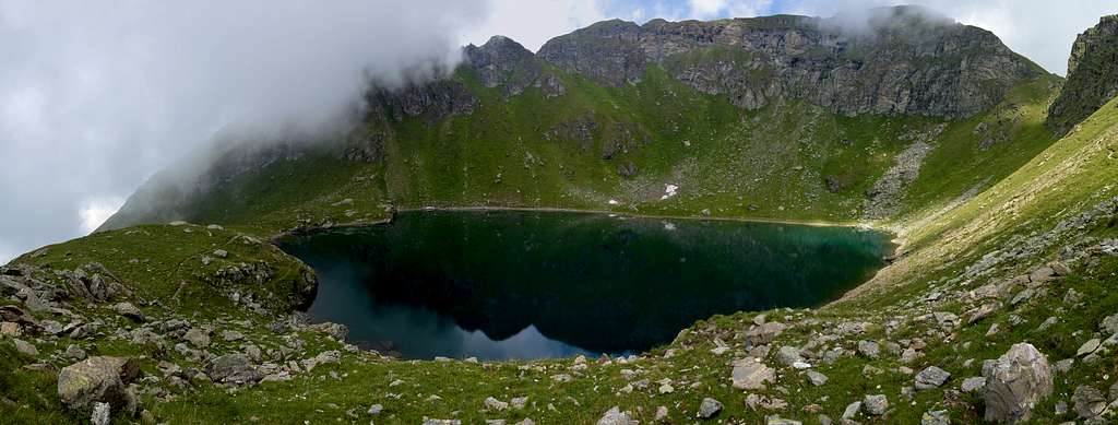
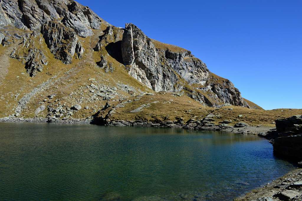
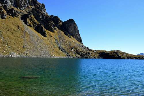
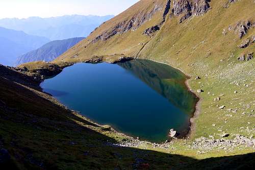
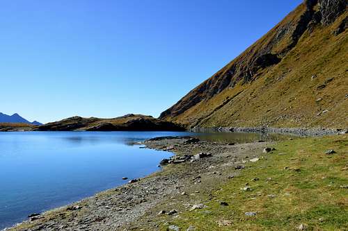
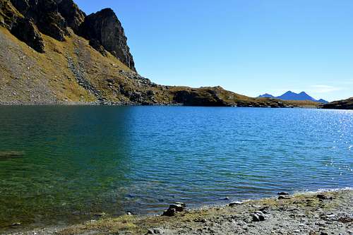
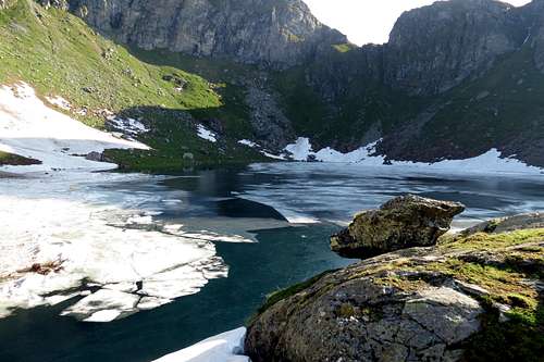
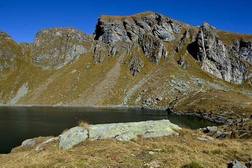
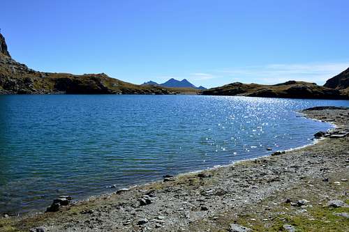
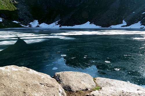
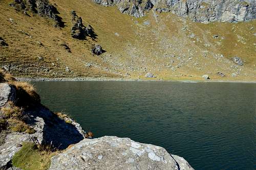
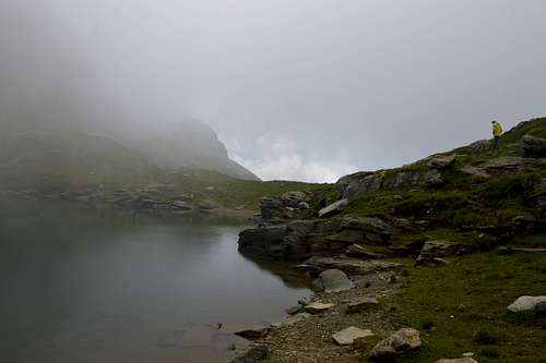
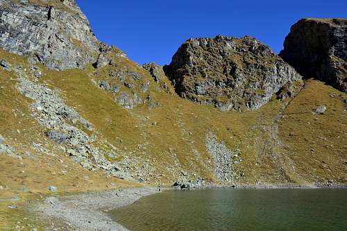
The Lake Bringuez it is one of the most beautiful lakes in the Ayas Valley, although the view from the lake is quite limited as it is enclosed in a small basin. Surrounded by Punta della Gua (2.778m) and Pointe Palon (2.737m) to the west by the Bringuez pass (2.661m) to the north and Monte Quiappa (2.684m) to the east. It is also one of the deepest lakes in the area and its waters are of a beautiful deep blue color.
Il Lago Bringuez è uno dei laghi piu’ belli della Valle d’Ayas, anche se dal lago il panorama è abbastanza limitato essendo racchiuso in una piccola conca. Circondato dalla Punta della Gua (2.778 m) e dalla Pointe Palon (2.737 m) a Ovest dal colle di Bringuez (2.661 m) a Nord e dal Monte Quiappa (2.684 m) a Est. E’ inoltre uno del laghi piu’ profondi della zona e le sue acque sono di un bellissimo colore blu intenso.
Getting There
- From TORINO, MILANO, etc: Motorway A5. Exit at IVREA or Quincinetto (PIEDMONT).
- From IVREA Town: in West (Southern side) to Pont Saint Martin, Verrès Municipalities in East from Aosta Town. From Verrès to Val d'Ayas Valley From Verrès (549m), with Regional Road, to Challant Saint Victor (765m), Challant Saint Anselme (1.060m), Brusson (1.332m) Municipalities; wanting, continuing to Northwest to Antagnod-Ayas (1.709m) Commune, below Mounts Tantané and Zerbion also in North towards Champoluc (1.570m) and Saint Jacques (1.670m) Communes at the end of Evançon or Ayas Valley and under the Western side of Monte Rosa (Rollin Hump, Breithorns, Pollux and Castor).
- From Courmayeur Resort: in East-southeast to Aosta, Nus, Chatillon, Saint Vincent, Verrès Municipalities.
- From FRANCE: through the Mont Blanc Tunnel to Entrèves/Courmayeur. By Little Saint Bernard Pass, closed since November until half May to La Thuile Valley - Pré Saint Didier - Aosta - Verrès Municipalities. It is not necessary to take Motorway A5: you can drive on SS.26, in the direction of AOSTA - IVREA - TURIN.
 |
 |
 |
 |
 |
Approach and Route
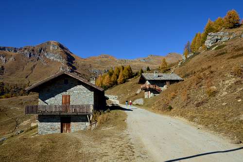
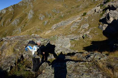
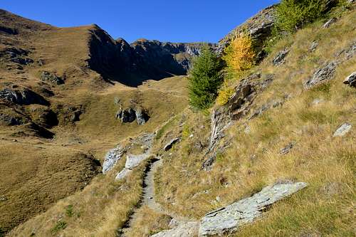
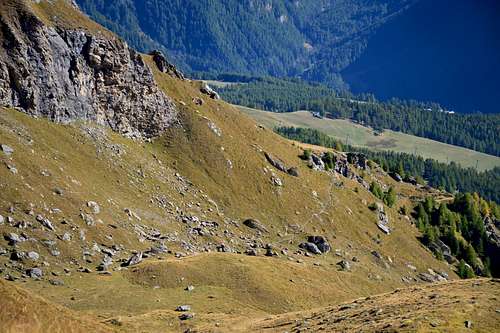
Approach from the Vallone di Palasina: from the Village of Estoul (1.818 meters; large parking lot with various signposts) first towards the Northwest then North via the Regional Road; from the village, heading north via the farm road concomitant with path n° 5, up to the Chavanne mountain pasture (2.107m), proceed for about 150 meters and then turn left onto the farm (not numbered) which descends and leads to the 'Lavassey pasture (2.004m) and to the Quiappa pasture (2.245m). From this point follow the path bearing the n° 4A up to an altitude of 2.352 meters where it joins the path n° 3 which after about 0h'40 leads to the lake (2.529m 2h'30/2h'50 from the parking).
Avvicinamento dal Vallone di Palasina: dal Villaggio di Estoul (1.818 metri; grande parcheggio con pannelli con segnalazioni varie) dapprima verso Nordovest poi Nord tramite la Strada Regionale; dal villaggio, con direzione a Settentrione per mezzo della poderale concomitante al sentiero n° 5, sino all’Alpeggio Chavanne (2.107 m), si procede per circa 150 metri per poi svoltare a sinistra sulla poderale (non numerata) che scende e conduce all’Alpeggio Lavassey (2.004 m) e all’Alpeggio Quiappa (2.245 m). Da questo punto seguire il sentiero recante il n° 4A sino a quota 2.352 metri dove si congiunge con il sentiero n° 3 che dopo circa 0h'40 conduce al lago (2.529 m 2h'30/2h'50 dal parcheggio).
 |
 |
 |
 |
 |
Difficulties
The itinerary is to be considered E, if from the Lavassey pasture, also suitable for children, always under the watchful attention of those accompanying them. EE if from the Colle di Bringuez, not suitable for small children. ATTENTION the signal ball placed on the Hill is wrong EE towards Lake Lungo and E towards Lake Bringuez is to be considered the opposite.
L'itinerario è da considerarsi E, se dall'Alpeggio di Lavassey, adatto anche ai bambini sempre sotto la vigile attenzione degli accompagnatori. EE se dal Colle di Bringuez, non adatto ai bambini piccoli. ATTENZIONE la pallina di segnalazione posta sul Colle è errata EE verso il Lago Lungo e E verso il Lago di Bringuez è da considerare l'opposto.
 |
 |
 |
 |
 |
Essential Gear
For hiking.
Da escursionismo.
External Links
- REGIONE AUTONOMA VALLE D'AOSTA the official site.
- FONDAZIONE MONTAGNA SICURA Villa Cameron, località Villard de la Palud n° 1 Courmayeur (AO) Tel: 39 0165 897602 - Fax: 39 0165 897647.
- A.I.NE.VA. (Associazione Interregionale Neve e Valanghe).
 |
 |
 |
 |
 |
Useful Numbers
- Protezione Civile Valdostana località Aeroporto n° 7/A Saint Christophe (Ao) Tel. 0165-238222.
- Bollettino Meteo (weather info) Tel. 0165-44113.
- Unità Operativa di Soccorso Sanitario Tel. 118.