
-
 1354 Hits
-
 78.27% Score
-
 9 Votes
|
|
Route |
|---|---|
|
|
45.78779°N / 7.75708°E |
|
|
Hiking |
|
|
E |
|
|
Overview
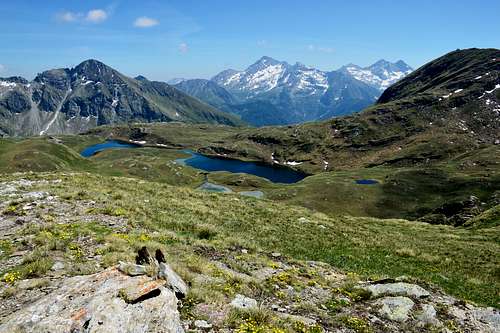
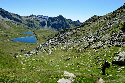
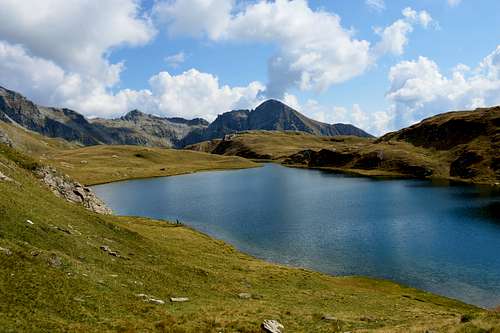
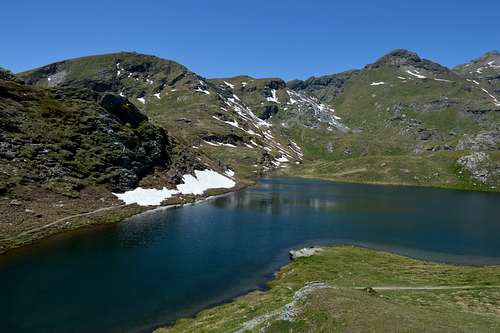
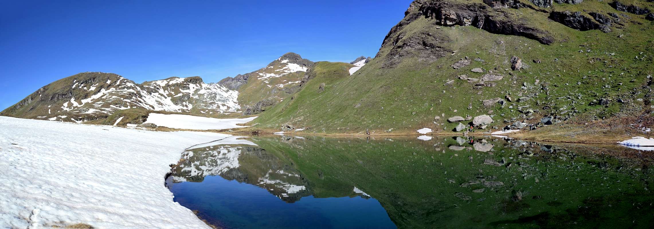
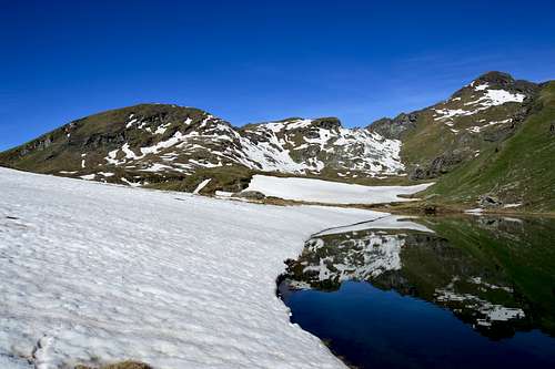
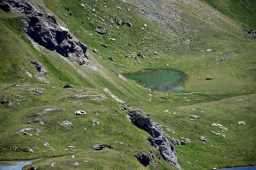
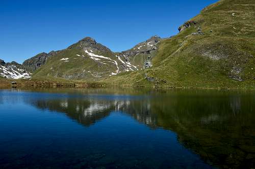
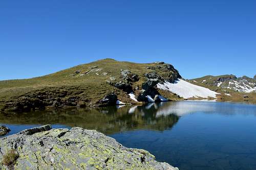
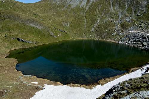
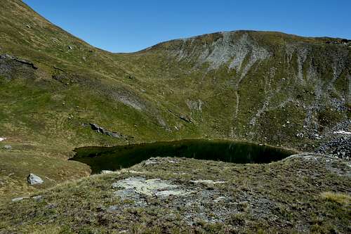
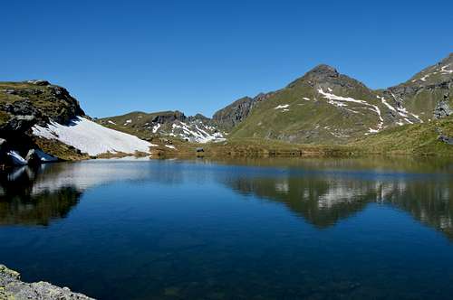
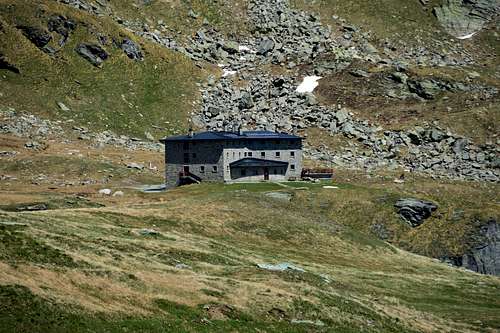
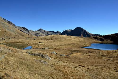
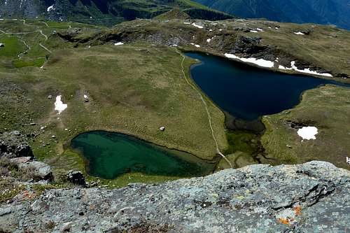
These three beautiful lakes located in the enchanting Ayas Valley and very popular in late spring in summer and early autumn (easy to reach due to the proximity of the Arp Refuge (2.439m) are also suitable for children, always under the watchful attention of the companions especially to reach the lake of Palasina, where in this section the path, even if not long, is quite steep and tiring. From here you can enjoy an excellent view of the lakes below and the Ayas Valley.
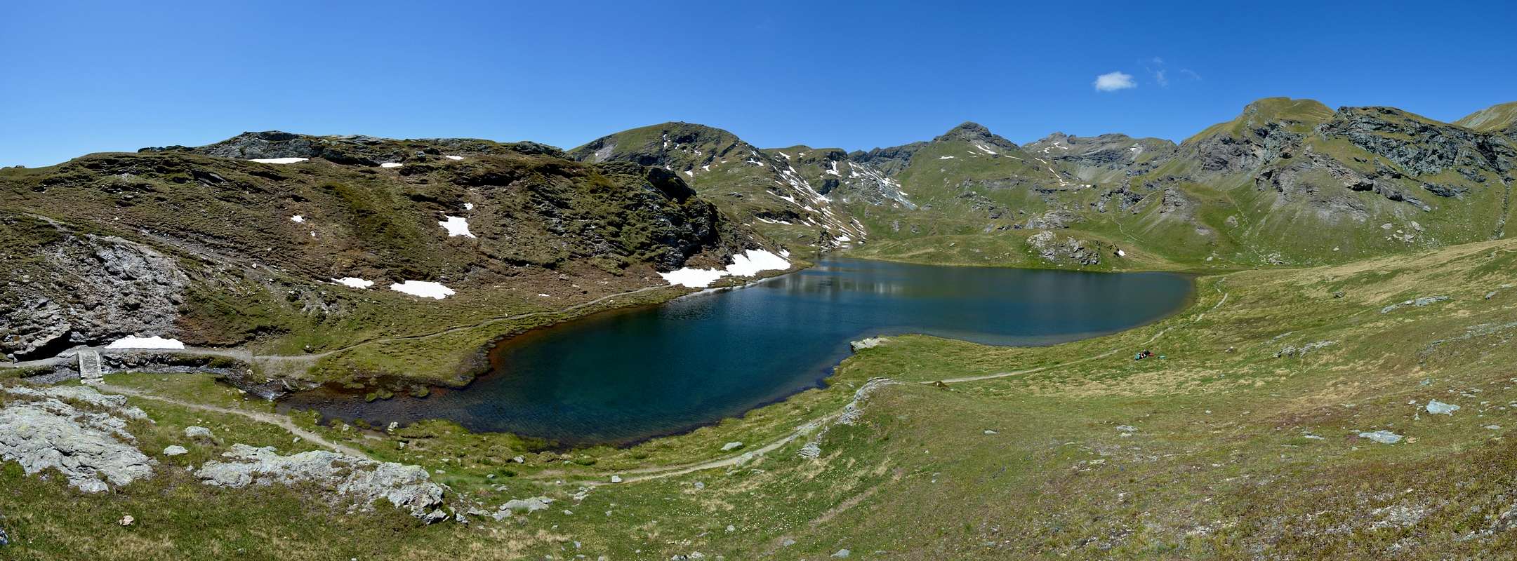
Questi tre bellissimi laghi siti nell’incantevole Valle d’Ayas e molto frequentati nella tarda primavera in estate e all’inizio dell’autunno (comodi da raggiungere per la vicinanza del Rifugio Arp (2.439m) sono indicati anche per i bambini, sempre sotto la vigile attenzione degli accompagnatori specialmente per raggiungere il lago di Palasina, dove in questo tratto il sentiero, anche se non lungo, e abbastanza ripido e faticoso. Da qui si gode un ottimo panorama sui laghi sottostanti e la Valle d’Ayas.
Getting There
- From TORINO, MILANO, etc: Motorway A5. Exit at IVREA or Quincinetto (PIEDMONT).
- From IVREA Town: in West (Southern side) to Pont Saint Martin, Verrès Municipalities in East from Aosta Town. From Verrès to Val d'Ayas Valley From Verrès (549m), with Regional Road, to Challant Saint Victor (765m), Challant Saint Anselme (1.060m), Brusson (1.332m) Municipalities; wanting, continuing to Northwest toAntagnod-Ayas (1.709m) Commune, below Mounts Tantané and Zerbion also in North towards Champoluc (1.570m) and Saint Jacques (1.670m) Communes at the end of Evançon or Ayas Valley and under the Western side of Monte Rosa (Rollin Hump, Breithorns, Pollux and Castor).
- From Courmayeur Resort: in East-southeast to Aosta, Nus, Chatillon, Saint Vincent, Verrès Municipalities.
- From FRANCE: through the Mont Blanc Tunnel to Entrèves/Courmayeur. By Little Saint Bernard Pass, closed since November until half May to La Thuile Valley - Pré Saint Didier - Aosta - Verrès Municipalities. It is not necessary to take Motorway A5: you can drive on SS.26, in the direction of AOSTA - IVREA - TURIN.
 |
 |
 |
 |
 |
Approach and Route
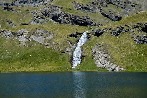
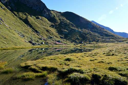
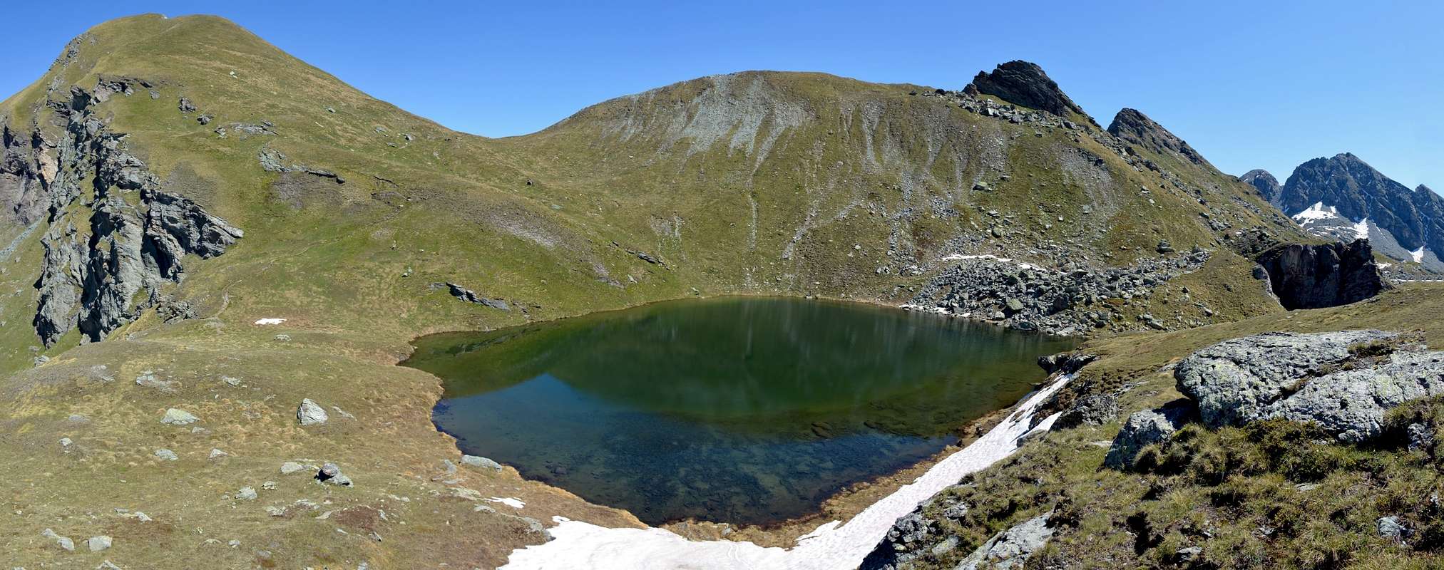
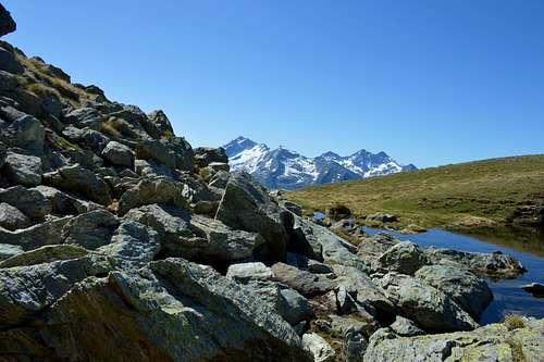
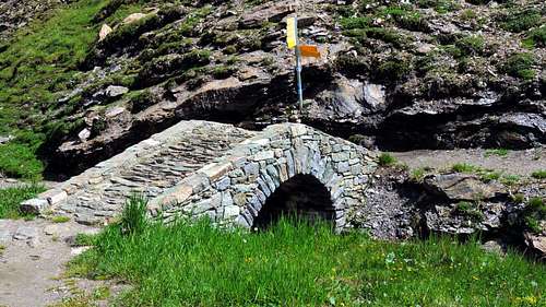
Approach from Vallone di Palasina: from the Village of Estoul (1.818 meters; large parking lot with panels with various signs) first towards the Northwest then North via the Regional Road; from the village, with direction to the north by means of the farm road concomitant with path n° 5, up to the Chavanne pasture (2.107m), continue along the farm road to the junction that leads to the Arp Refuge (2.439m), from here the choice whether to go to the refuge or directly to the lakes, in this case continue on the left along the path that at times crosses the farm road n° 5, after a traverse you reach the Chavanne Alp (2.347m) from this point continue until you reach a new hut at ( 2.435m), after passing a short valley and a characteristic stone bridge, you reach Lago della Battaglia (2.487m) and after 0h'05, keeping to the east shore of the lake, the small Verde Lake (2.488m), which as soon as you cross it begins on the on the right the steep path that leads to Palasina Lake (2.615m) which can be reached in about 0h'20.
Times: For the Battle Lake from the Estoul parking lot: 1h'50/2h'10. From Battaglia Lake to Verde Lake 0h'05. From Verde Lake to Palasina Lake 0h'20/0h'25. In total 2h'15/2h'40.
Avvicinamento dal Vallone di Palasina: dal Villaggio di Estoul (1.818 metri; grande parcheggio con pannelli con segnalazioni varie) dapprima verso Nordovest poi Nord tramite la Strada Regionale; dal villaggio, con direzione a Settentrione per mezzo della poderale concomitante al sentiero n° 5, sino all’Alpeggio Chavanne (2.107 m), continuare lungo la strada poderale fino al bivio che porta al Rifugio Arp (2.439 m), da qui la scelta se andare al rifugio o direttamente ai laghi, in questo caso continuare sulla sinistra lungo il sentiero che a tratti attraversa la strada poderale n° 5, dopo un traverso si raggiuge l’Alpeggio Chavanne (2.347 m) da questo punto continuare fino a raggiungere una nuova baita a (2.435 m), superato un corto valloncello e un caratteristico ponte in pietra si raggiunge il Lago della Battaglia (2.487 m) e dopo 0h'05, tenendosi sulla sponda est del lago, il piccolo Lago Verde (2.488 m), che non appena oltrepassato inizia sulla destra il ripido sentiero che porta al Lago di Palasina (2.615 m) che si raggiuge in circa 0h’20.
Tempi: Per il Lago Battaglia dal parcheggio di Estoul 1h'50/2h'10. Dal Lago Battaglia al Lago Verde 0h'05. Dal Lago Verde al Lago Palasina 0h'20/0h'25. In totale 2h'15/2h'40. Add Route Description text here.
 |
 |
 |
 |
 |
Difficulty
The route can be classified as E.
L'itinerario è classificato E.
Equipment
For Hikings.
Da Escursionismo.
 |
 |
 |
 |
 |
External Links
- REGIONE AUTONOMA VALLE D'AOSTA the official site.
- FONDAZIONE MONTAGNA SICURA Villa Cameron, località Villard de la Palud n° 1 Courmayeur (AO) Tel: 39 0165 897602 - Fax: 39 0165 897647.
- A.I.NE.VA. (Associazione Interregionale Neve e Valanghe).
Useful Numbers
- Protezione Civile Valdostana località Aeroporto n° 7/A Saint Christophe (Ao) Tel. 0165-238222.
- Bollettino Meteo (weather info) Tel. 0165-44113.
- Unità Operativa di Soccorso Sanitario Tel. 118.
 |
 |
 |
 |
 |