
-
 5950 Hits
-
 83.1% Score
-
 16 Votes
|
|
Mountain/Rock |
|---|---|
|
|
46.48546°N / 14.96223°E |
|
|
Hiking |
|
|
Spring, Summer, Fall, Winter |
|
|
5574 ft / 1699 m |
|
|
Topographic isolation: 18.5 km
Nearest higher peak: Mala Peca (1731 m)
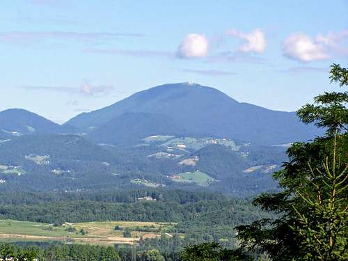
Prominence: 668 m![Urslja gora as seen from Velenje]()
Urslja gora as seen from VelenjeUršlja gora is the easternmost mountain of the Karavanke range.![TV broadcasting tower]()
TV broadcasting tower
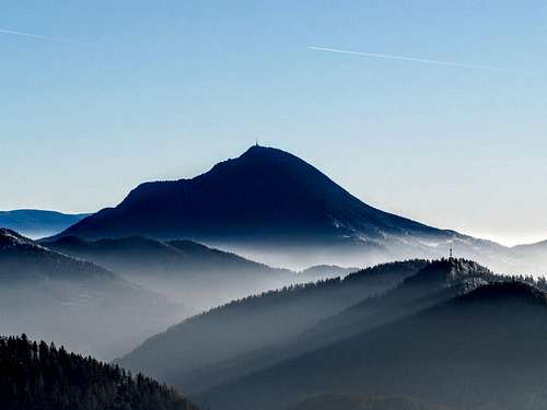
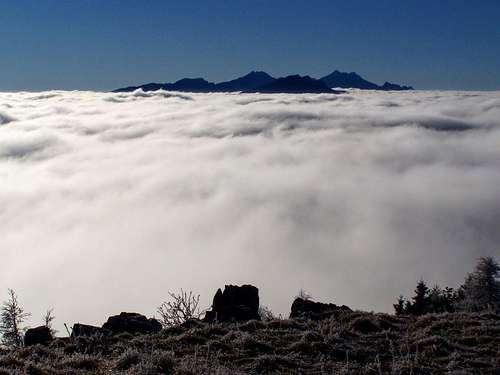
![Urslja gora - view from Petzen]()
Urslja gora - view from PetzenFor those who don’t speak slovenian language, the name “Uršlja gora” may sound as it derived from the Latin ursus, and so it means Bear Mountain. But it is not so: Uršlja gora means Mount St. Ursula, and it becomes evident as soon as we think on the St. Ursula Church church that was built on the summit of the mountain. The german name of the mountain is Ursulaberg, following the same logic. And just to have a twist in the story: the peak has another name, too. It is also called Plešivec ('the bald one').![Winter scene on Urslja gora]()
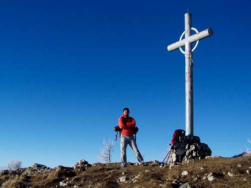
Winter scene on Urslja goraUršlja gora meets the expectations: not only its measures are considerably big but also its view is impressive from all directions. It has the shape of a “classic” peak from a distance.![At the summit cross of Urslja gora]()
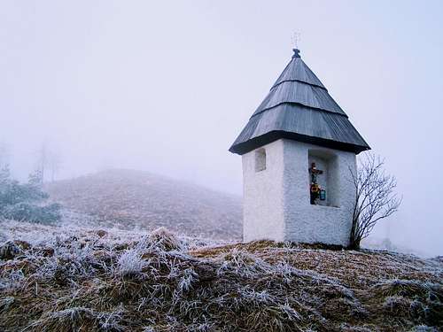
At the summit cross of Urslja goraThe peak of Uršlja gora is a lively place with a lot of objects. What are these objects? ![Small chapel near the peak of Urslja gora]()
Small chapel near the peak of Urslja gora
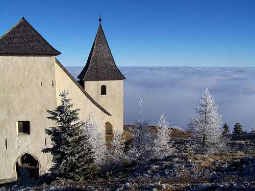
![St. Ursula Church]()
St. Ursula ChurchLet me start with the oldest one: this is the St. Ursula Church. It’s a late gothic structure from the years of the 1570’s. The church was built very near to the peak. The peak is 1699 m high, and the church was built on 1678 m. This is the church that is on the highest elevation in Slovenia.![Winter scene on Urslja gora]()
Winter scene on Urslja gora
Routes
Routes to the peak:
Camping sites![Dom na Uršlji gori]()
Dom na Uršlji gori
There are 2 campings nearby: one in Slovenia and another one in Austria.
Kamp Gaj (500 m a.s.l.)
Address: Airport Slovenj Gradec, Mislinjska Dobrava 110, 2380 Slovenj Gradec, Slovenia
Phone: +386 (0) 2 88 39 850
Website: http://www.avtokampi.si/kamp/1/535/Gaj/
Camping Pirkdorfer See (520 m a.s.l.)![Postarski dom pod Plesivcem]()
Poštarski dom pod Plešivcem
Address: Pirkdorfer See Pirkdorf 29, 9143 St. Michael ob Bleiburg, Austria
Phone: +43 4230 321
Website: http://www.pirkdorfersee.at/camping.php
Tourist huts
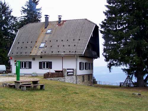
Dom na Uršlji gori
On the peak of Uršlja gora, in elevation of 1680 m.
Phone: +386 51 612 586
Website: http://www.pzs.si/koce.php?pid=74
Poštarski dom pod Plešivcem
On the northeastern slope of Uršlja gora, in elevation of 805 m. Accessible with car from Vrhe
Phone: +386 2 822 10 55
Website: http://www.pzs.si/koce.php?pid=75
Andrejev dom na Slemenu
In southern direction from the peak of Uršlja gora, in elevation of 1086 m
Phone: +386 3 589 51 54
Website: http://www.pzs.si/koce.php?pid=99
Koča na Naravskih ledinah
On the western slope of Uršlja gora, in elevation of 1072 m.
Phone: +386 2 82 21 001
Website: http://www.pzs.si/koce.php?pid=73
Nearest higher peak: Mala Peca (1731 m)
Prominence: 668 m
Overview
Urslja gora as seen from Velenje
TV broadcasting tower
Urslja gora - view from Petzen
Why does this mountain has a Geman name, too? Uršlja gora/Ursulaberg is in Slovenia, only 12 km far from the Slovenian/Austrian border. Slovenia (and neither Jugoslavia) didn’t exist before 1918. Almost the whole area of today’s Slovenia was a part of Austria. The border of the Austrian provinces of Styria and Carinthia just crossed the mountain. The areas around Uršlja gora/Ursulaberg had a mixed German/Slovenian population. The towns (Slovenj Gradec/Windischgraz and Ravne na Koroškem/Gutenstein in Kärnten) had German majority before World War II, while some smaller settlements had Slovenian majority. It’s interesting that one of these small settlements (actually just a hamlet) is called Uršlja gora. After WWII most of the people belonging to the German nationality had to leave Jugoslavia.
Uršlja gora is 1699 meter high. Though this is not a very big number, still the mountain is very impressive if you look at it from the direction of Slovenj Gradec. Slovenj Gradec is on 410 meter above sea level, so the relative height of Uršlja gora is 1290 meter from here!
Also the prominence of the mountain is quite big: 668 meter. With this prominence it is the 6th most prominent peak of the Karavanke range, and it is the 21st most prominent mountain of Slovenia.
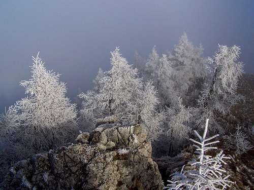
Winter scene on Urslja gora
The mountain is forested, except for some bare limestone rock walls on its northern side, and except for the hilltop that is grassy.
The mountain is popular among hikers, and also the mountain bikers like it since the hilltop can be reached on mountain road that is steep but has a relatively good quality. The mountain is suitable for tour skiing and even for rock climbing. On the northern side there are a few rock walls where a few quite popular (for locals) rock climbs are performed.
The Peak
At the summit cross of Urslja gora
Small chapel near the peak of Urslja gora
St. Ursula Church
There is also a very small chapel near the hilltop, on the eastern edge of the grassy area. I didn’t find anything about it in the sources, but it looks like a building from the 19th century.
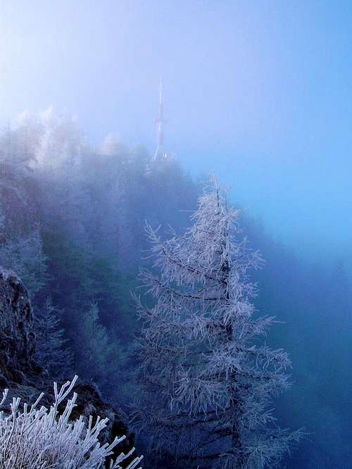
In 1962 a TV broadcasting tower was built on the peak, near its highest point.
Winter scene on Urslja gora
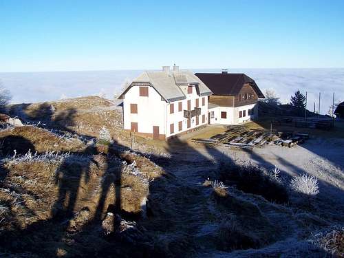
Also a tourist hut has been built on the peak, on elevation of 1680 meter. It has quite a big capacity with more than 80 beds.
And finally let me speak also about the highest point of the peak. There you can see the “mandatory” summit cross. Near to it there is a World War I monument.
Panoramic view from the peak:
- N: Grosser Speikkogel (2140 m)
- E: Pohorje (1543 m)
- SE: Basališče (1272 m)
- S: Kum (1220 m)
- SW: Smrekovec (1577 m)
- W: Petzen (2126 m) and the Kamnik Alps (2558 m)
- NW: Ladinger Spitz (2079 m)
These are the peaks that are the most exposed on the Horizon. On clear winter days, if you are lucky, you can see even Grossglockner (3798 m) in northwestern direction. Grossglockner is in 185 km distance from here.
 Kamnik Alps | 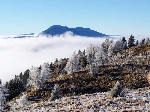 Petzen emerging from the sea of clouds | 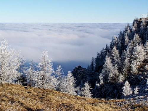 View from the peak of Urslja gora |
Routes
Routes to the peak:| Trailhead | Starting elevation | Distance | Duration | Elevation gain |
| Poštarski dom pod Plešivcem | 810 m | 5.5 km | 2 h 30 min | 920 m |
| Koča na Naravskih ledinah | 1075 m | 3.5 km | 1 h 45 min | 625 m |
| Ivarčko jezero | 640 m | 5.5 km | 2 h 30 min | 1060 m |
| Ciganija | 1110 m | 6 km | 2 h 30 min | 590 m |
The Slovenian Mountain Hiking Trail (Slovenska planinska pot) crosses the mountain and its peak. This trail is the longest hiking trail of Slovenia: it is 599 km long, stretching over the whole country from east to west. Those who complete the full trail must do 45200 meter elevation gain (and similar loss)!
And now let me share an old text with you. It is not interesting from informative aspect but rather as a historical source. I have an old tourist guide of Baedekker’s, published in Leipzig, in 1900. It was in the times yet when Austria-Hungary was an empire in Europe. The book describes the mountains of the Eastern Alps in details. What does it write about Ursulaberg?
"[Von Windischgraz] Aufstieg in 4½-t St. auf den *Ursulaberg (1696 m), hochberühmte Wallfahrtskirche mit weiter Aussicht über die Ostalpen vom Dachstein und den Tauern bis zu den Kroat. Gebirgen."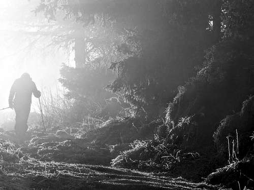 Mystic hiking | 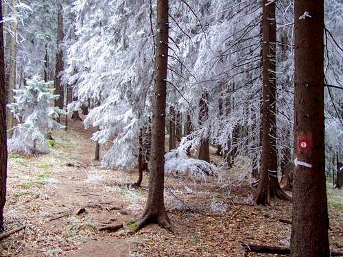 The trail from Postavski dom pod Plesivcem | 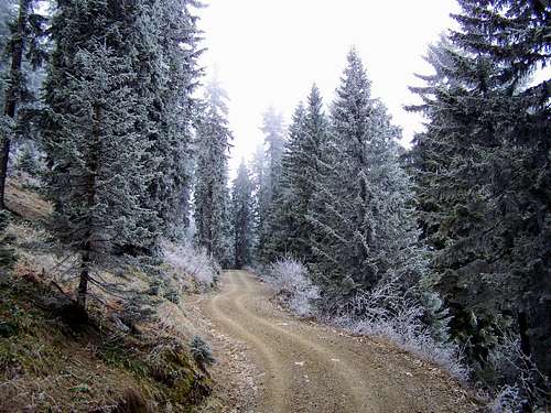 Mountain road to the peak |
Flora
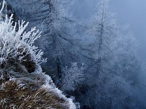
When I create a page on SummitPost, I like to give an impression for the readers about some typical flowers of the mountain. This time my attempt almost failed. I visited the mountain in the second half of December, so I didn’t have much chance for taking photos about flowers. Still, I was lucky to see 3 species. Let me share these photos with you: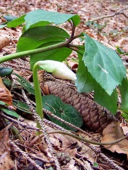 Christmas rose | 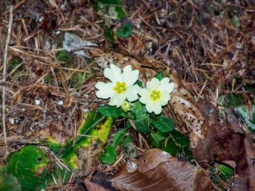 Primrose | 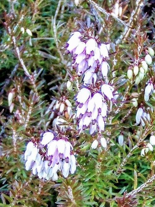 Alpine heath |
Camping and Mountain Huts
Camping sites
Dom na Uršlji gori
There are 2 campings nearby: one in Slovenia and another one in Austria.
Kamp Gaj (500 m a.s.l.)
Address: Airport Slovenj Gradec, Mislinjska Dobrava 110, 2380 Slovenj Gradec, Slovenia
Phone: +386 (0) 2 88 39 850
Website: http://www.avtokampi.si/kamp/1/535/Gaj/
Camping Pirkdorfer See (520 m a.s.l.)
Poštarski dom pod Plešivcem
Address: Pirkdorfer See Pirkdorf 29, 9143 St. Michael ob Bleiburg, Austria
Phone: +43 4230 321
Website: http://www.pirkdorfersee.at/camping.php
Tourist huts
Dom na Uršlji gori
On the peak of Uršlja gora, in elevation of 1680 m.
Phone: +386 51 612 586
Website: http://www.pzs.si/koce.php?pid=74
Poštarski dom pod Plešivcem
On the northeastern slope of Uršlja gora, in elevation of 805 m. Accessible with car from Vrhe
Phone: +386 2 822 10 55
Website: http://www.pzs.si/koce.php?pid=75
Andrejev dom na Slemenu
In southern direction from the peak of Uršlja gora, in elevation of 1086 m
Phone: +386 3 589 51 54
Website: http://www.pzs.si/koce.php?pid=99
Koča na Naravskih ledinah
On the western slope of Uršlja gora, in elevation of 1072 m.
Phone: +386 2 82 21 001
Website: http://www.pzs.si/koce.php?pid=73
Maps
Option 1: http://www.hribi.net/zemljevid_poti.asp?id=391Option 2: http://www.geopedia.si/#T105_x497560_y148920_s14_b4