When reading Slovenian words on maps or in books, you will find special characters for ch, sh, and zh. They are written with c, s and z with a caron - little v above them - like this: č, š, ž.
What's new on this page?
Feb 9, 2013 - SP V3 design updates.
Jan 9, 2010 - A chapter of fore-hills updated.
Jun 26, 2009 - A major page upgrade: Descriptions broadened, best pictures embedded, links checked and updated.
Feb 3, 2008 - The fore-hills chapter inserted.
Dec 10, 2006 - Links to the new page inserted: Vršaki
Dec 10, 2006 - Interactive map updated.
"I have only one or two days!"
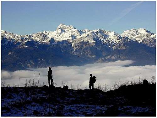
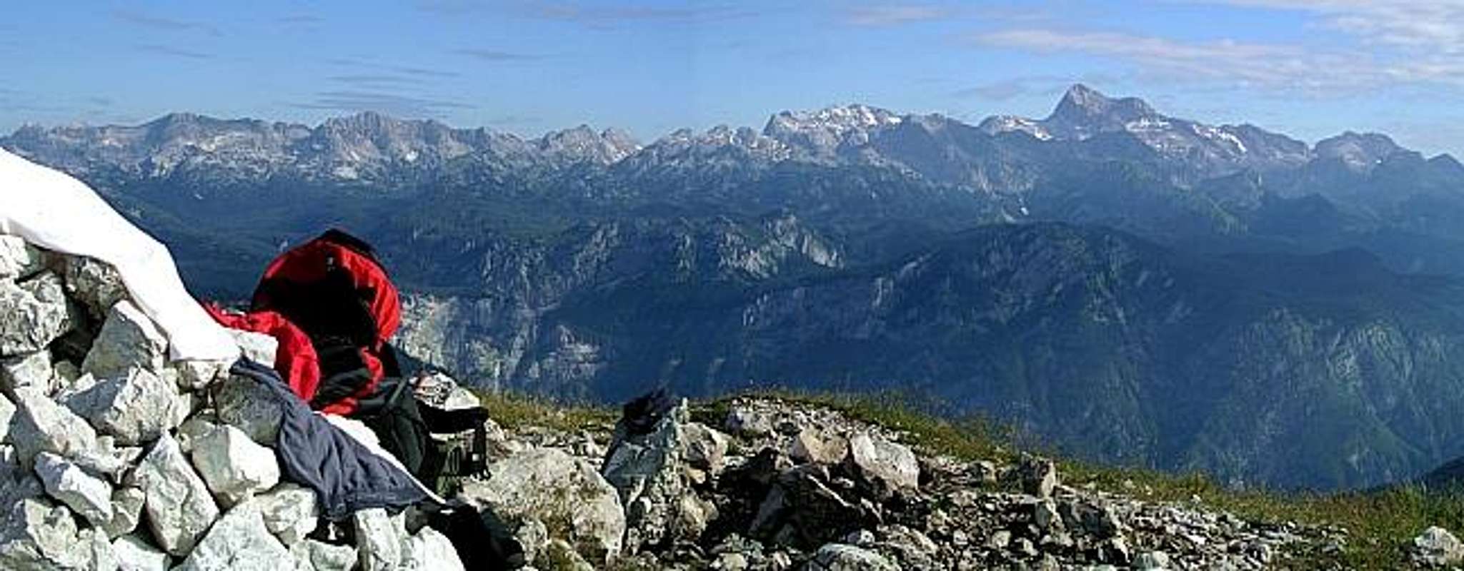
Inversion
Martuljek group
Those who want to spend holidays climbing in Julian Alps will hopefully read this page further on and find useful hints here. But it happens that people have a chance to come close to a mountain area only for a day or two. How to use them best?
You're fit to hike & climb a whole long day. Drive in Vrata valley and do the ascent on Triglav.
You'd rather do a shorter ascent and combine it with sightseeing. Get a car. Drive in Vrata valley to see Triglav. Drive out and along the northern side of Julian Alps to Kranjska Gora, then on Vršič pass. Ascend from there the summit of Prisojnik (round tour). Drive down in Trenta valley and sleep there. The second day continue through Trenta, then over Predel pass. If really keen, you can drive on Mangart saddle and even ascend Mangart (round tour). Continue in Italy and north around the Julian Alps back to Slovenia. You can get further ideas about Julian Alps highlights seeing the album: Famous Julian Alps Views.
Overview
"The Julian Alps have become for me, after forty years’ devotion to mountain scenery, the most desirable of all mountains…I believe this feeling is greatly due to their surprising quality of mystery…Triglav reigns over a dreamworld, sundered from time, full of unbelievable hidden nooks, of unsuspected passages, of sudden visions of cliffs which cannot be real. Surely there is no other mountain land like this." Tom Longstaff, in a letter to Julius Kugy
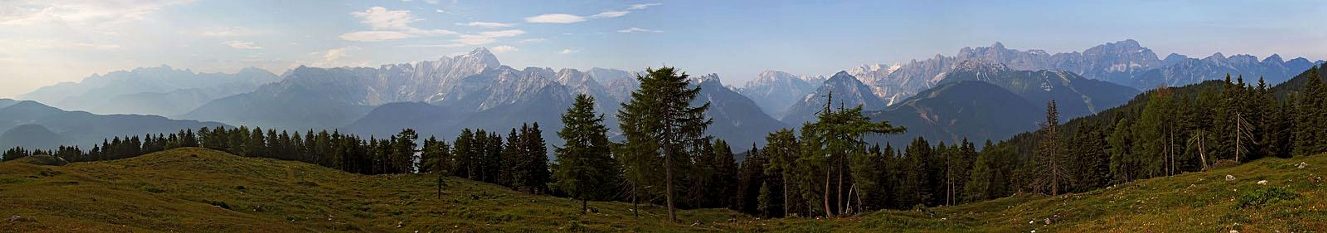
On the south-east European Alps (see also Alps - Eastern part GROUP page) could not finish more beautifully as they do with the group of Julian Alps. They are named after the ancient Roman province. West of them lie Carnic Alps and north, beyond Sava valley Karavanke/Karawanken. On the east and south are forehills, where Alps are connected with the long Dinarides chain. And on the southwest the plane of rive Po lies. Julian Alps are mostly characterised by high, rugged peaks, deeply carved valleys and giant limestone walls above them. They are the collosus of Triglav, the wilderness of Martuljek or Viš and Montaž group, they are other high mountains, each a kingdom of its own. Julian Alps are also the broad high karst plateaus of Kanin or a lower, never-smiling landscape of Komna and the Valley of Triglav Lakes. And Julian Alps is also Soča river, with its emerald blue color, unparalelled on the whole world. Human language and the photography technique has still not evolved enough to describe them. You need to come and experience them!
Doesn't matter from which side you approach Julian Alps, the group is inviting you with its dominance. From the fore-hills of Slovenia, down to the Adriatic coast, they appear as a high, white limestone group with the all surpassing king Triglav in the middle of it. You understand why among our ancestors Triglav was considered to be the seat of gods.
If you're coming from the rest of Alps, from the west or from the north, the mountains of Julian Alps distinguish from other mountains with their wilderness and high walls, towering above a much lower surroundings. Let's see what a mountain fan can find there!
Approaching Julian Alps from the SE, from Ljubljana, the capital of Slovenia, you notice how the landscape becomes more and more various. The famous Bled lake, the one with the island and the church on it and the castle on a high rock above the shore, is known worldwide. And deeply among the mountains there's naturally even better preserved, silent Bohinj lake, a world of its own kind. The main valley of Sava leads you along the northern border of Julian Alps.
You can enter the heart of Triglav group through one of long valleys: Krma, Kot, Vrata. The latter brings you just below one of the broadest and highest walls in Eastern Alps - the famous Triglav North Wall. Almost 1800 meters higher is the king's head and more than 5000 meters broad is the wall. But you even don't need to enter deep valleys if you want to admire the most famous views on Julian Alps peaks and walls.
Being aware of their beauty, the summits of Martuljek group are posing just above the main valley of Sava river. That is one of the most aesthetic mountain compositions in the whole arc of Alps. In Kranjska Gora a road, made in World War I, goes towards the south, over Vršič pass. That's one of the most beautiful car trips in the area, but also a motor bike trip and a usual bike trip. The scenery is changing again and again.
The western walls of Škrlatica group are especially nice in evenings, and the colossus of Prisojnik is watching down on you with its one eye - the famous rock window in its NW wall. Over Vršič you enter another world - a remote, but also wild Trenta valley with its rich mountaineering history from the pioneering times and its slight southern air flare.
We shall return there, let's continue now along the northern border of Julian Alps. High mountains and deep valleys appear one after another. The famous Planica valley, the one where world records in ski-flying have been achieved for several last decades, ends with the sharp crystal-shaped mountain - Jalovec. Then the norhern walls of Mangart massif come, with a valley, guarding two beautiful lakes. On the other side of Tarvisio the same picture - the wild, rugged group of Viš and Montaž, where some of the highest mountains of Julian Alps are located.
Only then the view on giants is obscured from the main valley, because a front range of less attractive peaks is rising above it. At Pontebba we are on the very NW corner of Julian Alps. A deep canyon is cut towards the south, dividing Julian Alps from the neighbouring Carnic Alps. Driving by a highway there, you will miss most of the attractive views, but to reach the popular mountaineering sites, you must anyway enter the deep valleys, which are cut into the Julian Alps massif from the west.
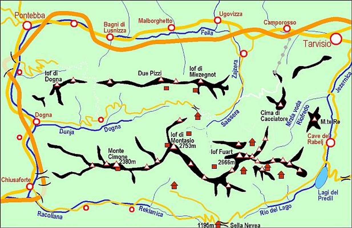
The first such valley is Dogna. It brings you below the W wall of Montaž - another one of the most astonishing views in the region. Raccolana valley brings you on Sella Nevea, a saddle, dividing Viš group and Kanin group. Other valleys more to the south are cut in the fore-Alps already. The fore-Alps are interesting for their long, tenths of kilometers stretching ridges. Hiking them in early summer, when they are blossoming in all colours is most rewarding, but those tours also take you more than just one day. Let's return in the heart of Julian Alps again.
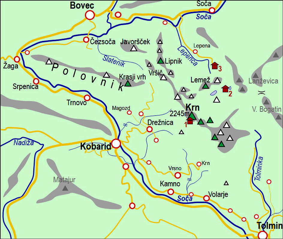
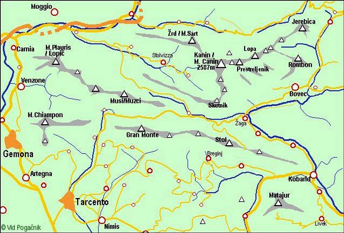
We shall go from the south, along the emerald blue river of Soča. Its colour is unique in Europe and the higher you get, the more beautiful is its valley. It is winding through the fore-hills of Julian Alps, on the right you see the high Krn group and on the left soon the massif of Kanin. Kanin is another unique group. Nowhere else the high mountain karst is so developed as on Kanin. There are the deepest caves and the high plateaus of those mountains look on some places like a barren Moon surface. All water disappears deep underground. The upper part of Soča valley is called Trenta.
Some 150 years ago the poor people there were unsurpassable climbers (starting with wild-hunting, of course). The famous pioneer Julius Kugy found among them his best guides, who took him as the first climber on many Julian Alps summits. And not only Julian Alps. It was only a matter of logistic and costs why Kugy did not engage Trenta guides more often also for endeavous in other Alps areas. When he was in the Central Alps, not prioritised at the best local guides, he used to write in his memory book: "We would succeed if I had with me my brave guides from Trenta...".
Nowadays Trenta is still remote, offering true adventures to those who attempt some of its wildest areas. We are almost around the group. I'd like to mention just one more area - the dreamy, beautiful Valley of Triglav Lakes and the nearby Komna plateau. The "land which can not smile", Kugy described it. High mountain lakes among the last larches, rugged karst around and silence, as soon as you go off the main Triglav hiking route. Equally, if not more beautiful in winter and spring, when it turns into a sea of snow-covered hills.
Geology
Generally, the geological history of Julian Alps is very similar to the history of other Southern Alps. Being on the border with Dinarides, Julian Alps have also its specifics which will be mentioned on subgroup pages. Idrija tectonic fault on the SW is already running in the Dinaric direction (NW-SE), while Fella-Sava fault on the N is running in the strict Alpine direction (W-E). It separates Julian Alps from Karawanks and Kamnik & Savinja Alps. The latter are very similar in their origin to Julian Alps, but the extention and lowering of the Ljubljana basin has been separating the two big groups.
Regarding the rocks structure the big majority of Julian Alps is build of up to 2000 m thick layers of Mesozoic limestones and dolomites, the rocks which were deposited in warm seas good 200 million years in the past. Older Triassic rocks are more on the north, the more we go southwards, the younger are the rocks, finally even some Jurassic rocks can be found. In the highest part around Triglav, older limestones are thrusted over younger Dachstein limestone which is otherwise prevailing in the massif. In the more recent times the landscape was substantially modelled by glaciation.
Subgroups
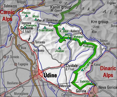
Julian Alps interactive map: Point on red numbers to see subgroup names, click on them to get SummitPost pages!
Roughly Julian Alps are divided into the western and the eastern part. The line between the two broad groups goes by the river Soča, over the Predel Pass and up to Tarvisio. But for practical purposes it is useful to divide Julian Alps to more than just two groups. One possibility is to form the following nine groups, all of them have their SummitPost pages (numbers refer to areas on the picture): Here referred groups of Julian Alps are:
Triglav subgroup from the NE, from Karavanke range.
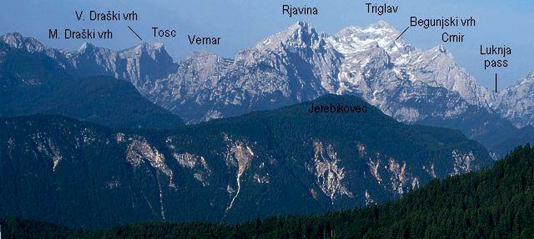
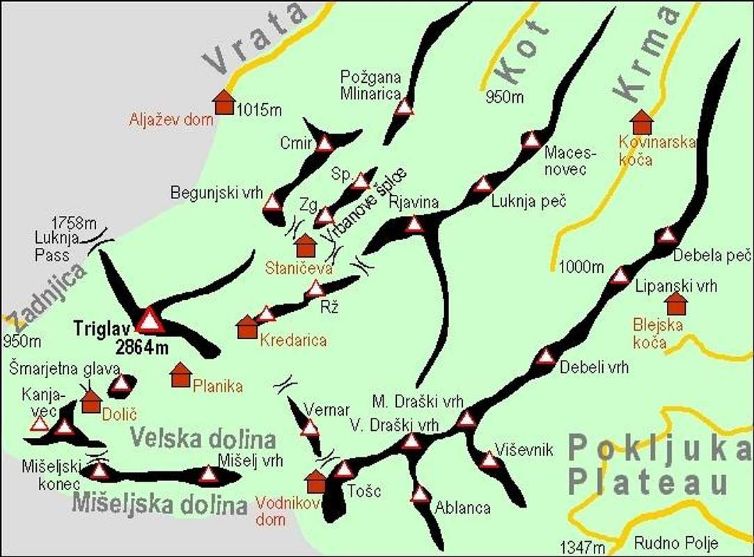
On the north-west the border is: Vrata valley, Luknja Pass, Zadnjica valley. Towards the south, beyond Mišelj valley and Hribarice plateau the Bohinj group lies. Triglav is the highest summit in Julian Alps, a mighty colossus and sacred mountain of Slovenian people as well. Several beautiful peaks stand around it and to the group also a somewhat remote chain of mountains above Pokljuka plateau belongs.
A self-made interactive map...
Important peaks:
2864 m Triglav. Ferratta. Huge north wall with many routes. Excellent panorama.
2568 m Kanjavec. Easy path. North wall. Excellent skiing from the summit. Nice panorama.
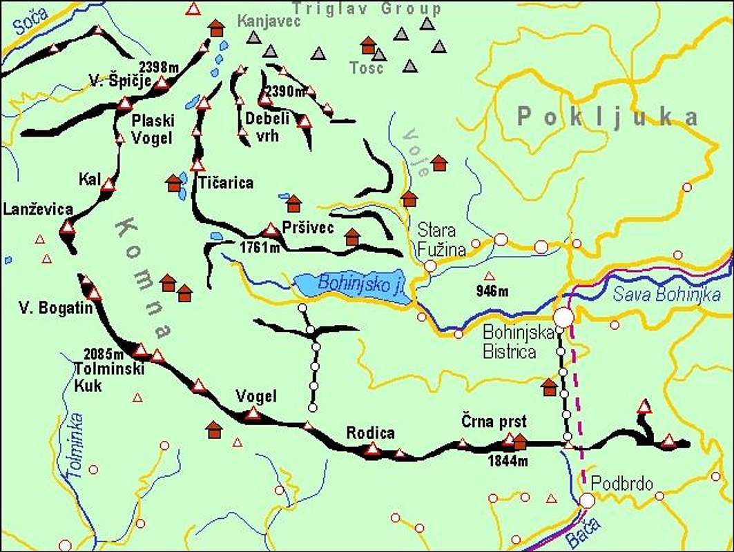
The world around unspoiled Bohinj lake is archaic. In this valley, from all sides surrounded by high mountains in past the civilized world ended. Above the lake there are broad areas: high carst plateau named Komna, The high Valley of Triglav Lakes and dark woods north of Bohinj lake, with places where men's foot probably still didn't step. The whole area is surrounded by The South Bohinj Range and by several ranges of high mountains on north and west.
A self-made map of Bohinj...
Important peaks:
2448 m Vršaki. Hundreds of Triglav visitors are passing them, rarely who scrambles up.
2398 m Veliko špičje. High peak in the ridge between The Valley of Triglav Lakes and Trenta. Ferratta. Nice panorama.
2390 m Debeli vrh. Mighty fat summit in the middle of nowhere of Bohinj's world. Hard ski route from the fore-summit.
2327 m Vogli (Zadnji Vogel). A deserted, round ridge in the middle of Bohinj mountain world.
2320 m Zelnarica. A sharp cone above the lake. Marked hike-up and very nice ski tour.
2309 m Skednjovec. A sharp peak with two nice ridges to scramble up.
2190 m Kopica. A 'nugget' on the crest above the Valley of Triglav Lakes. Marked path.
2091 m Tičarica. Home-summit of the hut at Triglav Lakes. West wall. Skiing from the summit. Nice panorama.
2087 m Ogradi. A grassy ridge in the middle of Bohinj meadows. Nice panorama.
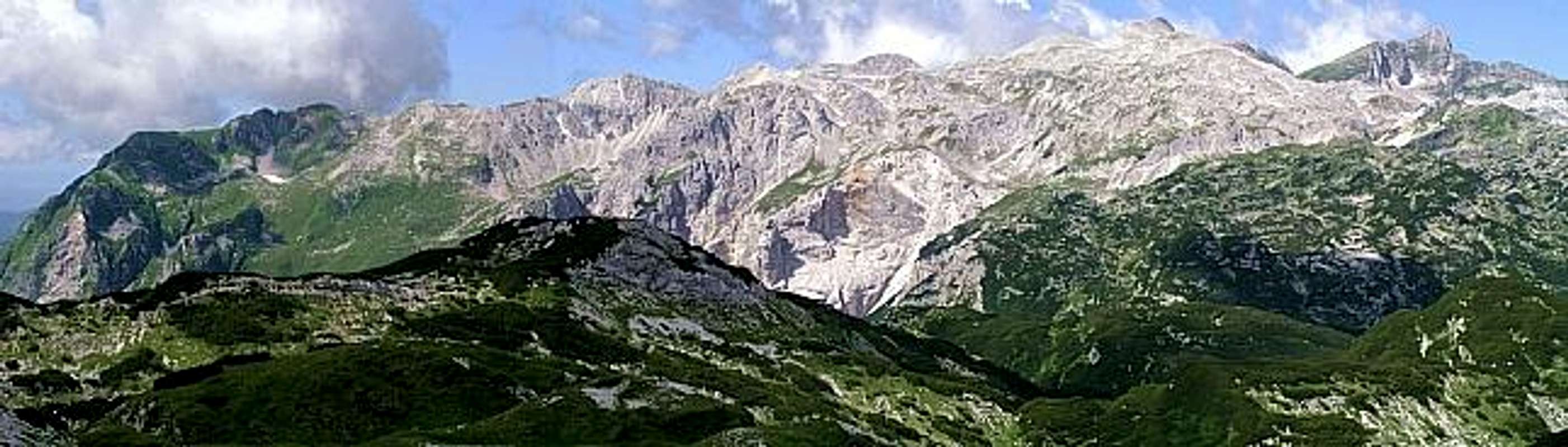
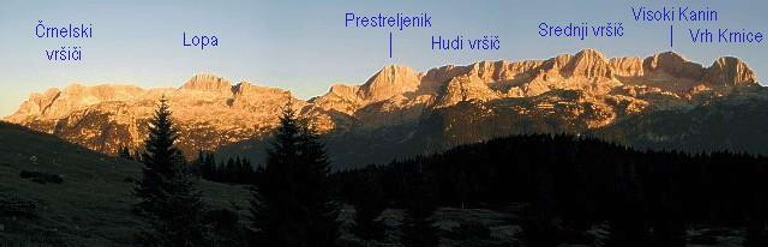
The Kanin group seen from north, from the pass Sella Nevea.
High group of mountains where karst phaenomena are most expressed. These limestone mountains are like Swiss cheese - a heaven for speleologists. Some deepest caves in Europe were discovered in this group. Several of them have vertical drops of more than 1000 meters. being the first barrier on the SW, this group has the highest quantities of rain and snow in Julian Alps. In the past, winters with 7 meters of snow on Kanin were not rare.
The broadest group with high variety. While on the northern part giants with high walls stand, in the southern part there is a world of a different wildernes. Summits above the Trenta valley (upper part of Soča river) are also high above valleys. But they don't offer hard technical climbs. Still this does not mean they are easily ascendable. They are wild, steep, often grassy, with no paths. Special skills are needed to survive there. End of 19th and start of 20th century Trenta's wild hunters were unsurpassed climbers. Many of them were mountain guides of the great explorer of Julian Alps Julius Kugy.
An interactive map of...
Important peaks:
2678 m Mangart. Ferrata. High north wall. Nice panorama.
2643 m Jalovec. Beautiful. crystal-shape peak. Ferrata. North wall. Nice panorama.
2448 m Pelc nad Klonicami. Long approach, hard to ascend. A typical 'Trenta' summit.
2379 m Travnik. Scramble, not marked. Great north wall with hard routes (Aschenbrenner).
2376 m Kotova špica. Nice sharp peak above Kotovo sedlo (saddle). Can be ascended only by (easy) climbing.
2347 m Briceljk. Highest point of Loška stena (wall). Very lonesome. Route hard to find. NW wall. Nice panorama.
2344 m Bavški Grintovec. High above Trenta. Ferrata. Great panorama.
2340 m Vevnica. Hard accessible mountain with a nice shell shape. Hard ferrata. Nice big walls for harder climbing.
2332 m Mojstrovka (Mala). Marked path. Nice ski tour from the summit. North wall. Panorama.
2305 m Šite. Famous N wall for hard climbs. No path to the summit.
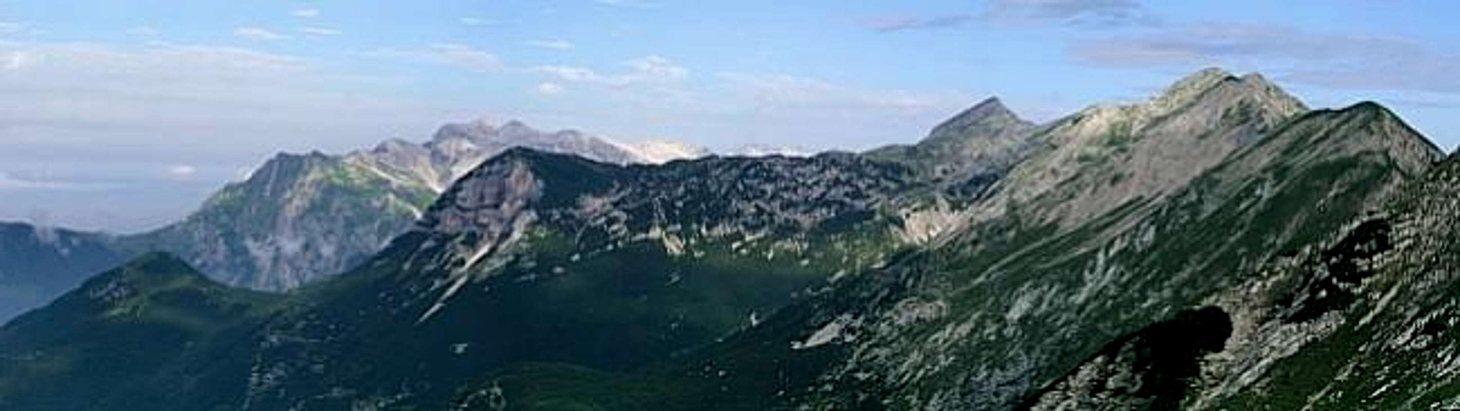
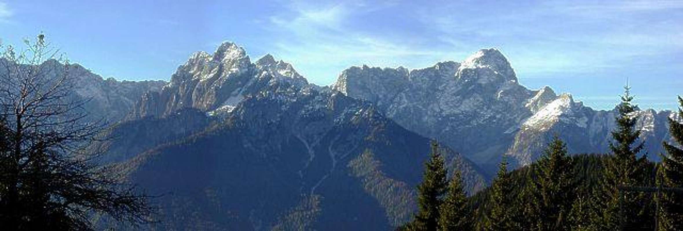
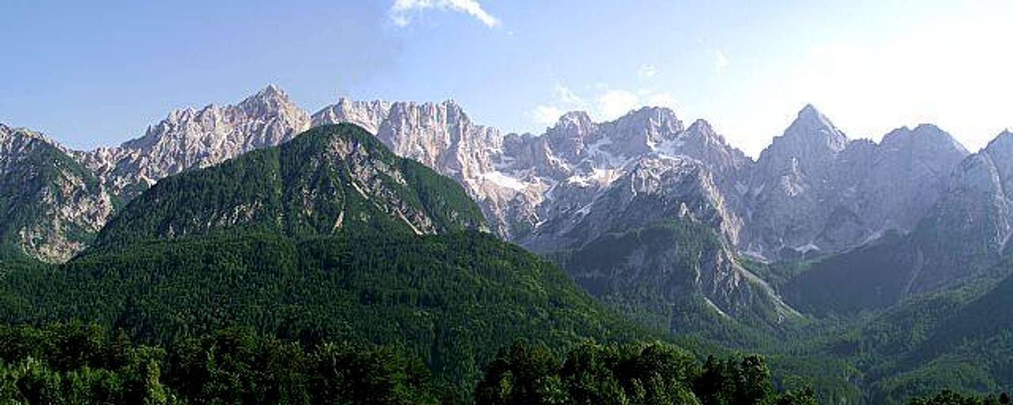
Left on the picture, beyond Vrata valley is Triglav, while on the right side is Škrlatica (the high summit) and Martuljek group.
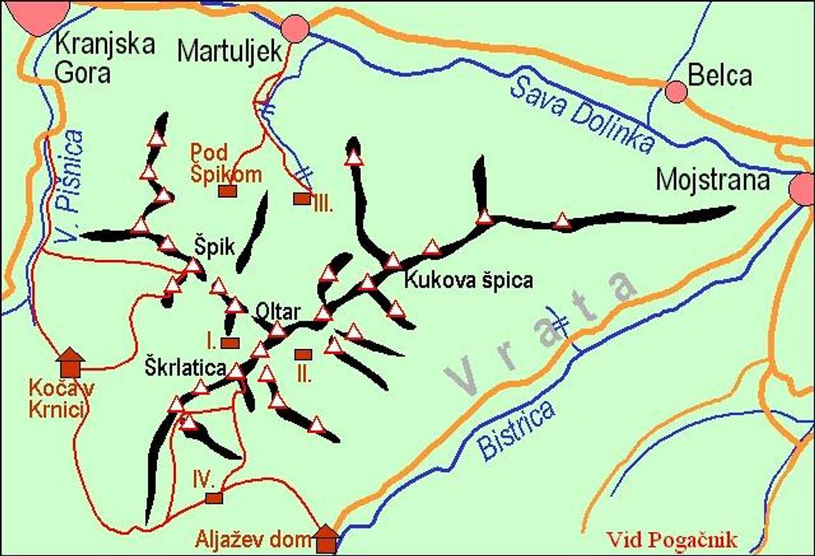
Besides other high, self-standing mountains, Martuljek group is a special pearl. Perhaps the most beautiful part of Julian Alps, standing right above the main Sava valley. The artistic composition of wild, hardly accessible peaks.
A self-made map of Martuljek...
Important peaks:
2738 m Škrlatica. Ferrata. North wall. Great panorama.
2621 m Veliki Oltar. Nice routes of easy climb (II. degree). Wild surroundings. Nice panorama.
2602 m Velika Ponca. In the middle of the wild Martuljek group. Easy climb and nice view.
2601 m Razor. Ferrata. North wall. Great panorama.
2591 m Dolkova špica. A nice panoramic mountain 'on the way to' Škrlatica. Marked routes (paths).
2547 m Prisojnik. Koloss with two windows. Ferrata. North wall. Nice panorama.
2501 m Stenar. Medium hard marked path. Skiing from the summit. North wall. Great panorama.
2497 m Široka peč. "Accordeon" of Martuljek. Only for climbers. Broad north wall.
2472 m Špik. Pearl of Martuljek. medium hard hike-up. North wall. Nice panorama.
2453 m Planja. A generous mountain hosting herds of wild goats and one tired rock tower. Very hard climbing routes in its N wall.
2448 m Škrnatarica. Hidden mountain above Amfiteater. Steep couloir and easy climb.
2440 m Dovški Gamsovec. A side summit near Dolkova špica. Rarely approached.
2419 m Pihavec. High grassy and rocky mountain above Zadnjica valley. Nice panorama.
2417 m Kukova špica. The easternmost peak of Martuljek group. Steep scramble. Very hard ski tour. Nice panorama.
2410 m Križ. A less importand peak where some mountain paths cross. Nice for tour skiing.
2392 m Bovški Gamsovec. An unsurpassable viewpoint for Triglav north wall. Nice crossing of the summit.
2284 m Frdamane police. High and hard north wall, easy climb from south. Nice view on Špik.
2108 m Goličica. Hardly accessible and wild mountain south of Razor. Start of one of the wildest ridges in Julian Alps.
2074 m Rušica. Wild peak in the western part of Martuljek group. Only for climbers.
Mountain huts and bivouacs
Aljažev dom, 1015 m, (04) 5891030, (031) 384011, (031) 384013,
Bivak IV na Rušju, open,
Bivak II in Velika Dnina, open,
Bivak Za Akom - III, open,
Biv. pod Špikom,
Mihov dom, 1085 m,
Koča na Gozdu, 1226 m, (050) 626641,
Erjavčeva koča, 1525 m, (041) 603-190, (050) 610-031,
Tičarjev dom, 1620 m, (050) 634571,
Poštarski dom na Vršiču, 1688 m, (01) 500 64 33, (041) 610029,
Koča v Krnici, 1113 m, (041) 654339,
Koča Zlatorog, 622 m,
Pogačnikov dom, 2050 m, (051) 221-319.
Martuljek group from north, from Karavanke/Karawanken.
9. Julian Pre-Alps
See more information on the Julian Prealps page! Even if called Pre-Alps, some of these summits are still high enough, rugged and hard to be climbed. Towards the SW the whole massif is lowering down to the Po river plane, the hilly landscape is fruitful in lower parts and covered with dense woods on upper parts. The whole area is nice for hiking and biking.
See more information on the Julian Alps Foothills page! On the eastern part, Julian Alps stretch towards the central Slovenia with a hilly landscape. Most of those hills are nice hikes and in winter also ski tour goals. The border with Dinaric Alps is Idrija river valley. The broad area can be divided into 4 groups, but as the northern group around Ratitovec is considered as a prolongation of the South Bohinj Range, let's name only the other 3 areas:
Cerkljansko hribovje (Cerkno Hills. The highest summit is Porezen, 1630 m, on the north. It is an exceptional panoramic pyramid, with steep southern slopes and a bit less steep other slopes. Very popular also for tour skiing. On the western side of the area is Šentviška planota (plateau) and on the south are a few more hills, popular due to their nice panorama, for example Bevkov vrh, 1051 m.
Škofjeloško hribovje (Škofja Loka Hills. This is a very nice, hilly area between the two rivers: Selška Sora and Poljanska Sora. There are a lot of nice hiking trails, connecting panoramic points and cute villages. The king of those hills is Blegoš, again a big forrested and grassy dome with an excellent panorama.
Polhograjsko hribovje (Polhov Gradec Hills. On the very east, there is a broad area of lower hills, stretching just to Ljubljana, the capital of Slovenia. A few mountains exceed a little the altitude of 1000 meters, all of them being nice panoramic points. The highest is Tošč, 1021 m.
Idrijsko hribovje (Idrija Hills). Finally a part of hills around Idrija also belongs to Julian Alps Foothills.
Getting There
By plane. The nearest airport (6o km away) is near Ljubljana, the capital of Slovenia.
By bus. From Ljubljana towards Kranjska gora, from Gorizia towards Bovec, from Udine towards Tarvisio.
By train. Ljubljana - Jesenice, Jesenice - Bohinj - Tolmin - Gorizia, Udine - Tarvisio.
By car. From Ljubljana: Highway towards Jesenice, then ordinary road to Kranjska Gora. From Austria: Through Karavanke tunnel or over Koren pass (Wurzen Pass) into Sava valley, highway to Tarvisio. From Udine: Highway to Tarvisio. From Trieste/Gorizia: By Soča valley to Bovec.
Mountain passes over Julian Alps:
Vrsic Pass, 1611m is the main...Vršič, 1611 m. The road connects Soča valley (Bovec) with Sava valley (Kranjska Gora). Opened from end of May (depends very much of snow) till firs snow fall (usually in December). See also the page of Russian Chapel!
Predel, 1156 m. The road connects Soča valley (Bovec) with Tarvisio. During winter the road is closed only when snow can not be cleared.
Nevejski preval / Sella Nevea, 1195 m. Connecting Jezerska dolina/Valle Rio da Lago and Trbiž/Tarvisio town with Reklanica/Raccolana valley.
Učja/Uccea, 700 m. Connecting Soča/Isonzo valley and Po plane on the west, or towards NW Rezija/Resia valley.
Cable car Kanin: Summer 2004: Up - from 7:00 to 15:00 (each full hour). Down - from 8:00 to 16:00 (each full hour).
Cable car Vogel (Bohinj): Spring 2006: Up - from 8:00 to 18:00 (each half hour). Down - from 8:00 to 18:00 (each half hour).
Towns, Valleys, Maps
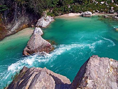
Soča
Kozjak waterfall
The picture below shows main town and valleys of Julian Alps.
Valleys Some valleys of Julian Alps are special pearls. As they don't belong to one particular group or mountain, I'll devote them a few words here. Vrata valley is certainly among the most attractive ones. With a beautiful river Triglavska Bistrica, Peričnik waterfall, nice woods and meadows, and, of course, high walls all around with a monster - Triglav north wall. Soča river is (not only by my opinion) one of the most beautiful river of Alps. It has a special turquois colour, from its souce down to Gorica city. The river itself, its gorges, ponds, meadows and views on high surrounding mountain can be admired by short hikes along it. Also some side gorges and waterfalls are very worth a visit. From Kal-Koritnica down to Kobarid and further on the river is a highly desired goal for rafting, cayaking and canoeing. But - this is a mountaineering site... Nadiža river valley - see more on the Kanin Subgroup page! Vintgar gorge is a finishing part of Radovna river. Being also beautiful in the upper part, the gorge has been for decades arranged for tourist visits.
Maps:
Kranjska Gora. Community of Kranjska Gora - Tourist map. 1:30000
Julijske Alpe - Vzhodni del (Eastern part). Planinska zveza Slovenije. 1:50000.
Julijske Alpe - Zahodni del (Western part). Planinska zveza Slovenije. 1:50000.
Julijske Alpe - Triglav. Planinska zveza Slovenije. 1:20000.
Julijske Alpe - Bohinj. Planinska zveza Slovenije. 1:20000.
Krnsko pogorje in Kobarid (Krn group). Planinska zveza Slovenije.
1:25000. Trenta. Planinska zveza Slovenije. 1:25000.
Red Tape
The majority of the eastern part of Julian Alps is within Triglav national park, established already in 1924. See more information on its formal web page: http://www.tnp.si/national_park/.
The second protected area is the Julian Prealps Nature Parc, established in 1996. Its headquarters are in Prati do Resia. For more details see the its official web page at: http://www.parcoprealpigiulie.org/.
When To Climb
In summer best months are from start of July till end of October. For tour skiing the best months are from February till May. First snow usually falls in November, in certain areas skiing is possible till end of May.
Best areas for tour skiing: Komna, The Valley of Triglav Lakes, Mountains north of Bohinj, Velo polje with Kanjavec, south and east slopes of Triglav massif, Stenar and Križ, almost whole Krn group, almost whole Kanin group, areas above Vršič pass.
Best high walls for climbing: Triglav, Draški vrh above Krma, Vršac above Zadnjica valley, Martuljek (Široka peč, Špik), Prisojnik, Travnik and Šite (walls above Planica), Jalovec, Mangart (eastern part), Viš (eastern part), walls above Riofredo (south of Viš), Montaž, Monte Cimone, Loška stena, Jerebica etc. Mountains above Trenta are a paradise for hard orientation adventures, routes without descriptions, hard ridges far away from civilization. Trenta style is a synonim in Slovenia for hard scramble and climbing in unknown terrain.
For weather see here. Even better site is wunderground - here's the direct link to Kredarica station, 2515m (below Triglav summit):
Printed Sources
T. Mihelič, P. Pehani: Triglav. Slovenia's highest mountain from all sides. Hiking Guide. Sidarta, 2014. (In English)
A More Remote History of This Page
Peričnik waterfall in winter
> Jun, 3rd, 2006 - Links to the new Julian Pre-Alps subgroup. > Jun, 3rd, 2006 - Links to the new page: Črna Prst. > Mar, 28th, 2006 - Links to two new pages: Rombon, Svinjak. > Mar, 25th, 2006 - Links to three new pages: Kobariški Stol, Veliki Lemež, Veliko Špičje. > Nov, 5th, 2005 - Links to the new page: Krniška glavica / Iof di Sompdogna. > Sep, 27th, 2005 - Links to the new page: Monte Nabois Grande / Veliki Nabojs. > Sep, 18th, 2005 - Links to the new page: Monte Piper / Pipar. > Apr, 19th, 2005 - The legend of Anton Tožbar - Špik added. > Apr, 16th, 2005 - Links to the new page: Velika and Mala Tičarica. > Mar, 28th, 2005 - Links to the new pages: Rž and Kopica. > Mar, 26th, 2005 - Links to the new page: Zelnarica. > Feb 28th, 2005 - Links to new pages: Dovški Gamsovec and Pelc nad Klonicami. > Feb 13th, 2005 - Links to the new page: Zadnjiški Ozebnik. > Feb 12th, 2005 - Links to the new SP page: Široka peč. > Feb 5th, 2005 - Links to the new SP page: Monte Cimone / Strma peč. > Jan 30th, 2005 - Links to the new SP page: Vrbanove špice. > Jan 24th, 2005 - Links to the new SP page: Kanin Group. > Jan 18th, 2005 - Links to the new SP page: Krn Group. > Jan 10th, 2005 - Links to the new SP page: Strmi Strug. > Jan 2nd, 2005 - Links to the new SP page: Rodica. > Dec 28th, 2004 - Links to the new SP page: Kotova špica. > Dec 13th, 2004 - Links to the new SP page: Pršivec. > Dec 5th, 2004 - Links to the new SP page: Bohinj Subgroup. > Dec 1st, 2004 - Links to the new SP page: Pizzo di Mezzodi / Kopa. > Nov 27th, 2004 - Links to the new SP page: Mali Draški vrh. > Nov 23rd, 2004 - Links to the new SP page: Tosc. > Nov 22nd, 2004 - Links to the new SP GROUP page: Razor and Prisojnik Group. > Nov 17th, 2004 - Links to three new SP pages: Viš and Montaž Group, Cmir and Mišelj vrh. > Nov 13th, 2004 - Links to the new SP page: Cima del Cacciatore / Kamniti Lovec. > Nov 9th, 2004 - Links to the new SP page: Vršac. > Nov 7th, 2004 - Links to the new SP page: Triglav Group. > Nov 6th, 2004 - Links to new SP pages: Šite, Križ and Martuljek Subgroup. > Nov 1st, 2004 - Links to new SP pages: Bovški Gamsovec and Travnik. > Oct 30th, 2004 - Links to the new SP page: Pihavec. > Oct 27th, 2004 - Links to two new SP pages: Planja and Goličica. > Oct 26th, 2004 - Page redesign: Subgroups introduced. Link to the Mangart&Jalovec subgroup inserted. > Oct 17th, 2004 - Links to the new Vevnica page. A panorana picture of Mangart/Jalovec group added. > Oct 13th, 2004 - Links to new Lopa and Dolkova špica pages. > Oct 5th, 2004 - Links to the new Velika Ponca page. > Oct 3rd, 2004 - Links to the new Frdamane police page. > Sep 28th, 2004 - Links to the new Vernar page. > Sep 22nd, 2004 - Links to the new Rušica page. > Sep 17th, 2004 - Links to the new Slemenova špica page. > Sep 14th, 2004 - Links to the new Visoka Rateška Ponca page. > Sep 5th, 2004 - Links to the new Debeli vrh page. A panorama of Mangart group added. > Aug 12th, 2004 - Links to new Škrnatarica and Veliki Oltar page. > August 7th, 2004 - Links to new Visevnik and Bavski Grintavec page inserted. > Jul 25th, 2004 - Three panoramas: Krn group, Bohinj group and South Bohinj range. > Jul 19th, 2004 - Links to new SP pages: Prestreljenik and Jerebica. > Jul 13th, 2004 - Some valleys and rivers descriptions and pictures added. > Jul 12th, 2004 - Picture of Martuljek Group from north. > Jun 13th, 2004 - Links to the new Kukova spica SP page. > May 26th, 2004 - Last update: Two more mountain passes mentioned. Links to the new Visoki Kanin / Monte Canin SP page. > May 22th, 2004 - Cable car Kanin schedule.
Hm? Bamberg route is not the southeast ridge. It is the NW ridge, the final section coming to the top from SW. From SE the route from Planika hut comes. And both of these routes are opened and well maintained. I mean - now, in winter - it's hard to say that they are opened. They are under snow and the ascent is a hard climb. But in summer they are normal ferratas.
Children refers to the set of objects that logically fall under a given object. For example, the
Aconcagua mountain page is a child of the 'Aconcagua Group' and the 'Seven Summits.' The
Aconcagua mountain itself has many routes, photos, and trip reports as children.
Parents refers to a larger category under which an object falls. For example, theAconcagua mountain page has the 'Aconcagua Group' and the 'Seven Summits' asparents and is a parent itself to many routes, photos, and Trip Reports.
Related objects are relevant to each other in some way, but they don't form a parent/child relationship. Also, they don't necessarily share the same parent.

 130358 Hits
 99.66% Score
 125 Votes
 Triglav across Bohinj valley
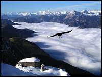 Inversion
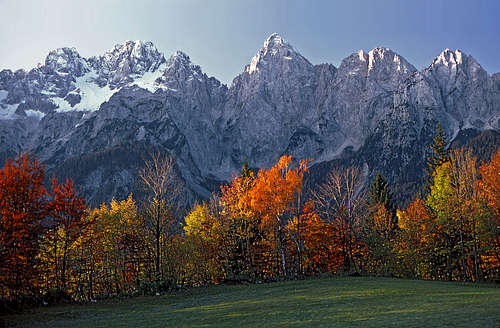 Martuljek group
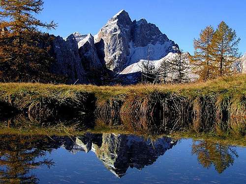 Jalovec
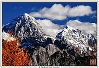 Velebit - Mangart and Jalovec
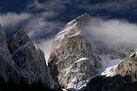 Gangolf Haub - Jalovec
 Mangart
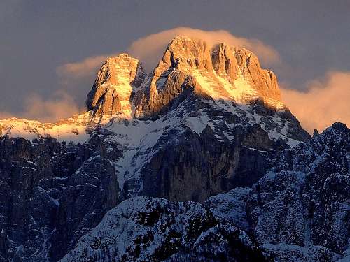 Montaž
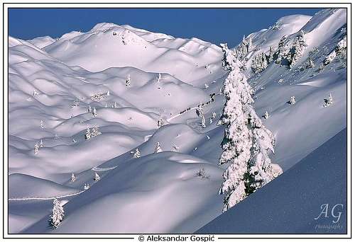 Velebit - Komna
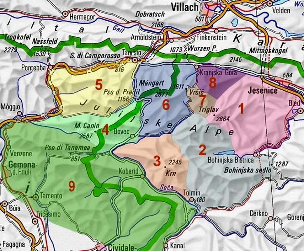


 Črni vrh in Polhov Gradec hills
 Soča
Soča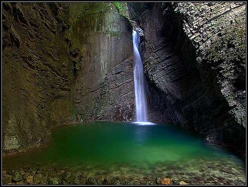 Kozjak waterfall


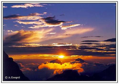 Velebit - Sunset on Kredarica below Triglav

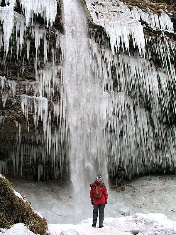 Peričnik waterfall in winter
janezarko - Nov 30, 2004 10:56 pm - Hasn't voted
Untitled CommentIs the southeast ridge route onto Triglav in Slovenija still open? I believe it is called Bambergerjeva pot.
Vid Pogachnik - Dec 1, 2004 9:23 am - Hasn't voted
Untitled CommentHm? Bamberg route is not the southeast ridge. It is the NW ridge, the final section coming to the top from SW. From SE the route from Planika hut comes. And both of these routes are opened and well maintained. I mean - now, in winter - it's hard to say that they are opened. They are under snow and the ascent is a hard climb. But in summer they are normal ferratas.