While the first week of our vacation to Slovenia provided fine weather during the remaining two weeks we had to study weather forecasts real carefully. We struck gold a few times but most of the time the weather window wasn't perfect. Still we managed to reach these windows so that there was only one day on which we had to leave the mountains to keep us busy. But you will see below ...
Sept 22nd – Viševnik, Mali Draški Vrh, Veliki Draški Vrh
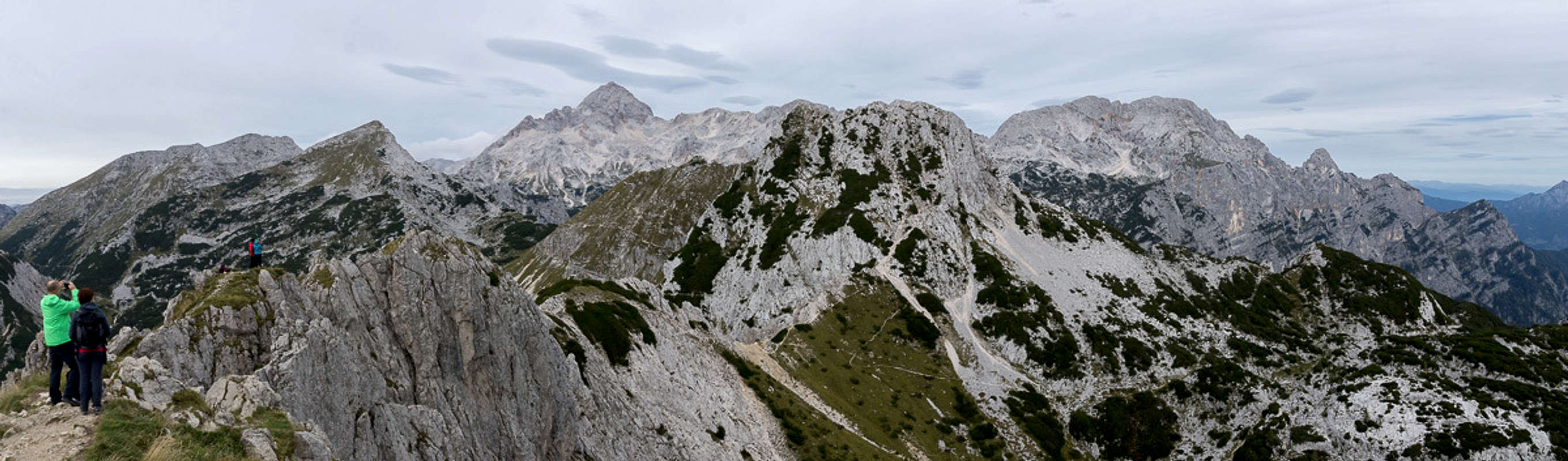
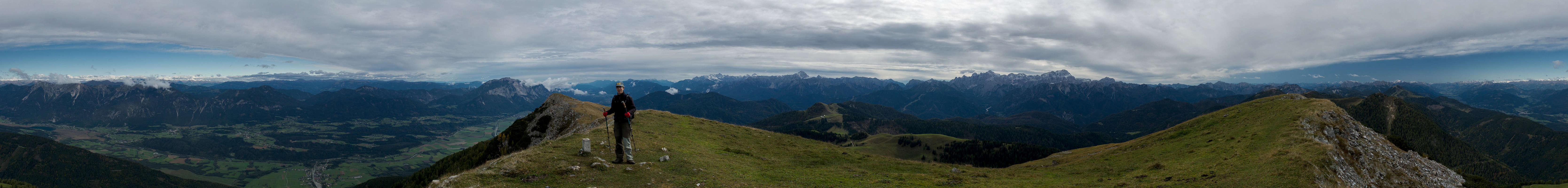
Summit view Viševnik with Tošc, Veliki Draški Vrh, Triglav, Mali Draški Vrh, Rjavina
After yesterday’s extravaganza, today we are back to the game “guess where weather will be best today”. At breakfast we quickly decide where we’ll start – at Rudno Polje (right there in Bled’s backcountry) but we have to tours to choose from, one to Debela Peč and one to Viševnik and Veliki Draški Vrh. We decide on the latter as we did the former back in the day, 12 years ago. Plus our choice is much closer to Triglav and we’ll be able to scout its routes.
Rudno Polje lies at 1350m so it is the highest starting point of all Triglav Routes. It is Sunday and although it is still early and there is fog all around the big parking lot is already well filled. We head out westwards into the woods until we reach a little ski lift. Here the route to Viševnik turns off and we follow the small ski run. Which turns out to be surprisingly steep. Once above the timber line most of the clouds have vanished and we have an overcast view towards the east and the south. With many other hikers we scramble upwards. Shortly before we reach the summit we pass a mother who is carrying her not so little child all the way up. Her husband and two other boys are waiting right beneath the summit block. And together all the five reach the top right behind us.
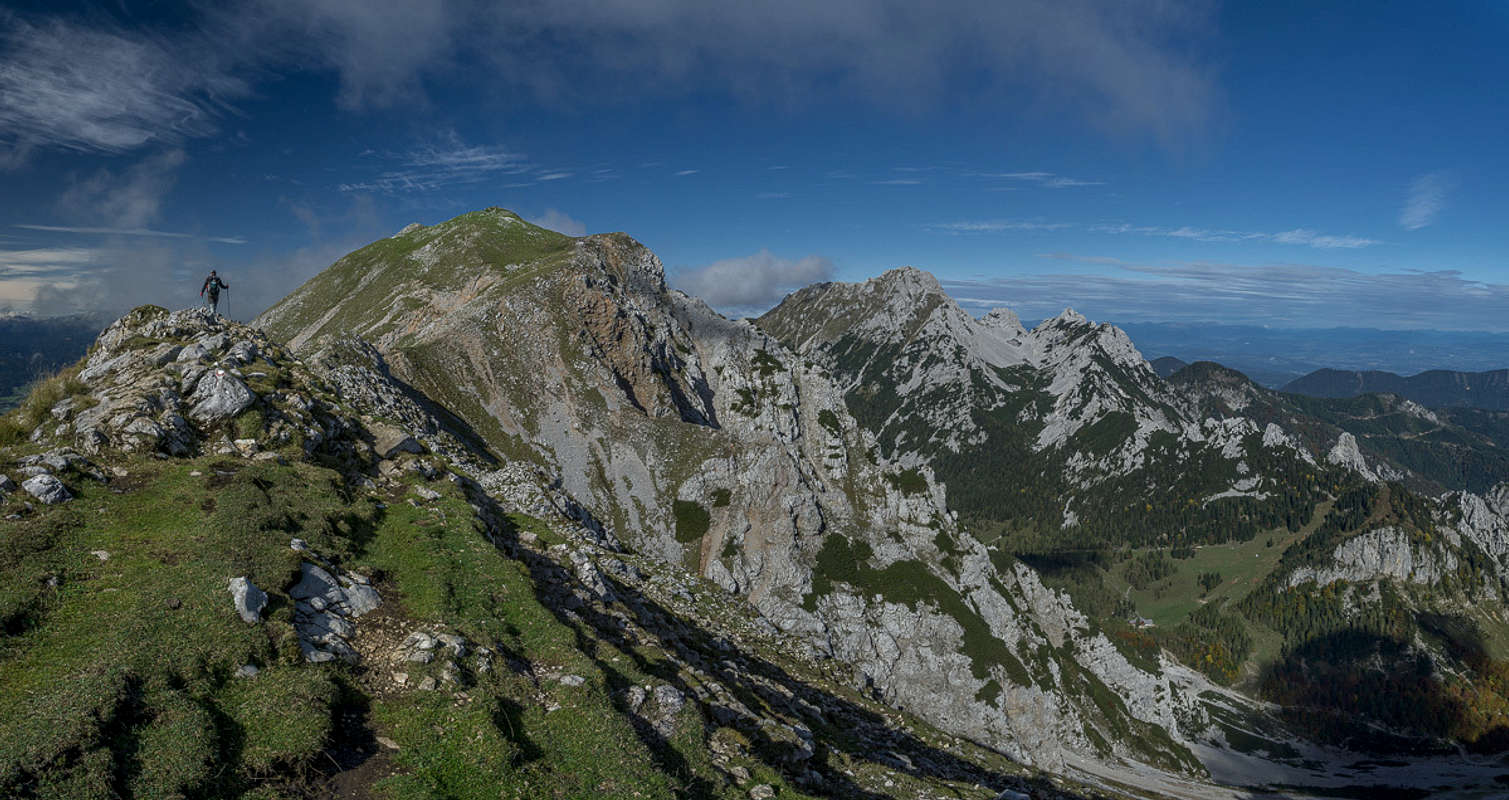
Thanks to the overcast skies the views could be better but if you look closely you can see everything you want. The summit is very crowded, however, and we quickly decide to leave. While most others return the way we all came we head the other way, down Viševnik’s east ridge, quite steep and very brittle. In the saddle between Viševnik and Mali Draški Vrh we have the choice between four different paths. Since we follow the suggestions of a guidebook and since there are GPS tracks for all routes in the book we consult our mobiles. The track leads to the Mali Draški Vrh Summit, descends the south ridge and then goes onward to Veliki Draški Vrh.
As we start heading up very steep and chossy terrain we question our decision. But where there’s a GPS track there must be a way and consequently we dance our way up the choss. We make it to the summit and realize we are much closer to Triglav than before but there’s no sign of the descent route. Moreover, the summit block drops vertically on all sides (bar the one we came) so we decide to have a look at the description in the book. There we read that we should have passed Mali Draški Vrh on one of the other paths. Obviously track and description don’t match!
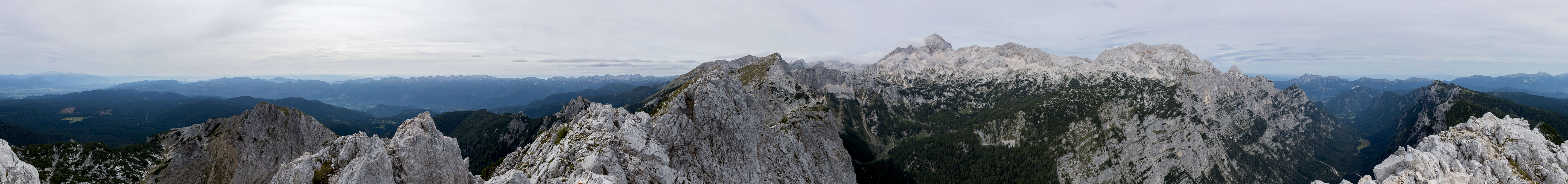
360° summit panorama Mali Draški Vrh
Descending is much worse. Again and again we start to slide, sometimes we have to take huge steps and my knees start to really hurt. I’m not as young as I used to be! A quarter down from the summit I think I see where the GPS track might really lead but we decide to skip it. After all we came up here so we know what we’re up (or down) against. And finally we manage to get back to the five way intersection.
This time we opt for a path which traverses the east slopes of Mali Draški Vrh. After a few steps it is protected, following a ledge in the slope. People with full ferrata gear come the other way. We are unprotected and wonder whether this is another bad idea. But no, the protected section gives way to the slope traverse on grass and we head almost directly to the next saddle, this one separating Mali and Veliki Draški Vrh.
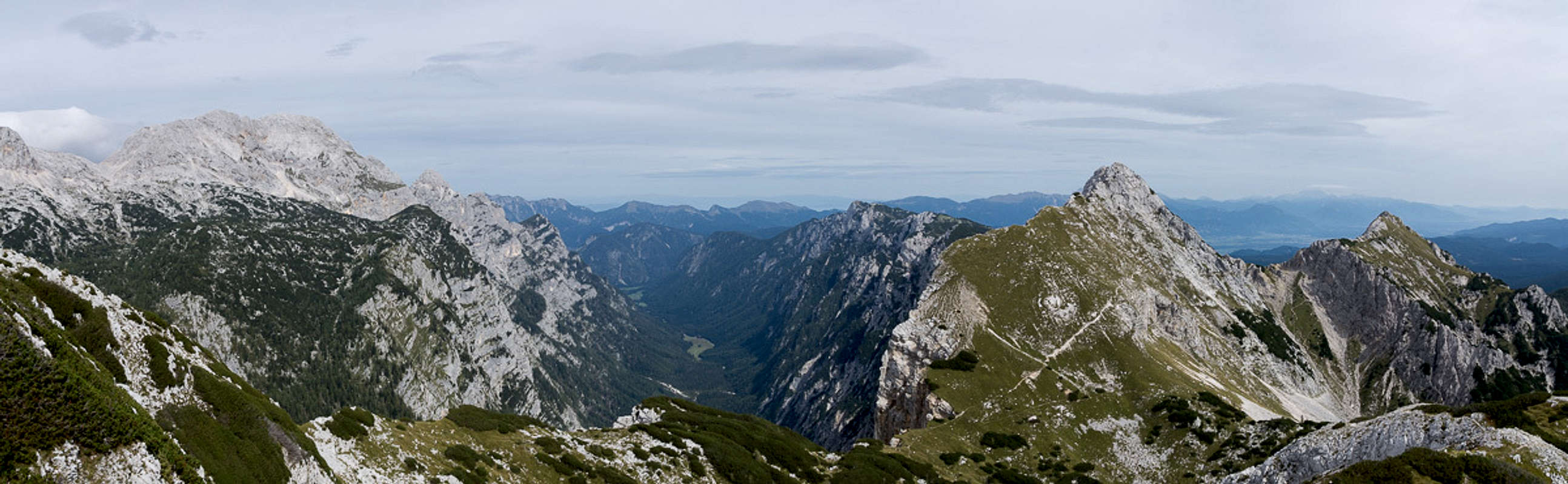
Krma Valley seen during the ascent to Veliki Draški Vrh
It is an impressive place. Without warning we suddenly stand more than 1000m above the U-shaped Krma Valley, Triglav, Rž and Rjavina on the far side and the Mali Draški Vrh west face on ours. Beyond the mouth of the valley we can see Rosenkogel, Hahnkogel and Kahlkogel, the Karawanken / Karavanke Summits we visited on the second day. Even though we are hungry it’s not late enough for lunch yet so we decide to head onwards to Veliki Draški Vrh. Only one other hiker seems to be heading our direction and we are slowly gaining but suddenly, clack, clack clack, one of the young biathletes from Rudno Polje passes us and reaches the summit first.
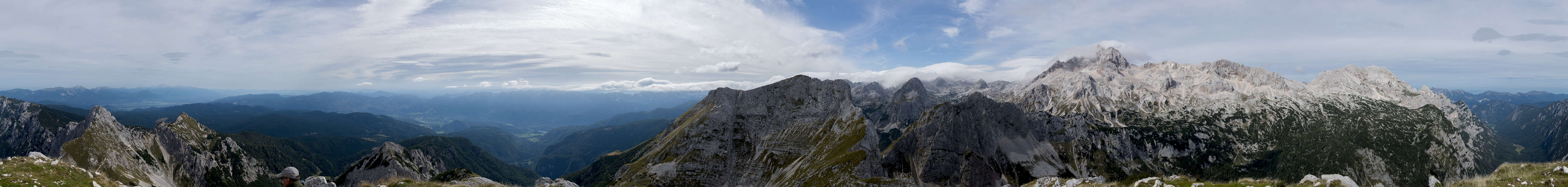
360° summit panorama Veliki Draški Vrh
We take the usual routine – pictures, lunch, sweets – then we discuss the mountains we see and finally we’re alone on the top. A few more minutes and we return the way we came. Back in the saddle we turn right and head across the Veliki Draški Vrh North Slope and finally join the Triglav Route. There’s a lot of traffic there, we file in and trudge the way back to Rudno Polje. Again we are very late as we reach the apartment.
Sept 23rd – Blejski Jezero, Vintgar Gorge
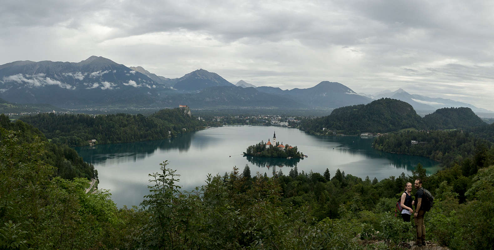
Blejski Jezero, complete with posing couple (unknown)
Today will be a rainy day and it doesn’t make sense to go to the mountains. In order to keep moving we decide to do the tourist routine – hike to Bled, around the lake, visit all the viewpoints and finally hike over to Vintgar Gorge to see that as well. It’s going to be a long hike but probably not with much elevation gain.
It is still early as we start and even as we reach Bled only few people are on the lake shore. The lake is famous for
The castle on a rock on its northern shore
The church on an island in the lake
The gondola which take the tourists to the island
It doesn’t take long, half an hour, until we reach the landing where you can hire the gondolas. Already several busloads of tourists, all of them Chinese, have arrived. Everybody is taking photos while the guides discuss the ferrying price. We gusess that this is the most photographed spot in the whole country Slovenia.
We hurry on and close to the western end of the lake we hike up the hills in search of the famous viewpoints where you can see lake, island, castle and the highest mountain of Karawanken / Karavanke, Stol / Hochstuhl) at one glimpse. There is a loooong ladder up towards the mirador and we are probably the first ones up there today. We leave after two photos and the next couple arrives. A few steps later we pass an upcoming group and it goes on like this. There is a second lookout where everybody takes turns to get themselvses photographed with the famous panorama.
It starts raining (only for a short time) and we head back to the lake, completing the circle and having an early lunch back on a bench on the shore in Bled. Afterwards we hike through town and some villages in its north, following the signs to Vintgar Gorge. There are several huge parking lots and even in this weather they are well filled. We have to pay 10€ per person to hike through but the gorge disappoints. It’s not even narrow. Also, as we enter it the forecasted downpour starts and doesn’t let off until we are back in Bled. The forest paths are very muddy and we rather slip and slide all the way back to civilized pavements.
Sept 24th – Komna Karst Area
Alpensalamander
Better weather today. Judith directs us to the very end of Bohinj Valley. She is fascinated by karst phenomena and high above the west of Bohinjski jezero there is the large Komna Karst Area. In WW I it was used to supply Austrian and German troops on the Izonzo / Soča Front and there is a well-kept mule trail up from the valley floor. What we did not expect, however, is that you have to hike 48 switchbacks and still are not even close to the plateau. Thus the Alpensalamanders we see close to the start are the only things we see for a very long time.
Komna Karst Area
We have the first views from the mountain hut Dom na Komni but not really much. After the hut we have to descend back into the woods and only reappear into the open on Planina Govnjac. It is an oval pasture surrounded by karst mountains (all about 2000m) and there are quite a number of WW I army ruins here. We have to decide between two paths and take the steeper and shorter one – only to realize that we have to bushwhack through big patches of dwarf pines. This path is virtually unused.
Komna Karst Panorama
Where both paths recombine we enter a big doline. It opens up like an amphitheater were we stand. On and on and on we go bt we have to realize that we have lost too much precious time so that we won’t reach Bogatin, a near 2000er on the plateau. Instead we scramble up to an unnamed saddle and climb some hills to both sides of it. I take a few photos before we get ready to return. Naturally we take the other (longer) trail to Planina Govnjac. Again we visit Dom na Komni before we head back down all those 48 switchbacks.
Sept 25th – Kaminški Vrh, Planjava
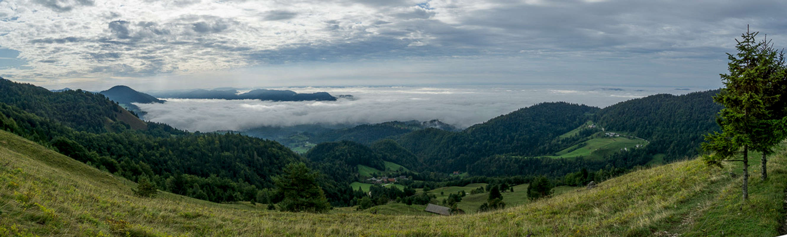
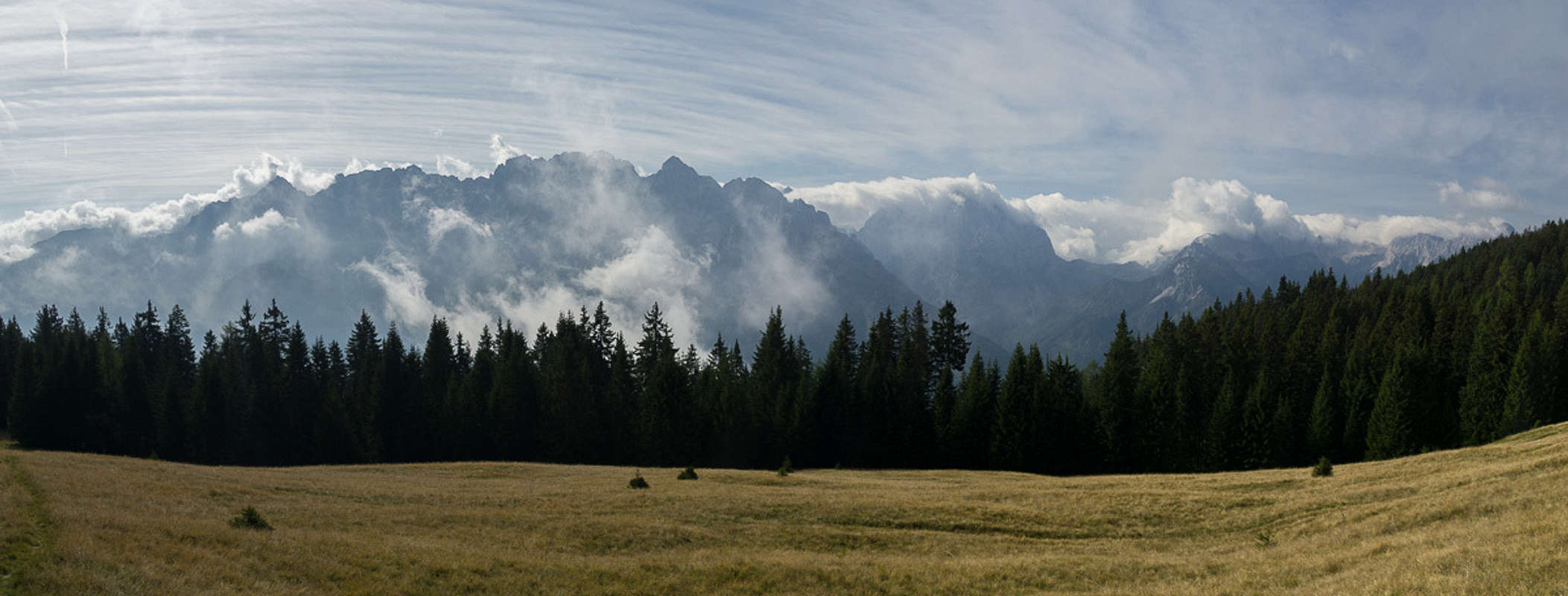
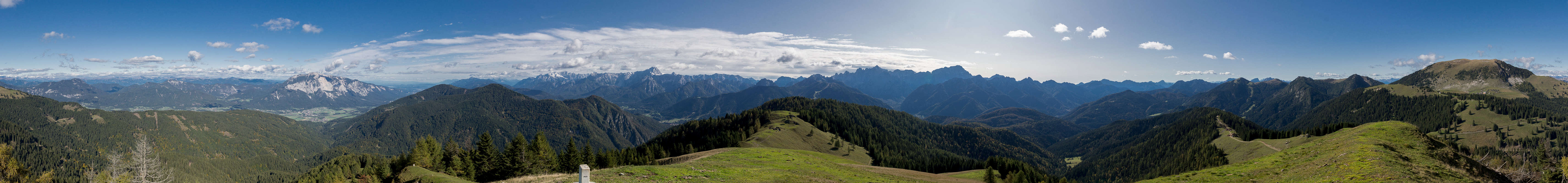
Fog above Slovenia
Another bad weather day! We drive out to the Kamnik Alps for the first time, trying to get in a morning hike before the big rain will arrive. Our destination is Kaminški Vrh, a grass summit located to the east of the Krvavec Ski Area. It’s a lonely area – nobody there except a handful of cows. As we head up the slopes we realize that the whole of Slovenia is covered with clouds. The plains lie underneath a cover, the mountains are deep inside the clouds only our summit lies in between. Seems like it was a good decision to hike here.
Yellow ladybug
From Kaminški Vrh we traverse to the similar Planjava and from there down to Planina Osredek. Here I encounter my first yellow (!!) ladybug but that’s about it for today.
Sept 26th – Vogel, Zabiški Kuk, Šija
Julian Alps Panorama from Zabiški Kuk
Now, then! Weather is gonna be a blast today. Judith suggests Vogel in the south of Bohinj. You can ride a cable car to 1500m and from there have to get up to 1900m. Doesn’t seem to be too long or difficult a hike. Maybe a short day today?
In Bohinj – it seems to be the usual pattern – there is fog above the lake. Buying those cable car tickets sure needs some persuasion. What if we go up there and stay in the clouds? But we needn’t worry. Shortly after the cable car starts we break through the cover and above it you can’t complain. No cloud in sight. Judiith forgets her walking poles in the cabin for all her happiness but is able retrieve them before it heads back down again.
As we head through the forest towards the Vogel ridge the first clouds develop above Triglav. It’s probably going to be a good but not perfect day. We can see many of the summits we’ve already been to, either this vacation or twelve years ago. We reach a saddle and for the first time are able to look across the south of Slovenia and towards the Adriatic Sea. We’really close it seems. In the next saddle a short ferrata starts. The rock is polished and slippery, so that we are happy about the protection.
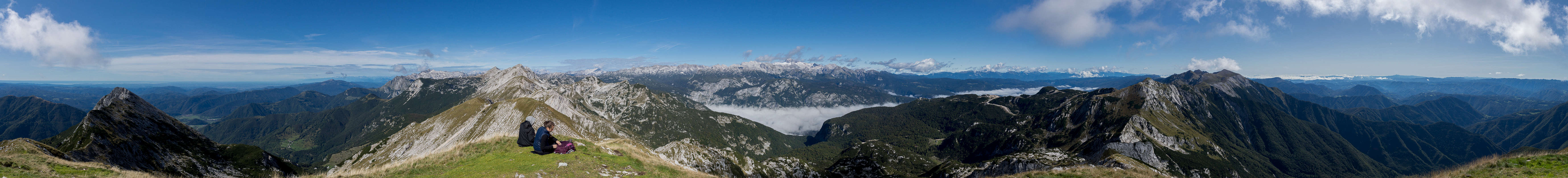
360° summit panorama from Vogel
After some 200m of steep, protected scrambling the path levels and heads across the Vogel north face. It heads for the next saddle to climb the summit from the western side. There are several trails and we hope we take the easiest one. An excellent panorama awaits us.
As it is too early for lunch we decide to climb Zabiški Kuk, Vogel’s southern neighbor. We return to the saddle and traverse towards the mountain losing quite a lot (and more than necessary) elevation. Zabiški Kuk has an overhanging east face and hiking its ridge is kinda scary. There are many summits and we declare the second one to be the main one and fit for lunch. Thanks to its location to the south of the main ridge, Zabiški Kuk has a curious panorama – the two branches of the South Bohinj Chain seem to run at it, forming a sharp point at Vogel.
We admire the views and scare ourselves a bit at the overhangs but after lunch we return. However, since the trail to the Vogel summit seems to be in better shape than the one we came upon, we decide to visit Vogel for a second time today. Again, there is another couple on the summit but since we’ve been here already we quickly pass by, heading for saddle and slope traverse. Back down the ferrata section it goes but at the base of Vrh Ldani we decide to make a detour across the Šija Summit. The ascent is easy but on top we realize that clouds are moving in from all sides. Thus we quickly descend along the steep north-east ridge. From the base we follow a trail which crosses a multitude of ski runs before it ends at the cable car. We ride down and head back out along the valley in a convoy of tourist coaches…
Sept 27th – Kalški Greben from the Krvavec Ski Area
More fog over Slovenia
Now we’ve been to Bohinj multiple times already and Judith has had her say, today we decide to go to the Kamnik Alps. Weather is a bit unsure so we won’t go to the centre but there is an option to start high up from the Krvavec Ski Area and thus reach the summit of Kalški Greben right vis-à-vis the highest mountains. Moreover, Jasmina and Vid had suggested an interesting ridge traverse so there are options.
Polyommatus icarus
The problem with the suggestion – or rather with us – is that we didn’t quite understand it. Some lower summits (2000ish) with good views into the heart of the Kamnik Alps. A look at the map lets us decide we have to climb Vrh Zvoh first, traverse to Vrh Korena from where we can tackle the big one at last. It is only much later that we realize that two completely different summits should have started the hike.
Again, Slovenia is lying beneath a cloud cover, which makes the hike through the ski area somewhat bearable. We pass the ski lifts, the ski hotel, we also pass the Krvavec Summit but then head up a very steep ski run to the summit of Vrh Zvoh. There’s a ski lift and a water reservoir on top and somehow both look like an industrial monument. From the summit we have a first view into the heart of the Kamnik Alps, but also a view of the ridge we intend to hike. It looks quite interesting.
360° summit panorama from Vrh Korena
Indeed it turns out to be a brittle knife edge. In one section there is a protected descent into a gully and another one back out of it. Without protective gear we feel a bit uncomfortable. But taking our time we finally manage to head off the ridge near Vrh Korena. We decide to hike the little detour to the summit, if only to take a summit panorama. Clouds are developing above the main ridge and we’re wondering whether it makes sense to proceed to Kalški Greben.
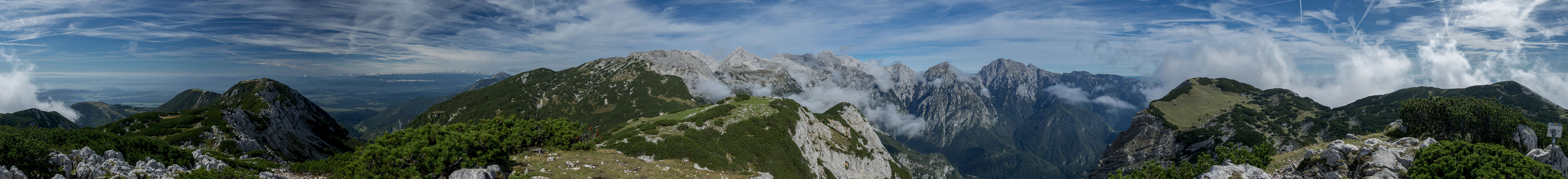
The Kamnik Alps Main Ridge seen from Kalški Greben
But as there are still blue skies to be seen we head onwards through a large patch of dwarf pines. As we reach a saddle right before the summit block of Kalški Greben, we dislodge a flock of sheep which head away from the summit. Passing them, we tackle the final ascent and finally stand on Kalški Greben, which is swept by ice cold winds. Lunch is not much fun today and yes, clouds are still forming everywhere.
So we quickly return but this time descend towards Planina Dolga Nijva, a nice mountain pasture, where we alays are able to see the ridge we traversed in the morning. Here, the sun is still shining and there is little wind so we quickly get warm again. Even more so as we have to climb back up to the ski area of Krvavec, where needlessly we get ourselves lost. Bushwhacking back into civilization through the omnipresent dwarf pines we barely realize that quite suddenly the weather turns for the worse. Once back on a trail we quickly hike back to Hotel Krvavec and back to our car.
Sept 28th – Bohinjsko Jezero and Šlap Savica
Bohinjski Jezero
Heavy weather forecasted so it’s another hike around a lake, Bohinjsko Jezero, this time. There’s no wind so the lake is like a mirror but that’s about all that's good. At the end of the lake we hike towards the Savica Waterfall (another 3€), then back and along the southern shore back to Ribčev Laz. Today’s highlight are the ducks fighting for breadcrumbs, surely fit for WWE wrestling.
Sept 29th – Ferlacher Horn
Ferlacher Horn from the south-west
It doesn’t get better today. There are chances of blue sky in Austria in the north so we drive across Loibl Pass towards Ferlach and Zell-Oberwinkel. Here we intend to climb Ferlacher Horn, famed for its wonderful views. In this kind of weather you gotta be lucky and indeed, as we get the first glimpse above the forest canopy, Hochobir and Ferlacher Horn have cloud caps while Košuta / Koschuta is hidden in a witches cauldron worth of clouds.
Brocken Spectre on the Ferlacher Horn west ridge
Most of the hike runs through forest so there is nothing we miss and indeed in the one open spot we are right above the clouds with the sun smashing across us into the fog. And for the third time in my life I’m treated to the spectacle of a brocken spectre. After that – more clouds and that’s what the famed view looked like:
Again the first look at breakfast goes to the weather forcast on the mobile. Murky throughout with a bit of a chance for fair weather in the west of Karawanken / Karavanke. Thus we decide to hike Trupejevo Poldne / Techantinger Mittagskogel, which Vid had suggested on the first day but we opt for the route described in our guidebook. Thus we start from Srednji Vrh above Gozd Martuljek, the best place to marvel at the skyline of Oltar, Ponca and Špik of the Martuljek Group of the Julian Alps. And that is exactly what we do as we get out of our car in the small parking lot of the hamlet.
The Julians are visible but there are thick (I mean THICK) clouds above their summits. Here on our side, things appear to be better and we set out on a slope traverse, direction Kranjska Gora. At a farm building we leave the road and head up a steep, unmarked dirt road, which crosses some pastures before it vanishes in the woods for quite a while. We reappear close to the summit of Vošca / Woschza, a shallow, round-topped grass mountain. Views have already deteriorated but that was to be expected.
Julian Alps Panorama from Vošca / Woschza
Almost on the summit we encounter a blindworm, a legless lizard, which is desperately trying to get out of the way. Far less elegant than a snake it throws itself back and forth across the path before hiding in the first grassy spot it can get to. From this summit we will now follow the border between Austria and Slovenia. The trail is an old Slovenian border trail but nowadays there are no patrols anymore.
The trail descends steeply in many switchbacks before heading up to the next mountain, Blekova / Blekowa. This, however is covered by trees and there is no single view so we quickly pass and descend again. The next destination is Blekowaalm, a pasture with a hut, where we can see our final destination, Trupejevo Poldne / Techantinger Mittagskogel for the first time. Also, there is a nice view northwards into the Drava / Drau Valley with the city of Villach lying 1500m below.
We now head onto the long south-west ridge of Trupejevo Poldne / Techantinger Mittagskogel, first negotiating dwarf pines and later reaching the brittle west face of the mountain. To please us, some of the clouds over the Julian Alps have vanished and we are treated with some quite decent views. The wind, however is very strong and cold and we barely find a place where we can hide from it. After lunch we hike over to the east summit where I take my 360° panorama. And from there we head back into the forest.
Martuljek Group from Srednji Vrh
At the end of the day, as we reach the meadows of Srednji Vrh, almost all clouds have retreated and we get another fine view of the Martuljek Group. It stands above an amphitheater-like cirque on the other side of the valley and we take a last break to marvel at it. Here the mountain tops are almost 2000m higher than the valley floor!
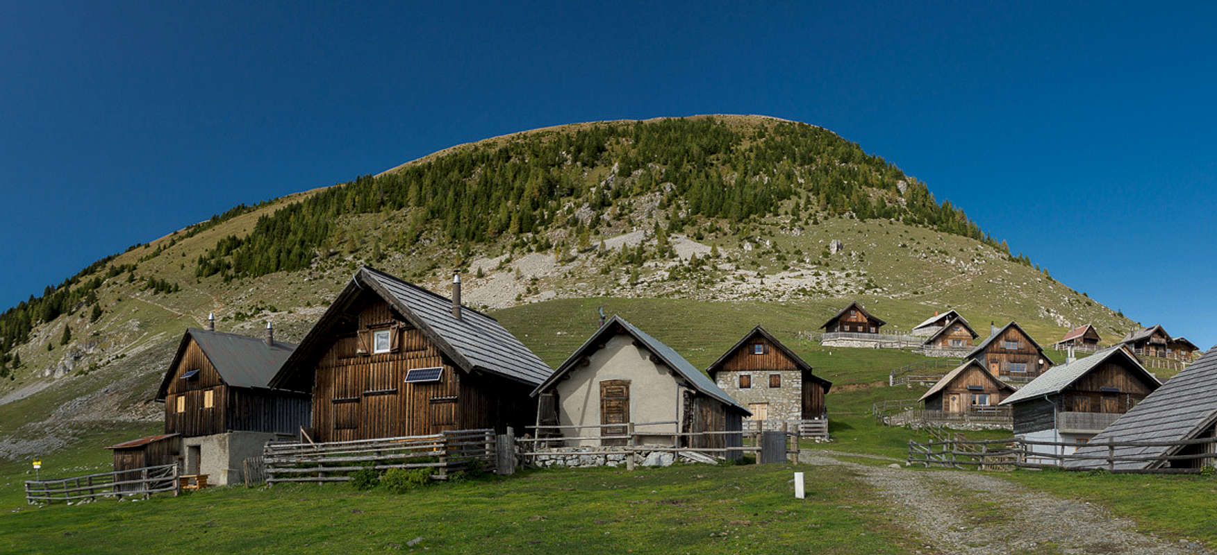
Oct 1st – From Črnivec to Planina Travnik
Planina Travnik
No weather luck today! We intend to drive to Velika Planina anyway but as we arrive at our intended trailhead we’re deep inside the clouds. So we turn around and head for Črnivec, where Judith has discovered a “ridge traverse” at medium height. Only it isn’t. We slide across muddy tracks inside dark forests and only very occasionally do we get something like a glimpse of our surroundings. Also we always stay deep beneath the north side of the ridge. At Planina Travnik we have lunch and afterwards head to the south side to return through the woods there. We really don’t see much today even though we hike close to 20km.
Oct 2nd – Pokljuka Gorge, Postojna Caves
Cave in Pokljuka Gorge
While yesterday it still was dry, today, in the late morning a veritable deluge is forecasted. We get up early and drive the short distance towards the dry Pokljuka Gorge in Bled’s backcountry. It has a cave with four openings and some rather nice narrows. However, it starts raining early on and we are lucky the gorge is so short. We’re back in less than two hours.
Dripstones in Postojna Jama
As there is nothing to expect from this afternoon anymore we decide to drive the 130km to Postojna and visit the world’s second largest dripstone cave. We’ve been there before and it’s a very impressive experience. You ride a small train through the first 2km of the cave system before the actual tour starts. However, the whole thing has become VERY touristy but that has to be expected from a sight of that calibre. Still we enjoy the sights and as we get back to the surface the deluge is still ongoing. This confirms that the visit was probably the best thing we could have done today.
Oct 3rd – Oisternig and Schönwipfel
Oisternig above the huts in Feistritzer Sattel
With all the water swishing around the region yesterday the start into today is still quite humid. There’s no rain but it’s quite dark because of a high cloud layer. Blue skies are bound to roll in from the west so that’s where we’ll go today. We’ll attempt Oisternig, the easternmost 2000er of the Carnic Alps, no impressive mountain for sure but one with famed views nevertheless. From Ugovizza a well-kept mountain road takes us to a large parking lot at the former Rifugio Nordio, where we start our hike.
Our first destination is Lomsattel / Sella di Lom to both sides of which you can find mountain huts. Both have closed for the season, however and as of yet there’s still little to see. Thus we start the traverse to Feistritzer Sattel / Sella Bistrizza at the southern base of Oisternig. There is a village of mountain huts in the saddle but these, also are closed. In the saddle the wind picks up and it really gets freezing cold. We’re waiting for the sun to come up but judging from the skies this is bound to take quite some time still.
360° summit panorama from the Oisternig east summit
We head up the south slopes of Oisternig, more or less heading directly for its main summit. There is an old army barracks close to the top, probably dating back to the times of WW I. Up at the summit we have clear views and can see the cloud cover ending far out in the west, where we can see as far as Monte Pelmo and Monte Antelao in the Dolomites. There perfect weather has already arrived hours ago.
There is not much shelter from the wind on the main summit so we hike over to the western one. A flock of goats hide in a depression and close by there’s a good spot for us. Still it's real cold and we pull on every piece of garment we brought with us. To the south we can see the big amphitheater between Jôf Fuart and Jôf di Montasio and right in front of it Jôf di Miezegnot, which we hiked more than two weeks ago. To the north, Großglockner can be seen but only occasionally when clouds allow.
360° summit panorama from Schönwipfel
We descend along the east ridge, like so often pushing through dwarf pines. As we reach the hut village in Feistritzer Sattel / Sella Bistrizza the first rays of the sun reach us. Immediately the temperature shoots upwards. We hike over to Achomitzer Alm / Malga Acomizza touching upon the nice little chapel Maria Schnee / Madonna della Neve. Once at the buidings of the Alm we decide to climb Schönwipfel / Monte Acomizza / Zahomec. It is a round-topped grass summit with a wonderful panorama towards the Julian Alps. On the way back to the parking lot we visit another chapel, Hubertuskapelle / La Rotonda.
Oct 4th - Begunjščica
On the Begunjščica summit ridge
So here it finally is – our last day in Slovenia. We decide to climb Begunjščica, which Jasmina and Vid had suggested for the first day so it seems to be fitting to do it on the last. Starting from Loiblpass, we follow an old ledge trail above Loibltal in order to reach Planina Preval. As we start to climb the steep south-east ridge the first clouds develop around neighbouring peaks. Is it going to be one of these days?
We take a short break to have a snack – and immediately we are pestered by choughs. Four of them line up to get a hold of something. No chance – guys! We close in on the first summit, Begunjška Vrtača, which we pass to the south heading for the east ridge of Begunjščica. There are several summits and it takes much longer than expected to get to the main one. However, hiking the ridge is also very nice with good views to the mountains of the vicinity, here in the centre of the Karawanken / Karavanke Range.
360° summit panorama Begunjščica
We meet half a dozen people and two dozen choughs on the summit. The birds feed from morsels held aloft, they climb boots and at the end one even jumps onto my lap. After lunch a sailplane starts jogging back and forth over Begunjščica’s south slopes and as we head down the west ridge again and again we are at eye level with the pilot. It feels strange…
We descend to Roblekov Dom (still open) and from there on to Dom Pri Izviru Završnice (closed). The valley is very nice with the massive west and north walls of Begunjščica towering above us. We head on to Dom na Zelenici (open again), from where we hike along a disused ski-run back to Loiblpass. As the sun sets behind the mountains it get freezing cold again but luckily we pretty quickly reach our car.
Last words
On Monte Cimone with Jôf di Montasio in the back
It was a good vacation and with two more fine days it would have been very good. We didn’t hike in the Julian Alps as much as we had planned but instead developed a taste for the smaller Karawanken / Karavanke Range. Some of the hikes (like Košuta / Koschuta) were absolutely stunning but a bit too many were marred by weather. I guess that means we will have to visit once again…
Gangolf, you did nice tours, despite not perfect weather.
One suggestion: Instead of relying on GPS tracks, posted by whoever, try to rely on SummitPost. From Mali Draški vrh there is indeed no direct path down on the saddle towards Veliki Draški vrh. The ridge is exposed, brittle as well and a stretch of it required UIAA II degree downclimbing.
Cheers!
Vid
Gangolf Haub - Nov 11, 2019 10:54 am - Hasn't voted
Re: Bag well filled with summits
Of course you are right about the GPS track. BUT - this is what I read on Bor's page:
On the W side is connected with Veliki Draski vrh with the beautiful ridge. This ridge can be climbed and the difficulty is not harder then UIAA II-III. Between Veliki and Mali Draski vrh is a small pass and from this pass to the summit of Mali Draski vrh goes this route.
So I guess I would have made the same mistake. And anyway, if you are in the saddle you can actually think you see the route. From the top it also looked like a path - however, it looked harder than our league ;-)
Parents refers to a larger category under which an object falls. For example, theAconcagua mountain page has the 'Aconcagua Group' and the 'Seven Summits' asparents and is a parent itself to many routes, photos, and Trip Reports.


Comments
Post a Comment