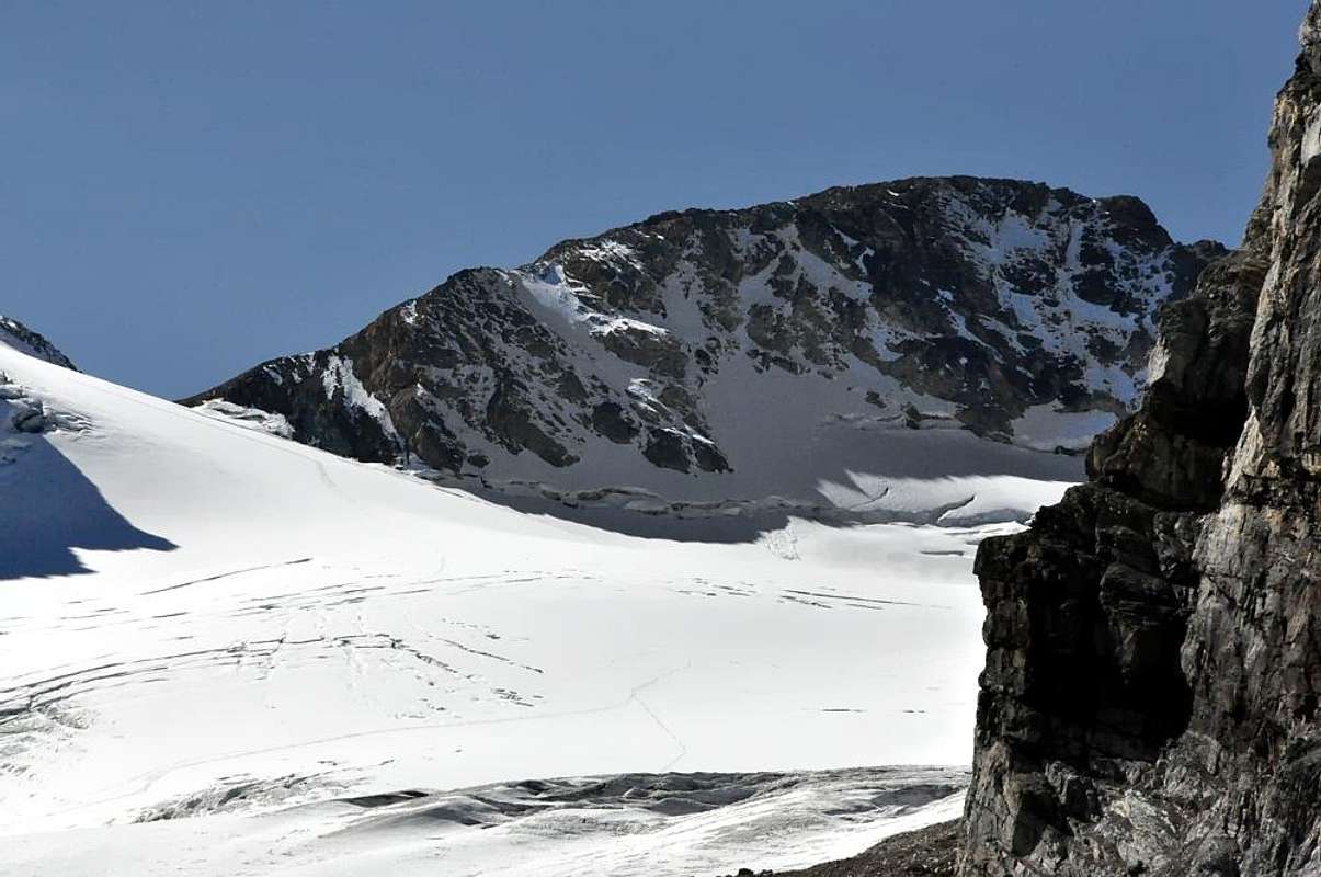
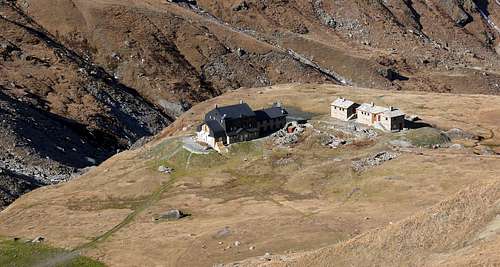
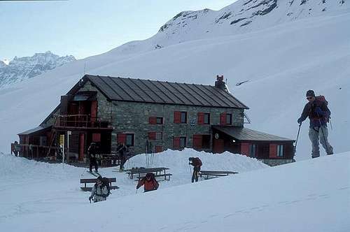
Punta Calabre is the southest point of Val di Rhêmes. A long and easy hike from Thumel, and Gian Fedrico Benevolo Hut (2.285m). For sure, better for ski-mountaineering, for a funny descent even in late spring. As for all icy minor peak of Val di Rhêmes, Punta Calabre is rather ignored from hikers. In summertime, alpin gear is required, because the Tsanteleynaz glacier has to be crossed to reach large summit. This glacier could be tricky! Pay due attention.
Punta Calabre, Frenchized in Pointe de Calabre, consists of a large icy hump, supported by a N-NW Shoulder (3.293m) which can also be considered as the second peak, if only for its rocky and fairly on Northeastern side which, accompanying the line of the North Wall, falls above the Centelina Glacier at an altitude of 3.065/3.079 meters while the base of the second is located at approximately 3.130 meters. A slope is the first, which is split into the Northeast and Northwest by a small NorthernEdge that starts at an altitude of about 3.200 meters. Two climbs, the first on the Northeast and North Walls, which certainly do not make the history of mountaineering, but are certainly considered fun and certainly less banal than the Normal Route. Looking to the right (West-Northwest), the snow-covered glacial slope formed by the extreme slopes of the Southern Slope of the Sauches Glacier climbs, congealed in the basin that swarms from Calabre towards the three summits of Quart Dessus (Dessus or Southern 3.472 meters; Dessus or Central 3.423 meters; Dessus or Northern 3.490 meters) , Tsantelèina (3.601m) and up to Pic de Golette (3.291m). This last slope constitutes the current (and perhaps almost always, since already in December 1931 it was used to carry out the first winter ascent) Via Normale, which, however, at the beginning corresponded to the E-NE Ridge from Colle di Rh & ecirc; mes , as evidenced by the path of the almost unknown first ascenders of August 1881 as well as the repetition of August 1889 by the a climbers rope of the famous Reverend W.B.A. Coolidge accompanied by the equally famous Swiss guide Christian Almer Junior. Even if the French brothers A. and P. Puisieux had not gone very far from the Summit, reaching, always on the Western Side (even if the climb came from the South, that is from the Isère Valley) and always in August but 1876, the wide saddle-collar about 3.355 meters at the junction of the Italian of Sauches Glacier with the French Glacier de Bazel in the Isère Valley. This Eastern Crest on the other hand, rises from the summit of the Glacier de Tsatelèine and is quite fun with some fairly demanding passages (from II°, II°+ to III°, for short stretches), but requires attention in choosing them due to the bad quality of the rock. (as indeed for all the itineraries of this mountain on the Valle d'Aosta side), as well as for the choice of passages on the edge of the ridge or below it. Things go a little better on the French one or as regards the itineraries carried out on the SE Face, where the rock is good (except for some parts in the final part of the various climbs with a height (from 330 to 420 meters) , while the difficulties range from IV° to V° and also to V°+ with overall assessments from TD to TD+ (extremely difficult and more than extremely difficult). On this mountain there are no hiking trails, for which one must opt or on
1) - ski-mountaineering trails; or
2) - on climbs in classic mountaineering style and again
3) - engaging on very difficult and demanding routes almost on the edge of sport climbing.
La Punta Calabre è il punto più a sud della Valle di Rhêmes. Una lunga e facile escursione da Thumel e dal Rifugio Gian Federico Benevolo (2.285 m). Di sicuro, meglio per lo sci-alpinismo, per una divertente discesa anche in tarda primavera. La Punta Calabre non è molto frequentata dagli escursionisti. In estate è necessaria l'attrezzatura alpinistica, perché il ghiacciaio di Tsanteleynaz deve essere attraversato per raggiungere la vetta. Questo ghiacciaio potrebbe essere difficile crepacci! Prestare attenzione.La Punta Calabre, francesizzato in Pointe de Calabre, consiste in una grande gobba ghiacciata, assecondata da uno spallone a N-NO (3.293 m) che può esere considerato anche come la seconda Vetta, se non altro per il suo roccioso ed abbastanza Versante Nordest che accompagnando la linea della Parete Nord, precipita al di sopra del Ghiacciaio di Centelina alla quota di 3.065 / 3.079 metri circa mentre la base della seconda si trova a circa 3.130 metri. Un Versante il primo, che viene sdoppiato in Nordest e Nordovest da uno spigoletto Nord che inizia da quota 3.200 metri circa. Due salite, le prime sulle Pareti Nordest e Nord, che di certo non fanno la storia dell'alpinismo, ma da considerarsi sicuramente come divertenti e certamente meno banali della Via Normale. Alla destra guardando (Ovest-nordovest), sale il versante iinnevato-glaciale formato dagli estremi pendii del Versante Meridionale del Ghiacciaio di Sauches, rappreso nel bacino che dalla Calabre sciama verso le tre sommità del Quart Dessus, della Tsantelèina e fino al Pic de Golette. Questo ultimo versante costituisce l'attuale (e forse da quasi sempre, poiché già nel dicembre del 1931 veniva utilizzato per effettuare la prima salita invernale) Via Normale, che, invece, agli albori corrispondeva alla Cresta E-NE dal Colle di Rhêmes, come testimoniano il percorso degli pressocché sconosciuti primi salitori dell'agosto 1881 nonché la ripetizione dell'agosto 1889 da parte della cordata del famosissimo Reverendo W.B.A. Coolidge accompagnato dalla altrettanto celebre guida svizzera Christian Almer Junior. Anche se i fratelli francesi A. e P. Puisieux non erano andati molto lontano dalla Vetta, raggiungendo, sempre sul lato Occidentale (anche se la salita proveniva da Meridione cioé dalla Valle dell'Isère) e sempre nel mese di agosto ma del 1876, l'ampio colletto-sella circa 3.355 metri. alla congiunzione dell'italiano Ghiacciaio di Sauches con il francese Glacier de Bazel nella Valle dell'Isère. Questa cresta Orientale sale invece dal sommo del Glacier de Tsatelèine e risulta abbastanza divertente con qualche passaggio discretamente impegnativo (dal II°, II°+ al III°, per brevi tratti), ma richiede attenzione nella scelta degli stessi per la cattiva qualità della roccia (come daltronde per tutti gli itinerari di questa montagna sul versante valdostano), nonché per la scelta dei passaggi sul filo della cresta od al di sotto della medesima. Un poco meglio vanno le cose su quello francese ovvero per quanto concerne gli itinerari effettuati sulla Parete SE, dove la roccia risulta buona (tranne alcune parti nel finale delle varie salite con altezza (dai 330 ai 420 metri), mentre le difficoltà vanno dal IV° al V° ed anche al V°+ con valutazioni complessive da TD a TD+ (estremamente difficile e più che estremamente difficile). Per contro su questa montagna non esistono percorsi escursionistici, per la quale cosa bisogna optare o su
1) - percorsi di sci-alinismo; oppure
2) - su salite in stile di alpinismo classico ed ancora
3) - ingaggiandosi su vie molto difficili ed impegnative quasi al limite dell'arrampicata sportiva
First Ascents
First on the summit: Ettore Troya and two Companions Corporals of the Italian Alpine Troops , (Aug 07th, 1881).
In winter: E. Andreis, F. P. and S. Ceresa, M. de Benedetti, (Dec 27th, 1931); in ascent and descent by ski from Thumel through Tsentelèina and Sauche Glaciers.
Northwestern Slope (standard Via): in ascent unknown; in descent Rev. W.B.A. Coolidge with Swiss Mountain Guide Christian Almer junior, (Aug 29th, 1889).
Northwest Face of Quota 3.293 meters and N-NW snowy Crest: Osvaldo Cardellina and Marco Cossard, (Aug 27th, 1982), in ascent from Thumel in day.
Northern Edge of Quota 3.293 meters and N-NW snowy Crest: Osvaldo Cardellina and Alessandro Cardellina, (Aug 03th, 1983), in ascent in day from Thumel Hamlet, Lavassey Pasture, Refuge Federico Benevolo and through Centelina or Tsentelèina and Sauches Glaciers.
Northeast Face of Quota 3.293 meters and N-NW snowy Crest: Osvaldo Cardellina and Alessandro Cardellina, (Jul 31th, 1985), in ascent in day from Thumel.
North Wall: Osvaldo Cardellina, solo, (Aug 24th, 1978), in ascent in day from Thumel Village and through Centelina or Tsentelèina and Sauche Glaciers.
E-NE Ridge (from Col de Rhêmes): Ettore Troya and two Companions Corporals of the Italian Alpine Troops, (Aug 07th, 1881), in ascent and in descent with round trip from Rhêmes Notre Dame, Lavassey Alp to, through Souteastern branch of Tsantelèina Glacier, Rhêmes Pass. First repetition: Rev. W.B.A. Coolidge with Swiss Mountain Guide Christian Almer junior, (Aug 29th, 1889).
Southeast Wall (Pilier Bazel Via): Alberto Bozon and Jacques Dupont, (Aug 11th, 1970), in ascent from Réfuge de Prariond in Val d'Isère.
Southeast Wall (Pivot Via): Albert Bozon and Jacques Dupont, (Summer 1972), in ascent from Réfuge de Prariond in Val d'Isère.
Southeast Spur (Soldanelles's Route): M. Benoit and B. Nivolet, (Jul 08th, 1972), in ascent from Réfuge de Prariond in Val d'Isère.
Getting There
From Italy
From Valgrisenche: From the motorway A5 Monte Bianco (from Geneve, Turin, Milan), take the exit Aosta Ovest and follow the direction to Arvier-Valgrisenche.
From Val di Rhêmes:
From the motorway A5 Monte Bianco (from Geneve, Turin, Milan), take the exit Aosta Ovest and follow the direction to Villeneuve-Val di Rhêmes.
From France:
From Val d'Isere: From the village of Val d'Isere, enter in the area called "Reserve Naturelle de la Grande Sassiere". From here, few routes, through Col de Rhêmes Goletta and Col de la Tsanteleina, permit to reach the Italian side at the foot of this mountain.
From Others parts: Is possible to reach the Aosta Valley also through the: France-pass of Piccolo St. Bernardo (closed in winter). France-Tunnel of Mont Blanc. Swiss-Tunnel of Grand St. Bernardo. Swiss-Pass of Grand St. Bernardo (closed in winter).
Red Tape
The Eastern side of the valley belongs to Gran Paradiso National park, the Western one is out of the boundaries of the Park ... but nature must be respected.
Il lato orientale della valle appartiene al parco nazionale del Gran Paradiso, quello occidentale è fuori dai confini del Parco ... ma la natura deve essere rispettata.
When To Climb
Ski-mountaineering: from march/april, until june (...it depends on snow quality). Alpin-trek: from late June to late September
"Guida delle Alpi Occidentali" di Giovanni Bobba e Luigi Vaccarone C.A.I. Sezione di Torino Volume II (parte II), 25 Maggio 1896.
"Guida dei Monti d'Italia-Gran Paradiso Parco Nazionale" E. Andreis, R. Chabod, M. C. Santis, Club Alpino Italiano/Touring Club Italiano, prima Ed. 1939; seconda Ed. 1963; terza Ed.
"Guida della Regione Autonoma Valle d'Aosta" di Mario Aldrovandi,Ed. S.P.E. di Carlo Fanton, Torino 31 Dicembre 1964.
"Rifugi e bivacchi in Valle d'Aosta", di Cosimo Zappelli aggiornata da Pietro Giglio, Musumeci Editore, Luglio 2002.
"Diari Alpinistici" di Osvaldo Cardellina e Indice Generale accompagnato da Schedario Relazioni Ascensioni 1964-2019 (inediti).
MAPS:
Kompass "Gran Paradiso Valle d'Aosta Sentieri e Rifugi" Carta Turistica 1:50.000.
Enrico Editore Ivrea-Aosta "Gruppo del Gran Paradiso" 1:50.000.
I.G.C. Istituto Geografico Centrale Torino "Valsavarenche Val di Rhemes Valgrisenche Parco Nazionale del Gran Paradiso", (carta n° 102), 1:25.000.
I.G.C. Istituto Geografico Centrale Carta dei sentieri e dei rifugi "Il Parco Nazionale del Gran Paradiso" 1:5.0000.
Children refers to the set of objects that logically fall under a given object. For example, the
Aconcagua mountain page is a child of the 'Aconcagua Group' and the 'Seven Summits.' The
Aconcagua mountain itself has many routes, photos, and trip reports as children.
Parents refers to a larger category under which an object falls. For example, theAconcagua mountain page has the 'Aconcagua Group' and the 'Seven Summits' asparents and is a parent itself to many routes, photos, and Trip Reports.


 10236 Hits
 84.82% Score
 19 Votes