
|
|
Mountain/Rock |
|---|---|
|
|
45.27183°N / 7.12801°E |
|
|
Alpi Graie |
|
|
Summer |
|
|
11700 ft / 3566 m |
|
|
Overview
The summit is on the border ridge between Italy and France, it is located in Val di Viù, the southernmost of the Valli di Lanzo.
At the end of the Val di Viù, departs two valleys, the principal is the Malciaussia one, that ends with Rocciamelone (3538m), the other one is the Arnas valley that culminate with Croce Rossa (3566m). Croce Rossa is also a fine sky-mountaneering goal!
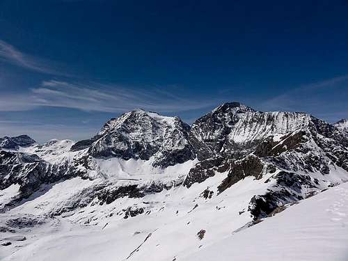
Croce Rossa and Punta d'Arnas
Getting There
From Turin motorway A55 exit Venaria Reale follow indications for Lanzo Torinese (SP1) and go on through Germagnanothan turn left on SP32, you enter in Val di Viù and continue passing Viù, Lemieand reach Usseglio (55 km from Turin).With the car pass Usseglio, and after the Villaretto village, just before the restaurant "la Furnasa" turn right on a on a steep, narrow dirt road, proceed for some km, entering in the Arnas valley, pass the small “S. Anna” chapel and reach a typical stone made house called “alpe Barnàs”, this is the starting point of the path, where there is a small car park, signpoint for "Rif. Cibrario.
Normal Route
Here we describe the normal route on the south -south west side, this route is used also as descent route.From “alpe Barnàs” (1500 m.) - Diff. F/F+ 5.30-6h, in one day approx 2000 m. of ascent, otherwiseyou can sleep at ref. Cibrario (2616 m) and divide the ascent in two days.
From the signpoint follow indications (path n°120 red painted signpoints and pyramid of stones for "Rif. Cibrario").
Cross on a bridge the small river "Rio Peraciaval” and start the ascent on the opposite side of the valley, reach the tracks of an old small railway that cut the mountain slopes.
This small railway “decauville” called “tracioulin” was built for the transport of construction materials during the construction of the dams present on the three main lakes of the valley: Malciaussia lake, Dietro la Torre lake and lago della Rossa lake.
Continue on the right on the railway tracks for a few hundred meters, than turn left and start a steep section (200 mt), here the trail joins up with the one from Margone (path n°118). Proceed on the path around the foothills of the “Lera prisons“ and reach the bridge close to the river "Rio Peraciaval” waterfall.
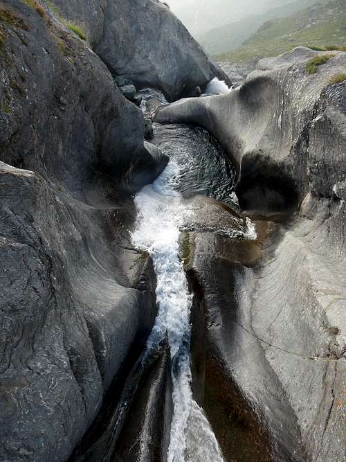
Waterfall along the path to refuge L. Cibrario (Valle di Viù)
Continue on the the left of the river (hydrographic) and continue on a sequence of turning, overcome some steep rocks, where if the season is not too dry you can find a good water source spilling directly from the rocks “fontan-a dël ciorgnét”, and reach the basin called “Pian del Sabiunin” where there is the hut (3.00 h).
Arnas valley ascending to colle della Valletta.
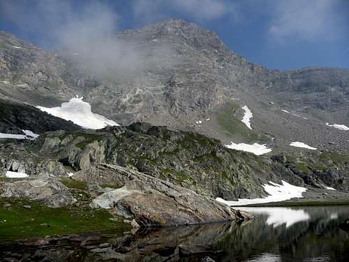
Croce Rossa from Arnas valley
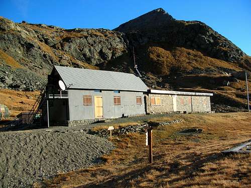
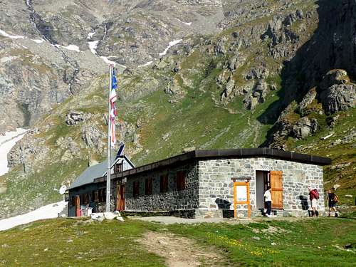
CIBRARIO hut (late autumn)
From the Cibrario hut (2.616 mt.) continue on path 118 on W direction, up to the Peraciaval lake. From here proceed on the path with well visible red painted signpoints and stone’s crain, that is going up the slope and leads directly to the “Colle della Valletta” – Valletta pass (3.207 m.; approx 1.30 h from the hut).
From “Colle della Valletta” – Valletta pass, two options are possible:- First one is to proceed directly on the ridge (south ridge) from “Colle della Valletta” to the summit with an easy climb. Main difficult is a passage (I/II) at the middle of the ridge length to the summit. Approx 1.30 h.
- Second one is to continue on some path traces on the SSW slope. Get on the right aroundthe glacier rest on the rocks. After the path becomes gradually more and moreinvisible and less marked. Continue ascending directly on a gully at the middleof SSW slope. After that on debris point directly to the summit. Approx 1.30 h.DESCENT: Descend on the same route.
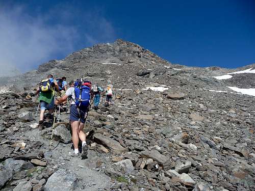
Ascending to Croce Rossa
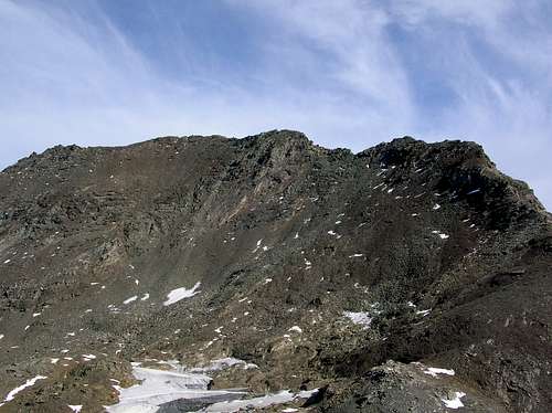
South -south west side

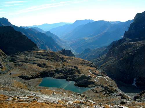
Della Rossa lake View from the top of Croce Rossa.
Red Tape
There are no fees or permits.Small parking on the side of the road. There are no limitations for climbing and hiking. No problem for free camping.
When to Climb
The best time is from May or June (depending of snow quantity and conditions) to October.First Ascents
SW slope: A. Tonini – 1857W ridge: H. Mettrier and J.M. Blanc -August 11, 1923
N ridge: W.A.B. Coolidge and C. Almer - July26, 1883
NE wall: V. Sigismondi and D. Castagneri- August 05, 1902
E ridge: M. Borgarelli, A. Hatz and A. Castagneri – August09, 1885
ESE side: L. Cibrario and G. Cibrario: - August 30, 1885
ESE ridge: G. Levi and B. Castagneri:1902 or 1903
S ridge: F. Mondini and B. Re Fiorentin - August 15, 1890.
Accomodations
You can find accommodations in allvillages of Valli di Lanzo.You can use ref. Cibrario (2616 m) and divide the ascent in two days.
CIBRARIO hut
Books and Maps
-BOOKS- G. Berruto, L. Fornelli " Guida dei Monti d'Italia ? Alpi Graie Meridionali" Club Alpino Italiano/Touring Club Italiano (1980). (Italian)
google books - Guida dei Monti d'Italia - Alpi Graie Meridionali
MAPS
- IGC- Istituto Geografico Centrale N° 103, 1:25.000 Rocciamelone Uja Di Ciamarella Le Levanne
- ASF- Alpi senza frontiere / Alps without frontiers (IGN Institute Geographique National) N° 13, 1:25.000 Mont-Cenis Ciamarella
- IGC- Istituto Geografico Centrale N° 2, 1:50.000 Valli di Lanzo e Moncenisio
Mountain Conditions
You can get whether forecast at this site:www.nimbus.it
www.regione.piemonte.it official site of the Regione Piemonte
www.meteofrance.fr
Miscellaneous Info
Useful:Mountain Rescue phone n°: Italy 118 , France 04 79 05 11 88
Avalanche Bulletin: www.aineva.it
Union of Mountain Guides (Piemonte-Valle d'Aosta) phone n°: +39 011 5171628
desainme - Feb 21, 2013 5:33 pm - Hasn't voted
altitude more like 11,700 feetdo you mean 3566 meters?
p-mike - Feb 22, 2013 2:29 am - Hasn't voted
Re: altitude more like 11,700 feetThanks Desainme! yes it is 3566 meters, i've miss one click ... ciao Paolo