
-
 4505 Hits
-
 84.82% Score
-
 19 Votes
|
|
Mountain/Rock |
|---|---|
|
|
44.65378°N / 6.94797°E |
|
|
Piemonte/Queyras |
|
|
Mountaineering, Trad Climbing |
|
|
Summer |
|
|
10423 ft / 3177 m |
|
|
Overview
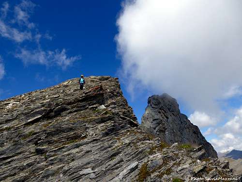
Roc della Niera/Tête des Toillies
Roc della Niera 3177 m is an impressive and slender rock tower belonging to the Alpi Cozie, located along the main watershed line between Italy and France. To be precise, it is located between the Col Blanchatre and the Col Biancetta, in the area of the Colle dell'Agnello 2744 m, a high alpine road col crossing the watershed between Italy and France, the third highest road crossing in Europe, preceded only by the Passo Stelvio and the Col de l'Iseran.

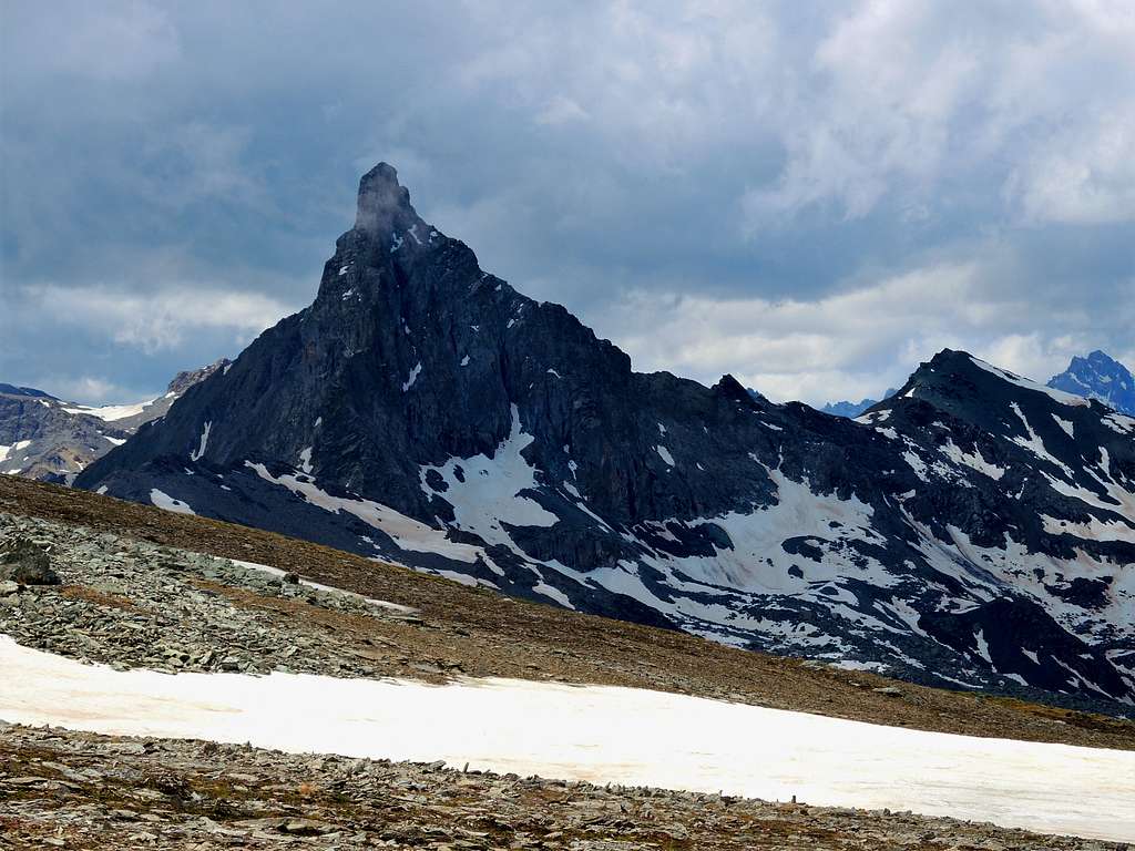
Roc della Niera is a beautiful mountain characterized by a bold profile wherever you look at it, but especially when viewed from the Southern, Northern and Eastern sides. From the geological point of view it is made up of gabbro, an intrusive macrocrystalline magmatic rock of good quality and variously colored, from yellow to pink and black. To this latter color is due the name Niera (the translation of "black" in Italian is "nero"). On the French side of the alpine chain the mountain is widely known as Tête des Toillies.

|

|
On the mountain there are several climbing routes; the standard route starts from the village of Chianale, located in the Piedmontese Valle Varaita, on the Italian side. This ascent route is easy but involves a single short step on exposed rocks that can be graded II UIAA. Another very interesting route, a little more technical and slightly more difficult than the normal route is the Via dei Diedri, reachable through the same approach as the standard route.
History
The first ascent was carried out on August 1879 by the Lieutenant Siccardi of the italian Military Geographical Institute, with some "Alpini" soldiers. The second ascent was carried out on August 14th by Paul Guillemin and André Salvador de Quatrefages with the guides Emile Pic and Giraud-Lèzin and the third one by William August Coolidge with Christian Almer and son, on August 30th, 1888.
Getting There
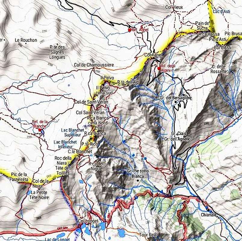
Roc della Niera is usually climbed both from the Italian side and the French one. The standard route from the italian side starts from the small and fascinating village of Chianale in the upper Valle Varaita on the road to Colle dell'Agnello, a very high road pass between Valle Varaita on the italian side and Queyras on the French side.

Road access to Chianale
From the A6 Torino-Savona motorway exit Bra-Marene and take the road to Savigliano, Saluzzo and Valle Varaita (road n. 8). Once you enter the Valle Varaita, drive to Sampeyre and Casteldelfino, overcoming different villages. At the junction in Casteldelfino ignore the left toad to S. Anna di Bellino and take the road on the right to Pontechianale and Chianale, getting to Chianale, the last inhabited village in the valley.
The Normal route can also be approached from the French side, starting from the Refuge de la Blanche across the Col de la Noire. The refuge can be reached from St Veran on foot or by taking a shuttle (summer months). Another access is from Colle dell'Agnello, with lower difference in level.
Normal route from Chianale
Roc della Niera Normal Route from Chianale
- Summit altitude: m 3177
- Difficulty: Alpine PD-, max II grade UIAA
- Vertical gain: 1300 m from the Rio Antolina bridge
- Climbing length: 150 m - Exposure: East, then North-West
A long worthwhile route inside a spectacular setting! The few difficulties are concentrated at the start of the final NW wall, with some climbing moves grading II UIAA. At the beginning of the season, when there is still snow or ice on the wall, the climb becomes more challenging (the presence of snow is possible also after some occasional summer snowfalls).

|

|
Road approach - From Chianale follow briefly the road to Colle dell'Agnello, then leave the main road and take on the left a road entering Valle Antolina. Park the car on a parking lot 1809 m before crossing a bridge. Proceed briefly across the bridge, after a few meters on the left it begins the path U21 with signposts at the start.
Walking approach
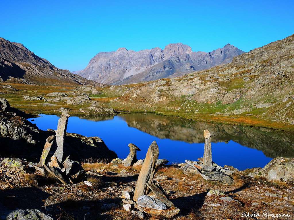
Take this path (U21) that enter a larch-wood and after an alm (Grangia Antolina) rises to reach the magnificent Lago Bleu at an altitude of 2522 m. Skirt the lake to the right (North) until you reach a fork. Here ignore the path on the right and take the left path to the Col Longet, pass near the other beautiful Laghi di Bes and finally reach the Col Longet 2655 m located along the watershed ridge between Italy and France, where it appears a small pond.
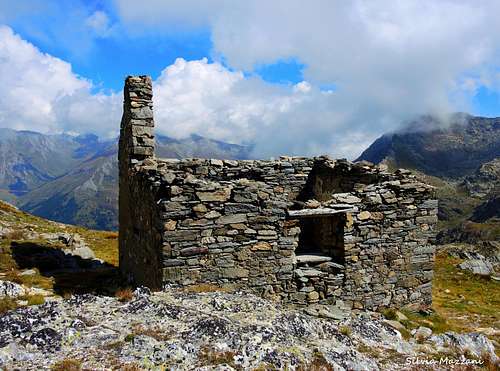
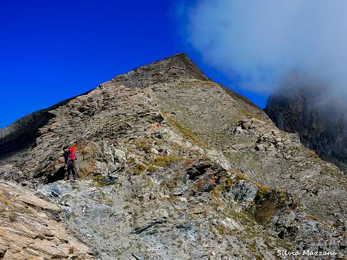
On the col we leave the path U21, turning sharply to the right and starting to walk up, reaching soon the ruins of an old stone alm. Continue to follow the trail with some cairns, climbing the long rocky ridge along the main watershed with magnificent views of the slim rocky pyramid of Roc de la Niera. Arrived nearby the imposing rocky pyramid of the Roc de la Niera, descend briefly to the Col Blanchâtre 3079 m, a small saddle just at foot of the tower. Follow follow the trail rising diagonally along a stone scree under the NW wall, until you reach the end of the track marked with red marks (commemorative plaque at the base of the Normal route). The attack of the Via dei Diedri is located 50 meters to the right of the Via Normale, and is reached first and is identifiable by an open dihedral of about twenty meters (red arrow and written).

|
|
Route report
Climb at first a little exposed wall (II+ UIAA, some pegs) leading to a slanting right ramp, reaching a shoulder. Here turn to left and climb up a second ramp that allows you to reach the South ridge and briefly the summit cross.
|
|
Descent: reversing the route
From the cross reach the exit of the easy rocky gully (big peg with ring), downclimb the groove down to a small shoulder, from which you can do a 25 m abseil (anchor in place) or downclimb. At the next anchor with a second shorter abseil reach the base of the wall
Via dei Diedri
Roc della Niera Via dei Diedri
- Summit altitude: m 3177
- Difficulty: Alpine PD+, max III grade UIAA
- Climbing length: 150 m
- Vertical gain: 1300 m from the Rio Antolina bridge
- Exposure: North-West
It's slightly more difficult than the Normal route, but it is much more fun and advisable. Same approach as for the Normal route. The starting point is found before the previous route, about 50 meters to the right, at the base of an open dihedral (red arrow) of about 20 meters which is climbed with some moves of III grade UIAA. After the first dihedral climb a second one on the left (a short move of III+). After 10 meters this dihedral is slanting right and leads to a ledge. Head to left (II+), then to right, getting a saddle between the fore-summit and the summit. Turn to left and climb up the S summit ridge to the cross on the South summit, the highest.
Descent: along the Normal route (see the description at the previous chapter)

|

|
Red Tape
No particulary restrictions in hiking and climbing.
When to Climb
Best season goes from the end of June to middle September.
Where to stay

Italian side
- Rifugio Alevè 1600 m
- Rifugio Savigliano 1743 m
- Bivacco Enrico Olivero - Col Longet 2649 m
Other kinds of accomodation in upper Valle Varaita: bed and breakfast and agriturismo
French side
Meteo
Meteo ARPA Piemonte
Meteo France
Guidebooks and maps
 |
 |
 |
Guidebooks
“Monte Viso – Alpi Cozie Meridionali” by Michelangelo Bruno – Collana CAI-TCI Guide dei Monti d’Italia
“Pays du Viso – Escalade en Queyras entre France et Italie” by Sylvain Pusnel and Guillaume Vallot
"Vette delle Alpi dalla Liguria al Monviso" 100 itinerari escursionistici e di alpinismo facile by Andrea Parodi 1996
Maps
"Monviso-Valle Varaita-Valle Po-Valle Pellice" - IGC sheet 106 1:25000