
|
|
Mountain/Rock |
|---|---|
|
|
44.67499°N / 7.05834°E |
|
|
Piemonte |
|
|
Hiking, Skiing |
|
|
Spring, Summer |
|
|
10105 ft / 3080 m |
|
|
Overview
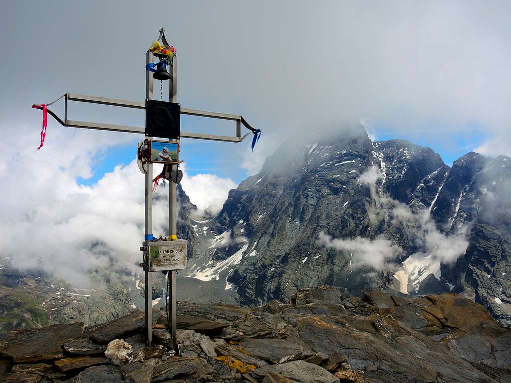
Punta Tre Chiosis 3080 m
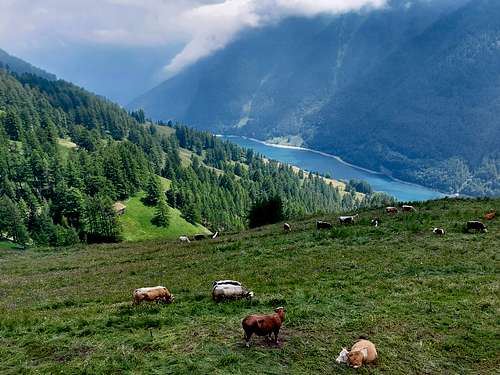
Punta Tre Chiosis 3080 m is a magnificent balcony overlooking Monviso and the surrounding mountains! The mountain, located in the upper Valle Varaita, on the orographic left side, belongs to the Alpi Cozie, Monviso group. Its position is entirely within the municipality of Pontechianale, on the crest separating the Vallanta valley to the East from the Val Varaita di Chianale to the West. This crest takes the name of Cresta Savaresch and has a length of about 3 km, offering a wonderful view on the West side of the Monviso group.
The summit is a large rounded relief, whose summit point is identified by a metal cross. The name "Tre Chiosis" refers to the three valleys Chiosis, Tiuri and Savaresch that the summit closes to the West.
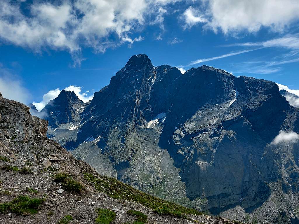
From the top you can enjoy a close and detailed view of the western side of the Monviso group, particularly on Viso di Vallanta, Visolotto, Punta Gastaldi and Punta Caprera.
Getting There
The Normal route to summit Punta Tre Chiosis climbs across Costa Savaresch and starts from the hamlet of Genzana in upper Valle Varaita. This ascent can be shortened using the chairlift starting from Pontechianale and rising up to an altitude of 2340 m.
From the A6 Torino-Savona motorway exit Bra-Marene and take the road to Savigliano, Saluzzo and Valle Varaita (road n. 8). Once you enter the Valle Varaita, drive to Sampeyre and Casteldelfino, overcoming different villages. At the junction in Casteldelfino ignore the left road to S. Anna di Bellino and take the road on the right to Pontechianale. Go around the dam and cross Pontechianale. At the end of the village, after passing the hamlet of Genzana, turn right following the signs to the Rifugio Savigliano, which can be reached quickly on a paved road, near which there is a parking lot.
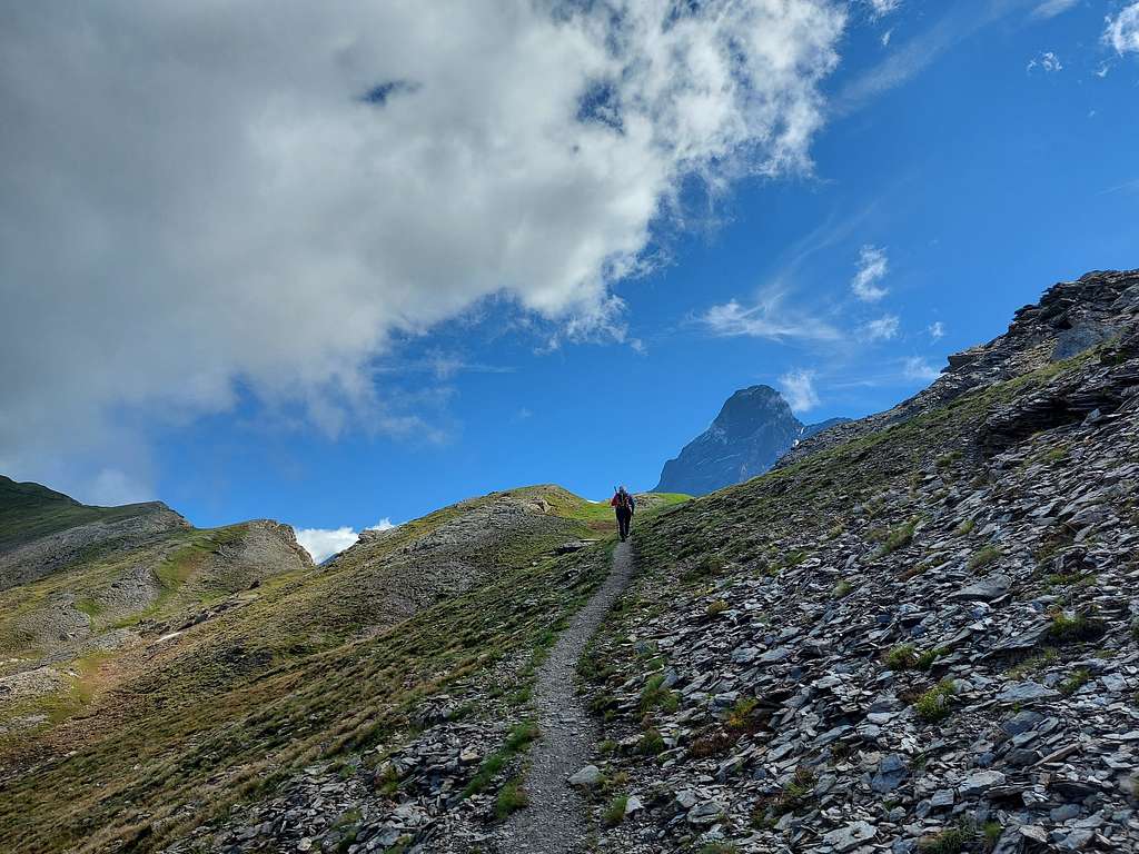
Punta Tre Chiosis across Cresta Savaresch
Punta Tre Chiosis accross Cresta Savaresch
Difficulty: E
Difference in level: 1300 m from Savigliano, 745 m from the arrival of chairlift
We leave the car in the parking lot and walk onto the Savaresch valley (orographic right) on the paved road rising behind the refuge Savigliano towards some beautiful renovated grange (alms). From the hairpin bend before the ban on transit at about 1860 m, above the small village of Loc. Sellette, proceed on a dirt road, which, if desired, from time to time you can cut across meadows avoiding the various hairpin bends, until you reach some crumbling alms, where it starts the long ridge called Costa Tre Chiosis. Continue on a dirt road that reaches another alm with a pole indicating the junction on the left for the Lanzetti path that leads to the Grange del Rio, to be neglected. Continuing on the dirt road you reach the ford on the Rio Varaita di Chianale, after which, in a moderate climb, you arrive at the Grange Rubin m. 2113.
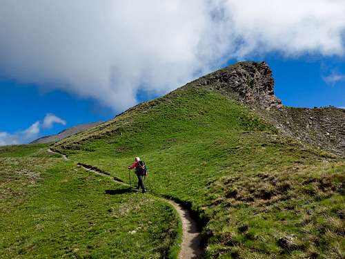
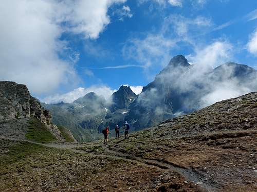
A few hundred meters later, at a crossroads, we keep to the left following the dirt road crossing the Grangia pastures and finally reaching the arrival point of the chairlift, at the Helios refuge. Here we must neglect the path that descends to the right towards Pontechianale, the U12 that leads to le Conce, to instead follow the obvious track starting behind the hut, also U12. This path in steep ascent always maintaining the same direction (North-East) reachs the long ridge dividing us from the Vallanta valley, leaving the top of Le Conce on the right (2429 m). Now the panorama widens towards the Monviso, which appears imposing at the bottom of the long Vallanta valley.
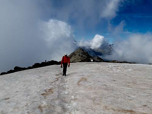
Turning to the left (North), a little further on we ignore a fork to the right (path U12) which descends into the Vallanta valley leading to the refuge of the same name. There are now numerous traces of ascent, between grassy valleys and small bumps, which climb up the Savaresch coast. After a steeper stretch, we reach the top of the ski lift at higher altitudes. In some points along the route we can look out over the precipitous Vallanta valley. The long Savaresch coast stretches to the north and in the final the climb, mainly on stones, is accentuated. After passing near some stone ruins remains of military shelters, the track cuts to the left and climbing diagonally reaches the ridge that separates the summit from the altitude of 3054. From here you quickly reach the summit cross by turning right, after passing a persistent snowfield.
Descent: reversing the same itinerary
Red Tape
No fees no permits required. Punta Tre Chiosis is located inside Parco del Monviso.
The Monviso Park is a protected natural area and occupies 9154 hectares of territory. Established in 2016, it extends around the Monviso group between the Po Valley and the Varaita Valley.
When to Climb
Hiking: from middle June to the end of September
Ski-Mountaineering and snow-shoes: Spring
Hut
- Rifugio Savigliano 1743 m
Other accomodation
Different possibilities in Valle Varaita
Meteo
Guidebooks and maps

“Monte Viso – Alpi Cozie Meridionali” by Michelangelo Bruno – Collana CAI-TCI Guide dei Monti d’Italia
Maps
"Monviso-Valle Varaita-Valle Po-Valle Pellice" -IGC sheet 106 1:25000
"Mont Viso" IGN 3637 OT