
-
 5243 Hits
-
 87.31% Score
-
 24 Votes
|
|
Mountain/Rock |
|---|---|
|
|
45.05615°N / 7.14399°E |
|
|
Piedmont |
|
|
Hiking, Mountaineering, Trad Climbing, Sport Climbing, Scrambling |
|
|
Summer, Fall |
|
|
9190 ft / 2801 m |
|
|
Overview
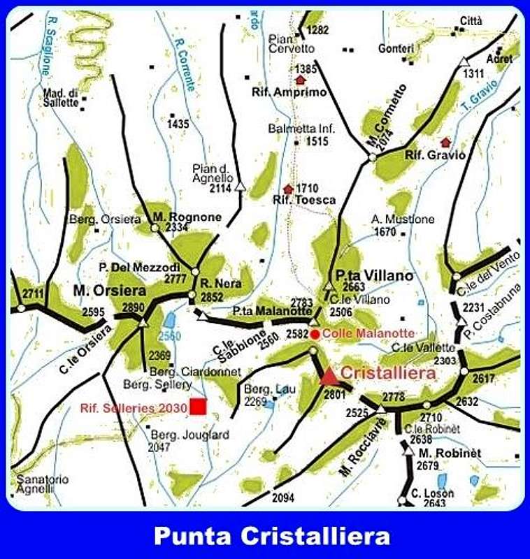
Geographical classification: Western Alps > Alpi Cozie > Assietta-Rocciavrè Group > Punta Cristalliera
Punta Cristalliera 2801 m
Punta Cristalliera belongs to Alpi Cozie, Assietta - Rocciavrè Group, and is one of the highest and most important peaks lying on the watershed dividing Val di Susa from Val Chisone, second in altitude only to Monte Orsiera. Located in the heart of the Natural Park Orsiera - Rocciavrè, Cristalliera looks like a massive rocky pyramid of reddish serpentine. The SW face drops steeply into the valley of Lau, forming the complex Central Tower, which hosts different superb climbing routes. On the northern side there is the West Tower also named Sbardella, the southern slopes between the ridges SSW and SE descends steeply into the valley of Vallette. While the SW wall is rocky and majestic, on the NW side the slopes are gently angled and crossed by a simple Normal route that allows you to reach the summit without particular technical difficulties.
Normal route is very popular in reason of its beautiful landscape and the great view from the summit, particularly wide because of the isolation of the mountain. From the summit you can see the nearby peaks of Mount Orsiera and Rocciavrè, while in the distance appear the slender pyramid of Monte Viso to the South and the massive Rocciamelone to NO, Mount Chaberton and the Ecrins massif westward. On a clear day you can see the groups of the Gran Paradiso and Monte Rosa.
Getting There
From Turin reach Pinerolo and from here take the road 23 entering Val Chisone, pass Perosa Argentina and Villaretto Chisone, reaching the village of Depot, shortly after Villaretto Chisone. In the village turn to right and follow the signs to Pra Catinat - Rif.Selleries. After about 8 km (bends) leave the main road and take a dirt road on the right with signs to the refuge Selleries. After about 5 km the road gets the hut at 2030 m. of altitude. Wide parking.
Red Tape
No fees no permits required. The mountain is located inside the Orsiera - Rocciavrè Natural Park, established in 1980 to defend the natural heritage. The territories belong to the valleys Chisone, Susa and Sangone. The boundaries of the protected area run on average at an elevation of 1400 meters and the most important peaks included within them do not reach the 3000 meters. The whole area offers several trails and also interesting climbing, particularly demanding on Monte Orsiera and Punta Cristalliera.

|
")
|
Climate and nature
There are no glaciers or even permanent snowfields inside the park. The area is characterized by relatively low rainfall, among the lowest ones in the North-Western Alps. It records a maximum in May and October and a minimum in January and July. The vegetation of the park is particularly interesting both because the protected territory covers a wide altitudinal range, both because the three valleys on which develops have different climatic characteristics.

|

|
While the Val Chisone and Valle di Susa are characterized by extreme temperature changes, with hot and dry summers and cold winters - in fact the pine is a typical representative of them – Val Sangone has a climate-type pre-Alpine, wetter, where the beechs are predominant. Larches, as well as red and white firs, represent the climax of the upper mountain horizon.

Superbianciotto report - French scale
Superbianciotto route report
Summit altitude: m. 2801
Difficulty: TD inf., F6a max
Equipment: spaced bolts, friends are useful to integrate
Climbing length: 2500 m.
Exposure: SW
First ascent: F. Michelin – C. Bocco 1999
Starting point: Rifugio Selleries m. 2030
On the left of the classic Spigolo Bianciotto runs this moderne and direct route on excellent red serpentine. A great outing!
")
|

|
Access: behind the hut follow the trail 339; after about 50 m take the left fork. The path becomes progressively steeper, getting a col with a fork. Should take to right: so you meet the "Bergerie of Laus" (Park bivouac available to walkers) and then to the Lake of the Laus (q. 2259, typical for the island at the center, also called Lake of Mouta, Occitan, "clod of earth"). Continue until Lake of the Manica (q. 2365 m) and leave the path up to the right bank of the lake go up the stony ground to the foot of the Central Tower. Superbianciotto starts at the lowest point of the wall by a dihedral mostly in the shade (blue arrow, name at the base). To the right there is the start of the classic Spigolo Bianciotto.
L1 Attach few meters to the left of the lowest point of the wall (name plate), pass a vertical dihedral, go left along a split and reach the stance under an overhang - 5c
L2 Avoid the overhang to the right and climb a vertical slab; a last hard move leads to the stance - 6a
L3 Directly climb a slab, then an overhanging crack - 5c
L4 Reach an obvious dihedral and climb its right edge with superb climbing and belay to the right - 5c
L5 Ascending traverse towards right along slabs full of handholds and stop at the base of a dihedral channel - 4b

|

|
L6 Great vertical pitch and ending slab - 5c
L7 To the right reach a beautiful dihedral and climb it (common pitch with the classic Spigolo Bianciotto) - 5b
L8 A last technical and beautiful wall leading to the summit ridge - 5c
Scramble up the ridge towards right, reaching the summit.
Descent The route is equipped for rapping down, but the best descent is done along the Normal route on the NW side
Other routes
- Diedro Ovest - Via Gay-Ghirardi 5c, A0, 220 m
- Spigolo Bianciotto 5b, 300 m
- Via Galante
- Diedro Caneparo
- Via Sorprendente Sud 6c, 150 m
Cristalliera Normal Route report
Punta Cristalliera Normal Route
Difficulty: Alpine F in winter conditions, otherwise E
Altitude Gain: 778 m.
Starting Point: Selleries Hut m. 2030
From Refuge Selleries take the path heading slightly downhill and after crossing the stream, rising up the steep grassy slope with hairpins and getting a crest where the path forks; both branches lead to Lago della Manica:
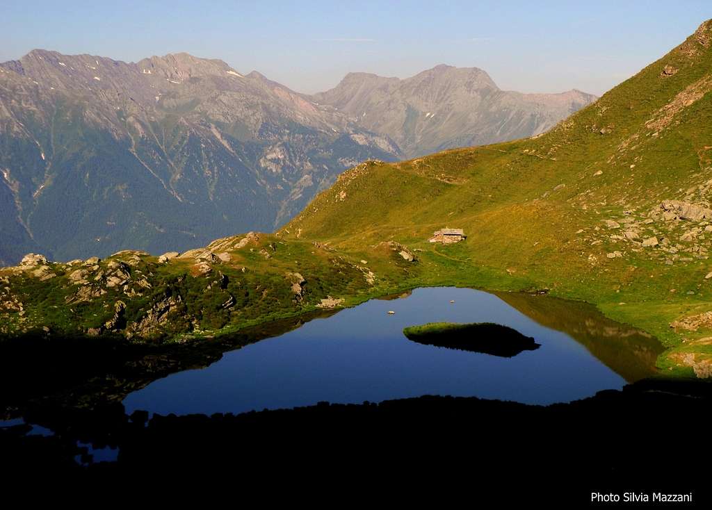
- The right path bypasses the ridge getting to a basin where it's situated the beautiful Lago di Laus 2259 m, showing a little island in the middle, and some little shelters of Orsiera - Rocciavrè Natural Park. The path gets Lago della Manica 2365 m., located at the foot of Torrione Centrale vertical wall - The second path goes up along the crest, leading directly to Lago della Manica (45 minutes with both itineraries).

|
")
|
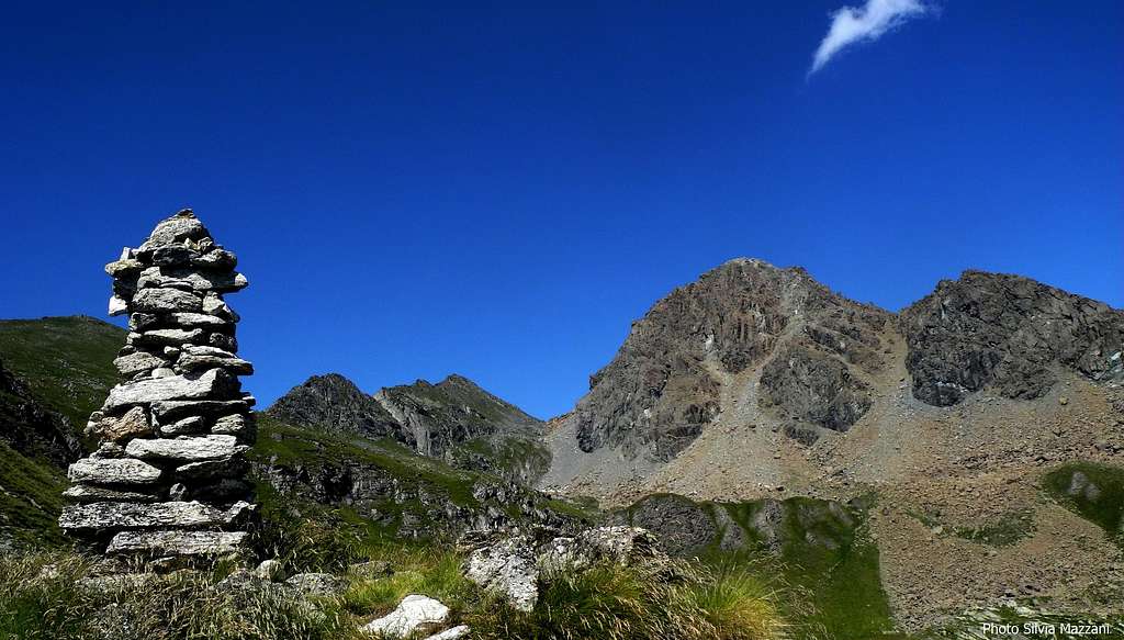
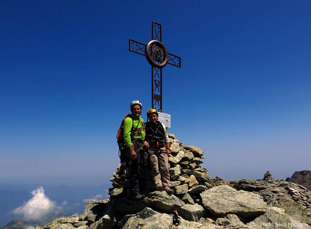
From Lago della Manica the trail leads to the bottom of the valley amongst large boulders and after a scree gets Colle Superiore di Malanotte 2680 m. From the col is clearly visible the iron cross placed on the summit of Cristalliera. From the col follow for about fifty meters the path which gradually descend towards the opposite side (Val Susa side), then leave the main path and turn to right, following an obvious trail (cairns).

|

|
The trail winds through easy rocks, reaching, in about twenty minutes, the summit of Monte Cristalliera (2.801 meters).
When to Climb
Best season to climb the Normal route goes from June to October. The route Superbianciotto is located inside a cold environment and it's advisable to climb it in full Summer.
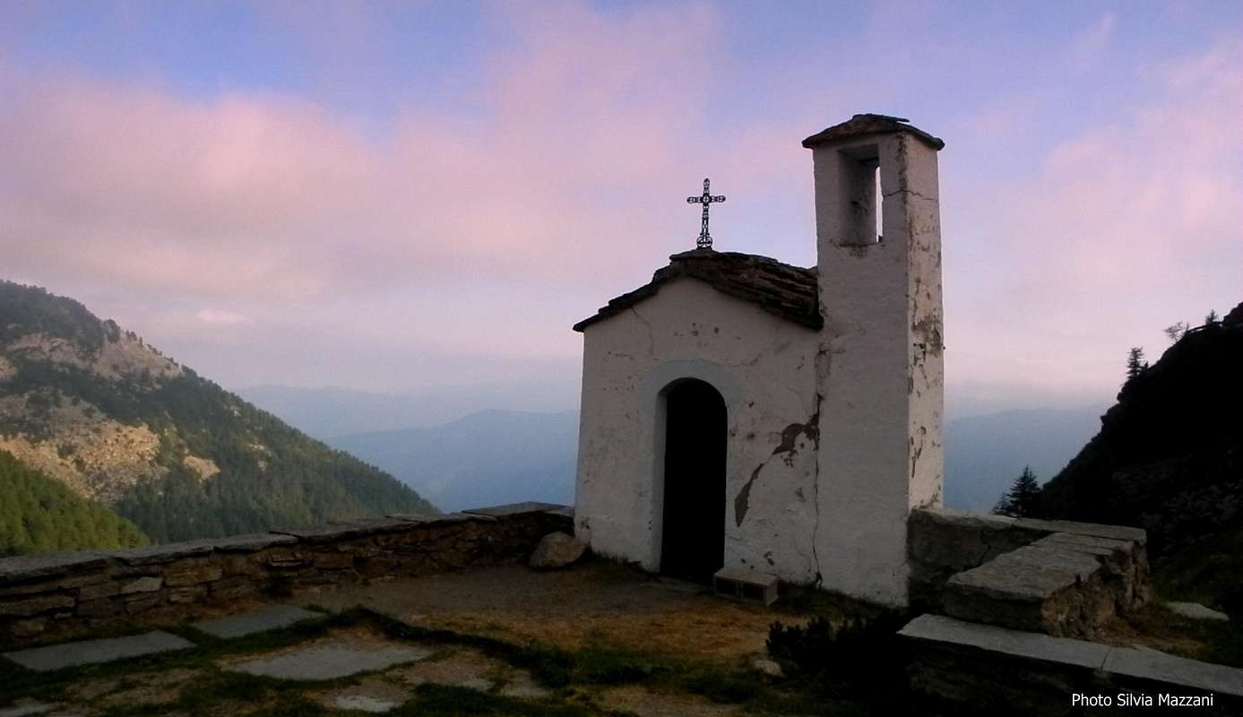
Huts
Rifugio Selleries m. 2023
Meteo
Guidebooks and maps
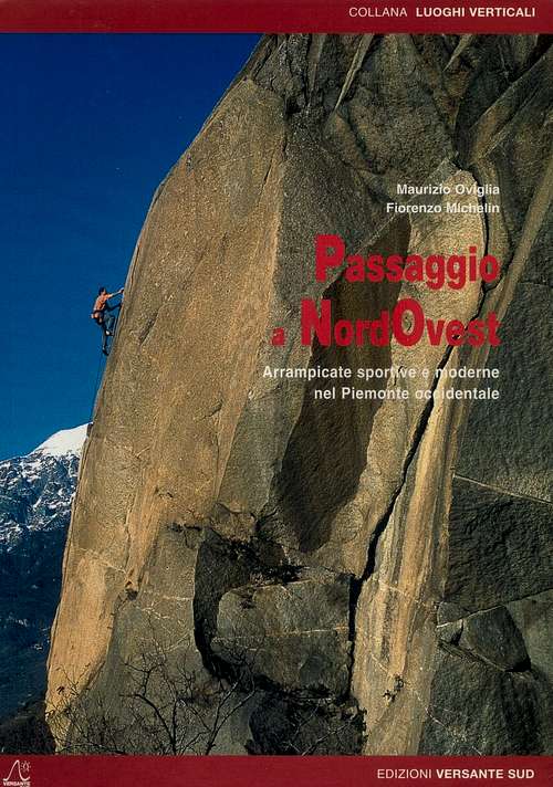 |
Passaggio a NordOvest
Maurizio Oviglia - Fiorenzo Michelin
Arrampicate sportive e moderne nel Piemonte Occidentale
Edizioni Versante Sud - Collana Luoghi Verticali
|
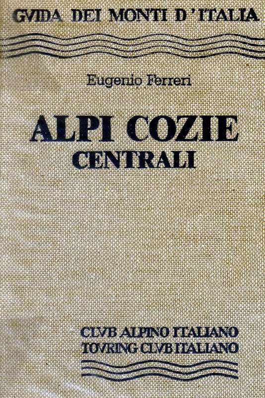 |
Alpi Cozie Centrali
Eugenio Ferreri
Guida dei Monti d'Italia Club Alpino Italiano - Touring Club Italiano 1997
|