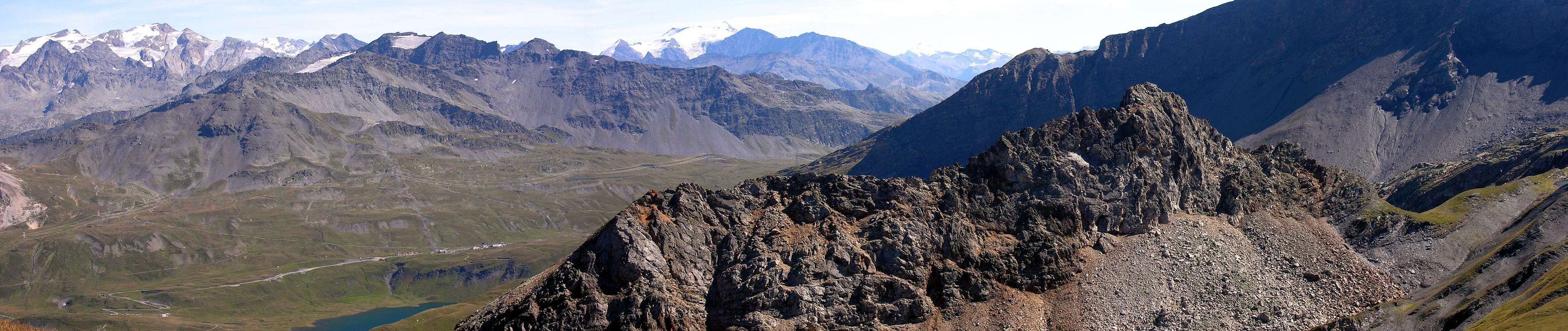
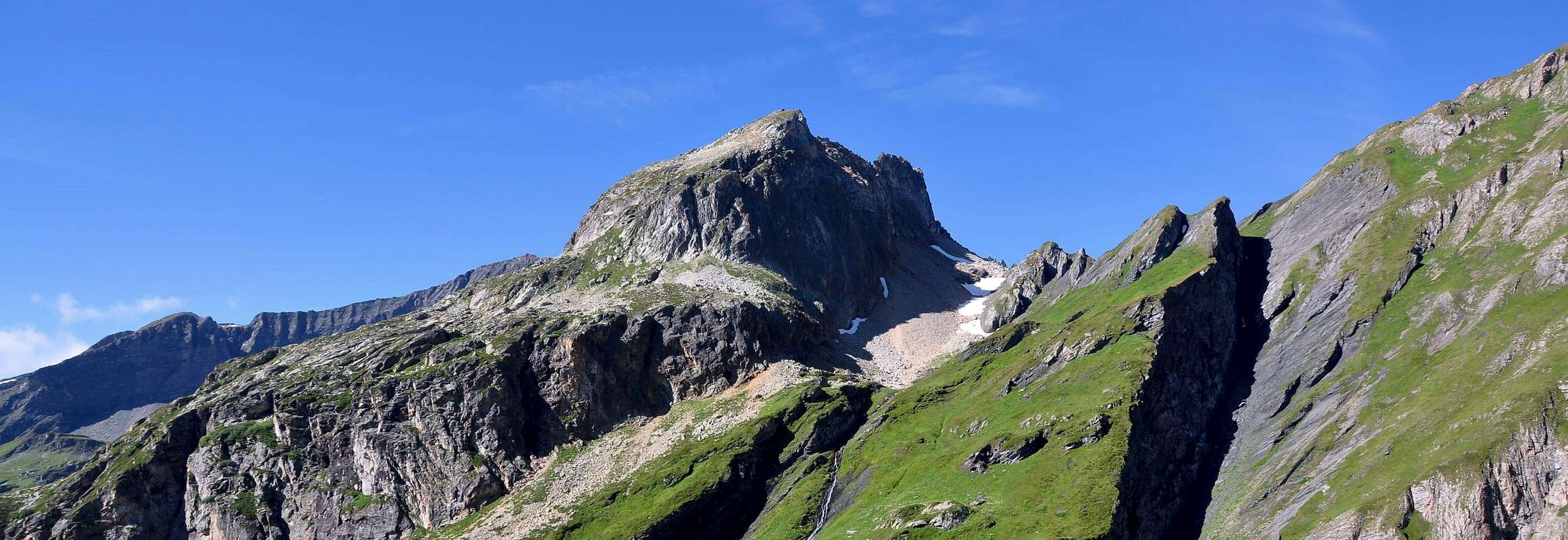
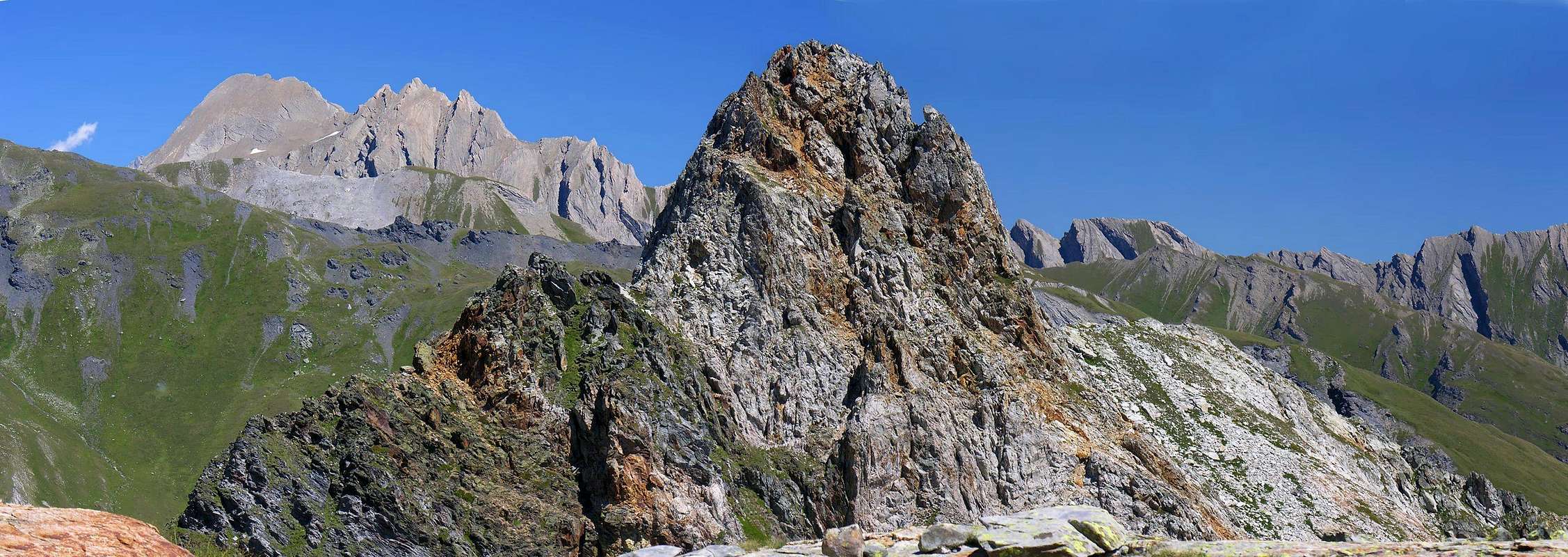
This small but sharp summit rises in the Valley of Breuil East and that long plateau from Lake Verney (2.088m) at the Little St. Bernard is directed towards the North, reaching first the Upper Lake Verney (2.294m) and immediately afterwards a rounded collar at an altitude of 2.551 meters at the base of his short but steep Ridge Southwest, which also constitutes the Normal Route of ascent. Also it has a more long ridge to the North-northeast that is linked to the nearby Punta Tormotta (2.686m), while a third ridge-edge down to the East-northeast in the direction of the Vallon of the Breuil. Towards this side both two tips present high and steep walls of limestone and yellowish, while, on the Pointe Rousse on other sides is made from the reddish color, from which the name derives.Good views of the nearby group of Punta Lechaud and Mount Ouille, while to the South stretch the great glaciers of the Testa del Rutor.
Questa piccola ma aguzza Sommità si innalza tra il Vallone del Breuil ad Oriente e quel lungo pianoro che dal Lago Verney (2.088 m) presso il Colle del Piccolo San Bernardo indirizzantesi verso Settentrione raggiungendo dapprima il Lago Verney Superiore (2.294 m) e subito appresso un colletto arrotondato a quota 2.551 metri alla base della sua breve ma ripida Cresta sudovest, che inoltre costituisce la Via Normale di salita. Inoltre presenta una più lunga cresta verso Nord-nordest che si allaccia alla vicina Punta della Tormotta (2.686 m), mentre una terza cresta-spigolo scende verso Est-nordest in direzione del Vallone del Breuil. Verso questo lato entrambe le due punte presentano alte e ripide pareti di roccia calcarea e giallastra, mentre per quanto concerne la Pointe Rousse sugli altri versanti è costituita dal colore rossiccio, dal quale ne deriva perlappunto il toponimo.Buone vedute sul vicino Gruppo della Punta Lechaud e sul Monte Ouille, mentre verso Meridione si distendono i grandi Ghiacciai della Testa del Rutor.
First Ascents
First on the summit: Unknown. 2° Ascent: E. Ferreri and S.M. Madonno; Jul 15th, 1914.
In winter: Unknown.
Getting There
BY CAR:
From the Morgex exit of Motorway A5 (921m), continue for about 3 km on SS.26 towards Pré Saint Didier (1.017m). SS.26 becomes the main street of the small city and then continues toward Colle del Piccolo San Bernardo (2.188m). After several hairpins, and past the Villages of Elevaz (1.302m) and la Balme (1.309m) reach the famous ski resort of La Thuile (1.441m). Turn left on the bridge that crosses "Dora di La Thuile", a go on along the same road continue to rise along the SS.26, which leads to the Piccolo San Bernardo Pass to Lake Verney (2.088m) just below the pass.
From TORINO, MILANO, etc: Motorway A5. Exit at Morgex.
IN AUTO:
Dall'uscita dell'Autostrada A5 nel comune di Morgex (921 m) proseguire per circa 3 km lungo la SS.26 verso il Paese di Pré Saint Didier (1.017 m), addentrarsi nella via centrale del paese e proseguire sempre lungo la SS.26 che porta al Colle del Piccolo San Bernardo (2.188 m). Dopo numerosi tornanti e superate le Frazioni di Elevaz (1.302 m) e la Balme (1.309 m) si giunge alla famosa località sciistica di La Thuile (1.441 m). Svoltare a destra sul ponte che attraversa la "Dora di La Thuile", continuare a salire lungo la SS.26 che conduce al Colle de Piccolo San Bernardo fino al Lago di Verney (2.088 m) sito appena sotto il colle.
BY PLANE:
Aeroporto "Corrado Gex" Saint Christophe (Aosta).
Approach and Route
From parking (2.098m), near the Verney Lake (2.088m), by Northwest direction and groundroad to descend briefly to of same effluent (Lake Torrent) in quota (2.079m); in fork of same (continued in Northeast toward nearby Lechepré Pasture, (2.017m) with other three paths, to choose the first in left and, by before Southwest direction, after North to reach the Higher Verney Lake (2.280m). Tourning in right (East) and passing between the same and a tiny lake to arrive at a cross with principal path, in the junction of two small torrents. Continue in Northnortheast to Torvéraz Alp (variant), also, always by the same and Northwest direction, to small basin, with little lake, sited below Southern Slopes of small, but smart, Red Point (2.659m); to go up higher collar, straight away in West of same (2.551m). From the collar, before the entrance on long Tormotta Vallon, to begin climb through the easy and exposed Southwest Ridge and with steep rocks but much rotten to aerial Summit (F+/PD-; 1h'00/1h'15).
Dal parcheggio (2.098 m), presso il Lago di Verney (2.088 m), con direzione NW e strada poderale scendere brevemente verso l'emissario dello stesso (Torrent du Lac) a quota (2.079 m); all'incrocio della stessa (che continua a Nordest verso la vicina Alpe Lechepré; 2.017 m) con altri tre sentieri, prendere il primo di sinistra e, con direzione prima Sudovest e poi Nord, raggiungere il Lac de Verney Dessous (2.280 m). Aggirandolo sulla destra (Est) e transitando in mezzo tra lo stesso ed un minuscolo laghetto, pervenire all'incrocio con il sentiero principale, vicino alla congiunzione di due torrentelli. Continuare verso Nord-nordest verso l'Alpe di Torvéraz (variante), oppure sempre con lo stesso, e con direzione Nordovest, verso il piccolo bacino con laghetto posto alle pendici Meridionali della piccola, ma elegante, Pointe Rouge (2.659 m); risalire al soprastante colletto, subito ad Ovest della stessa (2.551 m).Dal colletto, prima di entrare nel lungo Vallone della Tormotta, iniziare a salire lungo la facile ma esposta Cresta sudovest che tramite rocce ripide ma rotte conduce all’aerea Sommità (F+/PD-; 1h'00/1h'15).
Difficulty
The route is rated EEA; from F to F+.
L'itinerario è da classificare per EEA e da F a F+.
Equipment
Hiking equipment, but better even with rope.
Da Escursionismo, ma meglio anche con corda.
Campings
Remember that free camping is forbidden (except for emergency reasons, over 2.500m, from darkness until dawn).
Mountain Conditions
You can get meteo information at the official site of the Regione Valle d'Aosta:
Parents refers to a larger category under which an object falls. For example, theAconcagua mountain page has the 'Aconcagua Group' and the 'Seven Summits' asparents and is a parent itself to many routes, photos, and Trip Reports.

 1994 Hits
 84.82% Score
 19 Votes