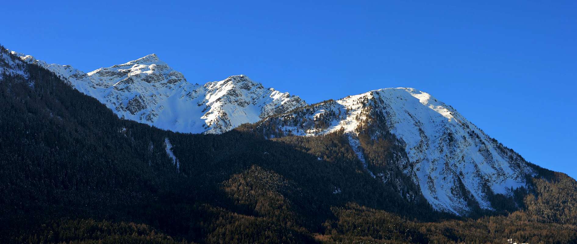
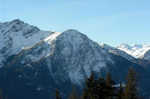
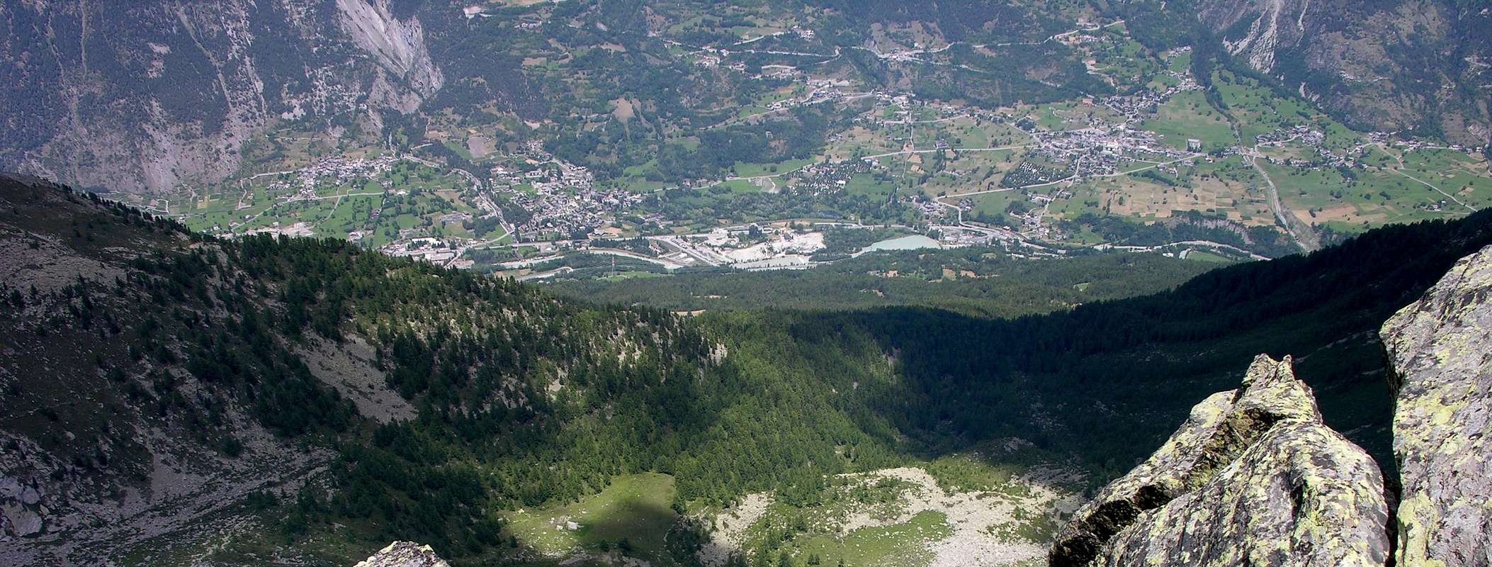
Mount Paramont a long ridge descends to the Northwest to first separate the Valley des Ussellettes (La Thuile) from the d'En Haut, and then, bending over towards the north, the latter from the Conca-country skiing. The crest, after forming the head Paramont, Mont Monchette, Mont Lüsse first reach the Ridge and the Ameran Hill and after Becca Pouignenta. From this ridge descends northwards to finish with Mont Charvet, large balcony above the rocky wooded-over medium-high heat in the Valley of Aosta. Interest and scenic hiking trip offers beautiful views on the central axis of Dora Baltea Stream up the Chain of Mount Blanc to Northwest.
Dal Mont Paramont una lunga cresta scende verso Nordovest a separare prima il Vallone des Ussellettes (La Thuile) da quello d'En Haut e poi, flettendo più verso Nord, questo ultimo dalla Conca di Arpy. La cresta spartiacque, dopo aver formato la Testa del Paramont, il Mont Monchette, il Mont Lussé raggiunge dapprima la Cresta ed il Passo di Ameran e dopo la Becca Pouignenta. Da questa una cresta scende verso Nord per terminare con il Mont Charvet, grande balcone roccioso-boschivo sopra il corso medio-alto della Valle di Aosta. Gita di interesse escursionistico e panoramico, offre belle vedute sull'asse centrale della Dora Baltea fino alla Catena del Monte Bianco verso Nordovest.
First Ascents
First on the summit: Unknown.
In winter: Unknown.
Getting There
BY CAR:
From Torino, Milano, etc: Motorway A5. Exit at Morgex.
From Switzerland: through the Grand Saint Bernard Tunnel or the namesake Pass.
From France: through the Mont Blanc Tunnel or Petit Saint Bernard Pass: It is not necessary to take Motorway A5: you can drive on SS.26, in the direction of Aosta.
BY PLANE:
Aeroporto "Corrado Gex" Saint Christophe (Aosta).
Route A
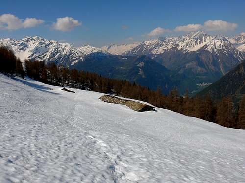
From Morgex (923m) climb the path that leads to n° 12/10/13 Croix de Folliet (2.335m), reaching the Alps Costablinaz and Champex (1.445m, 1.519m), go through the same again until you reach the Torrent de la Bouiya. This continue to point toward the Southwest, reaching the route n° 13 Rancon Plan (2.104m) and after continue westward on poor tracks that run through the pastures reaching a plateau above. Continue along a fairly steep grassy slope debris and reaching a saddle South of Summit and along the South Slope-Crest easily reach the Summit (E; 4h'00/5h'00 in total).
Da Morgex (923 m) salire con il sentiero n° 10/12/13 che conduce alla Croix de Folliet (2.335 m) raggiungendo le Alpi di Costablinaz e Champex (1.445 m, 1.519 m); proseguire ancora tramite il medesimo fino a raggiungere il Torrent de la Bouiya. Da questo punto continuare verso Sudovest raggiungendo con il sentiero n° 13 Plan Rancon (2.104 m); quindi continuare verso Ovest su scarse tracce che attraversano i pascoli raggiungendo un soprastante pianoro. Continuare lungo un pendio detritico-erboso abbastanza ripido che raggiunge una sella a Sud della Cima e lungo il Versante-Cresta Sud facilmente raggiungere la Sommità (E; 4h'00/5h'00 in totale).
VARIATION: from the center of the Municipality of Morgex cross the small bridge over the Dora Baltea (immediately behind the Church) and the Regional Road to San Carlo Hill (who later goes down to the Valley of La Thuile) transit through the Villages of Liarey, Pre Villair, Biolley, Mont Rotie and leaving the Gym Rock in West, continue to the hairpinbend shaped elbow above Clos, about half of the long straight, which is directed to the West, leave the Main Road and take at an altitude of about 1.375 meters the farm dirt road concomitant with the path n° 13/14 and with Southeast direction to reach the Alp of Costablinaz Desot (Lower) whence the route before (0h'30).
VARIANTE: Dal centro del Comune di Morgex attraversare il piccolo ponte sulla Dora Baltea (immediatamente dietro la Chiesa) e con la Strada Regionale per il Colle San Carlo (che in seguito scende verso la Valle di La Thuile) transitare per le Frazioni di Liarey, Pre Villair, Biolley, Mont Rotie e, lasciando ad Ovest la Palestra di Roccia, proseguire fino al tornante a forma di gomito al di sopra di Clos; a circa la metà del lungo rettilineo, che si indirizza ad Ovest, abbandonare la Strada regionale e prendere a quota 1.375 metri circala strada poderale concomitante con il sentiero n° 13/14 e con direzione Sudest raggiungere l'Alpe di Costablinaz Desot donde all'itinerario precedente (0h'30).
Route B
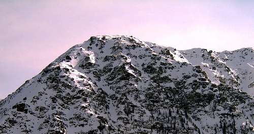
From Morgex cross the bridge over the Dora Baltea (right behind the church) and the Regional Road to San Carlo Hill (towards the Valley of La Thuile) transit through the Villages of Liarey, Pre Villair, Biolley, Tirecagne, Arpy Dessous, Prariond -Prés Rionds reach the Hamlet of Arpy (1.680m; Church of Notre Dame des Neiges). Take the path n° 14 which, with a Southerly direction, to the West of the salt Torrent Arpy reaching Fond of Arpy Desot and immediately after Damon (1.743m), from this point the same, after crossing the torrent, goes slightly further to the Southeast bringing against the Western Slope of Mount Charvet. Exceeded three furrows of torrent the trail, which turns into the path reaches after a large couloir, a rocky spur, past the same and turning more to the East rise the next steep channel composed of rocks mixed with debris and grassy stretches. Climb up through the path or evident traces completely until you reach the North-northwest Crest at an altitude of about 2.235/40 meters up to the an balcony rocky. Continuing South through broken rocks, blocks and debris catch up with tedious journey, but scenic, reaching the Cross placed on the Summit (E; 2h'30/3h'00).
Da Morgex attraversare il ponte sulla Dora Baltea (subito dietro la Chiesa) e con la Strada Regionale per il Colle San Carlo (verso la Valle di La Thuile) transitare per le Frazioni di Liarey, Pre Villair, Biolley, Tirecagne, Arpy Dessous, Prariond-Prés Rionds raggiungere il Villaggio di Arpy (1.680 m; Chiesa di Notre Dame des Neiges). Prendere il sentiero n° 14 che, con direzione Sud, sale ad Ovest del Torrent d'Arpy raggiungendo Fond d'Arpy Desot e subito dopo Damon (1.743 m); da questo punto il medesimo, dopo avere attraversato il torrente, si dirige leggermente più verso Sudest portandosi contro il Versante Ovest del Mont Charvet. Superati tre solchi torrentizi la mulattiera, che si tramuta in sentiero, raggiunge, dopo un grande canale, una costola rocciosa; oltrepassata la medesima e voltando maggiormente verso Est salire il ripido canale successivo composto da rocce miste a sfasciumi e tratti erbosi. Risalirlo completamente su sentiero o tracce sempre evidenti fino a raggiungere la Cresta Nord-nordovest a quota 2.235/40 m~ presso un balcone roccioso. Continuando verso Sud tramite rocce rotte, blocchi e detriti raggiungere con percorso noioso, ma panoramico, la Croce posta in Vetta (E; 2h'30/3h'00).
Route C
From San Carlo Pass park at the Hotel Genzianella (1.971m; fountain) on the road that crossed the same, down to La Thuile. Take the private road (plenty of signs at beginning) to Lake Arpy (2.063m) concomitant with the path n° 15/16 and direction South continue towards Saint Maurice (1.994m) who is immediately to the West. After a bend where the direction changes significantly towards the East, you reach a junction, leave the path n° 16, which continues through higher towards the Hill of the Cross, continuing instead with the private dirt road that direction with more reach in the Southeast, after a small climb at the end, the lake. Immediately before a short descent leads to the same panneau a wooden indicates the path to the Mount Charvet, this crosses the effluent of the lake and is directed East to a torrential groove. After this a fairly steep slope in a very narrow and small walloon leading to the large saddle on the ridge South and through the same as for the route to easily reach the Top (E; 2h'15/2h'30).
Dal Colle San Carlo parcheggiare presso l'Hotel Genzianella (1.971 m; fontana) sulla Strada che, oltrepassato il medesimo, scende a La Thuile. Prendere la strada poderale (abbondante segnaletica all'inizio) per il Lago di Arpy (2.063 m) concomitante con il sentiero n° 15/16 e con direzione ud proseguire verso Saint Maurice (1.994 m) che si lascia subito ad Ovest. Dopo un'ansa dove la direzione cambia decisamente verso Oriente, si raggiunge un bivio; abbandonare il sentiero n° 16, che prosegue passando più in alto verso il Colle della Croce, continuando invece con la poderale che con direzione maggiormente a Sudest raggiunge, dopo una piccola salita nella parte terminale, il lago. Subito prima di una breve discesa che conduce al medesimo un panneau in legno indica il sentiero per il Mont Charvet; questo attraversa l'emissario del lago e si indirizza ad Est verso un solco torrentizio. Dopo questo un pendio piuttosto ripido in uno stretto vallone conduce alla larga sella sulla Cresta Sud e, tramite la medesima come per l'itinerario A facilmente si raggiunge la Cima (E; 2h'15/2h'30).
Difficulties
This route can be considered E.
L'itinerario è classificato E.
Equipment
Normal hiking gear.
Da escursionismo.
Campings
Remember that free camping is forbidden (except for emergency reasons, over 2.500m, from darkness until dawn).
Mountain Condition
Meteo: you can find all the needed informations at the official site of the Valle d'Aosta Region:
Parents refers to a larger category under which an object falls. For example, theAconcagua mountain page has the 'Aconcagua Group' and the 'Seven Summits' asparents and is a parent itself to many routes, photos, and Trip Reports.

 4969 Hits
 79.78% Score
 11 Votes