


-
 3486 Hits
-
 80.49% Score
-
 12 Votes
|
|
Mountain/Rock |
|---|---|
|
|
45.64560°N / 7.60845°E |
|
|
Spring, Summer, Fall, Winter |
|
|
8241 ft / 2512 m |
|
|
Note
La montagna chiama i suoi figli, ed essi rispondono fedelmente al suo appello… Osvaldo Cardellina, Diario alpinistico, 1964-65 Page texts: @ OsvaldoCardellina "Osva", passed away on May 2, 2022. Page owners: Christian Cardellina e Osvaldo Cardellina. Any updates from September 12, 2022: Antonio Giani, page administrator, friend and climbing companion. Testi della pagina: @ OsvaldoCardellina "Osva", scomparso il 2 maggio 2022. Proprietari pagina: Christian Cardellina e Osvaldo Cardellina. Eventuali aggiornamenti dal 12 settembre 2022: Antonio Giani, amministratore della pagina, amico e compagno di salite. |
Flat Overview
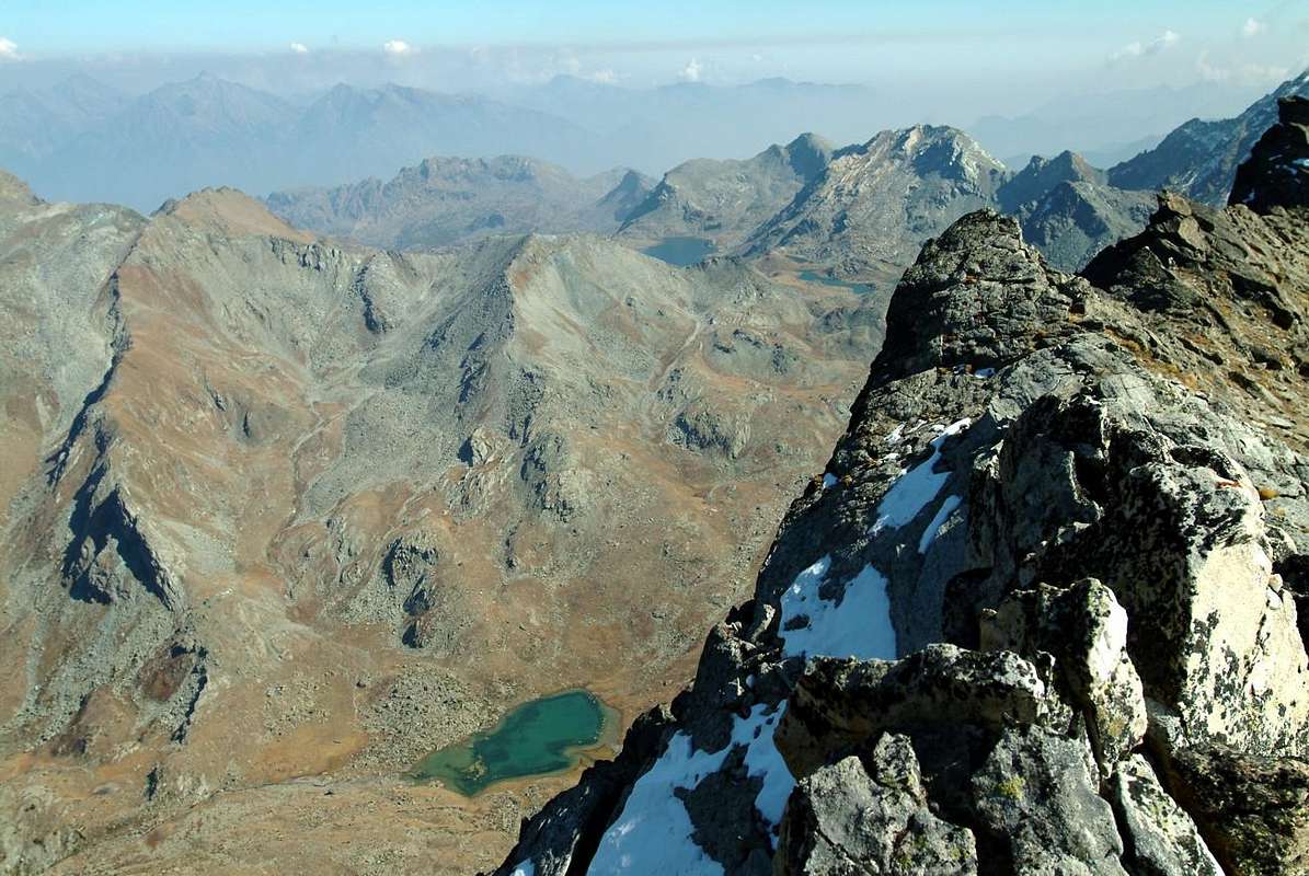
This Summit is part of the Group of Mont Glacier (3.186m), located amongst the Valleys of Champdepraz, Issogne or Brenve also Boccoueil and Champorcher. For which it presents three sides facing their respective municipalities and as many ridges (as well as the East Ridge but down from Mont Perché), who head to South, reaching Cima Piana also said Pana or Panaz Hill and the eponymous peak (2.319m, 2.388m), to the West in the direction of the Hills della Croce and the Lago Bianco (2.287m, 2.308m), to the East towards those of Terra Rossa (2.090/5m, 2.076m), but now after having climbed the Mont Perché, and finally to the North where it forms a watershed secondary; the latter is adapted to separate the Valley from Champdepraz to Brenva now above the Municipality of Issogne. This ridge forms from the South to the North, after the Cima Piana, the Mont Grimon (2.522m) and the characteristic and daring spire "La Pertze" (2.403m; "The Pole or better The Perch") before concluding, after the Collar 2.350 meters about, with the Bec di Nona (2.331m). It is the only part that provides the possibilities of climbing in rock (in parts that also more difficult) even if not of good quality, since all the remaining is formed from accumulations of broken blocks and chaotically superimposed. He knows a good attendance from Champorcher-la Cort and the Valleys of Champdepraz through ease the path that climbs under crest from Colle della Croce, while it is less frequented by the side of Issogne, still easily accessible via the Col di Pana or Panaz and short Crest South. Much less, in fact very rarely, through the Terra Rossa Hills (Red Earth), it is quite easily accessible from Champorcher-Collin (1.614m) from Issogne to the Valley of Brenve(a), and the Eastern Ridge of Mont Perché with which takes place connection with the previous route. From the Summit you can enjoy a wonderful and unusual views on the three valleys up to their entrances, as well as of all the highest tops of the district (Rafray, Glacier Delà to the West, North Mont Avìc and Rosa dei Banchi South) and on countless existing lakes (Leser, Serva, Bianco, Nero, Cornuto and Gran in Champdepraz; Pana in Issogne; Vernouille and Muffè Champorcher).
![]()
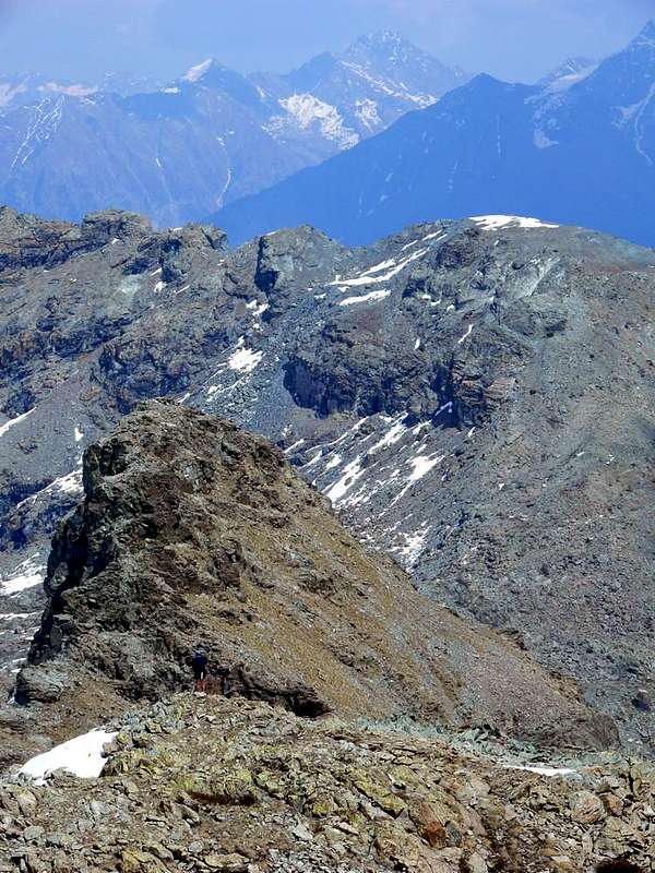
Left: Bec di Nona, Mont La Pertze, Mont Grimon & Cima Piana from Bocon Damon, by emilius
![]()
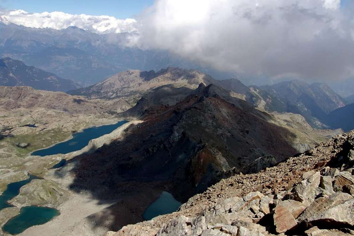
Cima Piana Area from Mont Glacier with its Eastern appendages, by emilius
![]()
![]()
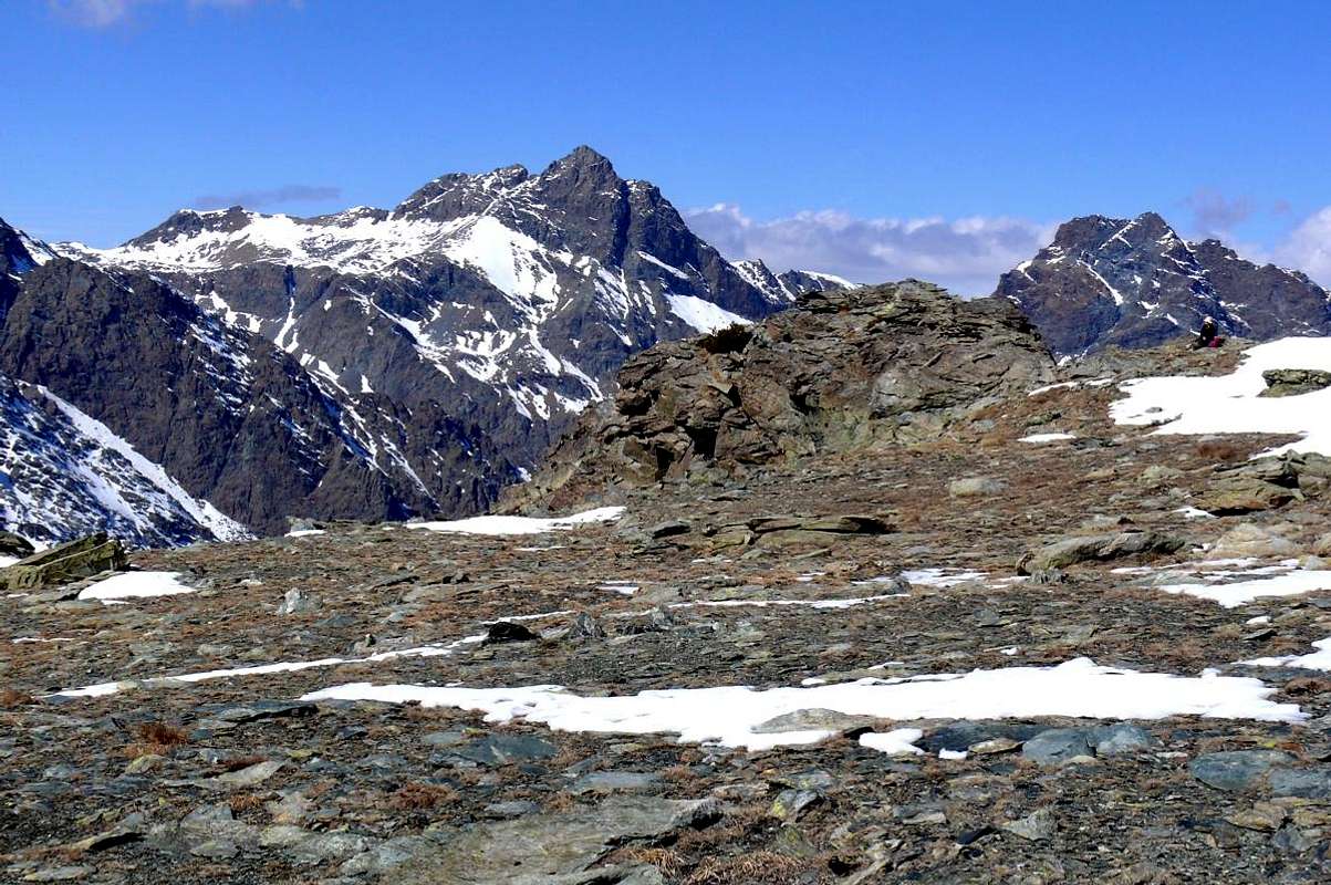
"... To Cima Piana from Croce Hill ...", by emilius

Questa Sommità appartiene al Gruppo del Mont Glacier (3.186 m), sito tra le tre Valli di Champdepraz, Issogne o di Brenve oppure Boccoueil e Champorcher. Presenta quindi tre versanti rivolti ai rispettivi comuni ed altrettante creste (oltre alla Cresta Est che però scende dal Mont Perché), che si dirigono verso Sud raggiungendo il Col Cima Piana oppure detto di Pana(z)e l'omonima punta (2.319 m, 2.388 m), verso Ovest in direzione dei Colli della Croce e del Lago Bianco (2.287 m, 2.308 m), ad Est verso quelli di Terra Rossa (2.090/5 m, 2.076 m), ma ormai dopo aver scavalcato il Mont Perché, ed infine verso Nord dove forma uno spartiacque secondario. Quest'ultimo é atto a separare la Valle di Champdepraz da quella di Brenva o Brenve ormai sopra il Comune d'Issogne. Questa cresta forma da Mezzogiorno verso Settentrione, dopo la Cima Piana, il Mont Grimon (2.522 m) e la caratteristica ed ardita guglia della "La Pertze" (2.403 m; "Il Palo o meglio La Pertica") prima di concludere, dopo il Colletto 2.350 metri circa, con il Bec di Nona (2.331 m); é l'unica parte che offre delle possibilità d'arrampicata in roccia (in alcune parti anche più che difficile) anche se non di buona qualità, poiché tutto il restante é formato da accumuli di blocchi rotti e caoticamente sovrapposti. Conosce una buona frequentazione da Champorcher-la Cort e dalla Valli di Champdepraz grazie alla facilità del sentiero che sale sottocresta dal Colle della Croce, mentre risulta meno frequentata dal versante d'Issogne, comunque facilmente raggiungibile tramite il Col di Pana o Panaz e la breve Cresta Sud. Molto meno, anzi assai raramente, tramite i Colli di Terra Rossa, raggiungibili abbastanza facilmente sia da Champorcher-Collin (1.614 m) che da Issogne per il Vallone di Brenve(a) o del Boccoueil, e la Cresta Orientale del Mont Perché con la quale avviene il collegamento con la precedente via. Dalla Vetta si gode d'uno splendido ed inusuale panorama sulle tre vallate fino ai loro imbocchi, nonché su tutte le più alte Sommità del circondario (Rafray, Glacier e Delà ad Ovest, Monte Avìc a Nord e Rosa dei Banchi a Sud) e sugli innumerevoli laghi esistenti (Leser, Serva, Bianco, Nero, Cornuto e Gran Lago a Champdepraz; Pana ad Issogne; Vernouille e Muffè sopra Champorcher-Château).
First Ascents
- First on the Summit: unknown.
- In winter: unknown. *** There is an attempt to complete the crossing in the winter of 1928 stopped about half way by Lino Binel and Amilcare Crétier with return to the Pana Alpage. This winter ascent will then be made by Diego Margiotta with Felice Bechon; March 12th, 2003.
- West, South and North Ridges: unknown.
- Integral Traverse: Sonia Amengo, Renato Francescotti, Ermo Noro and Nanni Scavarda ; Sep 09th, 1951. *** First solo: Osvaldo Cardellina; Jul 12th, 1992, by Voella.
- Crossing by Northwest Ridge of Mont Grimon: Diego Gaioni, Erik Bellotto and Fabrizio Lateltin; Nov 03th, 2001, in ascent from Barbustel Shelter and by Leser Loch.
Getting There
BY CAR:
- From TORINO, MILANO, etc: Motorway A5. Exit at IVREA or Quincinetto (PIEDMONT).
- From IVREA Town: Pont Saint Martin, Donnas, Hône, Bard, Pont Bozet, Champorcher; Verrès, Issogne; Champdepraz Municipalities. From Hône Commune (364m), crossing the bridge above Dora Baltea, to Bard Municipality (566m; renowned Austrian Fortress) and through Regional Road towards Pont Bozet Common (775m) with the asphalt road to Champorcher Valley (Savin, La Place, Dogier, Salleret, Mellier little Hamlets) up to the Camporcher-Château (1.427m); in Northwest towards Petit Mont Blanc, Grand Mont Blanc, Collin, la Cort Villages through Royal Road towards the parking in soil 1.800 meters about, at the entrance of Regional Park Mont Avìc Southern Sector; from this with paths towards the Colle del Lago Bianco and Barbustel Refuge, now into the Champdepraz Valley or Valleys of the Lakes. Also, leaving left the preceding route, from la Cort small Village before in East and after in Northeast towards Terra Rossa two Hills with path. From Hône directly by the Regional Road in South of Baltea or from Bard by the State Road in North towards Arnad or Arnaz (354m), Verrès (390m) Municipalities; crossing on bridge the Dora reach Issogne Common (387m; splenid Medieval Castle). From this towards the Brenve small Valley with path along Boccoueil Torrent. From Verrès through the SS.26 towards Torille Fraction and immediately after, crossing the Baltea with a stone bridge, to Fabbrica locality just before the Champdepraz Municipality (523m) and from this to Lakes small Valley and Voella or Raye Chevrères Village (1.307m; by Regional Road in asphalt). Through various paths from Voella Hamlet, into the Park Nature of Mont Avìc Northern Sector towards the Barbustel Refuge by connection of various paths to Southeast (Serva Lake).
- From FRANCE: through the Mont Blanc Tunnel to Entrèves-crossroads to Vény/Ferret Valleys nearby Courmayeur Resort. By Little Saint Bernard Pass, closed since November until half May to La Thuile Valley - Pré Saint Didier - Courmayeur. It is not necessary to take Motorway A5: you can drive on SS.26, in the direction of AOSTA - IVREA - TURIN.
BY PLANE:
- Aeroporto "Corrado Gex" Saint Christophe (Aosta).
Approaches by Champorcher, Issogne Champdepraz
A) - From Camporcher-Château (1.427m) Continue with the road to the small village of the Cort and the subsequent parking in the ground on the Royal Road to the entrance of the Southern Sector of the Regional Park of Mont Avic. From the La Cort Hamlet, continue verse West-northwest through Royal Road to Dondena reaching not very after a small parking 1.800 meters about; noumerous signs to entry in the Park); to begin awry immediately with the path n° 10 that part (North) and it goes up again with steeply zigzagging bringing itself, with direction Northeast, at first towards a small secondary torrent and subsequently placing side by side that more important descendant from the impending Lake Muffé. To go up again along the bank right hydrographic of the same one with the path, almost muletrack, that unties him with a series of hairpin bends flanking the wood, alternate to rectilinear lines in diagonal. Go out, leaving on the right (East) the deviation for the La Grand Cort Alp (1.944m, that from he is quietly seen here, abandoned among green pastures) so in the superior tableland in her narrowing among the appendixes of the Mont Ros (2.289m) to West and you it terminal of the Southwestern ridge that it climbs to the Cima Perche (2.396m; also with the toponym of Perché, or Perforated), or Southern shoulder of the Cima Piana (Flat Top also called Mont de Panaz 2.512m). Continue on the valley floor through less steep slope with run mostly open and, abandoning on the left (West) the deviations for the Lake Vernouille (2.145m) with the paths n° 9C/10B and, momentarily, also the n° 10, goes up with the n° 10C reaching the ruins of the Muffé Pasture (2.076m), close to the homonym Lake suffered to East (2.119m; 0h'30). From this to ascend up with direction Northwest in a area even more disclosed among morainic soil (numerous sources that gush out a little everywhere) again meeting the path n° 10, that it originates from the Loch Vernouille, few more than hundred metres more aloft. To abandon therefore the aforesaid variation continues with, that goes in opposite (Northeast) towards the nearby Lake Bianco Hill (2.308m), and to proceed with this last I pour the neighbour Croix Hill (2.287m) through the path n° 10C, reaching it with a final line of a more steep, but always easy. A short descent leads quickly to the Barbustel, at Lake Bianco in the High Champdepraz Valley or Lakes Valley (E/F; 1h'15/1h'45).
B) - From Issogne (387m) Climb for a short distance with the farm dirt road to the Village Barmet, then heading Southwest and trail n° 2 consists of switchbacks to reach Prele (858m). From this point, the same turns to the South and, by dominating the high Torrent Boccoueil, will then approach the Pastures of Cousse di Sotto (1.365m; up to here also comes from a farm road that goes back Barmet on the opposite side), di Sopra (1.415m), Pessey, Rosset (1.622m), Brenve di Sotto and di Sopra (1.852m); from here the trail, which becomes n° 3A, goes up directly to the Colle di Terra Rossa Eastern (2.076m; EE/F; 0h'30 from Brenve Damon, 2h'30/3h'00 by the end of the private dirt road at Versey or Vesey; 5/6h'00 from Issogne), just before leaving on your right (Northwest) deviation n° 10I for the monument of the Menhir, immediately below Cima Perchè and Pana(z) Hill.
C) - From Champdepraz (523m) From the Municipalities of Verrès (390m) in Southeast, or Montjovet (489m) to catch up with the Northwest Regional Road, South of Dora Baltea and Motorway A5, to Champdepraz (523m), located at the entrance of the with the same name valley. From this go along way towards Southeast with a first series of seven windings road to the junction, near the Bridge of Gorf, for Gettaz des Allemands (995m, old village that bears witness to the passage of Walser People) a dozen others, even closer, door in the upper part of the walloon, dominating from steep and wild precipices overhanging the Torrent de Chalamy, which originates at the base of the Northern Slope of the Invers of Lake Gelato. Left to right (West) to the branch Crestaz (1.293m) with its ancient ironmines now abandoned and closed, the same goes with a long diagonal to the South reaching Villages Barbustel or Barbuste (1.240m) and the adjacent Covarey, just before you reach Volla or Voella also called in old time as Chevrère (1.307m; Museum of the Natural Park of Mont Avic, small restaurant with a few rooms amongst the houses not long ago renovated keeping the style of the Aosta Valley), where it ends with ample parking. Parked in the large square climb the path n° 5B to Serva Lake (1.801m) at the foot of Bec L'Espic, and then through the n° 5C that, heading more towards Southeast, reaches the Alps Bayet Cousse and then the Barbustel Hut located on a rocky-grassy promontory immediately above the Lago Bianco (E/F; 3h'00/3h'30 by Voella).
![]()
"... To Cima Piana near Mont Glacier ...", by sergioenrico
A) - Da Camporcher-Château (1.427m) Continuare con la strada in asfalto fino al Villaggetto di la Cort ed al successivo parcheggio in terra battuta sulla Strada Reale all'ingresso del Settore Meridionale del Parco Regionale del Mont Avìc. Da La Cort, continuare verso Ovest-nordovest tramite la Strada Reale per Dondena raggiungendo non molto dopo un piccolo parcheggio in terra (1.800 metri circa; pannello con nunerose segnalazioni per l'ingresso nel Parco del Monte Avìc); inizare con il sentiero n° 10 indirizzantesi subito a monte (Nord) risalendo ripidamente e tramite zig-zag portandosi, con direzione Nordest, dapprima verso un torrentello secondario e successivamente affiancando quello più importante, discendente dal soprastante Lac Muffé, presso l'omonima alpe. Risalire lungo la sponda idrografica destra del medesimo con il sentiero, quasi mulattiera, che si snoda con una serie di tornanti affiancando il bosco, alternati a tratti rettilinei ad altri in diagonale. Uscire, lasciando sulla destra (Est) la deviazione per l'Alpe La Grand Cort (1.944 m, adagiata tra verdi pascoli) così nell'altipiano superiore nella strettoia tra le appendici del Mont Ros (2.289 m) ad Occidente e la propaggini terminali della Cresta Sudovest risalente alla Cima Perche (2.396 m; o Perché, cioé Forata), o spalla Meridionale della Cima Piana o Mont de Panaz (2.512 m). Continuare sul fondo del vallone con percorso alquanto meno ripido e maggiormente dischiuso e, abbandonando sulla sinistra (Ovest) le deviazioni per il Lac Vernouille (2.145 m) con i sentieri n° 9C/10B nonché, momentaneamente, anche il n° 10; risalire tramite il n° 10C raggiungendo i ruderi dell'Alpe Muffé (2.076 m), vicino all'omonimo Lago, subito ad Est appresso (2.119 m; 0h'30). Da questo proseguire con direzione Nordovest in una zona ancora più dischiusa tra dossi prativi e terreno morenico (piccole sorgenti che sgorgano un pò dappertutto) incontrando nuovamente il sentiero n° 10, proveniente dal Lac Vernouille, poco più di un centinaio di metri a mezzacosta sopra. Abbandonare quindi la variante seguita, che continua in opposta direzione (Nordest) verso il Col de la Croix con sentiero n° 10C (2.387 m), e con quest'ultimo verso il Colle del Lago Bianco (2.308 m), raggiungendolo con un tratto finale di poco più ripido ma pur sempre facile. Una discesina conduce in breve al Rifugio Barbustel, presso il Lago Bianco nell'Alto Vallone di Champdepraz conosciuto anche come Vallone dei Laghi (E/F; 1h'15/1h'45).
B) - Da Issogne (387 m) Salire per breve tratto con la strada poderale fino al Villaggio di Barmet, poi con direzione Sudovest e con sentiero n° 2 formato da stretti tornantini raggiungere quello di Prele (858 m). Da questo punto il medesimo volge più a Sud e, dominando dallo alto il Torrent Boccoueil, raggiunge in successione gli Alpeggi di Cousse di Sotto (1.365 m; fino a qui arriva anche una strada poderale che dal Barmet risale sul versante opposto), di Sopra (1.415 m), Pessey, Rosset (1.622 m), Brenve di Sotto e di Sopra (1.852 m); da qui il sentiero, che diventa n° 3A, sale direttamente fino al Colle di Terra Rossa Est (2.076 m; EE/F; 0h'30 da Brenve Damon, 2h'30/3h'00 dal termine della poderale presso Versey; 5/6h'00 da Issogne), lasciando poco prima a destra (Nordovest) la deviazione n° 10I pel monumento del Menhir, subito sotto di Cima Perchè e del Col di Pana(z).
C) - Da Champdepraz (523 m) Dai Comuni di Verrès (390 m) a Sudest, oppure Montjovet (489 m) a Nordovest raggiungere con la Strada Regionale, a Sud della Dora Baltea e dell'Autostrada A5, quello di Champdepraz (523 m), sito all'ingresso dell'omonimo vallone. Da questo percorrer la strada verso Sudest con una prima serie di sette tornanti insino al bivio, presso il Ponte di Gorf, per Gettaz des Allemands (995 m, vecchio villaggio testimoniante il passaggio dei Walser); una dozzina d'altri, ancor più ristretti, porta nella parte alta del vallone, dominando dall'alto erti e selvaggi dirupi sovrastanti il Torrent de Chalamy, originantesi proprio alla base del Versante Settentrionale dell'Invers del Lago Gelato. Lasciata a destra (Ovest) la diramazione per Crestaz (1.293 m) con le sue antiche miniere di ferro ormai abbandonate e chiuse, la stessa procede con un lungo diagonale verso Sud raggiungendo i Villaggi di Barbustel o Barbuste (1.240 m) e l'attiguo di Covarey, appena prima di raggiungere Volla o Voella od anche Chevrère in tempi più remoti (1.307 m; Museo del Parco Naturale del Monte Avic, piccolo ristorante, con alcune camere, tra le case da non molto tempo ristrutturate mantenendo lo stile valdostano), dove termina con ampio parcheggio. Parcheggiato nell'ampio piazzale si sale con il sentiero n° 5B fino al Lago della Serva (1.801 m), ai piedi del Bec L'Espic, e poi tramite il n° 5C che, dirigendosi più verso Sudest, raggiunge le Alpi Bayet e Cousse e poi il Rifugio Barbustel sito su d'un promontorio roccioso-erboso appena sopra al Lago Bianco (E/F; 3h'00/3h'30 da Voella).
![]()
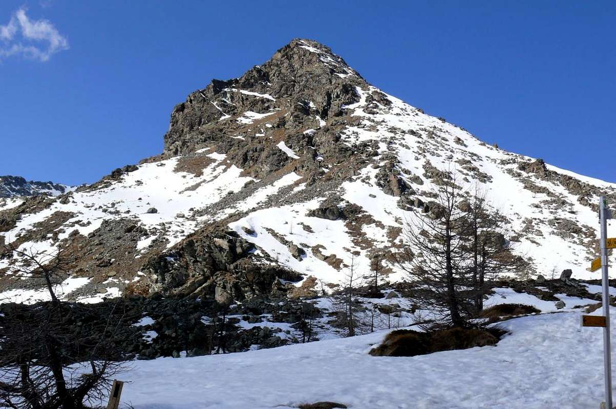
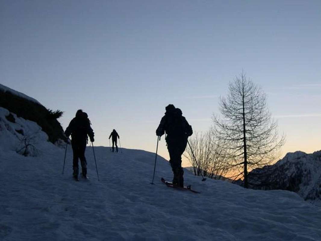
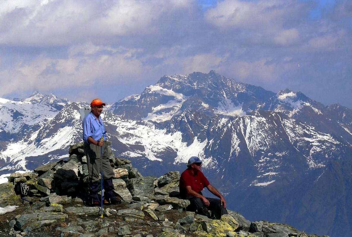
Ski-Mountaineering towards the Cima Piana, by sergioenrico
![]()
"... At the beginning of Western Crest ...", by emilius
![]()
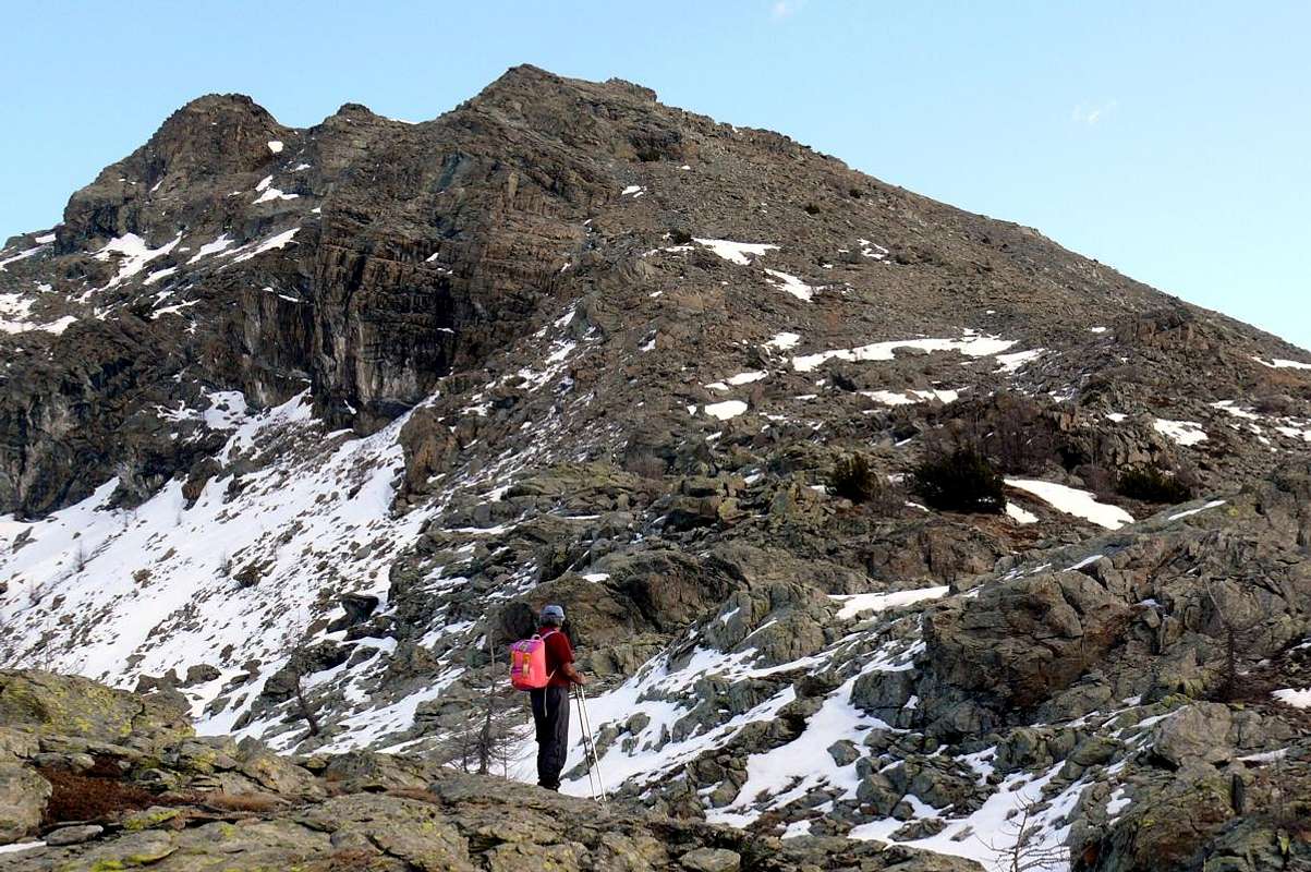
Southern Crest from Terra Rossa Hills & Cima Perché, by emilius
Routes Description
Route A (West Crest) Approach from la Cort before through Royal Road, after path towards Colle della Croce: from Château (1.427m), Arbussey, Mont Blanc, La Cort Villages, la Grand Cort Alp (1.944m) in North to Alp near Lake Muffé (2.019m), Croix Hill (2.287m; just above Barbustel Refuge in Champdepraz Walloon), with paths n° 10B/10C (E; 1h'30/1h'45). Route from Hill of the Cross: from the last hill to the East Cima Piana, by easy small path unnumbered or short rocky bands under the West Crest (EE; 0h'30/0h'45).
Via A (Cresta Ovest) Avvicinamento da la Cort con sentiero verso il Colle della Croce: da Château (1.427m), Arbussey, Mont Blanc, La Cort, la Grand Cort Alp (1.944m) verso Nord all'Alpe presso il Lago Muffé (2.019 m) poi al Col de la Croix (2.287 m; appena sopra il Rifugio Barbustel nel Vallone di Champdepraz), con sentieri n° 10B/10C (E; 1h'30/1h'45). Via dal Colle della Croce: da quest'ultimo ad Est verso la Cima Piana, con sentierino non numerato e brevi tratti di roccette sotto la Cresta Ovest (EE; 0h'30/0h'45).
Route B (South Crest) From la Cort (1.800m; see Approach C from Champdepraz) go up first to the East and then to the Northeast with the trail n° 11/11A, or from the nearby Village of Petit Mont Blanc (1.863m) directly to the North with the n° 10/11 reaching Colle di Terra Rossa Eastern; or by Brenve Damon with the Approach B from Issogne Common. From this cross towards Northwest on the watershed with the small Valley of Brenve coming soon to the Western Pass with some small bypass to the right (North; 2.090/5m; F; 0h'10). From the West Hill enough easily follow the Ridge South-east of Cima Perché overcoming a rocky, steeper than difficult and above an area of obvious reforestation (I°+/II°-), which takes place after the conjunction with the Crest South-southwest just before the Summit (EE/F+/D-; 0h'45/1h'00; up to come here along the trail from Lake Muffé and also on the side of the Issogne Menhir, both with traces). Get off easy enough with North Ridge-northwest following the ridge or bypassing some short step to the left (West; F+; 0h'15) reaching the Col de Cima Piana or Panaz; from this last climb through the easy Crest South-southeast through a variety of blocks stacked, you can avoid the left (I°+/II°-; always West) rising to just below the edge (EE/F+; 0h'35/0h'45 from the Pass of Panaz; EE/F+/D-; 2h'00/2h'15 by that of Terra Rossa East).
Note: it is possible to avoid the Cima Perché is climbing the side of Champorcher departing from Lake molds that on the opposite menhirs in the small Valley of Brenve or Boccoueil: both trace back to a small hill with trail n° 10F to the lake and not numbered Brenve Damon whence via the South ridge to the Summit. Wanting to climb, you can rise from the lake to the East until you reach the Crest South-southwest at an altitude of 2.250 meters, with slopes of debris and grass, reaching the Cima Perché first, following the ridge with some little wall (I°+/II°-) followed by a short ramp to the left followed by a dihedral (II°+/III°-) and finally small rocks (A/F+/AD-; 1h'15/1h'30).
Via B (Cresta Sud) Da la Cort (1.800 m; vedi Avvicinamento C) salire dapprima ad Est e poi a Nordest con il sentiero n° 11/11A, oppure dal vicino Villaggio di Mont Blanc (1.863 m) direttamente verso Settentrione con il n° 10/11 raggiungendo il Colle di Terra Rossa Orientale; oppure da Brenve Damon con lo Avvicinamento B. Da questo traversare verso Nordovest sullo spartiacque con il Vallone di Brenve arrivando in breve tempo a quello Occidentale con qualche piccolo aggiramento sulla destra (2.090/5 m; F; 0h'10); dal Colle Occidentale seguire la Cresta Sudest di Cima Perché superando un salto roccioso, più ripido che difficile ed al di sopra un'area di evidente rimboschimento (I°+/II°-), dopo il quale avviene la congiunzione con la Cresta Sud-sudovest appena prima della Cima (EE/F+/D-; 0h'45/1h'00; fino a qui arrivano tracce di sentiero anche dal Lago Muffé e sul versante di Issogne dal Menhir). Scendere con la abbastanza facile Cresta Nord-nordovest seguendo il filo di cresta oppure aggirando qualche breve passo sulla sinistra (Ovest; F+; 0h'15) raggiungendo il Colle di Cima Piana o Panaz; da questo ultimo salire tramite la facile Cresta Sud-sudest superando una serie di blocchi accatastati, che si possono evitare a sinistra (I°+/II°-; sempre Ovest) salendo appena sotto al filo di cresta (EE/F+; 0h'35/0h'45 dal Colle di Panaz; EE/F+/D-; 2h'00/2h'15 da quello di Terra Rossa Orientale).
Nota: risulta possibile evitare la Cima Perché sia salendo dal versante di Champorcher con partenza dal Lago Muffè che sull'opposto dal Menhir nel Vallone di Brenve o Boccoueil: da entrambi una piccola traccia risale al colle con sentiero n° 10F dal lago e non numerato da Brenve Damon, donde tramite la Cresta Sud alla Cima. Volendo arrampicare, si può salire dal lago ad Est fino a raggiungere la Cresta Sud-sudovest a quota 2.250 metri circa, tramite pendii detritico-erbosi, e con questa raggiungere la Cima Perché seguendo il filo di cresta con qualche muretto (I°+/II°-), seguito da una breve rampa a sinistra e da un diedro (II°+/III°-) ed infine roccette (A/F+/AD-; 1h'15/1h'30).
![]()
In distance from Mont Rafray or Northwest, by emilius
![]()
Northern Ridge from Mont Giron, by emilius
Route C (North Ridge) This path is long and complex, since it is not limited exclusively to the final part of the North Ridge of Cima Piana (ie the Collar 2.500 meters around between this and the Mont Grimon), but it is necessary to start from much further North, or from Bec's Nona (2.331m) at the end of the divide and from this cross to the South bypassing the "Pertze" or even Mont Pertsè (2.403m) and the subsequent Mont Grimon (2.522/3m). An alternative is to take on the watershed along the Northwest Ridge of the latter starting from Lake Leser (2.019m), reached by crossing to the North-northeast from the Refuge Barbustel via trail n° 4/5. Or you can reach it from the valley starting from Barbustel (1.420m) with the steep path to very narrow bends to the South-southwest n° 4 and again by Voella with path n° 5 directed to the South at the Alps Leser Under Above (1.908m). In the case of the Northwest Ridge of Mont Grimon must make a climb up the rock pretty good, but with uneven path overcoming an easy route to more challenging (from II° to III°+; A/PD+/AD-; 2h'00/2h'30 from the base in altitude 2.100 meters about; 3h'00 to Cima Piana). Wanting instead to make the full crossing, from Lake Leser or Lese head to the Northeast through rocks until you reach the base of the Crest Northwest Bec di Nona at 2.220 meters about altitude; overcome the same with the initial portions of broken rock alternating with other of compact, but also air and sharp (from I°+ to III°-). From the Summit descend easily to a notch above a great tower, rising direct but very difficult to circumvent both the right (West) with crossing to a rocky channel showing on the ridge, or to the left through a rock plate followed by a crack in the rock (III°-). All the rest on the crest takes place along these lines: it continues through rocks easier and routes that lead to a notch next followed by some elevations up against a small wall shattered by a split (III°/III+°), beyond which is a fork; the difficult next tower you win by means of a good crack (III°+/IV ° and then again III°+); following a sudden "serrated" that with a difficult downhill leads to a collar which is followed by a sharp spire (III°+/IV° and then again III°+) reaching the Northern base of the "La Pertze". Circumvent the same to the West and go up the opposite side through a chimney exposed (12/13 meters; MD with a step of V° with nail already in place, but hemi occulted; small mound with a tiny statue of the Madonna on the Top); descend via the same route (possible short rappel to a small rocky balcony) to the terrace at the base, from which it continues bypassing two other pinnacles. From the second of these cross right (always West) not easily reaching a reddish block, followed by carving; through a slot followed by a short chimney you get away saddle 2.355 meters around, reachable from West to East that (better this slope). Overcoming two other pinnacles (I°+/II°/II°+) more easily reach the Mont Grimon; another series of elevations, progressively easier and less complicated route and more evident, leading to Cima Piana (A/AD+/D-; 0h'40 from Mont Grimon; 4h'45/5h'15 from the base at 2.100 meters around of the Bec di Nona towards Cima Piana; 6h'00/7h'00 by Barbustel Shelter; even 10h'00 by Voella Hamlet).
Via C (Cresta Nord) Questa via é lunga e complessa, poiché non si limita esclusivamente alla parte finale della Cresta Settentrionale di Cima Piana (cioè dal Colletto 2.500 metri circa tra questa ed il Mont Grimon), bensì é necessario partire da molto più a Nord, cioé dal Bec di Nona (2.331 m) e da questo attraversare a Sud scavalcando la "Pertze" od anche Mont Pertsè (2.403 m) ed il successivo Mont Grimon (2.522/3 m). Un'alternativa consiste nel portarsi sullo spartiacque percorrendo la Cresta Nordovest di quest'ultimo dal Lago di Leser (2.019 m), raggiungibile con traversata verso Nord-nordest dal Rifugio Barbustel tramite il sentiero n° 4/5. Oppure é possibile qui arrivare partendo dal fondovalle da Barbustel (1.420 m) con il ripido sentiero a stretti tornantini verso Sud-sudovest n° 4 ed ancora da Voella col n° 5 indirizzato verso Sud all'Alpi di Leser Sotto e Sopra (1.908 m). Nel caso della Cresta Nordovest del Mont Grimon bisogna effettuare una salita su roccia abbastanza buona, ma con percorso disomogeneo superando tratti facili ad altri più impegnativi (dal II° al III°+; A/PD+/AD-; 2h'00/2h'30 dalla base a quota 2.100 metri circa; 3h'00 fino a Cima Piana). Volendo invece effettuarne la traversata integrale, dal Lago di Leser o Lese dirigersi a Nordest tramite pietraie fino a raggiungere la base della Cresta Nordoivest del Bec di Nona a quota 2.220 metri circa; superare la medesima con tratti iniziali di roccia rotta alternati ad altri di compatta, ma anche aerea ed affilata (dal I°+ fino al III°-). Dalla Sommità scendere facilmente ad un intaglio che precede un torrione, di salita diretta molto difficile, ma aggirabile sia a destra (Ovest) con traversata verso un canale che riporta sul filo di cresta, oppure a sinistra tramite una placca seguita da una spaccatura nella roccia (III°-). Tutto il prosieguo sulla cresta avviene su questa falsariga: si continua tramite rocce più facili e rotte conducenti ad un intaglio successivo seguito da alcune elevazioni sin contro una paretina infranta da una spaccatura (III°/III°+), oltre la quale trovasi una forcella. Il difficile torrione successivo si vince per mezzo d'una buona fessura (IV°+ poi III°+/III°); segue un tratto "seghettato" che con un passaggio difficile in discesa porta ad un colletto al quale seguono una guglia affilata (III°+ poi IV° e di nuovo III°+) raggiungendo la base Nord della "Pertze". Aggirare la medesima ad Ovest e salire dal versante opposto tramite un camino esposto (12/13 metri circa; MD un passaggio di V° con chiodo già in loco; tumulo con statua della Madonnina sulla Vetta); scendere tramite la stessa via (possibile breve corda doppia) fino al terrazzo alla base, dal quale si continua oltrepassando altri due pinnacoli. Dal secondo di questi traversare a destra non facilmente raggiungendo un blocco rossiccio, seguito da intaglio; tramite una fessura e successivo breve camino s'arriva alla larga sella 2.355 metri circa, raggiungibile sia da Ovest che da Est (meglio). Superando altri due pinnacoli (I°+/II°/II°+) più facilmente si raggiunge il Mont Grimon; un'altra serie di elevazioni, più facili e con percorso meno complicato nonché più evidente, portano alla Cima Piana (A/AD+/D-; 0h'40 dal Mont Grimon; 4h'45/5h'15 dalla base a quota 2.100 metri circa del Bec di Nona fino a Cima Piana; 6h'00/7h'00 dal Rifugio Barbustel; anche 10h'00 da Voella).

Difficulties & Equipment
From F to D+, second the Routes.Da F a D+, a seconda delle Vie.
![]()
Hiking, with rope and some nails for the Route C.
Da Escursionismo, con corda ed alcuni chiodi per la via C.
Mountain Conditions
- You can get meteo information at the official site of the Regione Valle d'Aosta:
- Valle d'Aosta Meteo
Books and Maps
- "Guida delle Alpi Occidentali" di Giovanni Bobba e Luigi Vaccarone C.A.I. Sezione di Torino Volume II (parte II), 25 Maggio 1896.
- "Guida dei Monti d'Italia – Emilius Rosa dei Banchi-Parco del Mont Avic" di Giulio Berutto e Lino Fornelli - Club Alpino Italiano/Touring Club Italiano, Marzo 2005.
- "Diari Alpinistici" di Osvaldo Cardellina e Indice Generale accompagnato da Schedario Relazioni Ascensioni 1964-2019 (inediti).
 |
 |
 |
- Ingenia "Parco Naturale del Mont Avic" Carta dei sentieri 1:25.000.
- Enrico Editori Ivrea "Carta turistica del Canavese" 1:100.000
- Enrico Editore Ivrea-Aosta "Gruppo del Gran Paradiso" 1:50.000.
- L'Escursionista editore "Valle di Champorcher Parco Mont Avic" Carta dei Sentieri (n° 11) 1:25.000.
- L'Escursionista "Valle di Cogne" Carta dei Sentieri 1:25.000.
Important Information
- REGIONE AUTONOMA VALLE D'AOSTA the official site.
- FONDAZIONE MONTAGNA SICURA Villa Cameron, località Villard de la Palud n° 1 Courmayeur (AO) Tel: 39 0165 897602 - Fax: 39 0165 897647.
- A.I.NE.VA. (Associazione Interregionale Neve e Valanghe).
Useful Numbers
- Protezione Civile Valdostana località Aeroporto n° 7/A Saint Christophe (Ao) Tel. 0165-238222.
- Bollettino Meteo (weather info) Tel. 0165-44113.
- Unità Operativa di Soccorso Sanitario Tel. 118.