|
|
Mountain/Rock |
|---|---|
|
|
19.38746°N / 100.31599°W |
|
|
Hiking, Mountaineering |
|
|
Winter |
|
|
10532 ft / 3210 m |
|
|
Overview
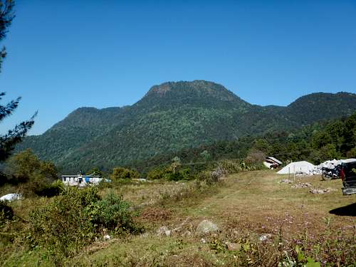
Cerro El Cacique (translated to "Mountain of the Chief") is the most impressive and scenic mountain around the Cerro Pelón Butterfly Sanctuary. Not many people visit the mountain, but it is still a great hike and climb. The mountain is an old volcano and is made of volcanic rocks. The area around Cerro Pelón has become famous in recent years because of the North American monarch butterfly migration where literally millions of butterflies gather for the winter on the slopes of Cerro Pelón. The area around Cerro Pelón itself is much lest touristy than the butterfly reserve at El Rosario. A visit to the area is high recommended.
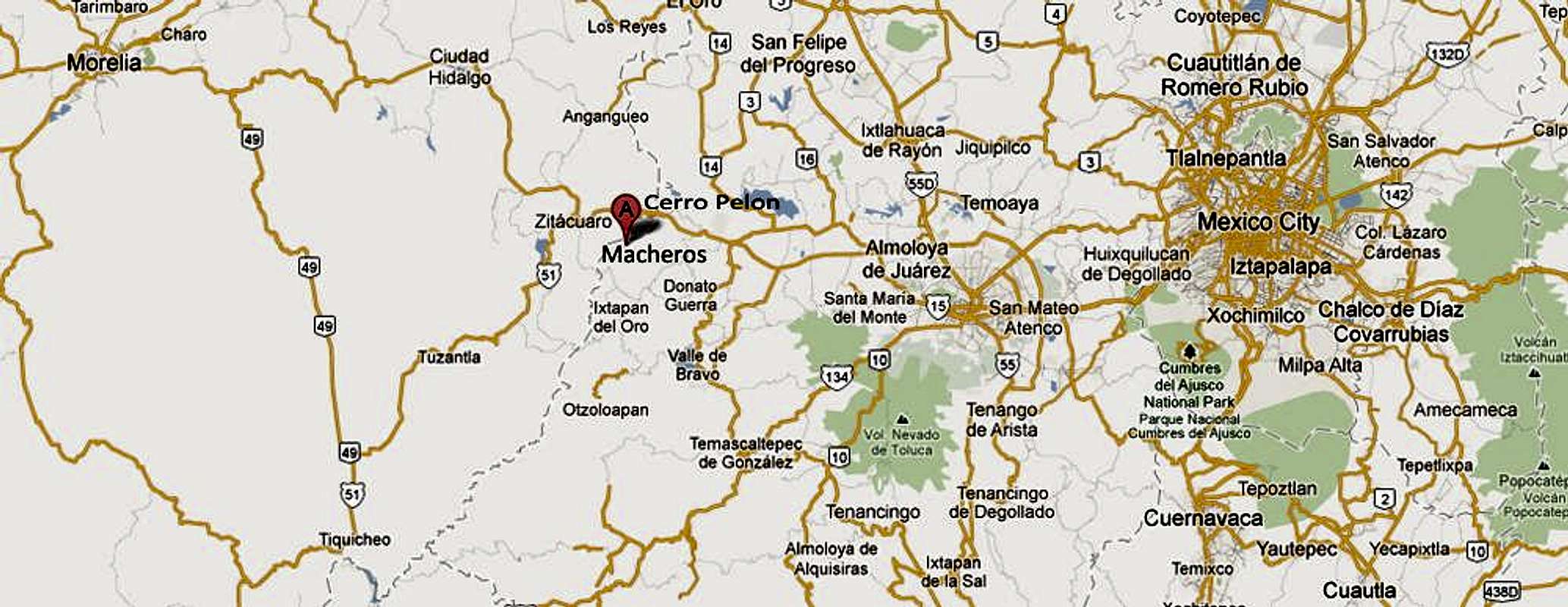
As of now, the butterflies flock to Cerro Pelón, next to Cacique and no butterflies roost on Cacique. Because of this, the mountain is mostly ignored. As mentioned, it is still a really nice hike/climb and highly recommended. The views of Cerro Pelón and areas to the north are really good as well. Although not that far from Mexico City (2.5 hours), this area is far removed from the hustle, bustle, crowds, and noise of the City. Macheros, the launching point for the mountain is a nice, quiet, and peaceful rural hamlet.

Getting There
Buses in Mexico is convenient, safe, inexpensive, and comfortable. Most busses run 7 days a week, year-round, including all holidays. Most people come from Mexico City and the east, but we came from the west.
From the East and Mexico City to Zitácuaro
From JM’s Butterfly Reserve B&B:
If you are coming from the Mexico City airport or elsewhere in the city, take a taxi or the metro to the Observatorio terminal, also known as Poniente (it’s at the end of the pink metro line). Buy a “directo” ticket to Zitácuaro with a company called La Linea. Their desk is across from the restaurant/snack bar area. They take credit cards. Buses leave every hour during the week and every half hour on weekends. They run from 4 am til 10 pm. The ride takes about two and a half hours. As of December 2017, a one-way ticket costs about 260 MXN.
From the West and Morelia to Zitácuaro
In Morelia, buses for Zitácuaro leave Terminal B in the center of the main bus terminal every half hour all day long with a company called Alegra. This bus is not a “directo,” so expect the ride to take at least 3 hours.
From Zitácuaro to Macheros via Taxi
When you arrive at the bus terminal in Zitácuaro, walk outside the main entrance to the queue of authorized taxis. You do not need to check in at the authorized taxi window ; they only sell tickets for transport within Zitácuaro. You need to ask the next driver in the line to take you to Macheros (pronounced Mah CHAIR os) in the State of Mexico. The fare should not be more than 300 MXN. The drive to Macheros takes about 30 minutes.
From Zitácuaro to Macheros via Public Transportation
For the budget traveler, there is also a public transportation service called a combi (a refitted VW bus) that can take you part of the way to our place. Exit the bus station and cross the street. The combis leave from the street that is to the left of the large supermarket in front of you. Take one that goes to Aputzio de Juarez get off at La Piedra. La Piedra is the on the border of the state of Mexico, where the combis are not authorized to operate. There are usually taxis waiting here if you arrive before dark: take one to Macheros from there. Note that if you are traveling solo, the taxis won’t leave until they have another fare. Also note that the taxi drivers call it a day by sunset, so plan your travels accordingly.

Routes Overview
A pretty good trail exist to the summit areas and several trails are on the lower slopes, but they can be hard to find. A guide is recommended in order to find the start of the trail. You can find one at the entrance station for Cerro Pelón or at JM's Butterfly B & B.
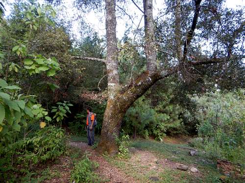
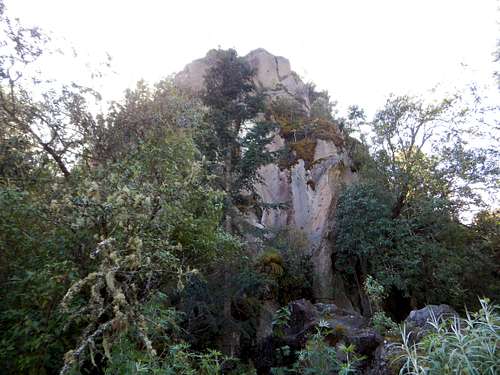
From Mucheros, we walked down to the village of Rincón, though avocado fields, and over a few barbed wire fences to the trail. We followed several trails and an old road to a spring high on the mountain. From the spring, we followed a steep trail up to a cave and after checking it out, to a faded trail and a minor bushwhack to the summit plateau. There were cows near the summit. We say many colorful birds and some butterflies. We walked across the summit plateau to a huge cross at a viewpoint of Zitácuaro. We took a nice rest there and headed over to the true summit with some bushwhacking along the way. We tried to follow a more direct route down to the cave, but there were too many cliffs and too much bushwhacking. We returned to the trail we took up and followed it to the cave and spring. From the spring we took a different way down. We took a trail which was faded in places that traversed the west side of the mountain and stayed above town. We eventually met the trail from Cerro Pelón and followed it down to Macharos. It was a nice hike, but pretty long. The route down was longer than the route up.

Red Tape
There is no red tape here that concerns those climbing the mountain so please take care of the place.
When to Climb
November through March is the best time to climb. This is the dry season and since you will also want to visit the butterflies on Cerro Pelón, which are only present during this time of year.

Camping
You can camp at JM's Butterfly B&B, but most people just stay in the lodge.
Mountain Conditions
Below are the weather averages for Cumbres del Ajusco at 2990 meters/9810 feet. It will be about 2-3 ° F (1-2 ° C) cooler on the summit of Cacique.
| Month | High (° F ) | High (° C) | Low (° F ) | Low (° C) | in. Rain | mm Rain | Rain Days |
| Jan | 59 | 15 | 38 | 3 | 0.58 | 15 | 2 |
| Feb | 58 | 15 | 39 | 4 | 0.30 | 8 | 1 |
| Mar | 60 | 16 | 40 | 4 | 0.78 | 20 | 2 |
| Apr | 61 | 16 | 40 | 5 | 2.01 | 51 | 6 |
| May | 62 | 17 | 41 | 5 | 3.24 | 82 | 10 |
| Jun | 61 | 16 | 42 | 6 | 8.62 | 219 | 17 |
| Jul | 60 | 15 | 42 | 5 | 10.54 | 268 | 22 |
| Aug | 59 | 15 | 42 | 5 | 11.10 | 282 | 22 |
| Sep | 59 | 15 | 42 | 5 | 9.16 | 233 | 19 |
| Oct | 60 | 15 | 40 | 4 | 3.58 | 91 | 10 |
| Nov | 60 | 15 | 39 | 4 | 0.61 | 16 | 4 |
| Dec | 60 | 15 | 38 | 3 | 0.30 | 8 | 2 |
External Links

