La montagna chiama i suoi figli, ed essi rispondono fedelmente al suo appello…
Osvaldo Cardellina, Diario alpinistico, 1964-65
Page texts: @ OsvaldoCardellina"Osva", passed away on May 2, 2022. Page owners: Christian Cardellina e Osvaldo Cardellina. Any updates from September 12, 2022: Antonio Giani, page administrator, friend and climbing companion.
Testi della pagina: @ OsvaldoCardellina "Osva", scomparso il 2 maggio 2022. Proprietari pagina:Christian Cardellina e Osvaldo Cardellina. Eventuali aggiornamenti dal 12 settembre 2022: Antonio Giani, amministratore della pagina, amico e compagno di salite.
Circular Overview
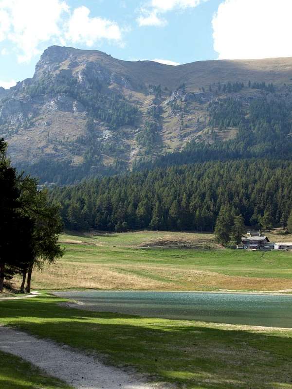
Verrayes/St. Denis Basin is located under Cima Longhede and at the foot of Becca d'Aver and above Chambave in valley floor nearby the course of Baltea. These two municipalities are "lying" on a sunny basin that extends from the Mont de la Pesse (1.708m) to the West until the attending Col Saint Pantaleon (1.650m) on the opposite watershed with the Municipality of Torgnon and the Valtournanche. This hill above the partition first reach the Col des Bornes (1.774m), the other gateway to the Valley of the Matterhorn from here you can admire beautifully, before rising abruptly in Colle and Becca Aver. Under the same it covers the rest of the watershed that formed the wooded-rocky promontory of Saint Evence with its famous Chapel (1.687m, 1.650m) ends above the Castle of Passerin Entrèves (529m), just outside the Châtillon Commune. This area offers beautiful walks, starting with the visit to the Castle of Cly recently restored and just above the Municipality of Chambave to those near the Pond of Lozon (1.520m) in the "Pic nic Area" neighbor Champlong Pastures, to excursions in higher altitude to reach progressively the Mont Ander, the Cima of Longhede and Becca of Aver (1.931m, 2.416m, 2.469m), the latter the highest elevation of the entire basin. So certainly the most suitable area for the practice of hiking, even snowshoeing, not to Mountaineering. The good disposition in the South in fact offers a rapid transformation of the snow, for which I have early tours also can be performed Ski-Mountaineering. This factor makes it possible to advance considerably outputs seasonal, making routes safe, fun, not excessively long and therefore very suitable for beginners. Among these you want to point out here the "Tour de Saint Evence", beautiful summer stroll among magnificent forests and beautiful hike through snow shoes starting from the bottom from the villages of Del, Plau and Semon, or from the top with reverse path from Col Saint Pantaleon accessible by car even in winter on the South and from the opposite or Torgnon Municipality through the Regional Road, where is normally closed and you still can quite extend to the tour in question. With regard to the Mountaineering instead the offer is modest relying exclusively on climbs Becca of Aver or the Top of Longhede, while it is completely devoid of possibility of Climbing, unless you want to try on the short and steep Southern and Western Walls of the latter. Bad quality of the rock does not completely recommend, for which reason we suggest to stay safely on paths traced and well-marked.
La Conca di Verrayes e Saint Denis é collocata alle pendici di Cima di Longhede e Becca d'Aver e sopra a Chambave sul fondovalle, presso il corso della Dora. Questi due Comuni sono "distesi" sopra un soleggiato bacino allargantesi dal Mont de la Pesse (1.708 m) ad Ovest sino al frequentato Colle di Saint Pantaleon (1.650 m) sull'opposto spartiacque con il Comune di Torgnon e la Valtournanche. Sopra questo colle il divisorio raggiunge dapprima il Col des Bornes (1.774 m), altra porta d'ingresso verso la Valle del Cervino che da qui s'ammira splendidamente, per poi risalire in modo brusco a Colle e Becca di Aver. Sotto al medesimo s'estende il resto dello spartiacque che, formato il promontorio di St. Evence con la sua famosa Cappella (1.687 m, 1.650 m) termina sopra il Castello dei Passerin d'Entrèves (529 m), alle porte del Comune di Châtillon. Quest'area offre belle passeggiate, a partire dalla visita al Castello di Cly, un vecchio maniero da poco tempo restaurato ed appena al di sopra del Comune di Chambave, a quelle nei pressi del Laghetto del Lozon (1.520 m) nell'"Area Pic nic" di Champlong presso a Grand-Villa, ad escursioni in più alta quota fino a raggiungere progressivamente il Monte Ander, la Cima di Longhede e la Becca di Aver (1.931 m, 2.416 m, 2.469 m), quest'ultima massima elevazione dell'intero bacino. Quindi una zona certamente più idonea alla pratica dell'Escursionismo, anche con le cosiddette "ciaspole" o racchette da neve, che non all'Alpinismo. La buona disposizione a Mezzogiorno offre infatti una rapida trasformazione della neve, per la qual cosa sono presto effettuabili gite anche di Sci-Alpinismo. Questo fattore permette di anticipare notevolmente le uscite stagionali, effettuando dei percorsi sicuri, divertenti, non eccessivamente lunghi e quindi molto adatti anche per i principianti. Tra questi si vuole qui segnalare il "Tour de Saint Evence", bella passeggiata estiva tra magnifiche foreste, nonché splendida escursione tramite racchette da neve con partenza dal basso dai Villaggi di Del, Plau e Semon oppure dall'alto con percorso inverso dal Col Saint Pantaleon, raggiungibile in auto anche in inverno sul lato Meridionale mentre dall'opposto o del Comune di Torgnon la Strada Regionale viene di norma chiusa e comunque si può prolungare di non molto la gita in questione. Per quanto concerne l'Alpinismo invece l'offerta risulta modesta basandosi esclusivamente alle sole ascensioni alla Becca d'Aver od alla Cima di Longhede, mentre é completamente priva di possibilità d'Arrampicata, a meno che non ci si voglia cimentare sulle corte ma alquanto ripide Pareti Sud ed Ovest di quest'ultima. Cattiva qualità della roccia lo sconsiglia del tutto, per la qual cosa vi suggeriremmo di restare tranquillamente sui sentieri tracciati e, quasi sempre, ben segnalati.
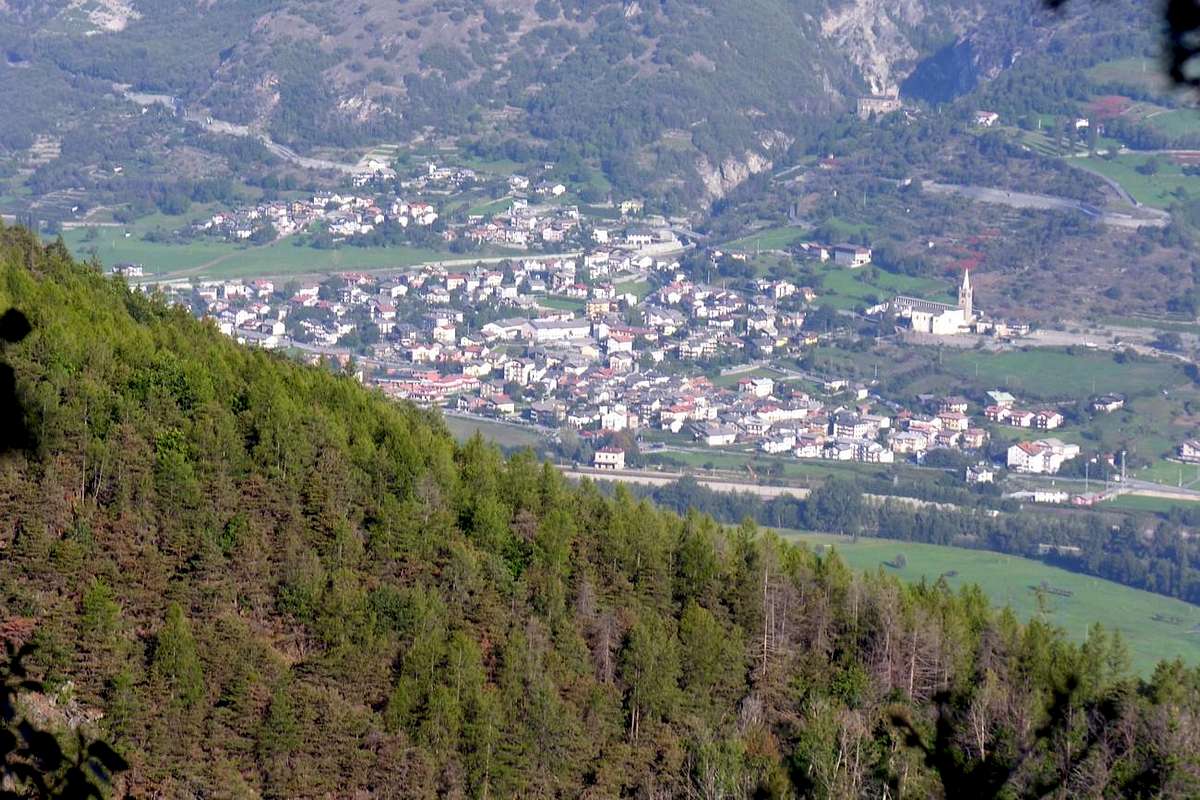
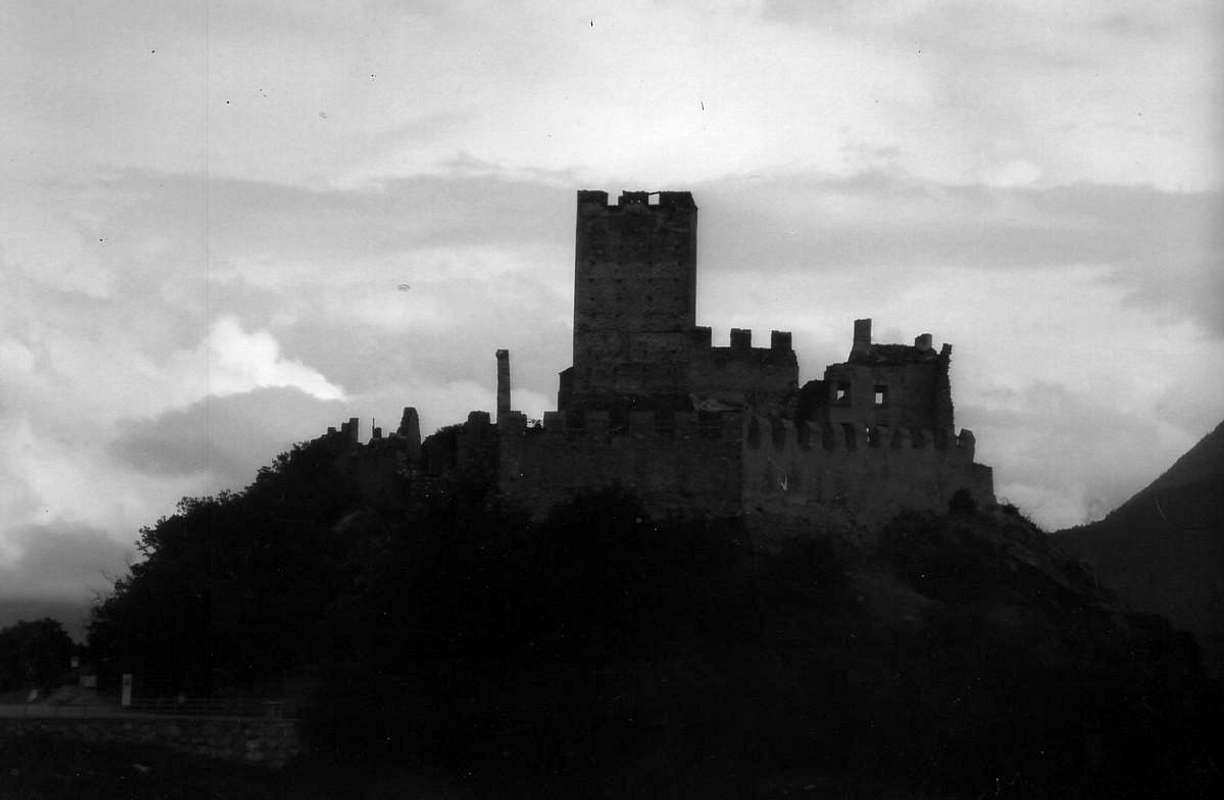
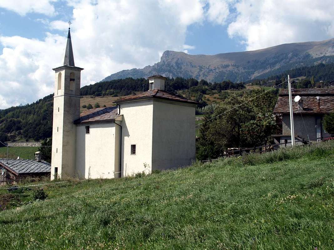
But this area is also interesting in the valley floor where, besides the aforementioned ancient Cly Castle built in 1351 by Boniface of Challant, we find other walks in the medium-low hill as in the Hamlets of Arlier, Margnier, Septumian and Diemoz (550m, 610m, 525m, 560m); by Septumian you can go towards Fénis Common through the known "Bridge of Elm". Famous for its muscat wine "Malvasia", has a beautiful Romanesque Bell tower at the Parish Church, and in Saint-Denis, we find the Church that from 1207 to 1647 had belonged to the jurisdiction of "Saint-Gilles". Returning to the castle, the massive and almost "dark" building, from historically remembered as the same from the first-born of the Count Bosone Challant is then passed to the Savoy Family. Indeed Amedeo VI°, called the "Green Count", the confiscated Bonifacio debt setbacks was aggregated to "Feuds Savoy". After various adventures became the property of Baron Roncas of Chatel-Argent (Villeneuve Common) who dismantled to build a house for the take rather original geometric arrangement and equipped with large rooms for meetings, symposia and conferences in that of Chambave. Simultaneously the Counts of Challant, surely the most powerful Family of the Valley with 15 fiefdoms and since 1557 also become Barons of Aymavilles Common, were owners of the nearby Castle of Châtillon Municipality, today "Castle Passerin d'Entrèves", also it built by the Challant with Ibleto in 1350. Then an area that also invites the historic visitations, perhaps combining the same in some short walks, not forgetting a visit to the Parish Church of Verrayes (1.026m) or to that of the nearby Commune of Saint Denis (803m).
Ma questa é un'area anche interessante sul fondovalle dove, oltre al già citato antico Castello di Cly costruito nel 1351 da parte di Bonifacio di Challant, troviamo altre passeggiate nella medio-bassa collina come nelle Frazioni di Arlier, Margnier, Septumian e Diemoz (550 m, 610 m, 525 m, 560 m); da Septumian si può andare a Fénis tramite il conosciuto "Ponte dell'Olmo". Famoso per il suo vino moscato "Malvasia", presenta bel campanile romanico presso la Chiesa Parrocchiale, mentre a Saint Denis troviamo la Chiesetta che dal 1207 al 1647 era appartenuta alla giurisdizione di "Saint-Gilles". Tornando al castello, massiccia e quasi "tenebrosa" costruzione, da storicamente ricordare come il medesimo dal primogenito del Conte Bosone di Challant sia poi transitato ai Savoia. Infatti Amedeo VI°, detto il "Conte Verde", lo confiscò a Bonifacio per debiti regressi aggregandolo ai "Feudi Sabaudi". Dopo varie peripezie diventò proprietà del Barone Roncas di Chatel-Argent (Villeneuve) che lo smantellò per costruirne un'abitazione pittosto originale per la disposizione geometrica ed attrezzata con saloni per riunioni, simposi e convegni in quel di Chambave. Simultaneamente i Conti di Challant, sicuramente la Famiglia più potente della Valle con 15 feudi e dal 1557 diventati anche Baroni di Aymavilles, erano proprietari del vicino Castello di Châtillon, oggi "Castello dei Passerin d'Entrèves", costruito anch'esso dai Challant con Ibleto nel 1350. Quindi un'area alquanto invitante pure alle visitazioni storiche, magari abbinando le medesime a brevi passeggiate, senza dimenticare una visita alla Chiesa Parrocchiale di Verrayes (1.026 m) od a quella del vicino Comune di St.-Denis (803 m).
Getting There
BY CAR:
From TORINO, MILANO, etc: Motorway A5. Exit at IVREA or Quincinetto (PIEDMONT).
From IVREA Town: in West towards Pont Saint Martin, Donnas, Arnad, Verrès, Bard, St. Vincent, Châtillon, Chambave, Nus, Quart, St. Christophe and Aosta Municipalities. From Courmayeur Resort: in East to Morgex, La Salle, Saint Pierre, Sarre, Aosta, Saint Chistophe, Quart, Nus, Chambave, Verrayes, Saint-Denis Municipalities.
From Aosta Town towards St. Christophe, Quart, Nus and Chambave Municipalities From SS.26, nearby Chambave, to Regional Road; towards Ollières, Marseiller (801m) to Verrayes (991m). With Municipal Road towards Tessellaz, Marquis, Dorinaz (1.323m), Charrière Villages to Grand-Villa Hamlet (1.423m), in Verrayes/Saint Denis Basin and to Aver-Longhede Area. From
A) - Verrayes, with Regional Road, towards Del (1.260m), Plau (1.305m), Semon to Cheresoulaz (1.487m) Villages. Also from
B) - Saint Denis (803m; reached from Chambave, Marseiller) with Regional Road towards Gubioche, Etrobleyaz, Petit Bruson, to Del Villages. C*** Road Connection towards Roves, Lozon (1.520m), Clavon, Fontane Villages, Pastures to Bornes Alp). From Cheresoulaz, through Municipal/Regional Roads, to Saint Pantaléon Hill (1.650m).
From FRANCE: through the Mont Blanc Tunnel to Entrèves-crossroads to Vény/Ferret Valleys - Mountain Guides of Courmayeur - La Saxe Rock Gym - Courmayeur. By Little Saint Bernard Pass, closed since November until half May to La Thuile Valley - Pré Saint Didier - Courmayeur. It is not necessary to take Motorway A5: you can drive on SS.26, in the direction of AOSTA - IVREA - TURIN.
BY PLANE:
Aeroporto "Corrado Gex" Saint Christophe (Aosta).
Almost All Itineraries
"Conca" or small Basin In order to deploy clockwise from Northern "Conca" of Chambave/Verrayes/St. Dénis Communes above the Central Valley of Baltea
Verrayes-Saint Dénis Northern Basin: from SS.26 to Verrayes/Saint Dénis Municipalities through Regional Roads.
A) - from Verrayes Municipal Road to Grand-Villa Hamlet (1.437m), Vieille (1.450m), Vencorère (1.563m; small parking), Prelaz (1.712m) Villages. From this in Southwest
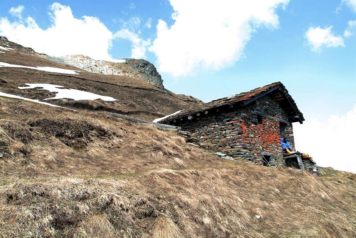
1) - la Bourra Alp (1.748m), through dirt road, Mont de la Pesse(1.708m) with path n° 3C;
2) - from Prelaz, pathless, to Mont Ander(1.931m) and with dirt to Filon Hill (1.894m).
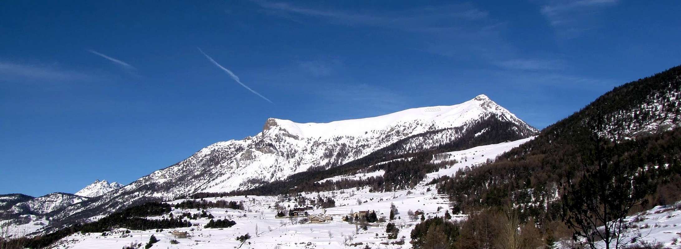
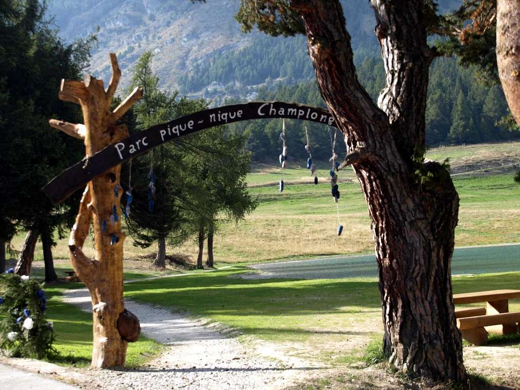
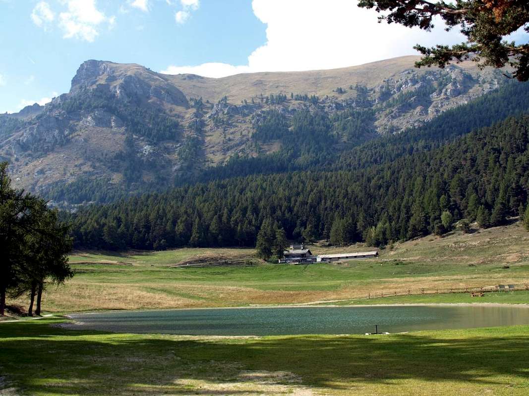
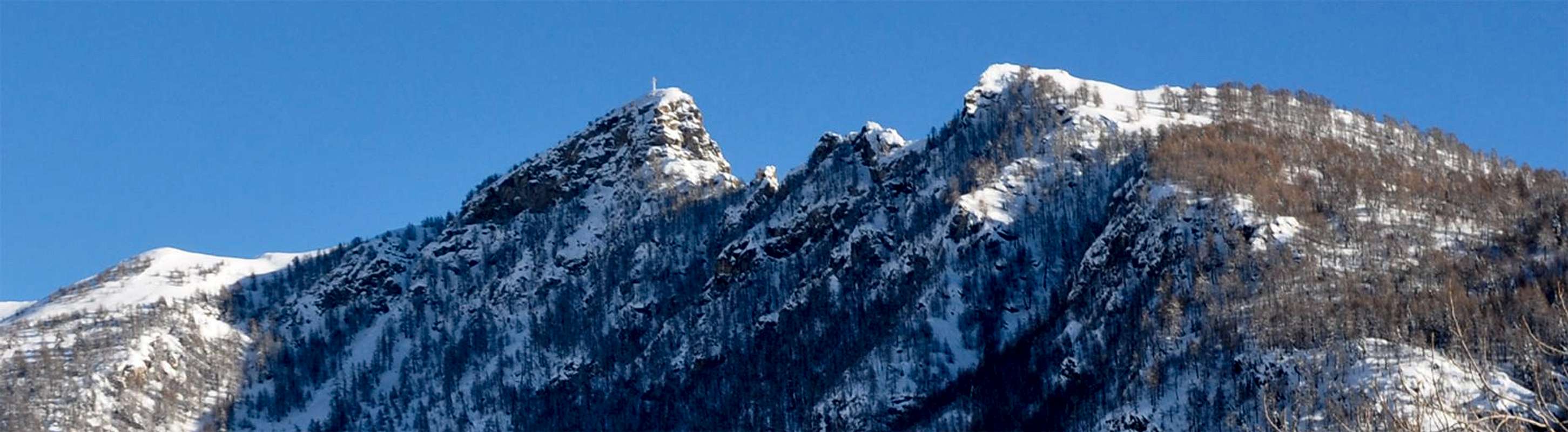
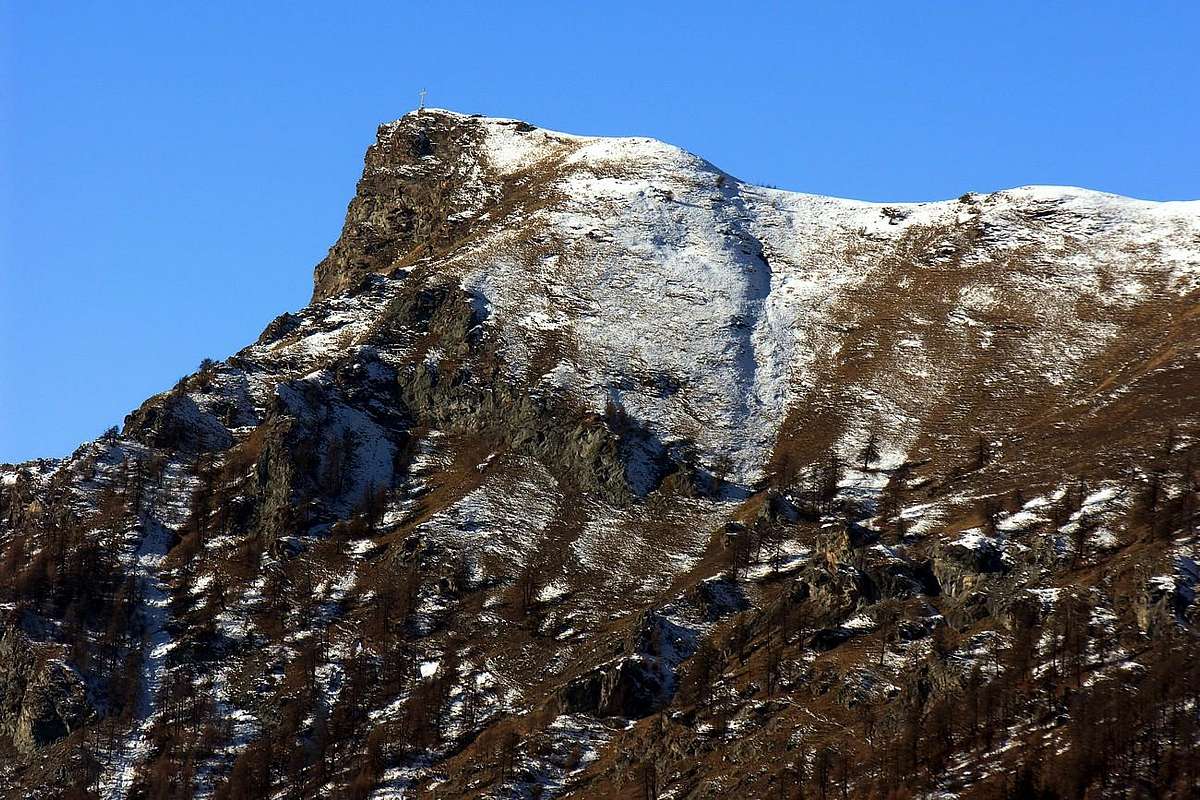
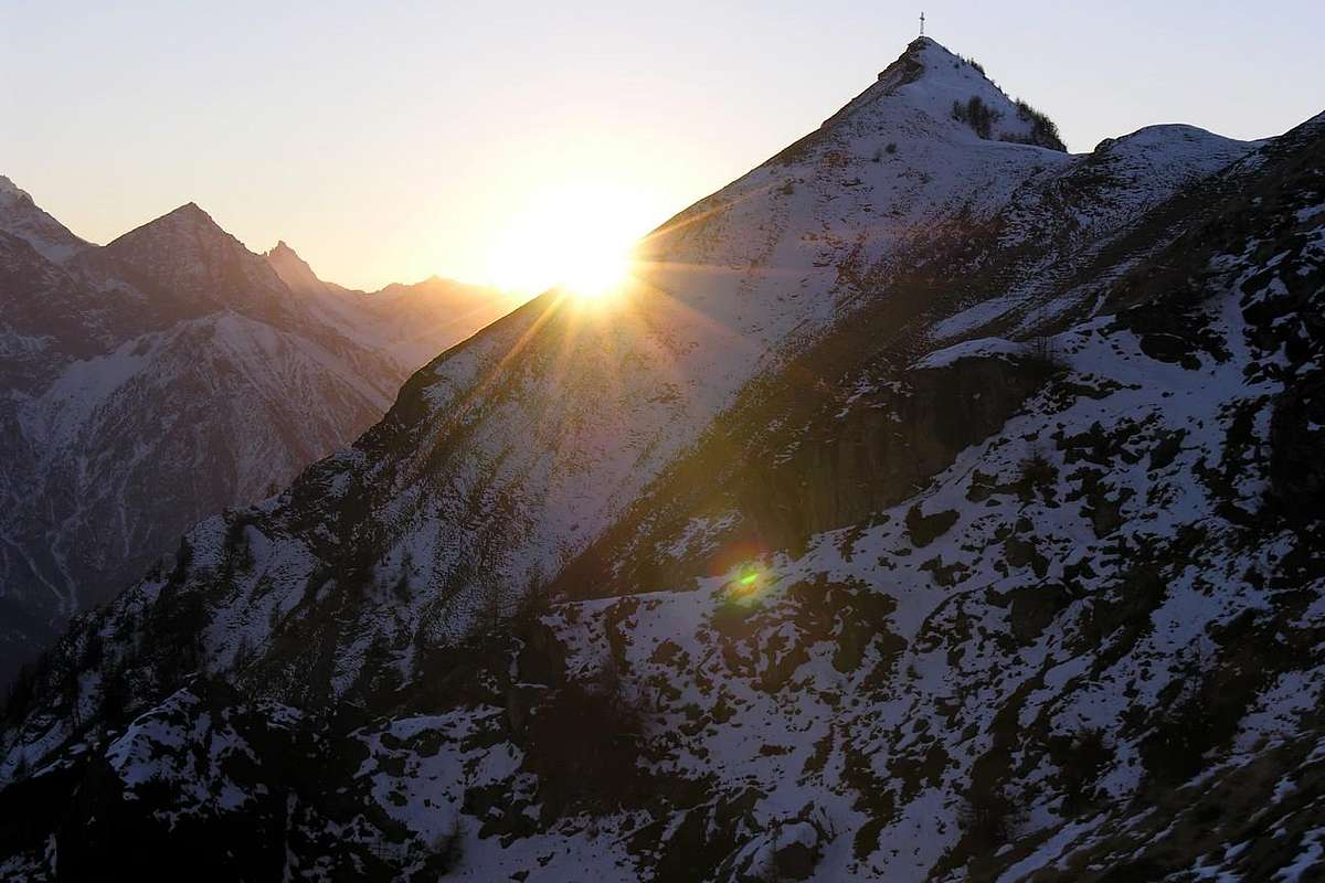
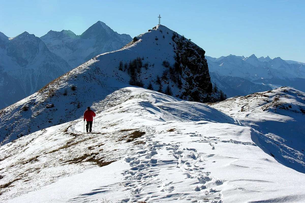
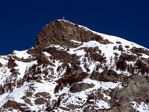
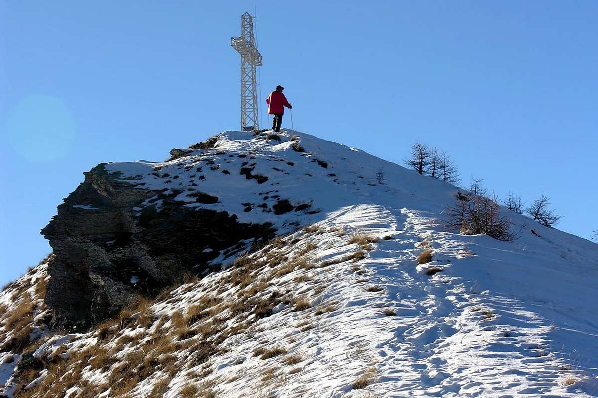
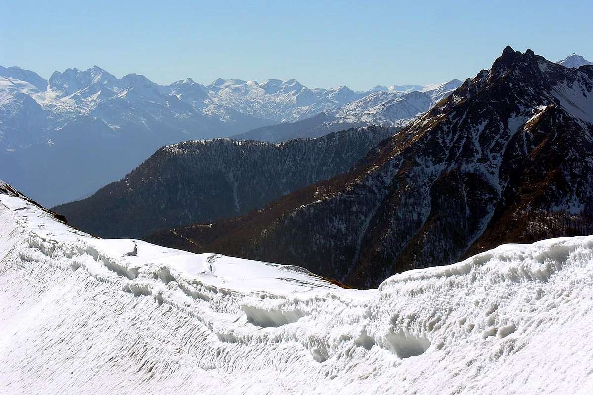
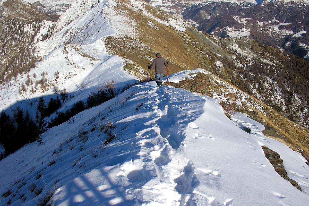
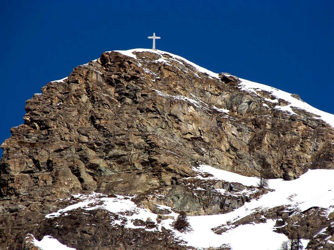
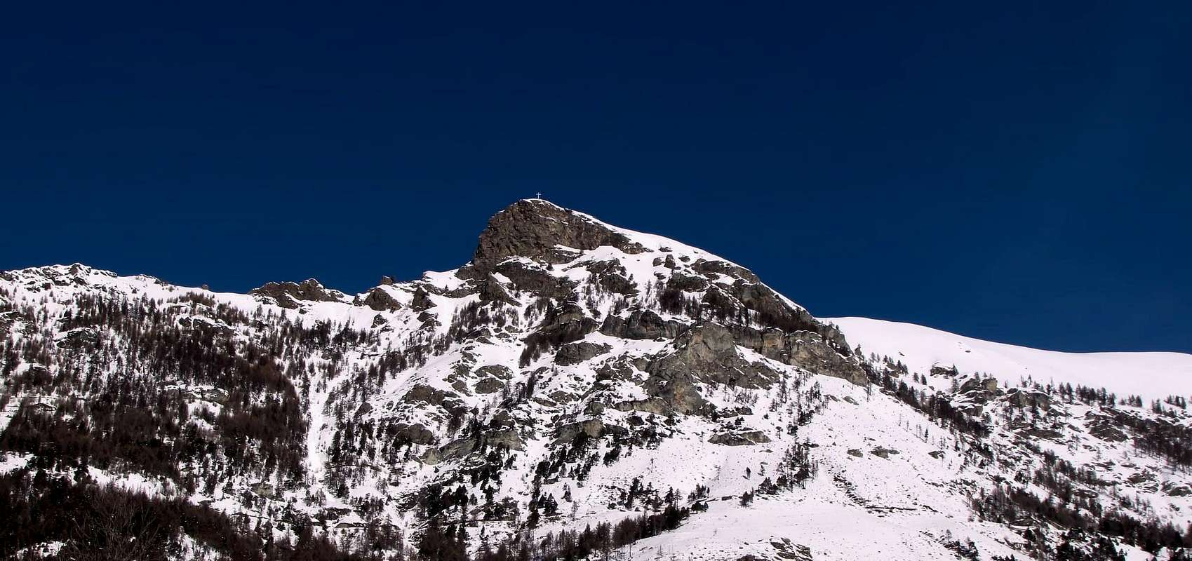
3) - From Grand-Villa, with asphalt road, to Clavon (1.644m)/Petit Lozon or Loson/Low Lozon (1.525m; parking; pond) and from these to Fontane, Champlong Damon, Bornes Alps, Bornes Hill (1.774m), with path n° 1. From the Bornes Alp with path n° 1 in Northeast to fork 2.050 meters (path n° 2 from Gr. Villa), Becca of Aver(2.469m) and traverse in Southwest on ridge with path n° 16A to Cima of Longhede (2.416m; ski-mountaineering and snowshoes).
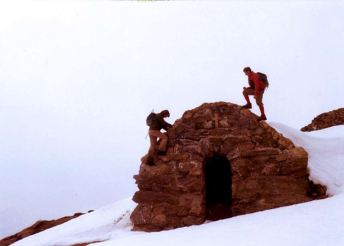
B) - From Chambave to Saint-Denis Communes with Regional Road and from this to Del (1.260m), Plau (1.305m), Semon (1.428m), Cheresoulaz (1.487m) Hamlets, Saint Pantaléon Hill (1.650m); from Semon through "Tour of Saint Evence" with dirt road-path n° 2 to Chapel (1.500m; beautiful by snow rackets, even in night) and in North-northwest to Sanctuary, just below the hill.
Ander Southern Comba & Southwestern Appendages:
1) - from alternative 1.900 meters around in Southwest with path n° 5 to Joux Alpage (1.803m), below Mount Ander (1.931m). Before the pasture in East, pathless, to narrow Filone Hill(1.894m). Also continue towards La Pesse Pasture (1.600m) and with path n° 3/3C to La Bourra Hill (1.748m); from this easily in crest to Mont de Pesse(1.708m).
2) - From the Bridge after Issologne (1.514m) in Southwest with path n° 3 to La Pesse and same routes.
3) - From Nus Commune through Regional Road to Petit-Fénis, Blavy Hamlets (1.056m); from this through dirt road or path n° 3 to Le Noueus (1.181m), Praille (1.242m) Pastures. Continue in North, crossing a first, reaching a second dirt road and with path n° 3 to
4) - La Pesse Alp or with path n° 3B to Mont La Pesse.
5) - Starting directly from valley floor (Nus-Le Bourg 540m) in North with path n° 3 towards Plane (718m), Petit Fénis, Blavy Hamlets and to Prailles Pasture and previous routes.
This hiking area stretches from Mont de la Pesse to the West until you reach the opposite promontory of St. Evence above the plateau called "des Sarrasins". Analyzing clockwise and starting with the first small wooded hilltop (located above the small villages Blavy (1.056m) at the entrance, starting from Nus Common, the adjacent Valley of St. Barthélemy and Lavenche and Hers small Hamlets (1.048m, 1.215m) in the mid-high hill above the same) to reach the opposite side (or above Semon, 1.359/99 meters around and last highest village of the Municipality of St. Denis) attended the hill of St. Pantaleon (1.650m), gateway to Torgnon and Valtournanche. This development semicircular, above the "Plan de Verrayes" that goes to the East to join with that of St. Denis, come in succession the Mont Ander, the two adjacent hills of Joux and Filone to reach the Top of Longhede with its high metal Cross (1.931m, 1.869m, 1.893m, 2.416m), all above the Villages Vencorère, Charrère-Dorinaz, Grand - Villa, Lozon, Roves and Cheresoulaz (1.553m, 1.344m, 1.407m, 1.524m, 1.510m, 1.506m), which belong to the Municipality of Verrayes (1.016/52m). This area, the highest and on average between 1.400/1.500 meters, towards the Pastures of Fontane, Ronc, Bornes and just the below Village Clavon, offers beautiful walks in the area of Champlong with the Lake Lozon at the "Area Pic Nic" through the path n° 1. From Grand - Villa and Vencorère instead depart to the West-northwest and Mount Ander easy and short excursions through the path of the base n° 6, concomitant to the various branches of the private farm road. Also from this area can be reached with the path of the base path of the base n° 1 Col des Bornes (1.781m; T/E/F; 1h'00/1h'15) or continue toward the North by the mountain pasture of the same name by the same to Becca Aver (2.469m), the highest elevation of this great diamond-shaped area, which belongs to Verrayes. An easy ridge disposed on the axis Northeast / Southwest and with a small trail n° 18 joins this summit at the Cima of Longhede; as is the hike of more "commitment" and rewarding the entire area and is also practicable departing from Grand - Villa with trail n° 2, which climbs directly North to Becca d'Aver (E/F; 2h '30 to 3h'00 for the two routes). In most Eastern sector of belonging of the Municipality of St. Denis, that triangle reaches its apex at Colle San Pantaleone, it is possible to connect to previous tours with the beautiful trail n° 4 that starting by this last towards the Northwest, reached by beautiful and moderate ascent, followed by a short descent in the forest above the Alp Vernaz, the Col des Bornes, from which farm road with concomitant to the previous path n° 1 you can go down with the left branch (West) in Plan with Prarion relative "Picnic area" and the tiny football field, or with the right to Goletta and Septumian and then in the Common of Torgnon (1.547m), now completely in Valtournanche. Finally in the watershed with the initial part of the latter and from Southeast over the "Plan des Sarrasins" as well as the Villages of Blavesse Champlong one hand and on the other, is feasible, even with snowshoes, the splendid "Tour de St. Evence" with circular path n° 2, which reaches the Chapel of the same name placed in a wonderful grassy esplanade between the forest or "Bois de Chérisoulaz" (1.650m), at a forest-rocky promontory. To do the same may from reaching the Chapel Hill (T/F; 0h'45/1h'00; different directions and panels at the Chapel of St. Pantaleon suffered the same below) and down to the Villages of Semon along the farm dirt road, or Plau (1.305m) always with the trail n° 2 and then up to the Col San Pantaleon or retracing your steps with departures from Del (1.260m), Plau or Semon (3h'00/3h'30).
"Tableland from Champlong with Lozon Pond under Cima Longhede/Becca d'Aver towards Semon, below St. Pantaleon Hill & St. Evence", by Osw 2015
Quest'area escursionistica s'estende dal Mont de la Pesse ad Ovest sin a raggiungere all'opposto il promontorio di St. Evence sopra l'altipiano "des Sarrasins". Analizzando in senso orario e partendo dalla prima piccola Sommità boschiva (sita al di sopra dei piccoli Villaggi di Blavy (1.056 m) allo ingresso, partendo dal Comune di Nus, della adiacente Valle di St. Barthélemy e Lavenche ed Hers (1.048 m, 1.215 m) nella medio-alta collina al di sopra del medesimo) per raggiungere sul lato opposto (ovvero sopra Semon, alla media quota di 1.359/99 metri circa, ultimo e più elevato Villaggio del Comune di St. Denis) il frequentato Colle di St. Pantaleon (1.650 m), porta di accesso verso Torgnon e la Valtournanche. In questo sviluppo semicircolare, soprastante il "Plan de Verrayes" che và ad unirsi verso Oriente con quello di St. Denis, si presentano in successione il Mont Ander, i due Colli adiacenti di Joux e del Filone fino a raggiungere la Cima di Longhede con la sua alta Croce metallica (1.931 m, 1.869 m, 1.893 m, 2.416 m), tutti al di sopra dei Villaggi di Vencorère, Charrère-Dorinaz, Grand - Villa, Lozon, Roves e Cheresoulaz (1.553 m, 1.344 m, 1.407 m, 1.524 m, 1.510 m, 1.506 m), che appartengono al Comune di Verrayes (1.016/52 m). Questa area, la più elevata ed in media tra i 1.400/1.500 metri, verso gli Alpeggi di Fontane, Ronc, Bornes ed lo appena sottostante Villaggio di Clavon, offre belle passeggiate nella zona di Champlong con il Laghetto di Lozon presso l'"Area Pic Nic" per mezzo del sentiero n° 1. Da Grand - Villa e Vencorère partono invece verso Ovest-nordovest ed il Monte Ander facili e corte escursioni tramite il sentiero di base n° 6, concomitante alle varie ramificazioni della strada poderale. Sempre da questa area si può raggiungere con il sentiero di base il sentiero di base n° 1 il Col des Bornes (1.781 m; T/E/F; 1h'00/1h'15) oppure dallo alpeggio omonimo proseguire verso Settentrione tramite il medesimo verso la Becca di Aver (2.469 m), massima elevazione di questa grande area a forma di rombo, che appartiene a Verrayes. Una facile cresta disposta sullo asse Nordest/sudovest e con un piccolo sentiero n° 18 unisce questa Sommità alla Cima di Longhede; risulta come l'escursione di maggior "impegno" e gratificante dell'intera zona ed é effettuabile anche con partenza da Grand - Villa con il sentiero n° 2 che sale direttamente a Nord verso la Becca di Aver (E/F; da 2h'30 a 3h'00 per i due itinerari). Nel settore più Orientale d'appartenenza del Comune di St. Denis, che a forma di triangolo raggiunge il suo vertice al Colle San Pantaleone, é possibile collegarsi ai precedenti itinerari con la bella mulattiera n° 4 che, partendo da quest'ultimo verso Nordovest, raggiunge con bella e moderata salita, seguita da una corta discesa nella foresta sopra l'Alpe Vernaz, il Col des Bornes, dal quale con strada poderale concomitante al precedente sentiero n° 1 si può scendere con il ramo di sinistra (Ovest) a Plan Prarion (1.778 m) con relativa "area Pic Nic" e campetto di calcio, oppure con quello di destra a Golette e poi a Golette e Septumian nel Comune di Torgnon (1.547 m), ormai completamente in Valtournanche. Infine nello spartiacque con la parte iniziale di quest'ultima e verso Sudest sopra il "Plan des Sarrasins" nonché i Villaggi di Blavesse da una parte e Champlong dall'altra, é attuabile, anche con racchette da neve, lo splendido "Tour de St. Evance" con il sentiero circolare n° 2 che raggiunge l'omonima Cappella posta in una meravigliosa spianata erbosa tra la foresta o "Bois de Cherisoulaz"(1.650 m), presso un promontorio boschivo-roccioso. Per effettuare il medesimo si può partire dal colle raggiungendo la Cappella (T/F; 0h'45/1h'00; diverse indicazioni e pannelli presso la Cappella di San Pantaleone subito sotto lo stesso) per poi scendere verso i Villaggi di semon lungo la strada poderale, oppure di Plau (1.305 m) sempre con il sentiero n° 2 per poi risalire al Col San Pantaleon od effettuare il percorso inverso con partenze dai Villaggetti di Del (1.260 m), Plau o Semon (3h'00/3h'30).
Cima di Longhede/Becca d'Aver...
Campings
Remember that free camping is forbidden (except for emergency reasons, over 2.500m, from darkness until dawn).
Mountain Conditions
You can get meteo information at the official site of the Regione Valle d'Aosta:
Parents refers to a larger category under which an object falls. For example, theAconcagua mountain page has the 'Aconcagua Group' and the 'Seven Summits' asparents and is a parent itself to many routes, photos, and Trip Reports.


 2894 Hits
 79.04% Score
 10 Votes