


-
 3336 Hits
-
 79.78% Score
-
 11 Votes
|
|
Area/Range |
|---|---|
|
|
45.78320°N / 7.22354°E |
|
|
Hiking, Mountaineering |
|
|
Spring, Summer, Fall, Winter |
|
|
10043 ft / 3061 m |
|
|
Note
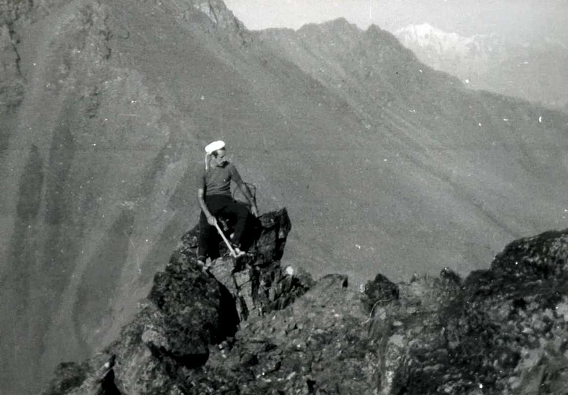
La montagna chiama i suoi figli, ed essi rispondono fedelmente al suo appello… Osvaldo Cardellina, Diario alpinistico, 1964-65 Page texts: @ OsvaldoCardellina "Osva", passed away on May 2, 2022. Page owners: Christian Cardellina e Osvaldo Cardellina. Any updates from September 12, 2022: Antonio Giani, page administrator, friend and climbing companion. Testi della pagina: @ OsvaldoCardellina "Osva", scomparso il 2 maggio 2022. Proprietari pagina: Christian Cardellina e Osvaldo Cardellina. Eventuali aggiornamenti dal 12 settembre 2022: Antonio Giani, amministratore della pagina, amico e compagno di salite. |
Alp Overview Ars
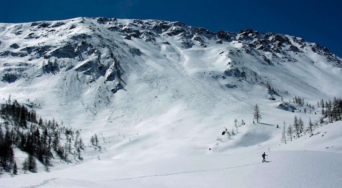
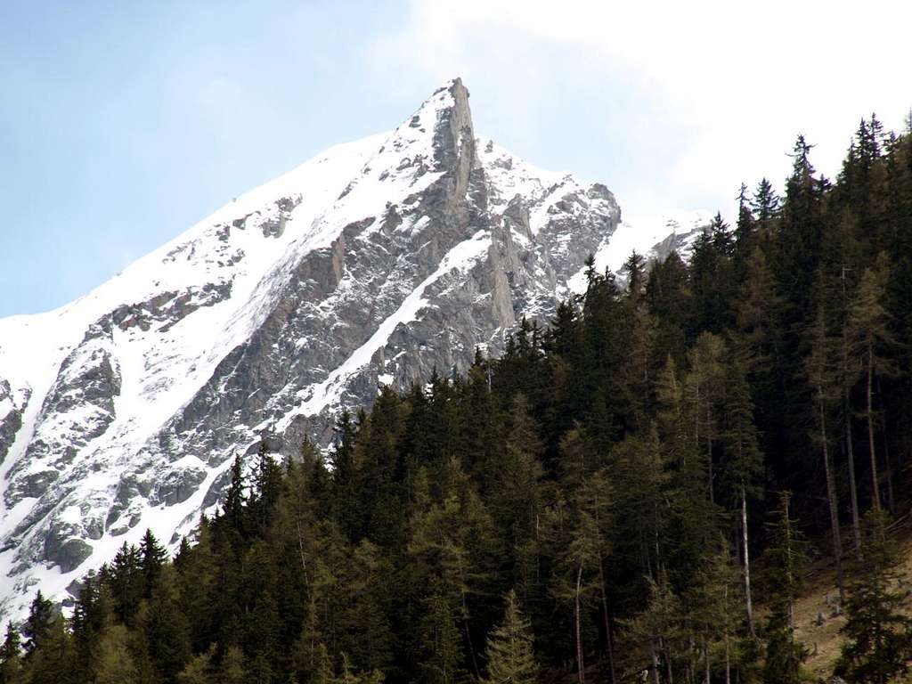
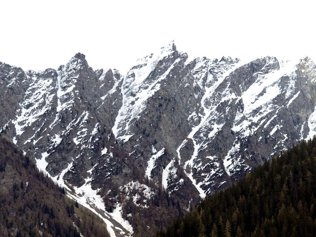
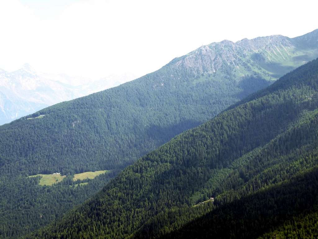
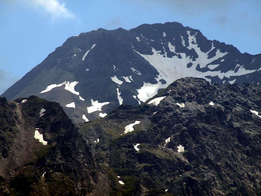
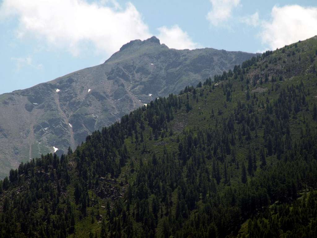
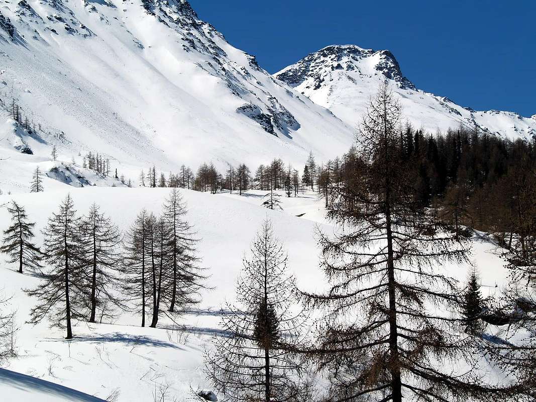
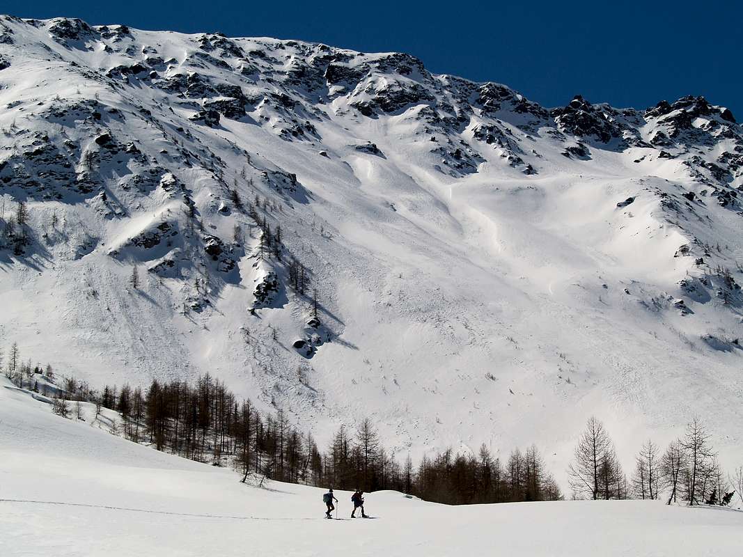
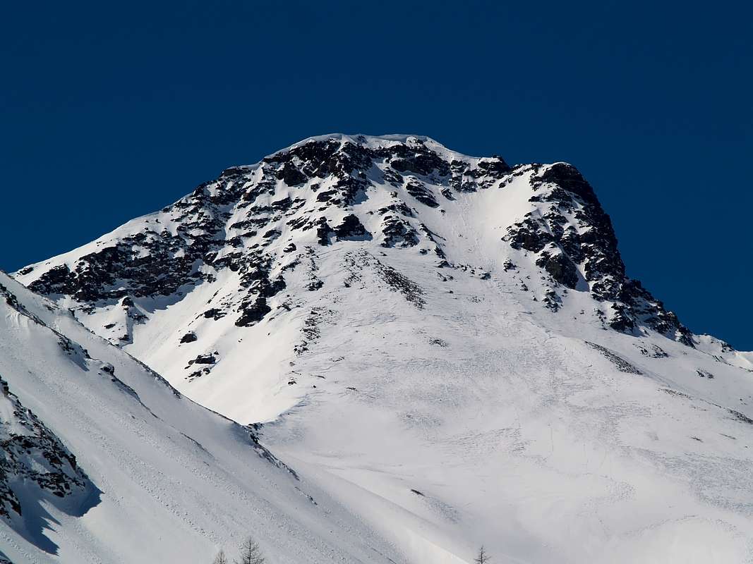
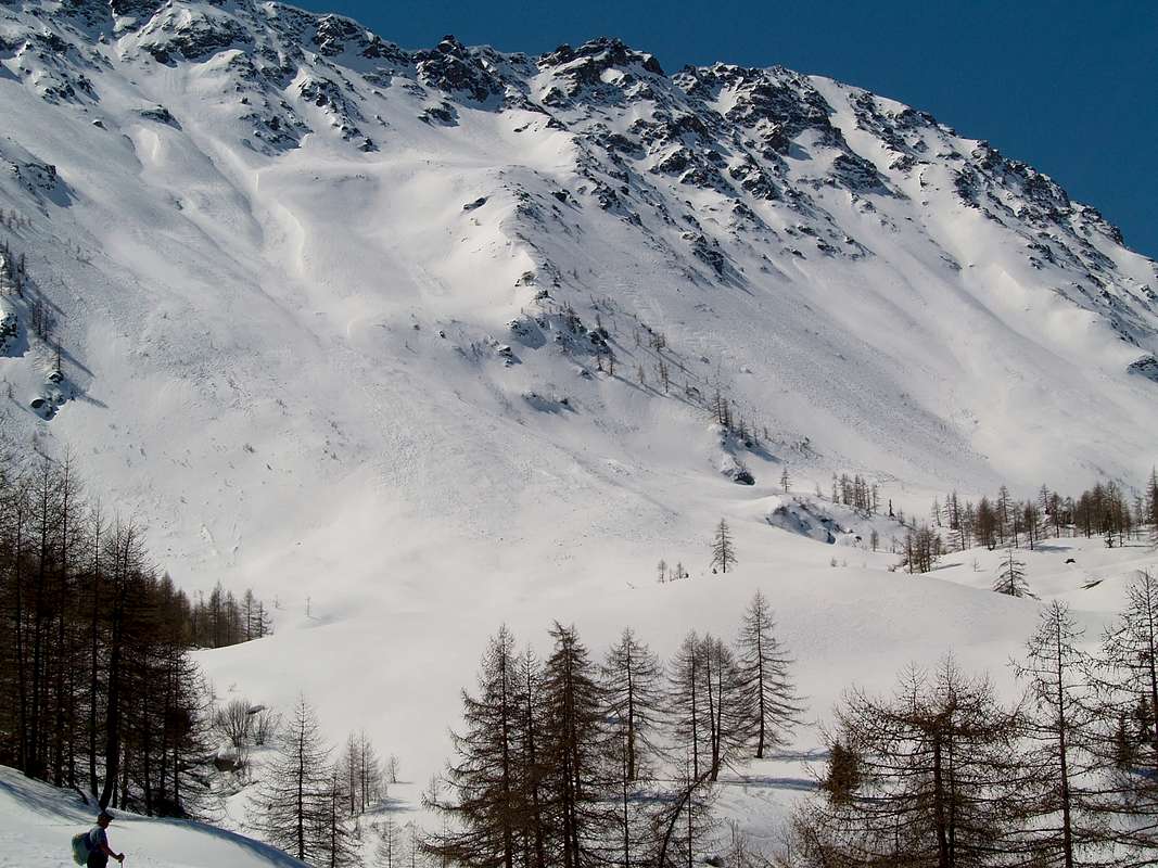
This valley marks Southwest border of vallon collocated among Gignod, Etroubles, St-Oyen, now in Gr. St. Bernard. After having, starting from the homonym shelter, climbed the La Tsa (2.742m), descend to Passo Tardiva and the Crest or Coast Tardiva (2.410m, 2.418m) from which quickly reach in East the new Refuge Chaligne (1.936m), in the uppermost part of Torrent Val Buthier in Gignod Common or in opposite towards West Arsy adjacent vallon, just below Mont Fallère (3.061m), highest Summit of the whole area. An other approach, but certainly a lot less frequented, is that with the departure by Echevennoz, Fraction of Etroubles, then up almost along all the adjacent Valley of Ars or Arsy, at the foot of the wide Northern Slope always of Fallère. Or, and again, directly from Etroubles through a farm road toward Southeast that, passing several pastures, reaches Torrent d'Ars on the bottom of the valley at the Alpe E'teley (1.716m), for then follow the course of the same to Alpe Ars (1.975m), and the next Tsa of Ars (2.260m), little beyond which ends near an old abandoned pasture 2.369 meters with a pond immediately to the East below the Col d'Ars (2.534m), towards Flassin Comba. Last case, you can make some connections between the Vallon Arsy or valley still own of Artanavaz Torrent and adjacent Val Buthier above Gignod Common.
Starting from Condemine at the Eastern entrance on the same, and continuing to the Southeast progressively reach the small Hamlets of Grand Petit Buthier.
This side entrance is not specific to the valley itself, being located in Val Buthier above the Municipality of Gignod, but practical and certainly more used than the one directed by Echevennoz Hamlet or from the West starting from the Municipality of Etroubles. It also allows, compared to the other two, to gain more in altitude through the asphalted road from Condemine on S.S. the Great St. Bernard until the ban (1.523m) at the Alp Mendey (1.547/62m) just above Petit Buthier. From this point take start the two farm dirt roads leading1) - to the West (concomitant with the path n° 3C) to the Alps Meriau Dèsott (1.632m) and Praz-Gallet (1.626m) to the junction of E'teley (1.689m) at the Torrent d 'Ars, now already in Arsy Vallon. Or
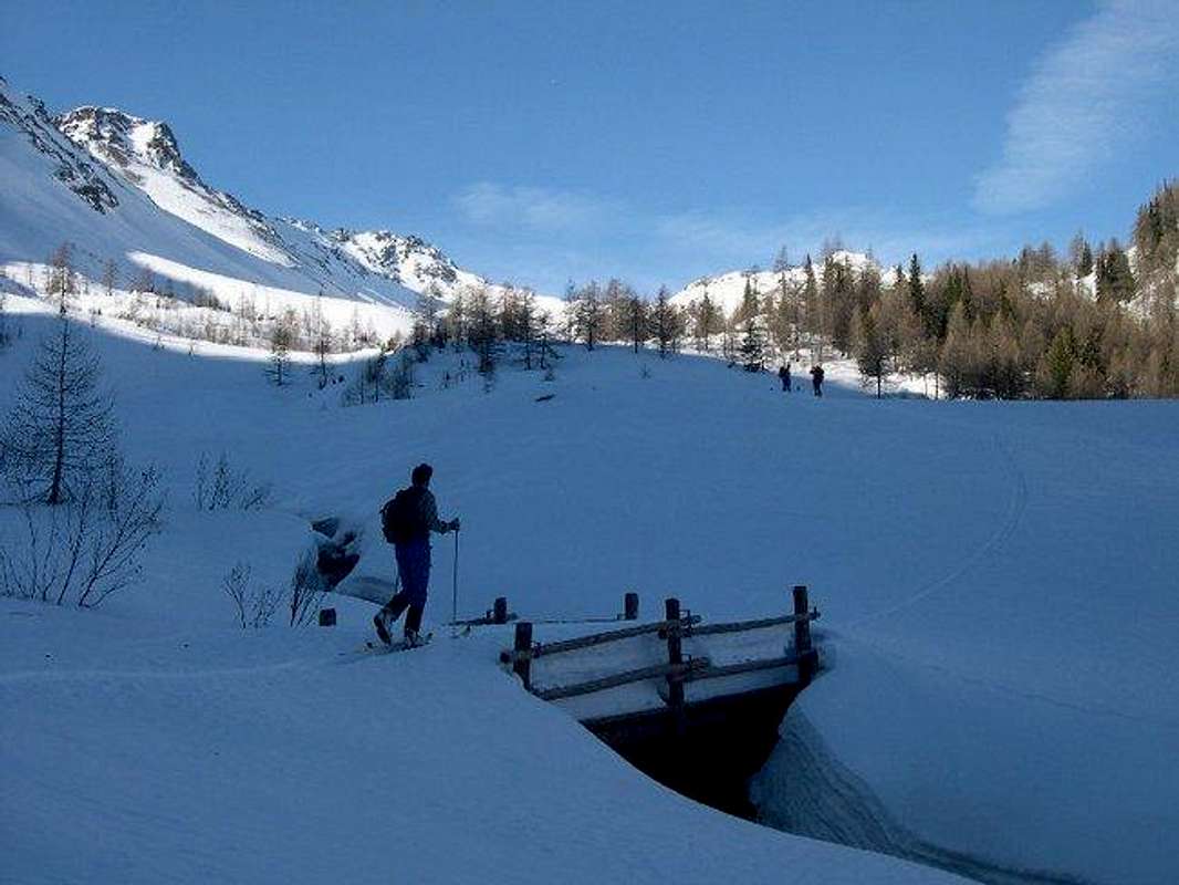
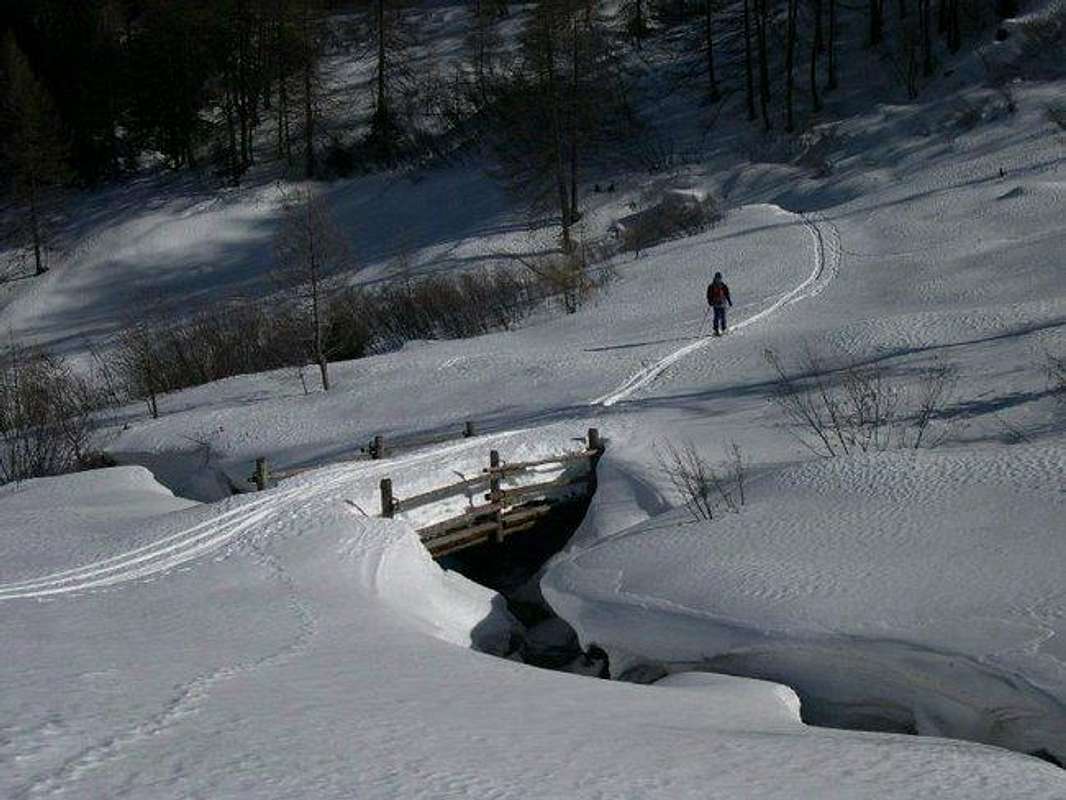
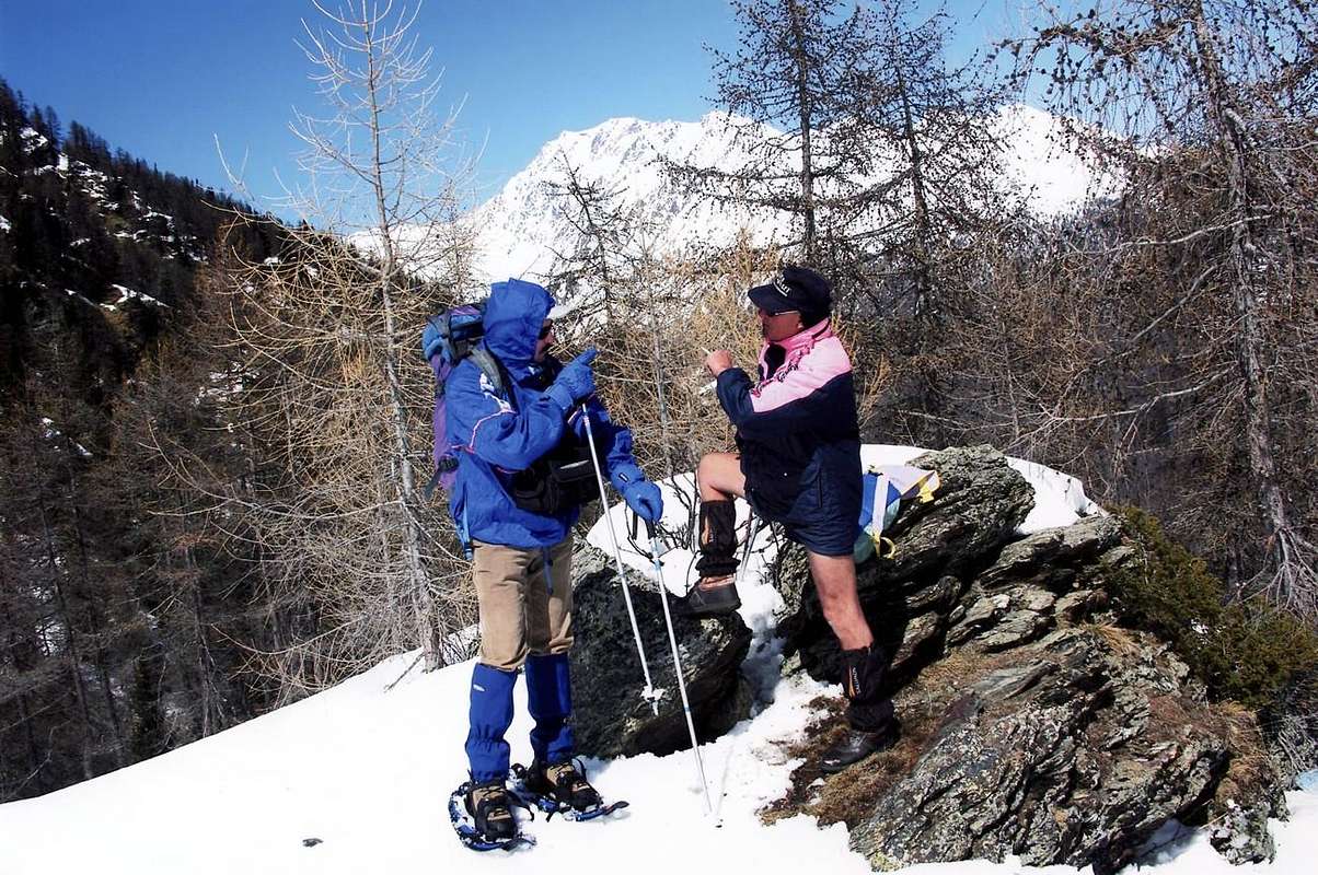
2) - to the South (concomitant with path n° 3) to Roncaille Alps, Rombason, Collet Chaligne until the above eponymous refuge (1.936m). Input variation: from the junction 1.854 meters before Alp and Refuge Chaligne, you can continue to the North-northwest with a branch of the private dirt road (concurrent at n° 3B/MTB) which leads to Alpe Collet (1.914m) to the Northern margin of the Costa Tardiva. Rounding it to the West along Ru (Brook) Collet you reach Alpe Ars (1.974m). From here beautiful Excursions to different locations, but the factor that differentiates these trips more results from the fact that while the one (Tardiva Pass and Coast) and the other (Mount de La Tsa) are directed almost exclusively to the Hiking, the middle to shelter is almost a requirement for the Ski-Mountaineering. Including all highlights the practice by Snowshoeing, always good aid for the presence of deep snow (renowned and well marked the popular path in the "Bois de Lance or Lanche" or Lance's Wood). Can do is arm yourself with good will always paying attention to the danger of snowslides and avalanches, which have already caused some fatal accidents. As a counterpart a splendid Nature still lush and well-preserved and beautiful views to the"Coumba Freida" (Valley or Basin Cold) until the Great St. Bernard Valley "flying" above nearby Valpelline. A series of valleys marked by the name Buthier like Buthier de Bosse better known as Rio Artanavaz or Buthier of Ollomont and that of the same Valpelline. They gather at the small Villages of Rhins and Moulin that downs to the unique Buthier that flows into the Dora Baltea near the City of Aosta. But the only valley that brings in a specific way this place name is only the small and "hidden" Val Buthier, which descends in silence towards the Northeast between the Pointe Chaligne and the valley floor ...
Il vallone segna il confine Sudoccidentale del vallone sito tra i Comuni di Gignod Etroubles e quello di Saint Oyen, ormai nell'attigua Valle del Gran San Bernardo.
Dopo aver scavalcato La Tsa (2.742 m), si scende al Colle ed alla Cresta Tardiva (2.410 m, 2.418 m) dalla quale in breve tempo si raggiunge verso Oriente il Rifugio Chaligne (1.936 m), collocato nella parte più elevata del Torrent Val Buthier nel Comune di Gignod ed ad Ovest il Vallone d'Arsy. Un altro approccio, ma sicuramente molto meno frequentato, risulta quello con partenza dai due Echevennoz Dessous e Dessus, Frazione di Etroubles, risalendo poi quasi tutto il Vallone d'Arsy, posto ai piedi del largo Versante Settentrionale del Fallère. Oppure ed ancora direttamente con partenza da Etroubles tramite una strada poderale verso Sudest che, oltrepassando diversi alpeggi, raggiunge il Torrent d'Ars sul fondovallone presso l'Alpe E'teley (1.716 m), per poi seguire il corso del medesimo fino all'Alpe Ars (1.975 m) ed alla successiva Tsa d'Ars (2.260 m) poco oltre la quale termina nelle vicinanze di un'antica alpe 2.369 metri abbandonata con laghetto subito sotto al Col d'Ars (2.534 m), posizionato sullo spartiacque con la Combe de Flassin. Da ultimo si posson effettuare alcuni collegamenti tra l'Arsy o Vallone ancor proprio del Torrent Artanavaz e l'attigua Val Buthier ormai sul Comune di Gignod.Iniziando da Condemine all'ingresso Orientale del medesimo, e continuando a Sudest progressivamente si raggiungono i Villaggetti di Grand e Petit Buthier. Questa entrata laterale non é specifica del vallone stesso, essendo collocata in Val Buthier sopra il Comune di Gignod, ma risulta pratica e sicuramente più utilizzata rispetto a quella diretta da Echevennoz o da quella Occidentale partendo dal Comune di Etroubles. Inoltre permette, rispetto alle altre due, di guadagnare in altitudine tramite la strada in asfalto da Condemine sulla S.S. del Gran San Bernardo fino al divieto (1.523 m) presso l'Alpe Mendey (1.547/62 m) subito appresso Petit Buthier. Da questo punto prendono avvio le due strade poderali conducenti
1) - verso Ovest (concomitante al sentiero n° 3C) alle Alpi Meriau Dèsott (1.632 m) e Praz-Gallet (1.626 m) fino al bivio di E'teley presso il Torrent d'Ars, ormai nel Vallone d'Arsy. Oppure
2) - a Sud (concomitante al n° 3) alle Alpi Roncaille, Rombason, Collet e Chaligne con soprastante omonimo rifugio (1.936 m). Variante di ingresso: dal bivio 1.854 metri, prima di Alpe e Rifugio Chaligne, si può continuare verso Nord-nordovest con ramificazione della poderale (concomitante al n° 3B/MTB) raggiungente l'Alpe Collet (1.914 m) al margine Settentrionale di Costa Tardiva. Doppiando quest'ultima ad Ovest lungo il Ru Collet si raggiunge l'Alpe d'Ars (1.974 m). Partendo da queste località é possibile effettuare diverse belle Escursioni, ma il fattore che diversifica maggiormente queste gite risulta dal fatto che, mentre l'una al Colle ed all'appena soprastante Costa Tardiva (2.410/18 m) e l'altra al Mont de la Tsa (2.742 m) sono rivolte quasi esclusivamente all'Escursionismo, quella intermedia al rifugio é quasi d'obbligo per lo Sci-Alpinismo. Tra tutte s'evidenzia la pratica delle Racchette da neve, sempre di ottimo ausilio in presenza di neve alta. Non rimane che armarsi di buona volontà facendo sempre attenzione al pericolo di slavine e valanghe, che qui han già provocato alcuni incidenti mortali. Come controparte una veramente splendida Natura ancora rigogliosa e completamente ben conservata, nonché splendide vedute dalla sottostante "Coumba Freida" fino al Gran San Bernardo "volando" al di sopra della viciniora Valpelline. Tutta una serie di vallate contrassegnate dal nome Buthier, come il Buthier de Bosse meglio conosciuto come Rio Artanavaz, oppure il Buthier di Ollomont e quello della stessa Valpelline. Si riuniscono presso le località di Rhins e Moulin originando lo unico Buthier che confluisce nella Dora Baltea presso la Città di Aosta. Ma l'unica valle che riporta in modo specifico questo toponimo risulta esclusivamente la piccola e "nascosta" Val Buthier, che scende in silenzio verso Nordest tra la Pointe Chaligne ed il fondovalle ...
 |
 |
 |
 |
Getting There
BY CAR:
- From TORINO, MILANO, etc: Motorway A5. Exit at IVREA or Quincinetto (PIEDMONT) From IVREA: in West towards Pont St. Martin, Donnas, Bard, St. Vincent, Chatillon, Nus, Quart, St. Christophe, Aosta (in West) and Roisan, Gignod (North) Municipalities. From Courmayeur Resort: in East to Pré St. Didier, Morgex, La Salle, Saint Pierre, Villeneuve, Sarre, Aosta and in North towards Gignod Municipalities.
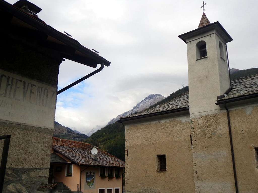
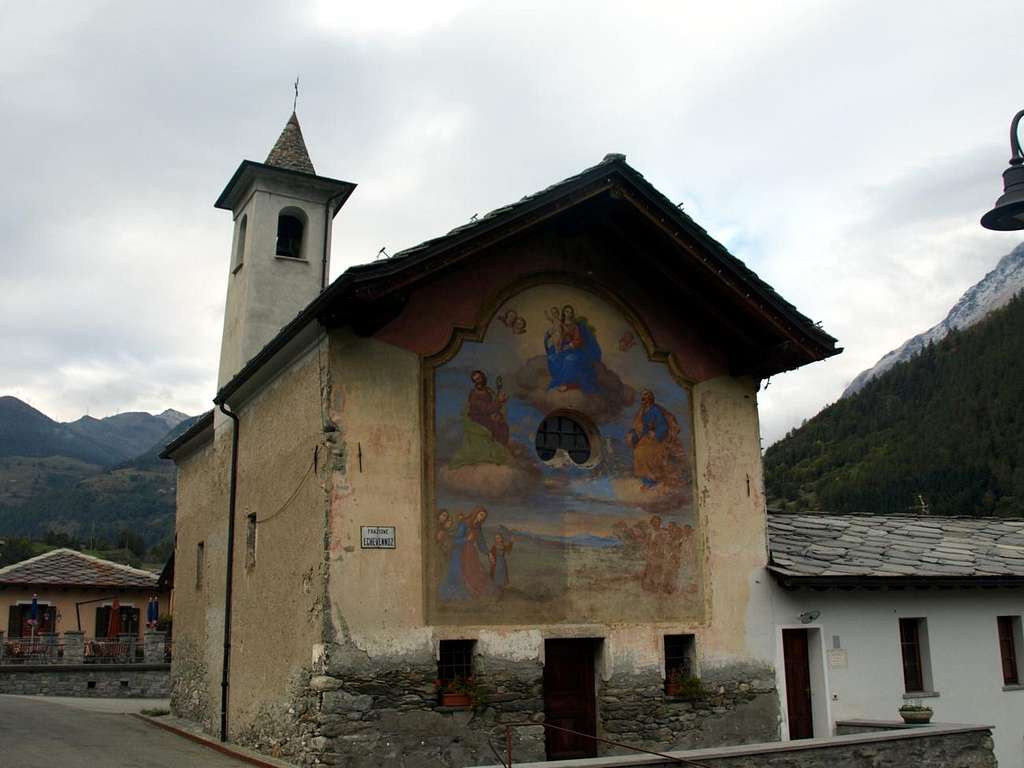
- From Aosta City towards Etroubles Municipality in Great St. Bernard Valley From Aosta North Town or by St. Christophe with Main Route towards Gignod Commune (988m) or Roisan (843m) with Great St. Bernard SR.27 to alternative nearby Condemine Hamlet (1.137m). Leaving left through Municipal Road to Grand Petit Buthier Villages (1.302m, 1.439m) in Chaligne Comba instead continue until Echevennoz Dessous Dessus Villages (1.233m, 1.264m) and Etroubles Commune (1264m). From this last, with private dirt farms roads in South and through Champ Rèclos, Yettes, Praz-Perrier, Eteley, Ars Pastures up to the Tsa d'Ars (2.263m), below Costa Mayan (2.836m), Mont Fallère (3.061m), Ars Pass (2.534m) neighboring of Forest Rangers Bivouac (2.632m) at Mont Labiez.From FRANCE: through the Mont Blanc Tunnel to Entrèves-crossroads to Vény/Ferret Valleys - Mountain Guides of Courmayeur - La Saxe Rock Gym - Courmayeur. By Little Saint Bernard Pass, closed since November until half May to La Thuile Valley - Pré Saint Didier - Courmayeur. It is not necessary to take Motorway A5: you can drive on SR.26, in the direction of AOSTA - IVREA - TURIN.
BY PLANE:
- Aeroporto "Corrado Gex" Saint Christophe (Aosta).
 |
 |
 |
 |
On foot or by Ski Some Hikes even with Snowshoing
Topographically can be divided into 3 areas that offer trips with different features, addressed to Hiking, Mountaineering, Snowshoeing and Ski-Mountaineering.
- Eastern Margin
- Southern Margin
- Northwestern Margin
 |
 |
Topograficamente può esser diviso in 3 settori offrenti gite con peculiarietà diverse, rivolte ad Escursionismo, Alpinismo, Racchette da neve e Sci-Alpinismo.
- Margine Orientale
- Margine Meridionale
- Margine Nordoccidentale
 |
 |
 |
 |
 |
Books and Maps
BOOKS:
- "Guida dei Monti d'Italia-Alpi Pennine" (Vol. I°) di Gino Buscaini-Club Alpino Italiano/Turing Club Italiano, Luglio 1971.
- "80 itinerari di Escursionismo Alpinismo e Sci Alpinismo in Valle d'Aosta", di Osvaldo Cardellina, Ed. Musumeci, Giugno 1977 (in Italian); seconda Ed. Luglio 1981; terza Ed. Luglio 1984; (in French), prima Ed. Febbraio 1978; seconda Ed. Marzo 1980.
 |
 |
MAPS:
- Kompass "Monte Bianco Valle d'Aosta Sentieri e Rifugi" Carta turistica 1:50.000.
- Kompass "Gran Paradiso Valle d'Aosta Sentieri e Rifugi" Carta Turistica 1:50.000.
- I.G.C. Istituto Geografico Centrale Torino "Massiccio del Monte Bianco" (n° 4), Torino, 1998 1:50.000.
- Studio F.M.B. "Monte Bianco-Mont Blanc", Bologna 1988 1:50.000.
- I.G.C. Istituto Geografico Centrale "Carta dei sentieri e dei rifugi" 1:25.000.
- I.G.M. Istituto Geografico Militare 1:25.000.
Important Information
- REGIONE AUTONOMA VALLE D'AOSTA the official site.
- FONDAZIONE MONTAGNA SICURA Villa Cameron, località Villard de la Palud n° 1 Courmayeur (AO) Tel: 39 0165 897602 - Fax: 39 0165 897647.
- A.I.NE.VA. (Associazione Interregionale Neve e Valanghe).
Useful numbers
- Protezione Civile Valdostana località Aeroporto n° 7/A Saint Christophe (Ao) Tel. 0165-238222.
- Bollettino Meteo (weather info) Tel. 0165-44113.
- Unità Operativa di Soccorso Sanitario Tel. 118.