La montagna chiama i suoi figli, ed essi rispondono fedelmente al suo appello…
Osvaldo Cardellina, Diario alpinistico, 1964-65
Page texts: @ OsvaldoCardellina"Osva", passed away on May 2, 2022. Page owners: Christian Cardellina e Osvaldo Cardellina. Any updates from September 12, 2022: Antonio Giani, page administrator, friend and climbing companion.
Testi della pagina: @ OsvaldoCardellina "Osva", scomparso il 2 maggio 2022. Proprietari pagina:Christian Cardellina e Osvaldo Cardellina. Eventuali aggiornamenti dal 12 settembre 2022: Antonio Giani, amministratore della pagina, amico e compagno di salite.
Overview
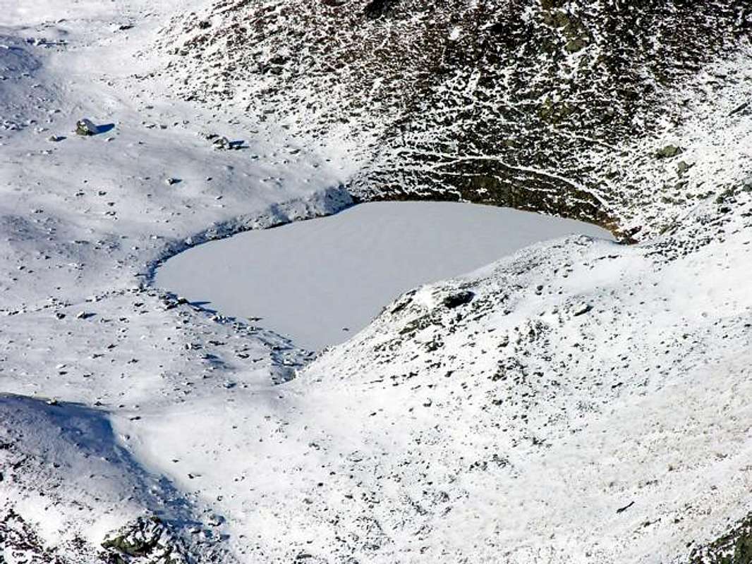
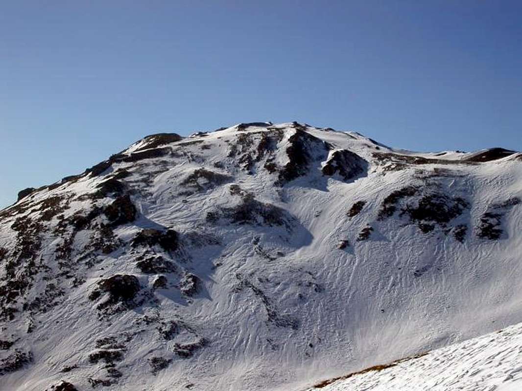
Punta Leissé or Pointe Leysser? Actually they have the same identical meaning, namely Summit left or abandoned. Even if the first name is used in the large-Vétan Conca (Basin) to indicate the overlying Punta (2.771m), while the second is known just into the adjacent Vertosan Vallone, later the Saddle of Joux (1.930m) above and the Vens Village (1.750m). In the second case, that is the name of Leysser, is appropriate for a small secondary small valley from the top of which there is a small lake of that name (2.418m). On the slopes of Monte Rosso di Vertosan (2.940m) and at the North Slope of Punta Leissé. An old dispute own place names in an area that gave birth to Jean Baptiste Cerlogne, summit Poet in Val d'Aosta dialect or Franco-Provençal? It can be inside a rich alpine Region with a thousand steeples and 1000 different ideas, also a short drive ...
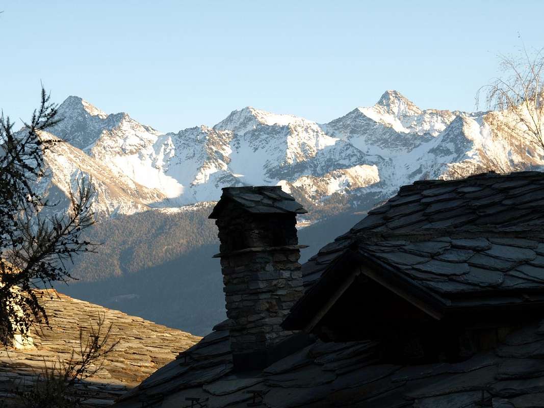
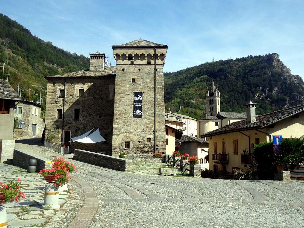
So this area, like a spacious balcony above the Avise Municipalities (762m, 16 km. West by Aosta), St. Nicolas (1.196m; center), St. Pierre (661m; to the East) , it can also be divided in terms of topographical views in two different areas, below the Pointe Aouillette or Pointe Leissé, the two small adjacent Summit that characterize it:
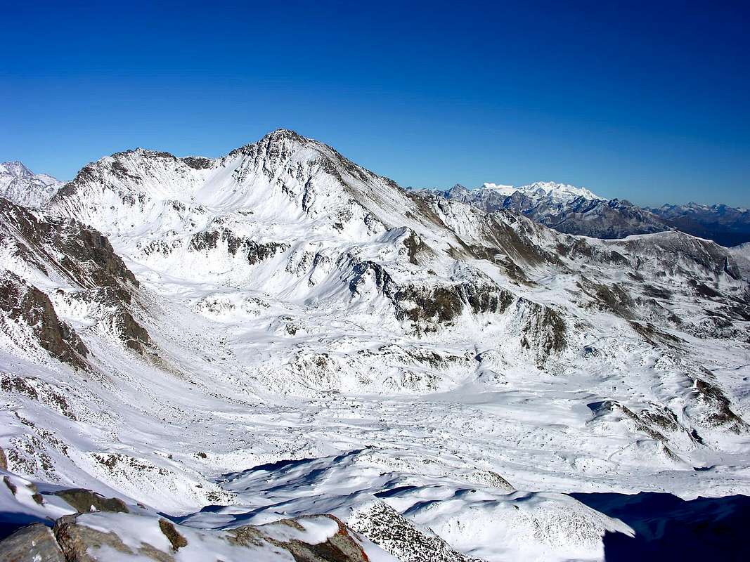
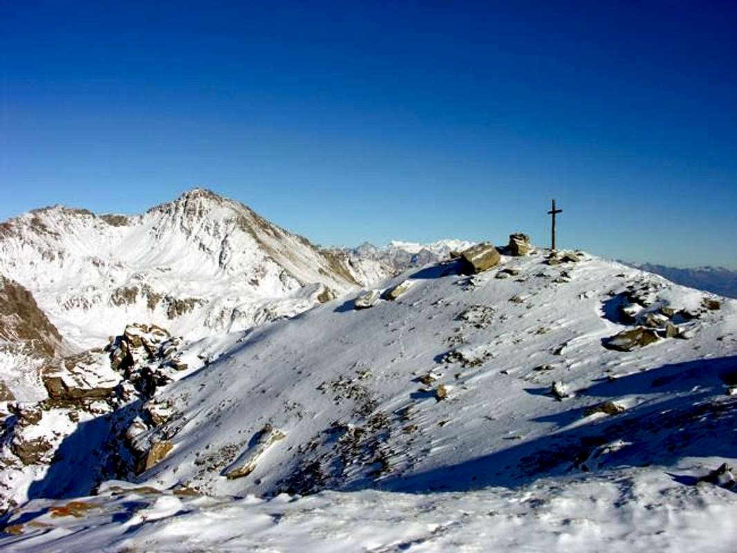
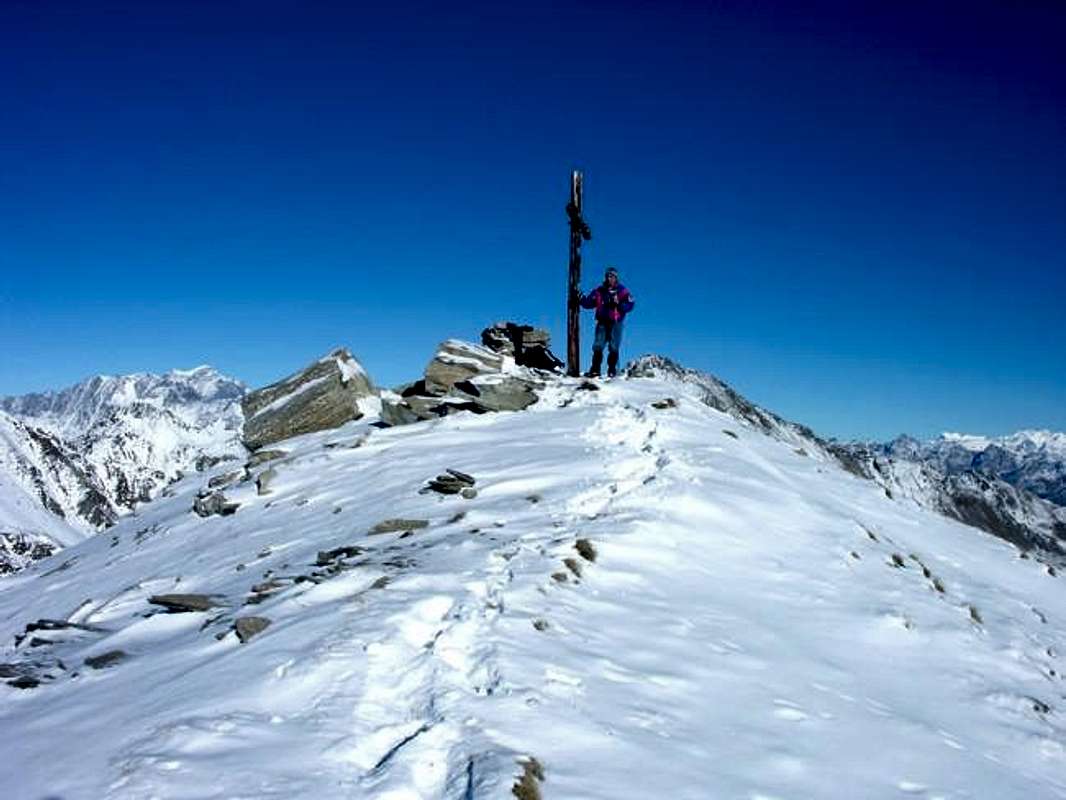
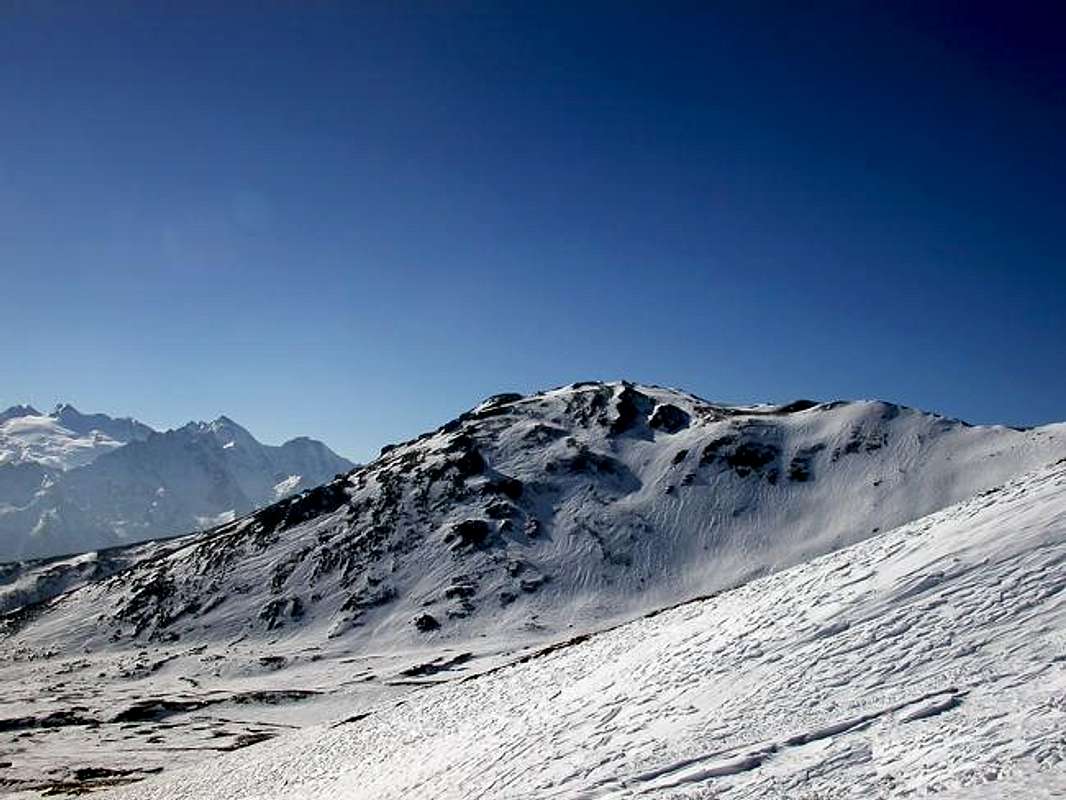
1) - the Eastern area that, starting from the long watershed between the Basin of Vétan and the adjacent Vallon of Verrogne at the foot of Mont Fallère (3.061m), reach, after the small saddle 2.206 meters, true door of more Western lateral entrance into the same, the Great Shoulder 2.617 meters and then Pointe Leissé (2.771m), highest elevation of all the neighborhood, here above the Commons of St. Pierre St. Nicolas, the first located in bottom into the Central Valley of Dora Baltea and the second in the middle-lower hill.
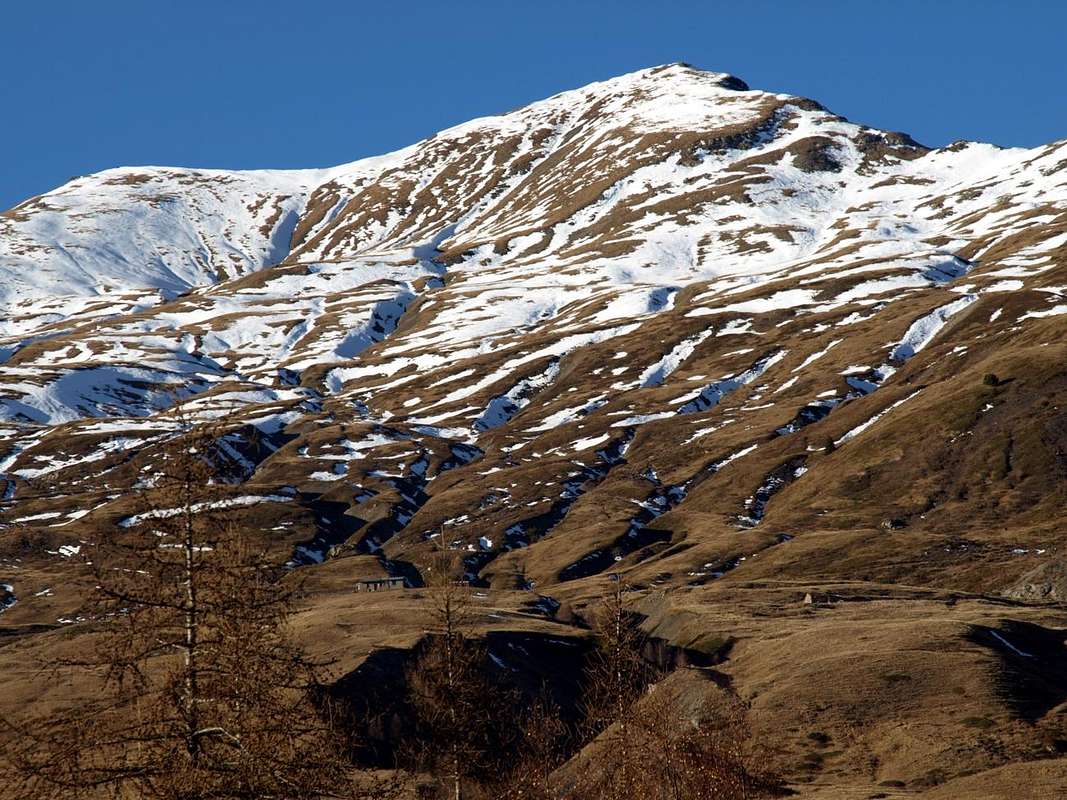
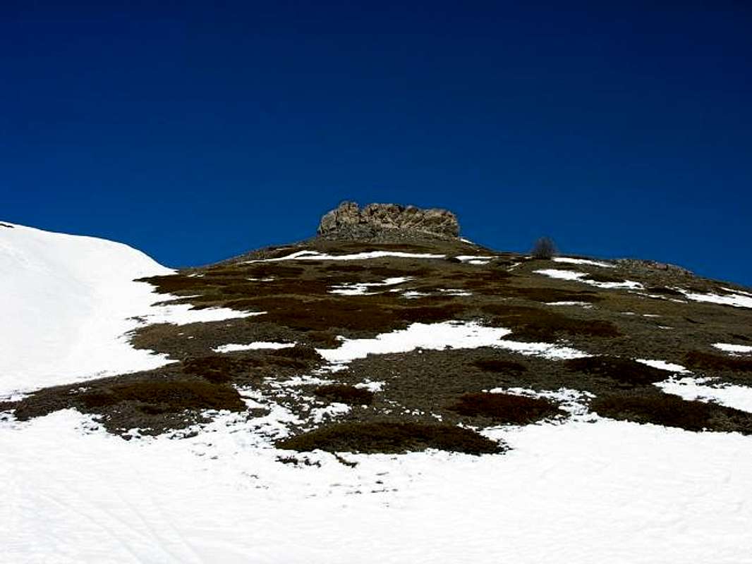
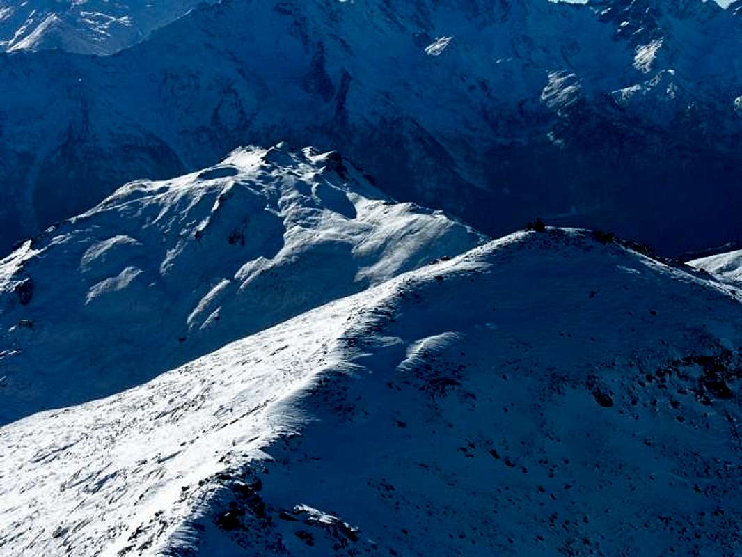
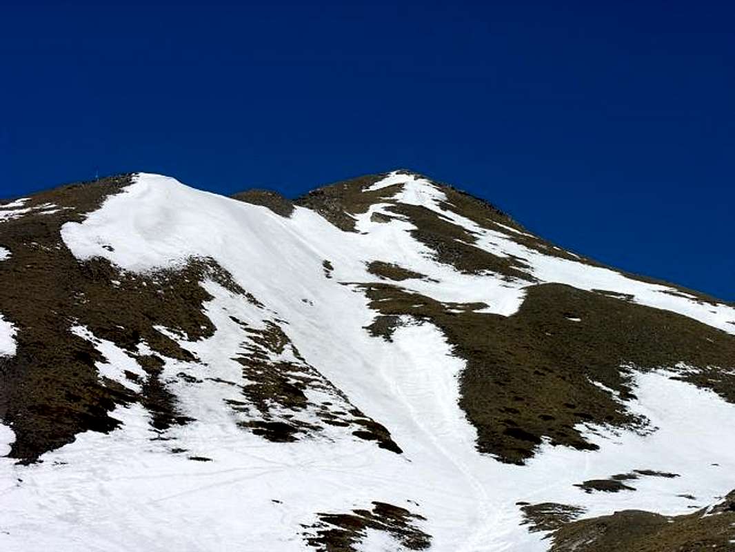
2) - the upper-middle area, that by Vétan Villages (Dessous Dessus, Villette and Granzetta) as well as by Alpages of Thoules and Grandes Arpilles, expands Westward above the St. Nicolas Municipality average hills and on the valley floor to Avise. This plateau, not very steep and below several grassy-detrital couloirs, dates back to the North through several villages and pastures reaching a small hollow where is located the Alpe isolated Chaz Creuse or Tsecreousa (2.398m) at the foot of the Pointe Aouillette or Oilletta (2.616m). From this last, that binds to the Pointe Leissé via an easy dividing crest with the small Vallon of Leysser, down the partition that reaches the Saddle and the small Mont de Joux (1.930m, 1.978m), before of the Vertosan Vallone and above the little Villages of Vens, Cerlogne Charbonnière and Cerellaz (1.750m, 1.580m, 1.263/87m, 1.254m).
Punta Leissé or Pointe Leysser? In realtà hanno lo stesso identico significato, ovvero Sommità lasciata od abbandonata. Anche se il primo nome viene utilizzato nella larga Conca di Vétan per indicare la soprastante Punta (2.771 m), mentre il secondo é proprio dello adiacente Vallone di Vertosan, oltre la Sella di Joux (1.930 m) e sopra il Villaggio di Vens. In questo secondo caso, cioé il toponimo di Leysser, viene appropriato ad un un piccolo vallone secondario al sommo del quale esiste un laghetto di tale denominazione (2.418 m). Proprio alle pendici del Monte Rosso di Vertosan (2.940 m) e del Versante Nord della Punta Leissé. Una vecchia disputa toponomastica proprio in una zona che ha dato i natali a Jean Baptiste Cerlogne, sommo Poeta in dialetto valdostano? Può essere in Regione ricca di mille Campanili e 1000 idee diverse, anche a breve distanza ...
Quindi quest'area, a guisa di gran balcone sopra i Comuni d'Avise (762 m; 16 Km. ad Ovest d'Aosta), St. Nicolas (1.196 m; centro) e St. Pierre (661 m; Est), può essere suddivisa anche dal punto di vista topografico in due differenti settori, sottostanti alle Punte Aouillette oppure Leissé, le due piccole Sommità che la caratterizzano:
1) - l'area Orientale che, partendo dallo spartiacque col Vallone di Verrogne ai piedi del Monte Fallère (3.061 m), raggiunge, dopo la selletta 2.206 metri porta d'ingresso al medesimo, lo Spallone 2.617 metri e quindi la Pointe Leissé (2.771 m), massima elevazione di tutto il bacino, qui soprastante i Comuni di St. Pierre e St. Nicolas nella Valle Baltea.
2) - la zona medio-alta che, dai Villaggi di Vétan (Dessous, Dessus, Villette e Granzetta) nonché dagli Alpeggi di Thoules e Grandes Arpilles, si espande verso Occidente al di sopra dei Comuni di St. Nicolas nella media collina e di Avise sul fondovalle. Questo altipiano, non molto ripido e sottostante a diversi canaloni erboso-detritici, risale verso Settentrione attraversando numerosi villaggi ed alpeggi raggiungendo una piccola conca dove é collocata l'Alpe isolata di Chaz Creuse o Tsecreousa (2.398 m) ai piedi della Pointe Aouillette oppure Oilletta (2.616 m). Da quest'ultima, che si lega alla Pointe Leissé tramite facile cresta divisoria col Valloncello di Leysser, scende il divisorio che raggiunge la Sella ed il Mont de Joux (1.930 m, 1.978 m), prima del Vallone di Vertosan e sopra ai Villaggetti di Vens, Cerlogne, Charbonnière e Cerellaz (1.750 m, 1.580 m, 1.263/87 m, 1.254 m).
Getting There
BY CAR:
From TORINO, MILANO, etc: Motorway A5. Exit at IVREA or Quincinetto (PIEDMONT).
From IVREA Town: in West (Southern side) to Pont Saint Martin, Donnas, Bard, Champdepraz,Aymavilles, to Villeneuve, Arvier, Avise Municipalities. From Courmayeur Resort: in East to Pré St. Didier, Morgex, La Salle, Saint Pierre Municipalities.
From Courmayeur or by Aosta Town towards Avise or St. Pierre From Saint Pierre-Pommier(783m), Champretavy, Rumiod, alternative just after Persod (1.351m), Ravoise, Chaillod, Clavel, Cerlogne (1.580m) to Vens small Villages (1.750m), with Regional Road in West-northwest. From this last to Joux Saddle (1.930m): through short descent to Vertosan Vallon From Saint Pierre-Chateau Sarrod de la Tour, Rumiod, Petit and Grand Sarriod (1.444/5m), Gerbore, Vetan Dessous (1.670m) and Dessus (1.737m), with Regional Road to Vetan Basin. From this, through dirt road, towards Genevrine Pasture, Chatalanez, Toules, Grand Arpilles Alps to Chaz Creuse Alp(2.398m).
From FRANCE: through the Mont Blanc Tunnel to Entrèves-crossroads to Vény/Ferret Valleys - Mountain Guides of Courmayeur - La Saxe Rock Gym - Courmayeur. By Little Saint Bernard Pass, closed since November until half May to La Thuile Valley - Pré Saint Didier - Courmayeur. It is not necessary to take Motorway A5: you can drive on SS.26, in the direction of AOSTA - IVREA - TURIN.
BY PLANE:
Aeroporto "Corrado Gex" Saint Christophe (Aosta).
Hiking & Ski-Mountaineering Little Routes
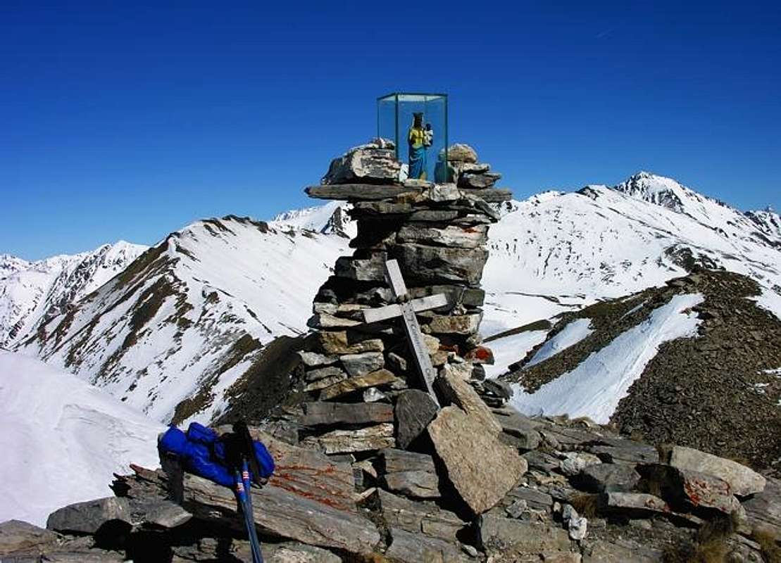
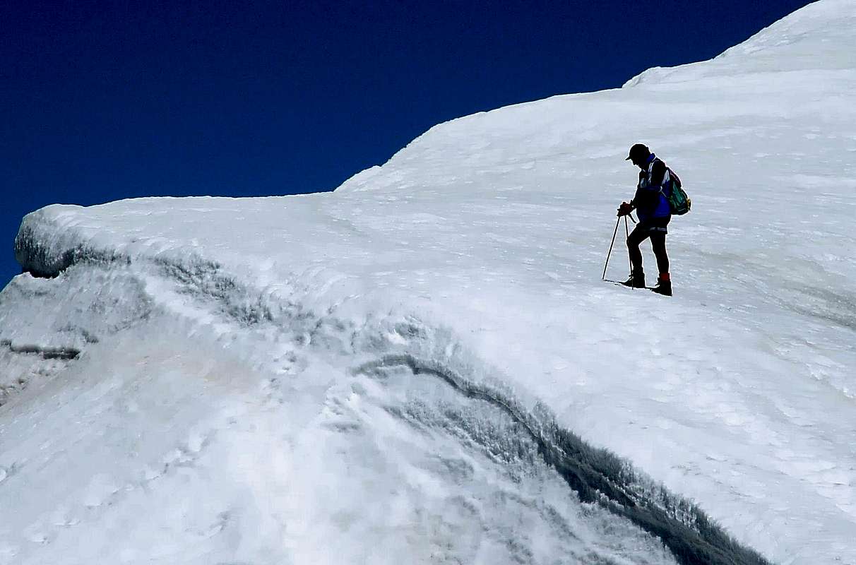
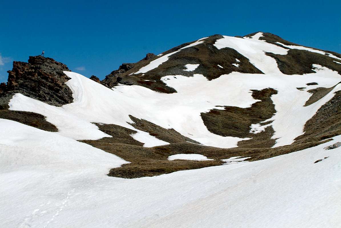
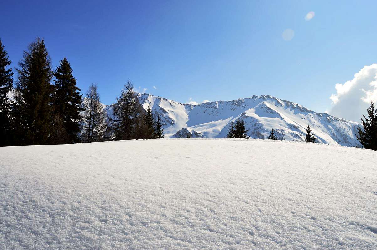
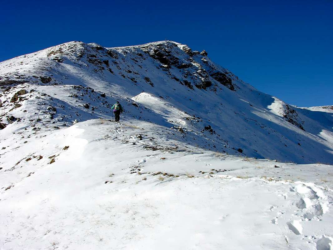
This wide Conca or Basin, once quite popular for Hiking and some easy Excursion, nowadays instead sees a large attendance to the Ski-Mountaineering classic. In fact, towards the overhanging Punta Leissé has for years organized a popular race, now even admitted in the circuit of the World Championships, this last discipline. Nevertheless, it remains always possible to make traditional excursions, as well as some beautiful promenade that connects the various mountain pastures, which date back from the valley floor the beautiful and evergreen hill offering stunning panoramic and splendid glances on all. In addition to this pleasant district may constitute a starting point for trips to the adjacent valleys of Vertosan (to the West with excursions towards Court de Bard, Punte Felita, Testa dei Frà, Testa di Serena, Corléans's Crest, Mont Flassin) and Verrogne (to the East and climbings towards Punta Paletta and Hill, Monte Rosso, Mont Vertosan and Col Fenêtre, Mont Fallère through the fairly easy Western or Southwest Ridges and Lago Morto, sited between the two, else Becca France) and, in the latter case, to the new Refuge Mont Fallère (2.385m), in Les Crottes locality and between Mount Fallère and Monte Rosso of Vertosan, as well, bypassing through the small saddle 2.417 meters, also for that of Closellaz where goes up through the path n° 14 along the Traditional Route on South Slope and towards the old Cabin Regina Margherita (2.983m), collapsed and of which remain only the most that miserable perimeter ruins. The path of all these beautiful trips is also completely suited to the Ski-Mountaineering, but also offer the same wonderful experiences through Snowshoeing; in both cases it is, however, required the utmost prudence in assessing the state of the snow. We must not forget that the whole area is facing the South side where the snow retires and turns in advance but at the same time records dangerously high temperatures. All that pleasingly is offered is generally offset by something really very dangerous. As the reverse of each coin ...
Questa larga Conca, una volta piuttosto frequentata per lo Escursionismo, oggigiorno vede invece una grande frequentazione verso lo Sci-Alpinismo classico.
Infatti verso la Punta Leissé é ormai da anni organizzata una rinomata gara, ammessa anche nel Circuito dei Campionati del Mondo, di questa ultima disciplina. Ciò non toglie che rimane sempre possibile effettuare le tradizionali escursioni, nonché qualche bella passeggiata che collega i vari alpeggi, che dal fondovalle risalgono la bella e sempre verde collina offrendo stupende panoramiche. Inoltre questo piacevole comprensorio può costituire punto di partenza per gite verso gli attigui valloni di Vertosan (ad Ovest con gite a Court de Bard, Punte Felita, Testa dei Frà, Testa di Serena, Cresta di Corléans, Mont Flassin) e Verrogne (ad Est e verso Colle e Punta Paletta, Monte Rosso, Mont Vertosan e Col Fenêtre, Mont Fallère tramite l'abbastanza facili Creste Ovest o Sudovest, nonché Lago Morto, posto tra le due, oppure Becca France) ed, in questo ultimo caso, verso il nuovo Rifugio del Mont Fallère (2.385 m), nonché, scavalcando la piccola sella 2.417 metri, anche per quello di Closellaz dove sale tramite il sentiero n° 14 la Via Tradizionale lungo il Versante Meridionale e la vecchia Capanna Regina Margherita (2.983 m), della quale però rimangon sol le più che misere rovine. Il percorso di tutte queste gite inoltre é completamente adatto allo Sci-Alpinismo, ma le medesime offrono anche belle esperienze tramite le Racchette da neve; in entrambi i casi é richiesta la massima prudenza nella valutazione dello stato nevoso. Non bisogna infatti scordare che tutta l'area é rivolta a Mezzogiorno, lato dove la neve si ritira trasformandosi in anticipo ma che allo stesso tempo registra temperature pericolosamente più elevate. Tutto quello che di piacevole viene offerto é generalmente controbilanciato da qualcosa di pericoloso. Come nel rovescio d'ogni medaglia ...
Campings
Remember that free camping is forbidden (except for emergency reasons, over 2.500m, from darkness until dawn).
Mountain Condition
Meteo: you can find all the needed informations at the official site of the Valle d'Aosta Region:
"Guida dei Monti d'Italia-Alpi Pennine" (Vol. I°) di Gino Buscaini-Club Alpino Italiano/Turing Club Italiano, Luglio 1971 (in Italian).
"80 itinerari di Escursionismo Alpinismo e Sci Alpinismo in Valle d'Aosta", di Osvaldo Cardellina, Ed. Musumeci, Giugno 1977 (in Italian); seconda Ed. Luglio 1981; terza Ed. Luglio 1984; (in French), prima Ed. Febbraio 1978; seconda Ed. Marzo 1980.
Kompass "Monte Bianco Valle d'Aosta Sentieri e Rifugi" Carta turistica 1:50.000.
Ediz. Bottega D'Arte Alpina Coumayeur "Carta Turistica della Valle d'Aosta" di Alessio Nebbia 1:100.000.
Parents refers to a larger category under which an object falls. For example, theAconcagua mountain page has the 'Aconcagua Group' and the 'Seven Summits' asparents and is a parent itself to many routes, photos, and Trip Reports.


 2033 Hits
 76.66% Score
 7 Votes