


-
 5125 Hits
-
 77.48% Score
-
 8 Votes
|
|
Area/Range |
|---|---|
|
|
45.78800°N / 7.47871°E |
|
|
Hiking, Mountaineering, Trad Climbing |
|
|
Spring, Summer, Fall, Winter |
|
|
11496 ft / 3504 m |
|
|
Note
La montagna chiama i suoi figli, ed essi rispondono fedelmente al suo appello… Osvaldo Cardellina, Diario alpinistico, 1964-65 Page texts: @ OsvaldoCardellina "Osva", passed away on May 2, 2022. Page owners: Christian Cardellina e Osvaldo Cardellina. Any updates from September 12, 2022: Antonio Giani, page administrator, friend and climbing companion. Testi della pagina: @ OsvaldoCardellina "Osva", scomparso il 2 maggio 2022. Proprietari pagina: Christian Cardellina e Osvaldo Cardellina. Eventuali aggiornamenti dal 12 settembre 2022: Antonio Giani, amministratore della pagina, amico e compagno di salite. |
Astronomical Religious Overview
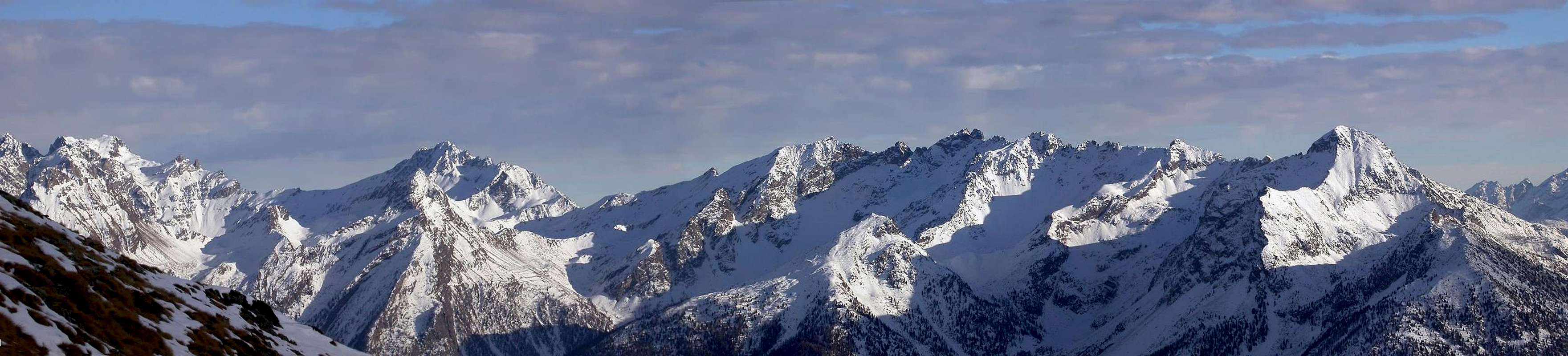
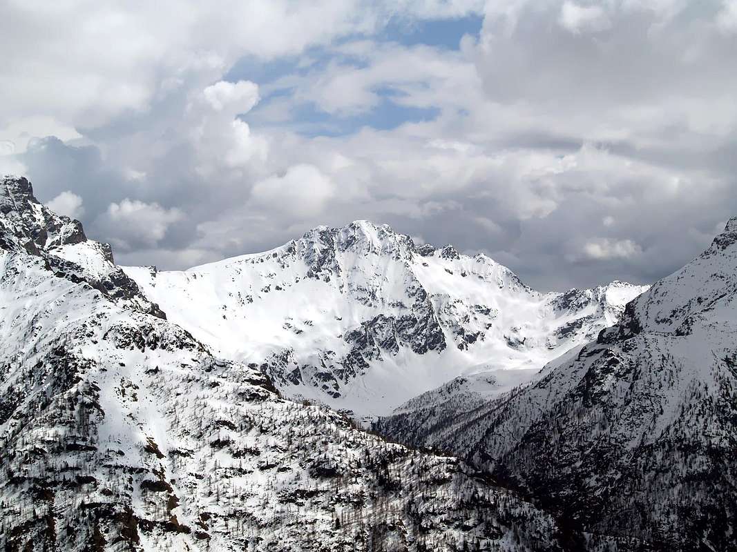
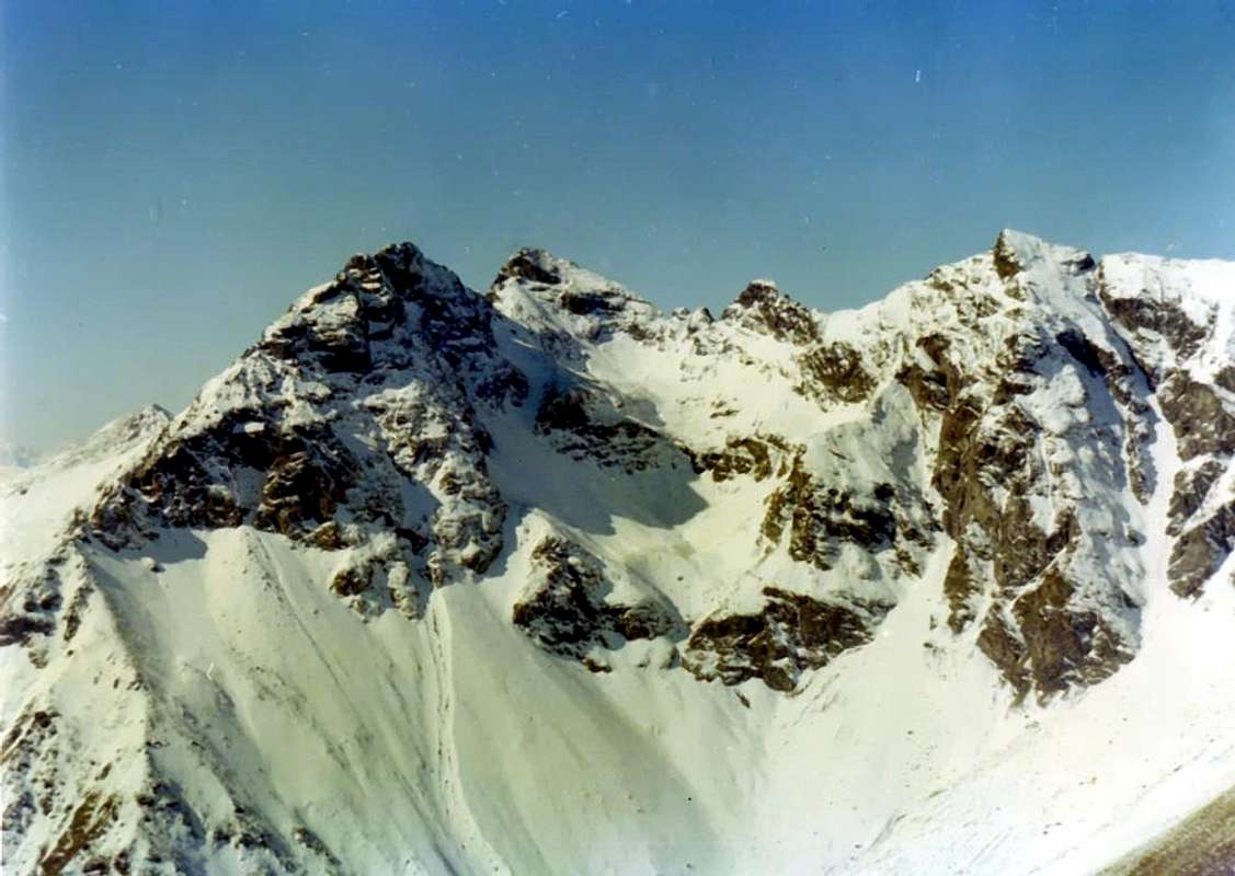
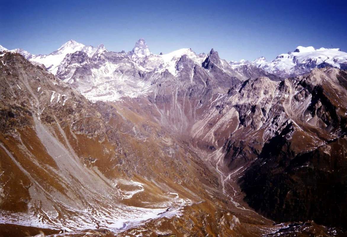
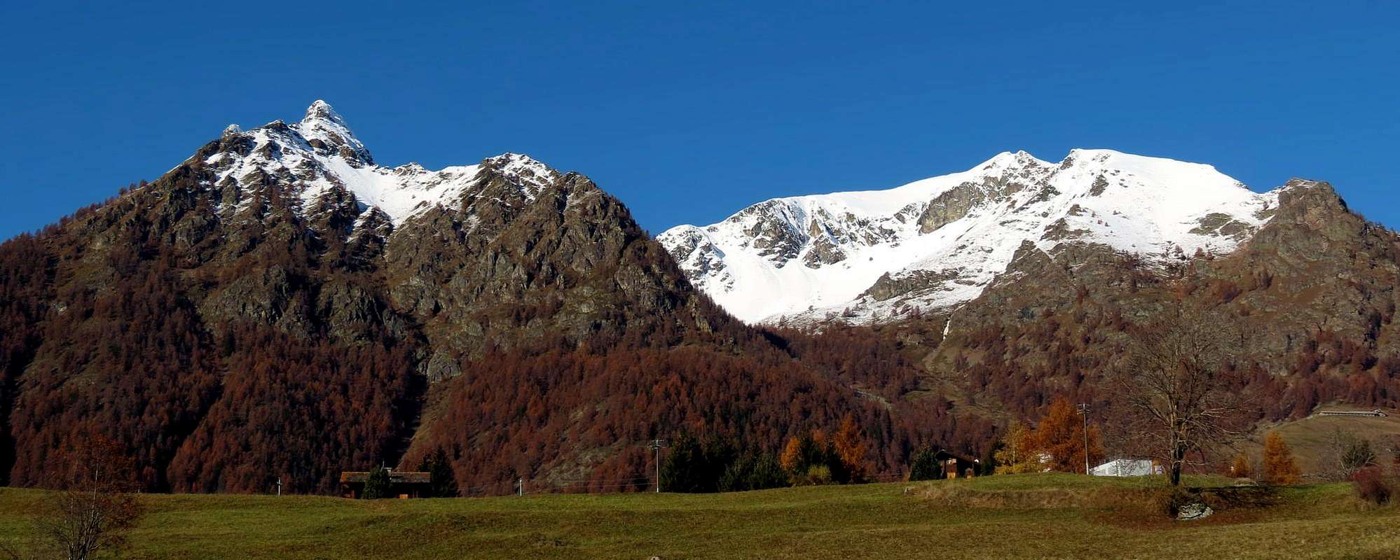
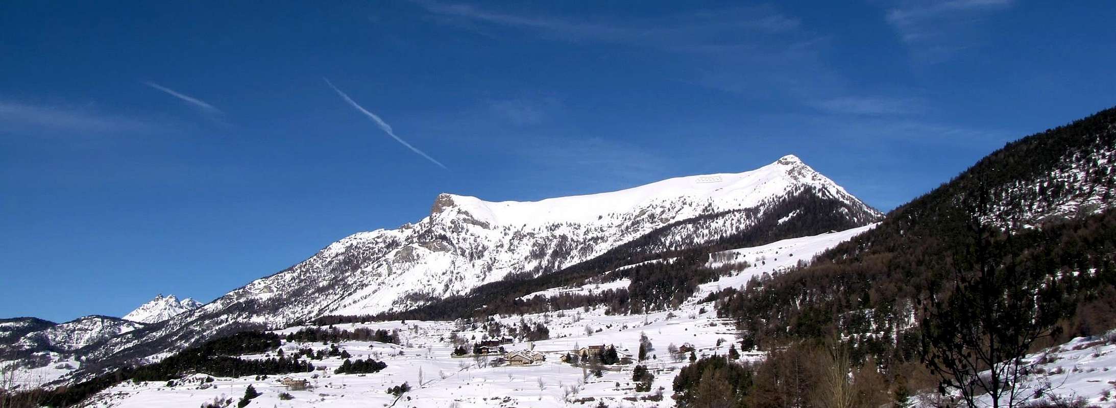
Saint Barthélemy Valley opens, from Southwest to the North-northeastast, above the Common of Nus, reaching its end of Northern Luseney Becca (3.504m), the highest elevation of the entire valley. In fact its top edge is formed by an additional appendix which by that first reach the Cima of Livournea (3.289m) and finally the Mont Redessau (NW 3.553m, 3.237m SE). A small but important sign wedge topographic and trigonometric, because between this place and the neighboring Valley of Valpelline (North) and Valtournanche (East). The head of the valley overlooking the Dam Artificial Places des Moulins in the North and Vallon Cian in the East; in the South instead incumbent on the plateau below the Lake Luseney, Refuge Luca Reboulaz (2.574m, 2.590m), who not long ago replaced the old Bivouac Franco Nebbia (currently at Lake Garin in Cogne Valley). La Valle di Saint Barthélemy s'apre, distendendosi da Sudovest a Nord-nordest, sopra il Comune di Nus, raggiungendo alla sua estremità Settentrionale la Becca di Luseney (3.504 m), la più alta elevazione di tutta questa abbastanza lunga vallata. In realtà il suo margine superiore é costituito da un'ulteriore appendice che dalla medesima raggiunge verso Est-nordest dapprima la Cima di Livournea (3.289 m) ed infine il Mont Redessau (Punta Nordovest 3.553 m, Punta Sudest 3.237 m). Un piccolo cuneo ma importante segnale topografico e trigonometrico, poiché posto tra la valle in oggetto e le limitrofe di Valpelline (Nord) e Valtournanche (Est). La testata della vallata domina la Diga Artificiale di Places des Moulins, sopra il Comune di Bionaz, a Settentrione ed il Vallone di Cian ad Oriente; a Meridione invece incombe sul pianoro sottostante col Lago di Luseney ed il "nuovo" Rifugio Luca Reboulaz (2.574 m, 2.590 m), che da non molto ha sostituito il vecchio Bivacco Franco Nebbia (attualmente sotto al Lago Garin in Val di Cogne).
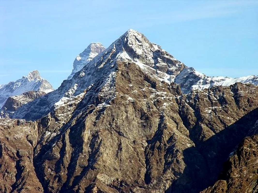
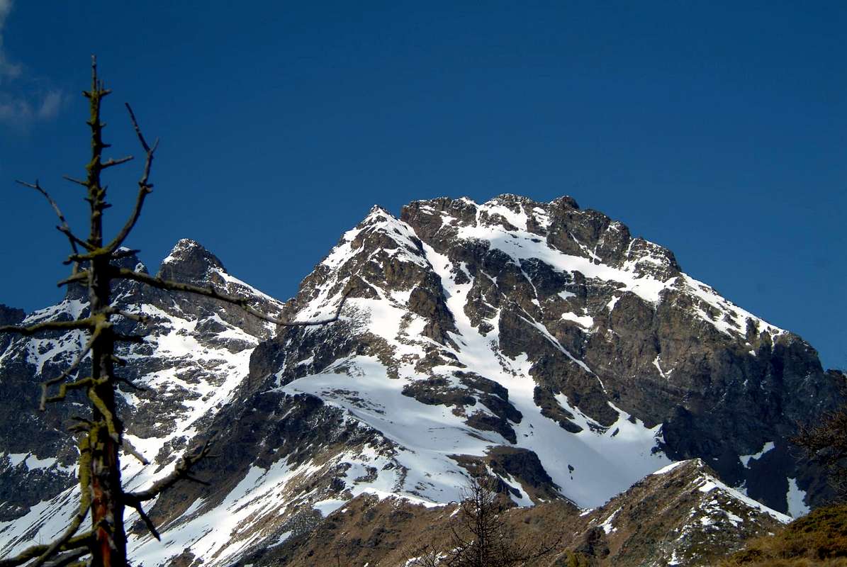
But, in our opinion, it is the Mont Faroma with its Gothic pyramid that characterizes this valley, because who reach Lignan Hamlet not see the Becca of Luseney. Instead he sees the Faroma (3.073m) like a great Gothic cathedral from the profile and that in winter, after a recent snowfall, takes lines Himalayas with its peaks adorned by large frames snowy who smoke against the sky. This is the entry point in a valley that opens out splitting it into three parts.
 |
a) - The first, the more Western is formed by the parallel Comba Dèche, secondary vallon with a district that goes from the Croix de Fana (2.212m), above the three Villages of Trois Villes (1.391m), the eponymous Beaks (2.951m) and then continue to the North with the Eastern Tsaat a l'Etsena (2.974/5 meters about), the Pointe Joseph Marie Henry (2.918m) and Becca Conge (2.954m) before reaching the important Saint Barthélemy Hill (2.645m), which leads towards Oyace Common in Valpelline. From this point the watershed flexes more to the East and, after the little Punta Verdona (2.868m), reaches Faroma. From this a partition to the South closes this first sector, after having formed the Grand Pays and Becca di Aveille or Avouille (2.623m), above the Village Effraz (1.478m).
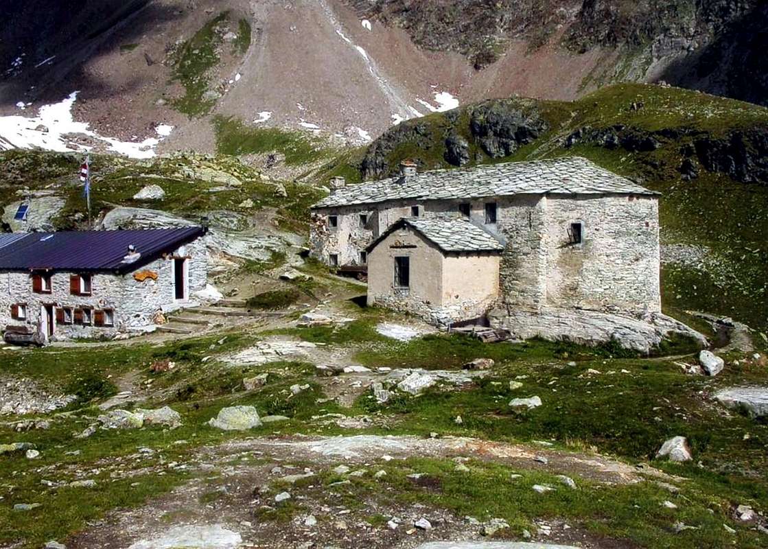
b) - The second is made up of a tiny vallon intermediate content to the West Coast of Champorcher (Southern elevation 2.656m, 2.700m Northern) to the Col de Chaleby (2.683m); near the Col du Salvé (2.568m) separates this from rounded Mont Morion (2.709m), which forms the natural barrier between this vallon and the Basin of Cuney with its famous Sanctuary and Refuge (2.625m).
c) - The third and final part, certainly the most important, stretches from the Village of Lignan (1.633m; Astronomical Observatory first to the Northeast to Praz Pasture (1.737m) below Col Fenêtre (2.182m), from the Torgnon Common in Valtournanche so far North, reaching, after several pastures, the final Praterier (2.060m), now at the foot of Becca's Luseney (namely between Punta Montagnaya West and Cima Bianca in opposite). Overall, the valley, crossed by Torrent de St. Barthélemy which originates from the former glacial cirque of Becca Luseney before falling in a gorge nearby the Village of Blavy (1.015/56m), is long about thirty kilometres, of which about 16.2 Km. between Nus Common and the Hamlet of Lignan. Besides these two there are a dozen of them including Petit Fénis, Clemençod or Clémensod (from the Latin Clemens), Saquignod, Noz or Venoz, Le Crêt, La Combaz, Issologne (Hic Columna), or Porliod Parliou, Baravex , Praz, Arlod or dialect "patois" Arlou (Ad Locum) and the picturesque Village of Val Deval Dessous and Dessus (Ad Vallem) before the Forest Ander below Mount Ander (1.931m) and Cima di Longhede (2.416m) on the watershed with the Basin Verrayes/St. Denis. While in locality Les Fabriques (1.411m) is the iron worked in the area. From Porliod (1.879m) to the Northeast part on the dirt road a renowned and popular trail Cross-country Skiing to La Nouva Alp (1.989m), through the Pastures of Praz de Verney and Barbonce (2.012m).
The Astronomical Observatory at Lignan & the Cuney Sanctuary at Becca del Merlo
The Observatory
L' Osservatorio
ITINERARIES for ALL 1) - from Effraz, Valservière (1.502m), Arliod (1.554m) small Villages, Les Rencores (1.700m) Pasture, through Municipal Road, and to Brevaz (1835m), Fontin Alpages, through private dirt road and path (2.003m; E/F+; 2h'15/2h'30), below Mont Grand Pays (2.624m)/Becca d'Aveuille (2.623m) Southeastern and Eastern slopes.
Ma, a nostro avviso, é il Monte Faroma con la sua piramide Gotica che contraddistingue questa vallata, perché chi arriva a Lignan non vede la Becca di Luseney. Vede invece il Faroma (3.073 m) a guisa di grande cattedrale dal profilo gotico e che in inverno, dopo una recente nevicata, assume linee Himalayane con le sue creste adorne di grandi cornici nevose che fumano contro il cielo. Questa è la porta di ingresso in una valle che si apre a ventaglio suddividendosi in tre parti.
a) - La prima, la più Occidentale é formata dalla Comba Dèche, vallone secondario con un circondario che và dalla Croix de Fana (2.212 m), sopra i tre Villaggi di Trois Villes (1.391 m), agli omonimi Becchi (2.951 m) per poi continuare a Nord con la Tsaat a l'Etsena Est (2.974/5 metri circa), la Pointe Joseph Marie Henry e la Becca Conge (2.954 m) prima di raggiungere l'importante Colle di Saint Barthélemy (2.645 m), conducente a Oyace in Valpelline. Da qui lo spartiacque flette maggiormente ad Est e, dopo la piccola Punta di Verdona, raggiunge il Monte Faroma. Da questo un divisorio a Sud chiude questo primo settore, dopo avere scavalcato il Grand Pays e la Becca di Aveille od Avouille (2.623 m), sopra il Villaggio di Effraz (1.478 m).
b) - La seconda é costituita da un minuscolo vallone intermedio contenuto ad Ovest dalla Costa di Champorcher (Sommità Meridionale 2.656 m, 2.700 m la Settentrionale) fino al Col de Chaleby (2.683 m); il vicino Col du Salvé (2.568 m) separa questa dal tondeggiante Mont Morion (2.709 m), che costituisce la barriera naturale tra questo vallone e la Conca del Cuney con il suo famoso Santuario e Rifugio (2.625 m).
c) - La terza ed ultima parte, sicuramente la più importante, si allunga dal Villaggio di Lignan (1.633 m) dapprima verso Nordest fino all'Alpe Praz (1.737 m) sotto il Col Fenêtre (2.182 m), verso il Comune di Torgnon in Valtournanche, quindi decisamente a Nord raggiungendo, dopo vari alpeggi, quello finale di Praterier (2.060 m), ormai alle pendici della Becca di Luseney ( per la precisione tra la Punta Montagnaya ad Occidente e la Cima Bianca all'opposto). Complessivamente la valle, percorsa dal Torrent de St. Barthélemy che prende origine dall'ex circo glaciale della Becca di Luseney per poi scendere "inforrato" verso la Frazione di Blavy (1.015/56 m), è lunga una trentina di Kilometri, dei quali circa 16,2 Km. tra il Comune di Nus e la Frazione di Lignan. Oltre a queste due si contano un'altra decina delle stesse tra le quali Petit Fénis, Clemençod o Clémensod (dal latino Clemens), Saquignod, Noz o Venoz, Le Crêt, La Combaz, Issologne (Hic Columna), Porliod o Parliou, Baravex, Praz, Arlod o in dialetto "patois" Arlou (Ad Locum) ed il pittoresco Villaggio di Deval o Val Dessous e Dessus (ad Vallem) prima della Foresta di Ander sotto il Monte Ander (1.931 m) e la Cima di Longhede (2.416 m) sullo spartiacque con la Conca di Verrayes/St. Denis. Mentre in località Les Fabriques (1.411 m) si lavorava il ferro della zona. Da Porliod (1.879 m) parte verso Nordest sulla poderale una rinomata e frequentata Pista di Fondo verso La Nouva (1.989 m), passando per gli Alpeggi di Praz de Verney e Barbonce (2.012 m).
 |
 |
 |
 |
 |
These two are the characteristics of this valley.
A very old who marked his Time Religious and other "modern" looking away from her towards the immense Space. You can not come in Saint Barthelemy without to visit one and the other. The Holy angry very for this bad History or Story...
A) - "Complicated", that originates really, directly since the year 1.000 when even the Valais Shepherds had taken refuge in this basin until the "End fel World". Catholic Religion were the first to build a small oratory dedicated to "Our Lady of the Heights" in what will become the Sanctuary highest in Europe. But let's calm: a landslide destroyed at that time and the same is "saved" only a tiny wooden statue of primitive art of the Ninth Century. The event "miraculous" upset the same that carried by the Dominican Fathers of Nus, which held up to that time the Church of Lignan. But the Little Statue returned, like Miracle, three times a Cuney, for which thing in 1650 the Dominican Priest Onorio decided to rebuild the ancient oratory, up there under the Becca del Merlo. In 1661 the same, struck by the great visitation of the people, he decided to transform the same into a Chapel with an altar to celebrate Mass and the same, on the orders of the Bishop of Aosta Alberto Bailly, is dedicated to "Our Lady of the Snows" complete with a lttle statue. But the Devil (Time) also destroyed this Chapel and the Parish Priest of St: Barthélemy, Pierre Jean Tutel, invited the locals to build a small Church stronger and resistant against bad weather. The Archdeacon Luigi Porliod he completed the work and 23 August 1869 was consecrated by Bishop Jans. In 1927 and 1928 Don Pantaleone Petran, Pastor of Lignan, with the inhabitants have built the sacristy and improved the same with rustic decorations religious inwardly, while the main altar has remained unchanged since the distant 1661. The Celebration, as throughout the Valley of Aosta dedicated to the "Madonna of the Snows", occurs on August 5th of each year. The Devil is avenged everything disappearing with a landslide the ancient lake that once stood in nearby moraine South, reducing the same in miserable puddle ...
L'Osservatorio Astronomico a Lignan ed il Santuario del Cuney sotto la Becca del Merlo"
Queste due sono le caratteristiche di questa vallata.
A) - Istoria "complicata" traente l'origini addirittura dall'anno 1000 quando i Pastori del Vallese s'eran rifugiati in questo bacino in attesa della "Fine del Mondo". Di Religione Cattolica sono stati i primi a costruire un piccolo Oratorio dedicato alla "Madonna delle Altezze" in quello che diverrà il Santuario più alto d'Europa. Ma andiam con calma: una frana distrusse a quei tempi il medesimo e si "salvò" esclusivamente una statuetta in legno d'arte primitiva del IX° Secolo. L'evento "miracoloso" sconvolse i medesimi che la trasportarono dai Padri Domenicani di Nus, reggenti a quell'epoca la Chiesa di Lignan. Ma la Statuina ritornò, come per Miracolo, ben tre volte al Cuney, per la qual cosa nel 1650 il Padre Domenicano Onorio decise di ricostruire l'antico Oratorio, lassù sotto la Becca del Merlo. Nel 1661 il medesimo, colpito dall'enorme visitazione della gente, decise di trasformare lo stesso in una Cappella con tanto di altare onde celebrare la Messa e la stessa, su ordine del Vescovo di Aosta Alberto Bailly, fù dedicata alla "Madonna delle Nevi" con tanto di piccola statua. Ma il Diavolo (Tempo) distrusse anche questa Cappella ed il Parroco di St. Barthélemy, Pierre Jean Tutel, invitò i locali a costruire una Chiesetta più solida e resistente contro le intemperie. L'Arcidiacono Luigi Porliod portò a termine l'opera ed il 23 Agosto 1869 avvenne la consacrazione da parte di Monsignor Jans. Nel 1927 e 1928 Don Pantaleone Petran, Parroco di Lignan, fece costruire la sagrestia e migliorò la stessa con rustiche decorazioni religiose all'interno, mentre l'altare maggiore é rimasto inalterato sin dal lontano 1661. La Festa, come in tutta la Valle d'Aosta nei confronti della "Nostra Signora delle Nevi", ivi ricorre il 5 d'Agosto d'ogni anno. Il Diavolo s'é vendicato di tutto ciò facendo sparire con una frana l'antico lago che sorgeva nella vicina morena Meridionale, riducendolo a ben misera pozzanghera ...
 |
 |
 |
 |
 |
B) - This is instead a History more "modern" that leads to the Cosmos Search of Asteroids, Comets, Satellites, Planets, Solar Systems, Galaxies & even Aliens ... Once the people of St. Bartholomew was simpler and was content with little, climb Mont Faroma; for the most talented Luseney, where they had already passed Augusto Enrico Martelli with the Guides Jean-Antoine Carrel and Jean-Joseph Maquignaz to August 1874 and A. Adams-Reilly with the Guides Jean-Antoine Carrel and Henry Charlet in that of 1886. Sending Augustus and Ferdinand Darbelley with the Carrier Grégoire Comé Charvensod to explore in 1895 the Southeast Face of Faroma and waiting, after the passage of Captain Albert and Casalegno Surveyors of Sardinian Staff, a few English or Academic Piedmont to complete Exploration, including the fearsome Becca del Merlo. At most, for the less skilled, he left to contemplate heaven from Mont Morion or by the Costa Champorcher, where even the cows go to graze or praying to the renowned Sanctuary of Cuney. But now the People had become less naive and more "tricky". That's why they built the observatory, right here at Lignan of St. Barthélemy, where the Sky is always clear. The Astronomical Observatory of the Autonomous Region Valle d'Aosta (OAVdA) was inaugurated around the mid-2003 is equipped with the most modern equipment, in order to promote both the research activities of the disclosure. The property is managed, along with the planetary Lignan, Foundation Clément Fillietroz - non-profit organization, and its activity is characterized by extreme openness to the public, students, tourists, astroamatori, to stimulate the dissemination of astronomy. At the observatory is located also the meteorological station of Nus-Saint-Barthelemy. It is located near the village of Lignan, at 1.675 meters in the upper part of the valley of Saint-Barthélemy, behind the town of Nus. The village of Lignan looks like a terrace, with a low visual impact (light pollution) and characterized by a weak trend in atmospheric turbulence. For scientific research are the Observatory Astronomical active four draft institutional research ranging from studying the solar system (research and characterization of asteroids) survey on the stars of the Milky Way, the observation of distant galaxies and search for extrasolar planets. Moreover OAVdA participates, on explicit requests from other institutions in Italy and abroad, also in international collaborations for specific countries of study, taking place in well-defined periods of time depending on the celestial phenomenon to be observed and analyzed. They have designed dozens of scientific publications with peer review, which appeared in the Proceedings of important international conferences and journals of reference worldwide as Astronomy & Astrophysics, The Astrophysical Journal, Icarus, Publications of the Astronomical Society of the Pacific, The Astronomical Journal. Researchers in OAVdA between late 2011 and early 2012 were associated all'INAF (National Institute of Astrophysics). There is also a helium physics laboratory, a classroom in which it is possible, during daytime visits, project the Sun and make observations of the Sun group safely to the view through a telescope with a mirror of 250mm. The laboratory is also equipped with filter H-α useful for observing the solar chromosphere.
B) - Questa invece é una Storia più "moderna" che porta alla Ricerca nel Cosmo di Asteroidi, Comete, Satelliti, Pianeti, Sistemi Solari, Galassie ed anche Alieni ... Una volta la gente di San Bartolomeo era più semplice e s'accontentava di poco: scalare il Mont Faroma; per i più bravi la Luseney, dove eran già transitati Augusto Enrico Martelli con le Guide Jean-Antoine Carrel e Jean-Joseph Maquignaz ad Agosto 1874 ed A. Adams-Reilly con le Guide Jean-Antoine Carrel ed Henry Charlet in quello del 1886. Mandando Augusto e Ferdinando Darbelley con il portatore Grégoire Comé di Charvensod ad esplorare nel 1895 la Parete Sudest del Faroma ed aspettando, dopo il passaggio del Capitano Albert e Casalegno topografi dello Stato Maggiore Sardo, qualche Inglese o gli Accademici Piemontesi per completar l'Esplorazioni, compresa la temibile Becca del Merlo. Al massimo, per i meno bravi, rimaneva per contemplare il cielo il Mont Morion o la Costa di Champorcher, dove van pascolar pur le mucche, oppure pregando al Santuario del Cuney. Ora le Gente era diventata meno ingenua e sempre più "difficile". Ecco perché han costruito l'Osservatorio, proprio qui a Lignan di St. Barthélemy, ov'il Cielo é sempre limpido. L'Osservatorio Astronomico della Regione Autonoma Valle d'Aosta (OAVdA) è stato inaugurato a circa la metà del 2003. È equipaggiato con le più moderne strumentazioni, al fine di favorire sia l'attività di ricerca che quella di divulgazione. La struttura è gestita, insieme al planetario di Lignan, dalla Fondazione Clément Filliétroz - Onlus, e la sua attività è caratterizzata da un'estrema apertura al pubblico, agli studenti, ai turisti, agli astroamatori, per stimolare la divulgazione dell'astronomia. Presso l'osservatorio si situa anche la stazione meteorologica di Nus-Saint-Barthélemy. Si trova vicino al villaggio di Lignan, a 1.675 metri, nella parte alta del vallone di Saint-Barthélemy, a monte del capoluogo di Nus. La frazione di Lignan si presenta come una terrazza naturale, a ridotto impatto luminoso (inquinamento luminoso) e caratterizzata da una debole tendenza a turbolenze atmosferiche. Per la ricerca scientifica nell'Osservatorio Astronomico sono attivi quattro progetti di ricerca istituzionali che spaziano dallo studio del sistema solare (ricerca e caratterizzazione di asteroidi) all’indagine sulle stelle della Via Lattea, l’osservazione delle galassie lontane e ricerca di pianeti extrasolari. Inoltre l’OAVdA partecipa, su esplicite richieste di altri istituti in Italia e all’estero, anche a collaborazioni internazionali per specifiche campagne di studio, che si svolgono in periodi ben determinati di tempo a seconda del fenomeno celeste da osservare e analizzare. Sono state prodotte alcune decine di pubblicazioni scientifiche con peer review, comparse negli atti di importanti congressi internazionali e su riviste specializzate di riferimento a livello mondiale come Astronomy & Astrophysics, The Astrophysical Journal, Icarus, Publications of the Astronomical Society of the Pacific, The Astronomical Journal. I ricercatori in OAVdA tra la fine del 2011 e l’inizio del 2012 sono stati associati all’INAF (Istituto Nazionale di Astrofisica). Esiste anche un laboratorio eliofisico, un'aula didattica nella quale è possibile, durante le visite diurne, proiettare il Sole e svolgere osservazioni di gruppo del Sole in piena sicurezza per la vista tramite un telescopio con specchio da 250 mm. Inoltre il laboratorio è dotato anche di filtro H-α utile per l'osservazione della cromosfera solare.
 |
 |
 |
 |
 |
Getting There
BY CAR:
- From TORINO, MILANO, etc: Motorway A5. Exit at IVREA or Quincinetto (PIEDMONT) From IVREA Town: in West towards Pont Saint Martin, Donnas, Verrès, Arnad, Montjovet, Saint Vincent, Châtillon, Nus Municipalities in East from Aosta Town.
- From Courmayeur Resort: in East-southeast towards Pré St. Didier, Morgex, La Salle, Arvier, St. Pierre, Sarre, Aosta, Saint Christophe, Quart and Nus Communes.
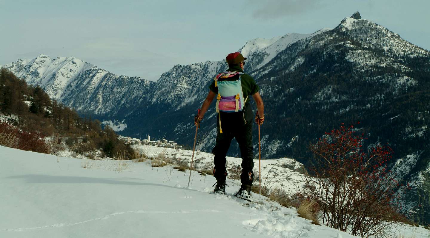
- From Nus Municipality towards Saint Barthélemy Valley From Nus (960m), with Regional Road, to Lignan-Saint Barthélemy Hamlet; from this, through various dirt roads and numerous paths, (1.628m) up to the Becca de Luseney (Luca Reboulaz Bivouac (2.575m neighbor the Luseney Lake), Livourneaz Pass 2.840m and Cian Fenêtre (2.736m)).
- From FRANCE: through the Mont Blanc Tunnel to Entrèves-crossroads to Vény/Ferret Valleys - Courmayeur. By Little Saint Bernard Pass, closed since November until half May to La Thuile Valley - Pré Saint Didier - Courmayeur. It is not necessary to take Motorway A5: you can drive on SS.26, in the direction of AOSTA - IVREA - TURIN.
BY PLANE:
- Aeroporto "Corrado Gex" Saint Christophe (Aosta).
Itineraries for ALL in St. Barthélemy Valley
 |
Northeastern Side (from Monte Faroma to Becca of Luseney Groups)
2) - from Fontin, through path and crossing two small secondary torrents in homonym Comba, to Collet Alp and Pass (2.251m, 2.500m) through Soutern slope and on North-northwest Crest to Becca of Aveuille North Antesummit (about 2.575/80m; * from this point it is best to remove the snowshoes continuing trough the rocks on edge of the crest), Summit (F+; 3h'00/3h'30; 5h'30/6h'00 from Effraz), at the end of watershed.
3) - from Effraz, Brevaz, Pleoles Dèsott Pasture (1.789m), through dirt road and path, or from Fontin Alp, with path, to Léchy Alp (2.299m; E/F; 1h'00/1h'15 from alpages; 2h'00/2h'15 from Effraz Hamlet).
4) - from Clémensod Village (1.655m), through path in Northwest along Chavalary Torrent, towards Pléo(u)les Désott, Damon (1.898m) to Chaleby Alp, through dirt road and paths (1.952m T/E; 0h'45/1h'00).
5) - from Effraz, with preceding routes throuh dirt roads and paths to Brevaz and Fontin Alpages, or from Clémensod (1.655m) Villages, through path in Northwest crossing twice Chavalary Torrent, towards Pleoles or Pléoules Dèsott Pasture to Léchy Alp and Hill (2.585m; E/F+; 4h'30/5h'00), below Mont Faroma (3.073m).
6) - from Léchy Hill, between Mont Faroma/Grand Pays, easily to Mount Grand Pays, through Northern Slope and North Crest (2.585; E/F; 0h'20 from hill; 5h'00/5h'15 from Effraz or Clémensod Hamlets).
7) - from Effraz or from Clémensod (1.655m) Villages, with previous routes, towards Chaleby (1.952m), Champanement (2.330m) Alps through dirt road and, with path before in North to fork 2.450 meters aroud and after in East-southeast on Haute Route number 1 to Plan Piscine (2.544m) just before Chaleby Hill (2.653m; E/F+; 5h'00/5h'15), between Becca Fontaney (2.971m)/Salvé Hill (2.569). The both hills at the entrance of Cuney Basin.
8) - from Lignan (+; 1.633m; fountain; Astronomical Observatory), through path in North-northeast, towards Saguignod Hamlet (1.699m), Place Damon (1.910m), Fontane (2.087m), Tsa de Fontaney (2.307m) upper Alpages to Salvé Hill (2.569m; E/F; 4h'30/5h '00), between Chaleby Hill/Mont Morion and to Cuney Sanctuary.
9) - from Tsa de Fontaney in West to Coteau (Coast) de Champorcher (2.595m; E/F; 4h'20/4h'40).
9) - from Tsa de Fontaney in West to Coteau (Coast) de Champorcher (2.595m; E/F; 4h'20/4h'40).
10) - from Lignan, through Municipal Road in Northeast, towards Vénoz (1.771m), Le Cret (1.791m), La Combaz (+; 2.010m), Larset (1.930m), nearby Porliod (1.879m), small Villages; from this last to Praz de l'Arp (1.978m) and Plaisance (2.037m) Pastures, through dirt farms road, to Tsa de Fontaney Alp (E/F; 4h'20/4h'40).
11) - from Lignan, Larset, Praz de l'Arp, fork around 2.025 meters immediately after and crossing a secondary torrent to Chavalary Alp (2.160m; E/F; 4h'00/4h'15), below Southern slopes and Crest of Mont Morion.
11) - from Lignan, Larset, Praz de l'Arp, fork around 2.025 meters immediately after and crossing a secondary torrent to Chavalary Alp (2.160m; E/F; 4h'00/4h'15), below Southern slopes and Crest of Mont Morion.
12) - from Tsa de Fontaney or from Chavalary Alpages, through small traces on grassy and debris, to Mont Morion (2.710m; E/F+; 1h'45/2h'00), easily through South Crest and South-southwest Slope.
13) - from Lignan, Larset, through Municipal Road, and towards Praz de l'Arp, alternative 2.023 meters, through dirt road and with path crossing a secondary torrent in altitude 2.023 meters and an other following, to Le Sarreun Alp (2.380m); from this to Mont Morion on East-northeast easy Crest (E/E/F+; 4h'00/4h'30 from Larset).
14) - from Lignan Hamlet, through private farms dirt road, to Larset and Le Sarreun Alps; from this last, doubling with path in Northeast/West-southwest the Mont Morion, to Salvé or to next Chaleby Passes, through small path and traces on Northeastern Slopes (E/F; 4h'00/4h'30), in Cuney Vallon with Sanctuary.
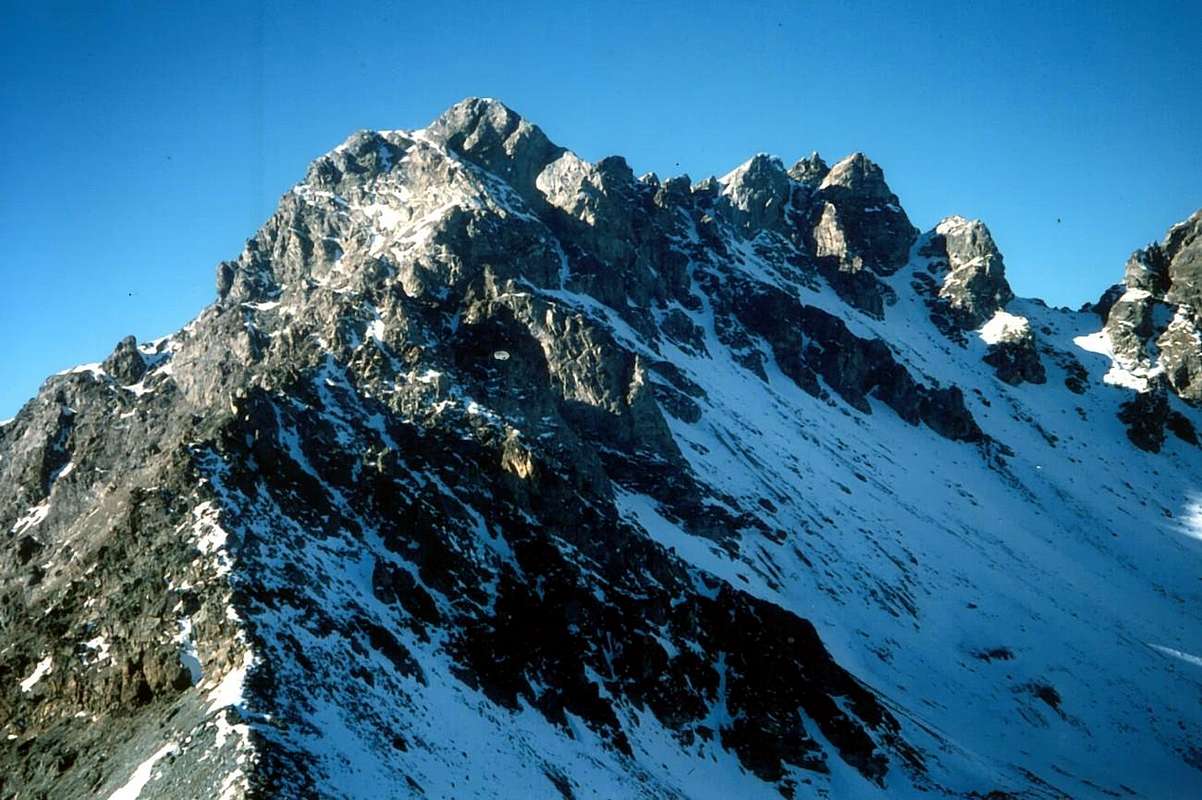
15) - from Lignan, Porliod (1.879m), neighbor Larset Villages, through dirt road/path (cross-country skiing run) in Northeast towards fork just before Praz de Verney (1.870m) and below Barbonce, La Nouva Pastures, towards Champcombre (1.930m) Alp, Champlaisant Sanctuary (+; 1.906m), Veyoux Alp (1.987m), Refuge La Servaz (+; 2.070m), near homonym alp (2.005m), La Reche Alp (2.388m) to Cuney Sanctuary (+; Refuge Oratory; 2.653m; F; 3h'00/3h'30), below the semi circular range Becca Fontaney (2.972m)/Pisonet (3.207m) and Franco Nebbia (3.205m) Summits/Becca of Merlo (3.231m)/Cuney Pass (2.917m)/Montagnayes Top (3.049m), into Cuney Comba.
16) - from Cuney Sanctuary with path Haute Route number 1 in Northeast to Luseney Lake and Bivouac (2.575m); from shelter to Luseney Alp (2.588m) and Livourneaz Pass (2.840m; E/F; 3h30/4h'00).
17) - from Nus (960m) towards Blavy Hamlet (1.056m), Val Dessus (1.268m), Les Fabriques 1.411m), Verney (1.586m), Les Fontanes (1.664m) small Villages or Pastures, through Regional and Municipal Roads; from this, in North with path and dirt road, towards Pierrey (1.910m), Tsa de Champagne (2.304m), Tsa de Pierrey (2.333m), Tsa de Voyoux (2.316m) Pastures, fork around 2.100 meters to
1) - Crottes Alp (2.389m) and overhanging Bivouac Luca Reboulaz (+; 2.575m; E/F; 4h00/4h'30). Also from Tsa de Voyoux Alpage or from La Servaz Refuge, with tour more in North-northwest, to
2) - Ollière (2.009m) and Praterier final Alps with preceding route (2.066m; same times).
 |
Southwestern Side (from Livourneaz Pass to Mont Ander/Mont de Pesse)
19) - from Les Fontanes Pasture, through path in North, towards Pierrey, Tsa de Champagne to Tsa de Pierrey Pastures; from this, crossing a torrent and through path on Southwestern Slope to Cime Bianche Northern Summit (+; 3.009m; EE/F+; 4h15/4h'30), between Becca des Crottes (3.004m)/Mont Miracle (2.601m).
20) - from Les Fontanes, Les Prèles Alps, dirt road-path in East, to Fenêtre Pass (2.162m; E/F; 2h00/2h'15), between South Crest of Mont Meabé Antesummit (+; 2.566m)/Mont de la Fenêtre (2.304m).
a) - to Becca d'Aver, in West-southwest
b) - to Cima Longhede, the both on crest watershed (2.469m, 2416; E/F; 2h'45/3h'00).
22) - from Nus, with Regional Road, to Blavy Hamlet (1.056m); from this, leaving left the same to Lignan-Saint Barthélemy Villages, continue right through dirt road before in Northeast, after North. Reached Le Noueus, Praille Pastures (1.181m, 1.242m), to Mont de Pesse, always dirt road or path in East (1.798m). From this traverse on Southwestern watershed and Southern slopes to the above Mont Ander (1.931m; E/F; 2h'30/2h'45).
Campings
Remember that free camping is forbidden (except for emergency reasons, over 2.500m, from darkness until dawn).Information
- Meteo: you can find all the needed informations at the official site of the Valle d'Aosta Region:
- Valle d'Aosta Meteo
Important Information
- REGIONE AUTONOMA VALLE D'AOSTA the official site.
- FONDAZIONE MONTAGNA SICURA Villa Cameron, località Villard de la Palud n° 1 Courmayeur (AO) Tel: 39 0165 897602 - Fax: 39 0165 897647.
- A.I.NE.VA. (Associazione Interregionale Neve e Valanghe).
 |
Useful numbers
- Protezione Civile Valdostana località Aeroporto n° 7/A Saint Christophe (Ao) Tel. 0165-238222.
- Bollettino Valanghe Tel. 0165-776300.
- Bollettino Meteo Tel. 0165-44113.
- Unità Operativa di Soccorso Sanitario Tel. 118.