
-
 3546 Hits
-
 77.93% Score
-
 9 Votes
|
|
Mountain/Rock |
|---|---|
|
|
47.22723°N / 15.04875°E |
|
|
Hiking, Skiing |
|
|
Spring, Summer, Fall, Winter |
|
|
6522 ft / 1988 m |
|
|
Topographic isolation: 1 km
Nearest higher peak: Lenzmoarkogel (1991 m)
Prominence: approximately 40 m
Overview
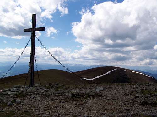
Speikkogel summit cross
Speikkogel is a commonly given name of mid-size mountains in Austria. On Wikipedia 12 such mountains are listed, ranging between 1200 m and 2265 m. As Vid drew my attention, the name Speikkogel derives from the name of a local plant, which is characteristic for the region around Mur valley. That is Speik (Valeriana celtica), known also as celtic baldrian. It grows up to 15 cm and its roots are used for production of aromatic substances (also in soap production).
This page is about Speikkogel in Gleinalpe. For an unknown reason most maps indicate Speikkogel as the most important (highest) mountain of Gleinalpe: there are less detailed maps indicating only this mountain in Gleinalpe, while other maps - that show more summits – often highlight Speikkogel with bold font or with bigger font size. Despite of its "celebration", it is only the second highest summit of Gleinalpe. The neighbouring Lenzmoarkogel is 3 meter higher (1991 m). If we want to find any category where Speikkogel is the highest, then we can find that it is the highest summit of the main ridge of Gleinalpe.
This summit doesn’t have a shape of peak. Like the other summits of Gleinalpe, its shape is more like a dome: deep valleys around the mountain, steep slopes emerging from the valleys, and round, almost flat hilltop.The hilltop is grassy.
The upper parts of the hillsides are grassy, too, but there are some screes there, too. In the valleys there are dense spruce forests. The mountain is in the drainage basin of Mur.
The southern slopes of Speikkogel are used as a summer grazing area of the famous Austrian Lipizzan breed of horses.
Getting There
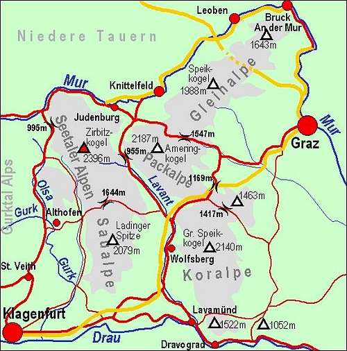
Map of Lavanttal Alps
If you want to know how to get to the foot of Koralpe, then you can look at the map prepared by Vid.
Gleinalmtunnel is only 6 km east from the summit of Speikkogel. It is an 8320 m long tunnel of the Austrian highway A9 (European E57 transit route). This highway connects Graz with the NW part of Austria and with Germany. The highway cannot be seen from the summit. But the Übelbach or St.Michael junctions of the highway can help approaching one of the trailheads more quickly.Routes
Gleinalm
3 important long distance hiking routes leads along the ridge of Gleinalpe:
- Route 02: it is a 1270 km long route between Feldkirch and Hainburg
- Route 05: it is a 510 km long route between Nebelstein and Eibiswald
- E6: this European route is 5200 km long, and it connects Kilpisjärvi in Finland with the Dardanelles in Turkey.
From east these routes are coming from the direction of Kreuzsattel (1583 m). From south these routes are coming from Gleinalmsattel (1586 m).
There is a also third direction to ascend Speikkogel: from north, from the village Vorlobming, via Türkentörl and Lenzmoarkogel. This is a long and tedious ascend: 1350 m elevation gain and 14-15 km distance. And you have to return, unless you sleep in the nearby Gleinalm Hut. Gleinalm Hut is a logistic centre with 5 interconnecting local and long distance routes.
On the Summit
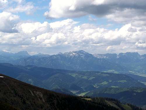
View from the summit: Gösseck (2214 m)
On the flat summit you can find the "mandatory" summit cross of the Austrian hilltpops.
View from the summit – some more exposed nearby mountains:
- N: Lenzmoarkogel (1991 m) and Gösseck (2214 m)
- S: Rossbachkogel (1848 m)
- SW: Ameringkogel (2187 m)
- NW: Seckauer Zinken (2397 m) and Pletzen (2354 m)
Some Photos about Nature
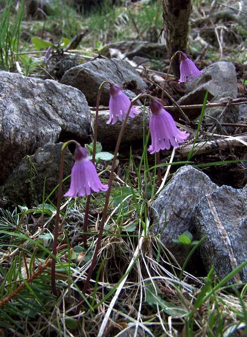
A Soldanella species
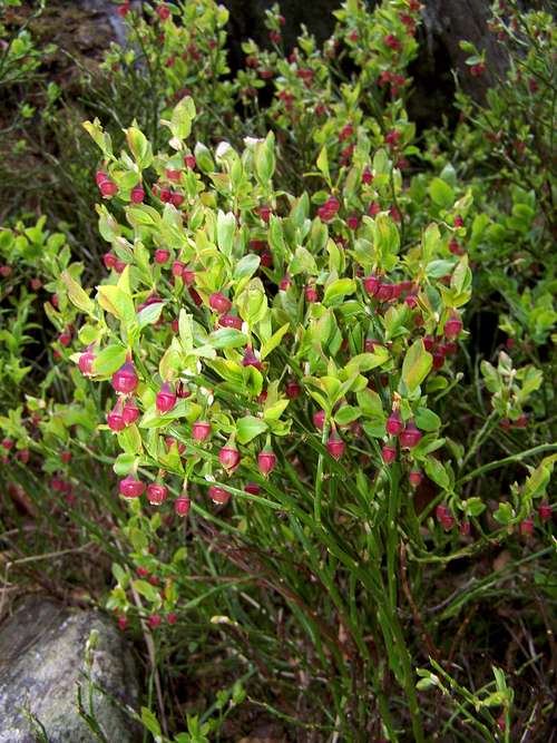
Bilberry (Vaccinium myrtillus)
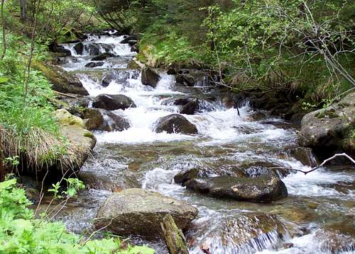
Übelbach
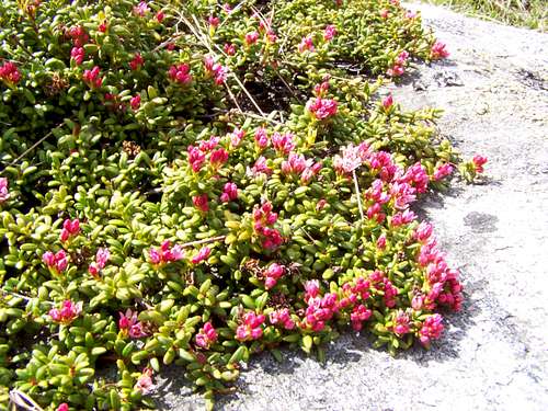
This type of plant covers Speikkogel
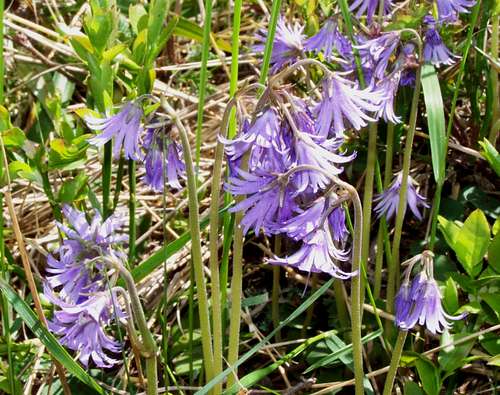
Soldanella montana
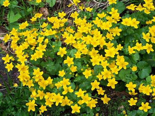
Kingcups
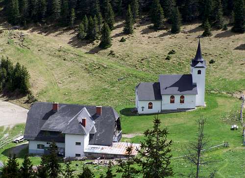
Tourist Hut
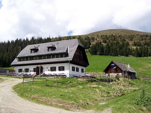
Gleinalm Hut
Gleinalm Hut (1.586 m) on Gleinalmsattel. Opened also in winter.
External Links
For online map click here.
For the webpage of Gleinalm and its environment (in German language only) click here.