
-
 1118 Hits
-
 78.27% Score
-
 9 Votes
|
|
Mountain/Rock |
|---|---|
|
|
46.90815°N / 15.06671°E |
|
|
Hiking, Skiing |
|
|
Spring, Summer, Fall, Winter |
|
|
5085 ft / 1550 m |
|
|
Topographic isolation of Schwarzkogel: 3.7 km
Nearest higher peak: Stoffkogel (1597 m)
Prominence: 182 m
Overview
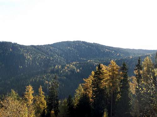
Koralpe is a mountain range stretching from north to south. Two alpine roads cross this range: one from Deutschlandsberg to Wolfsberg (L619/L148), the other from Deutschlandsberg to Twimberg (L606/L136). The two highest peaks of the area of Koralpe north of this latter road are Schwarzkogel (1550 m) and Gfällkogel (1527 m).
I could have referred to this area as Freilander Alm or as Hebalm.
Freilander Alm is the pasture land streching between Schwarzkogel and its northern neighbours: Münzerkogel and Gfällkogel.
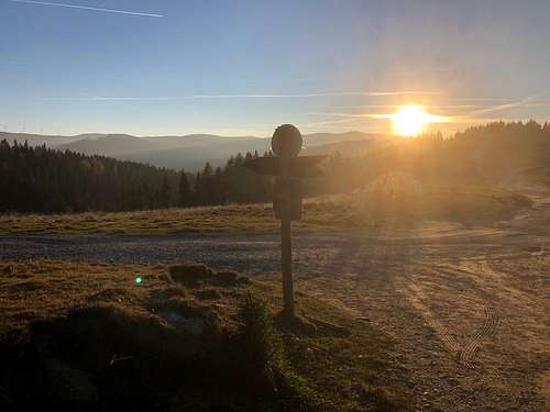
The highest point of the referred alpine road is the Hebalm pass (1420 m), and the area around the pass is called historically - and also now - as Hebalm. Even the traffic signs show this name. Hebalm is the trailhead of the best trails to the area of Freilander Alm, Schwarzkogel and Gfällkogel. Earlier the name „Hebalm” indicated also the area of Gfällkogel, but later this name transferred to the ski area opened near the Hebalm pass. So for tourist this is the best-known name of the wider area. Still, since SP is a website about mountains, I preferred to name this page about its two highest mountains, and not as „Freilander Alm” or as „Hebalm”.
Both peaks are in Styria, but very near to Carinthia. The border is only 3 km far from the peaks. And both peaks are in the drainage basin of river Mur. Mur is a tributary of the river Drau.
Schwarzkogel
The summit of the Schwarzkogel partially made of eclogite. Eclogite is the densest of all silicate rocks that is exposed on the earth's surface. The eclogite of the Schwarzkogel summit is estimated to be up to a half billion years. Its development began in the Cambrian period. Some layers (sediments with a young Precambrian sedimentation age) are about 800 million years old.
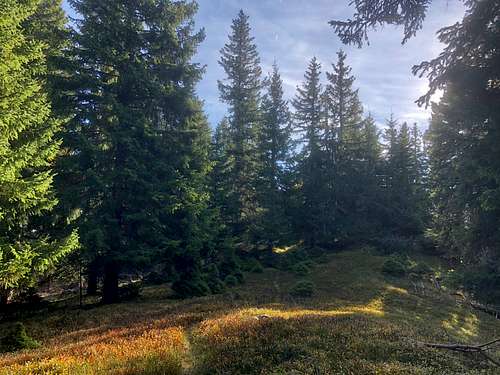
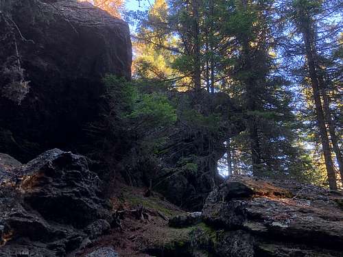
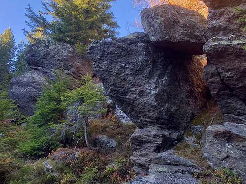
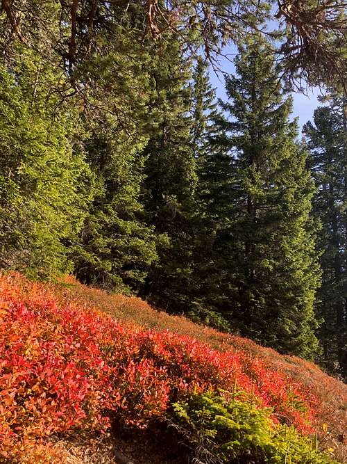
There are some rocky outcrops on Schwarzkogel. Otherwise the hill is covered by spruce forest, and with blueberry on the ground.
I’ve got a hiking map from the early 1990’s. According to this map the peak can be accessed from south-east direction, from St. Oswald. Now I haven’t see any trace of this trail. Moreover, the hill is surrounded with a fence, with no entrance.
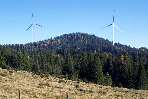
There has been a wind farm here – called Windpark Freiländeralm – since 2016. The turbines are not very near to the peak, and not within the fences areas. So I suppose that the fence is there to protect the nature from the cattles of the nearby pastures. This protection is valid: I haven’t met any tourist on the hill. I’ve met a chamois instead.
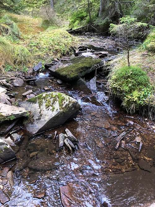
North to the mountain there is a wetland, called Filzmoos. It’s difficult to access it, and it is largely in its natural state yet.
Gfällkogel
The name of the mountain Gfällkogel in the north of the Hebalm is said to be in connection with the collection of fees (formerly called "Fall"). The forest road from the Hebalm to Modriach leads past this mountain. Since it was (and still is) the border of the provinces of Styria and Carithia, it’s realistic that tax had to be paid here. According to an alternative concept the word Gefälle can be attributed to a kind of weather damage (wind break, snow break) in the forest.
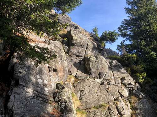
Gfällkogel is similar to Schawarzkogel. Nevertheless it’s not fenced, so anybody who wants to ascend it can do it more easily. No marked trail leads to it peak, but it can be still accessed on some tracks of forest heavy machines.
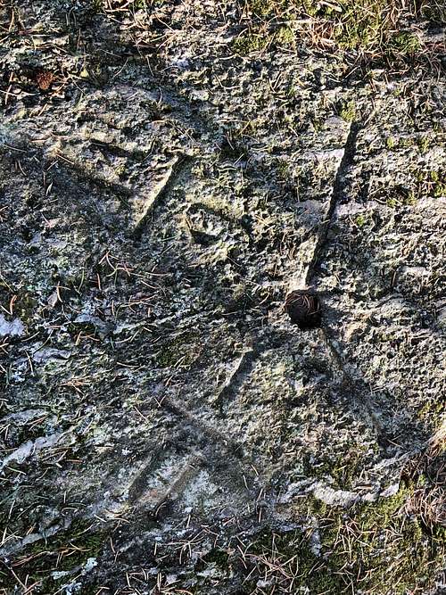
Like on Schwrazkogel – also here there are some rocky outcrops. These are more impressive than the ones on Schwarzkogel. And one small rock is a special one. It’s called Steinerner Tisch. It can be found aside the marked trail „Wanderweg 37”, at the highest point of the trail crossing the hill. There some incarvings in this rock. Their age is not defined yet. It can be anything between 60 years and a few thousand years.
Flora and Fauna
Flora
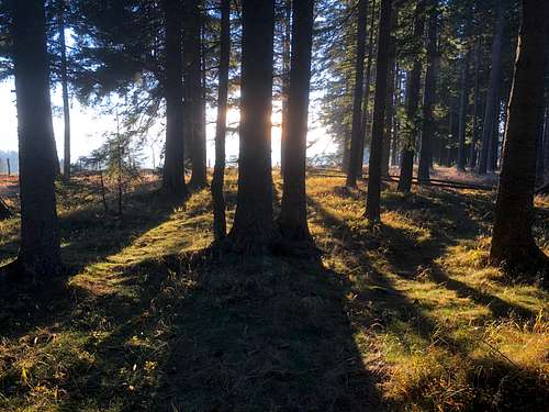
The area is covered either with forest or with pasture land. And there is also the wetland of Filzmoos. These forest areas are largely spruce forests. They were planted on the area of former alpine pastures. The natural forest at this altitude of the Koralpe would be a mixed forest, which is dominated by spruce in the coniferous wood, but also contains European larches and occassionally Scots pines and silver firs. There are also some maples, silver birch trees, common ash and red beech trees in the forests.
Early spring the the pasture lands are covered by thousands of crocuses. Willowherb, wild raspberry, ragwort can be found in forest clearings. And blueberry are can be found everywhere. Also Erica heather is widespread.
Fauna
Cattle, of course ;-) More seriously: red deer, roe deer and chamois are the most common wild animals here. Fox is a common predator. The large contiguous forest areas around Schwarzkogel and in the valleys around are home to many species of birds, including capercaillie. Me personally was lucky to meet a chamois on the summit of Schwarzkogel.
Red Tape
Schwarzkogel is fenced around. A general hint: take care of the cows. And please respect the nature!
Routes
Our area is criss-crossed with marked and unmarked trails. I would mention only a single one: Wanderweg 551. It’s a 44 km long trail, between Stainz (Styria) and Twimberg (Carinthia). The highest point of this trail is just the saddle between Schwarzberg and Gfällkogel, at an altitude of 1470 m.
When to Climb
In any season.
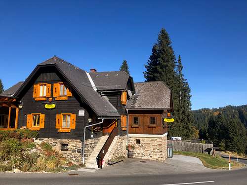
There was a ski center operating here between 1971-2015. As it doesn’t operate any more, in wintertime you can practice only ski running.
Camping
Nearest camping: Camping Almenland, in Tober, at 670 m a.s.l., in 10 km distance from the peak.
Nearest huts:
- Holzmeisterhütte, at Teichalm, at 1225 m a.s.l., in 2 km distance from the peak
- Almhütte Angerwirt, at Teichalm, at 1200 m a.s.l., in 2 km distance from the peak.
External Link
My recommended online maps: