
|
|
Mountain/Rock |
|---|---|
|
|
47.59094°N / 120.76731°W |
|
|
Hiking, Mountaineering, Scrambling |
|
|
Spring, Summer, Fall |
|
|
7029 ft / 2142 m |
|
|
Overview
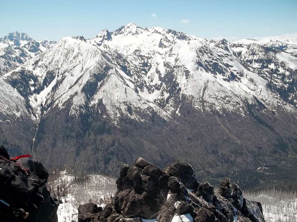
Oh the view of Cashmere Mountain from Icicle Ridge.
If you have ever been peakbagging in the Leavenworth region then you will see a common issue with a number of peaks in the region. What you will notice is that there are a couple of misnamed peaks in this area. Here is an example of another incorrectly named summit near Leavenworth. This peak is clearly a summit with over 1100 feet of prominence, amazing 360 degree views and takes over 4700 feet of elevation gain to get there by the easiest route. But the summit is commonly called "Icicle Ridge", which happens to be the same ridge it is located on. The issue with the name here is this summit is not even close to being the high-point on the ridge with a number of higher summits 4 miles to the west of it (aka. Big Lou, Frigid and Grindstone). In other words though this is an official summit, it is not the highest point on Icicle Ridge.
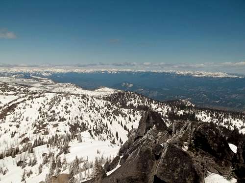 From the summit looking north | 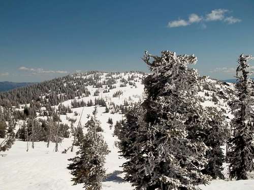 Rime ice on trees on the ridgeline |
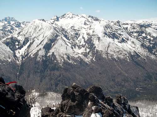
Let the above not deter you from climbing this incredible summit! This summit is ranked #36 on the Wenatchee Backcourt 100 List. That is not the only benefit of climbing this summit. If you want 360 degree views of incredible snow-capped mountains, a great workout on a decent trail, and a short but decent scramble with one brief Class 3 final move, then this mountain is for you. Cashmere Mountain is the closest summit to look at from this summit and from Icicle Ridge this mountain looks impressive. But this mountain also gives incredible views of summits of Colchuck, Dragontail, Cannon, Stuart, Big Lou and even distant Mission Ridge. This mountain is well worth the 10 mile trip with 4700 feet of elevation gain.
Route Information
Looking up from about 5500 feet
The preferable way up Icicle Ridge is via the Fourth of July Creek trailhead. From the trailhead, take The Fourth of July Trail (Trail 1579). This trail heads up through a mixture of dry eastern Cascade forest and brushy fields at pitches which start gradual down below and steepen up as it heads up. The trail then continues up through a number of steep switchbacks all the up past the burn area at about 5500 feet. It continues to switchback all of the way up to the ridge line just east of the summit. From there take the Icicle Ridge trail (Trail 1570) west to the obvious summit rocks.
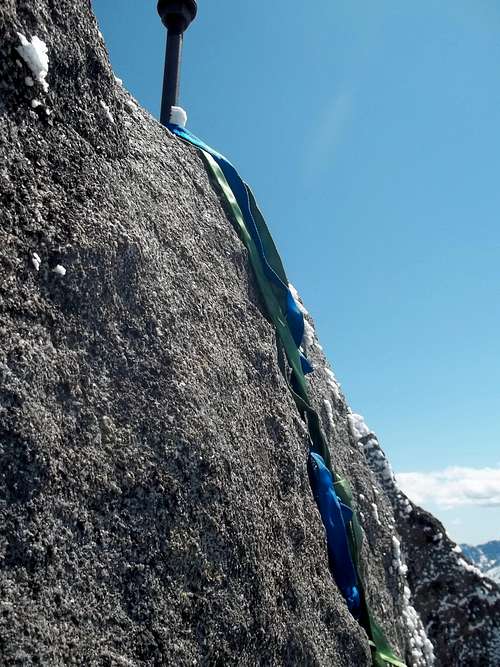
Slings not required but they really did help
The summit will require a final scramble that has one very brief Class 3 move in which you will have to grab one of the iron rods bolted into the top summit rock. You then have to put your foot on another steel rod located two feet from the surface. This one small move does have exposure on it and will require some caution. The following is not necessary but to ease the difficult bring a couple of runners (slings) and tie them in a way so that you can almost use them as a ladder up the six foot boulder. This technique REALLY helped Jimbopo and I achieve the true summit rather easily and made it very safe for us to descend the summit rock. This was the only difficult section of the scramble in what is otherwise just a steep hike.
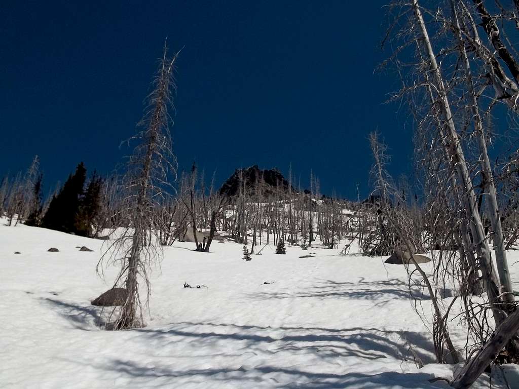
It should be noted that many climbers do this mountain in the spring as a conditioner for bigger mountains in the summer. Ideally you would want to go in early May when the snowline is about 5000 feet. From the 5000 foot level it is very easy just to walk up in the snow up the Fourth of July Ridge until you get near the summit rocks. You will then want head to the right of these rocks in order to avoid a much tougher scramble. StephAbegg wrote about this route extensively in her trip report a couple of weeks back and when Jimbopo and I did this we found this advise very useful. Depending on the snow conditions ,an ice axe, micro spikes, or even crampons might be needed during a spring snow ascent of Icicle Ridge.
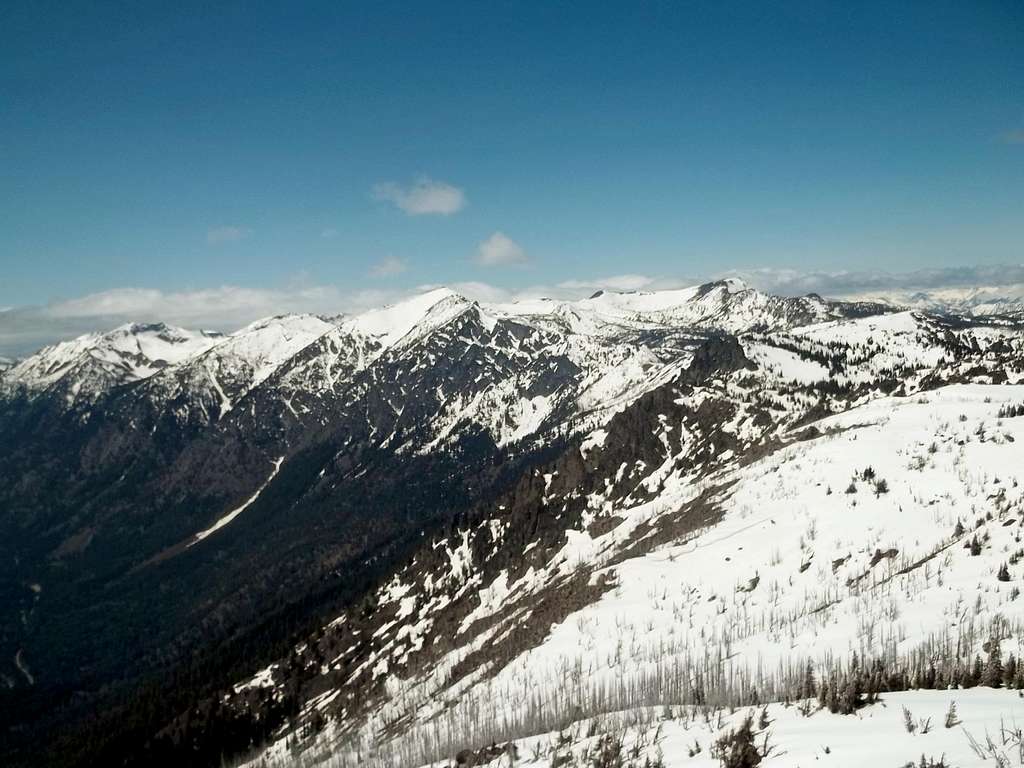
More summits to the west. These are higher peaks on the ridge
This summit was also home to a fire lookout tower at one time. Built in 1929, this was an active lookout tower until 1966 when it was destroyed. You can still see some of the remnants of the lookout on all sides of the summit pinnacle. The metal rods are what makes getting to this summit much easier. Otherwise you would be looking a much harder scramble with no place to put any sling or to pull your up to the true summit.
Map of the Route
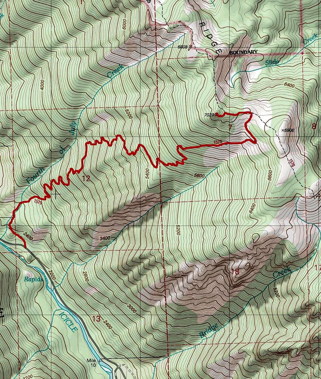
Map of the Route
Getting There
VIA THE FOURTH OF JULY TRAILHEAD: Head over to the western edge of Levenworth. Head southwest on Icicle Creek Road and follow it past the Snow Lake Trailhead and past the road leading to the Stuart Lake trailhead. The trailhead will be on your right roughly nine and a half miles from the starting intersection from US 2 in Leavenworth.Red Tape
Northwest Forest Pass required and Wilderness Permit required which can be found at the trailhead.Camping
No trailhead camping is allowed. However there is a good spot to camp when conditions are dry roughly 0.3 miles on the Fourth of July trail from the trailhead. Camping is also allowed on the ridge as well. If you choose to do it that way, be prepared for 4400 feet of elevation gain at moderate to steeper grades.External Links
Icicle Ridge Peakbagger PageGood spring trip report on Icicle Ridge
A fall trip report on Icicle Ridge
 Cashmere in your face | 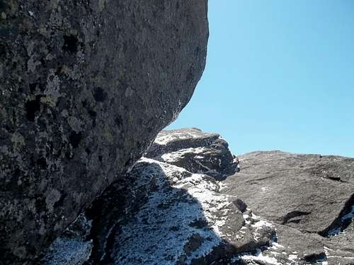 Follow the way around the boulder |