
-
 22671 Hits
-
 87.31% Score
-
 24 Votes
|
|
Mountain/Rock |
|---|---|
|
|
47.53185°N / 120.89726°W |
|
|
Hiking, Mountaineering, Skiing |
|
|
Spring, Summer, Fall, Winter |
|
|
7996 ft / 2437 m |
|
|
Overview
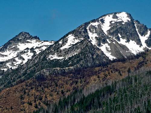
Eightmile Mountain is a lonely peak located in the Stuart Range about four miles north of Mount Stuart. This peak is interesting in the fact it has a large broad summit atypical of all other Stuart Rage Peaks like Dragontail, Colchuck and Cannon to name a few. The summit was about as large as a football field and offers great panoramic views of the Entire Stuart Range, much of the Alpine Lakes Wilderness and even most of the Glacier Peak Wilderness. These views don't come without a price however as the peak doesn't offer a friendly ascent. No matter which way you look at it Eightmile Mountain will require lots of bushwhacking, talus hopping and some scrambling. Plan for the majority of a day to climb this one, or make it a winter or spring ski trip since you will avoid much of the bush and have a great run down its east face couloirs.
With a stout elevation of 7,996 feet and 976 feet of clean prominence, it is one of the highest 200 in Washington and attempts to rival that of the main Stuart Range crest however it falls short and hides in the background. Much fewer ascents are made of this peak since it is less known and known to have a grungy approach. It is however a prominent peak offering grand vistas on the entire area and worth the ascent if for nothing else. It is recommended someone ascend this peak on a clear day.
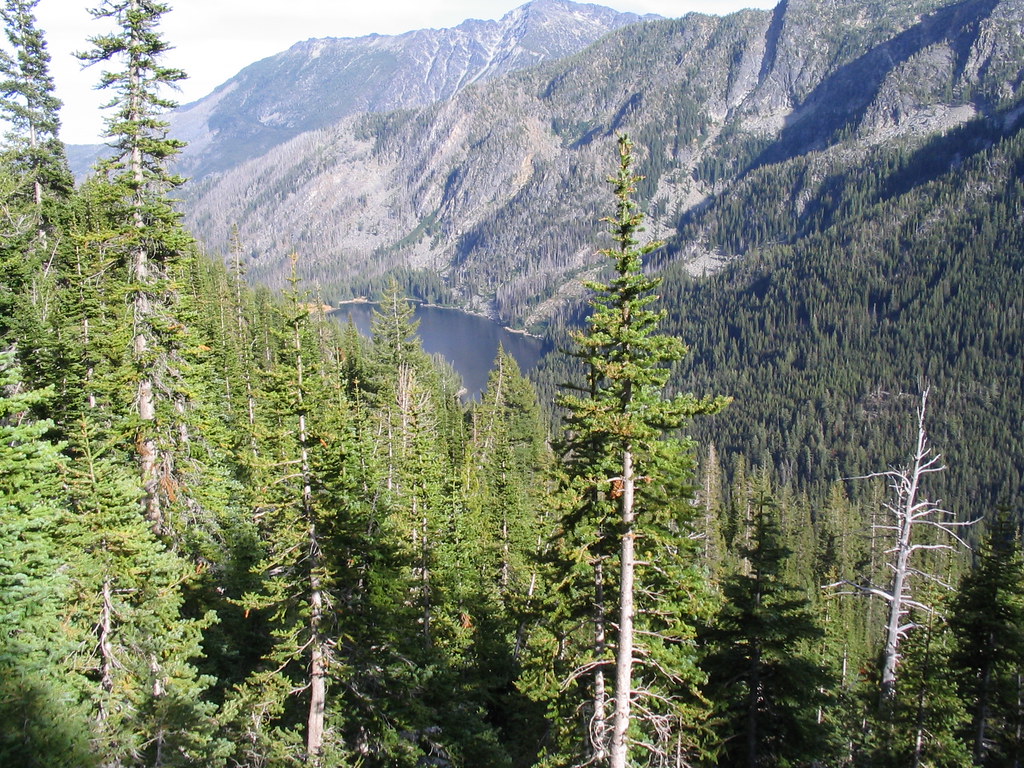
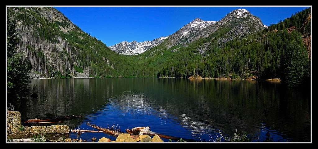 Eightmile Mountain at center-right from Eightmile Lake
Getting There
All feasible routes for this peak start at the Eightmile Creek trailhead off the Eightmile Road. Note that a forest service parking pass is required to park here however you can also pull off to the side of the road just before the "Entering Fee Area" sign about a tenth of a mile before the actual trailhead if you don't have the pass. From Leavenworth, WA turn south onto the Icicle Creek Road which is located at the west end of town on US Highway 2. There is a gas station at this intersection and a large sign for the Icicle Creek Road. Follow this paved road for 4.2 miles where you will pass the Snow Creek trailhead (used for the Snow Creek Wall and Snow Lakes). Beyond this point the road is not plowed in winter and much less maintained. Continue an additional 4.2 miles (8.4 total from Leavenworth) and turn left onto NF-7601 (Eightmile Road). Pass the Bridge Creek Campground and cross the bridge over Icicle Creek and continue up this well maintained but steep gravel road for 3 miles to the signed Eightmile trailhead at 3,300 feet elevation. This road climbs nearly 1,300 feet from the Icicle Creek Road so use caution when driving down.
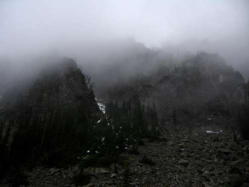
The Eightmile Road is gated closed at the Bridge Creek Campground upon the first major snowfall usually in late October and does not open again until it completely thaws out usually in the middle of May. An outing up any of the peaks accessed from this road adds an additional 6-8 miles round-trip when the road is closed. From the trailhead where there is room for 10-15 cars and a vault toilet facility, start up the Eightmile Creek Trail where the approach begins. In recent years, especially in the summer of 2012, the entire Eightmile Creek Valley burned down to the ground leaving behind a huge mess. In fact, much of the summer season in 2012 the Eightmile and Lake Caroline zones were closed and all of Cashmere Mountain was off limits due to the long term fires that plagued the area. Even as late as mid-November 2012 after weeks of rain there was still smoke pluming from the valley and the trail was virtually impossible to find under layers of downed trees and a think cover of wet ash. The landscape has virtually been destroyed and looked like the moon. Now, in the spring of 2013, crews have amazingly cleared much of the deadfall that was covering the trail and re-established it making the four mile hike to Eightmile Lake simple and enjoyable once again, however the scenery has been changed dramatically and will take years to recover. It is asked everyone be very careful when visiting this area and avoid fires of any kind.
From the trailhead, begin hiking up the trail which follows along the right side of the creek the whole time. The trail it the steepest in the first half-mile and shortly after meets with an old road and crosses a stream on a double log bridge. Past this bridge the trail winds through the valley gently gaining elevation. After about 3.25 miles you will pass Little Eightmile Lake where the signed junction with the Lake Caroline/Windy Pass trail heads to the right and up the steep slopes. Do not take this junction but stay straight and continue climbing an additional 0.75 mile to the end of the trail at Eightmile Lake.
 The Eightmile Lake trail heavily affected by the summer 2012 fires The Eightmile Lake trail heavily affected by the summer 2012 fires |
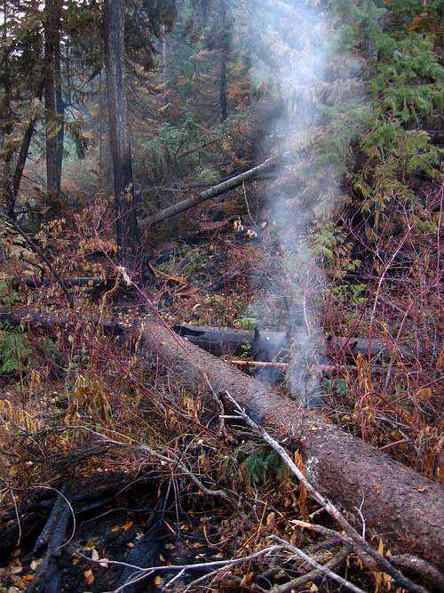 Some logs still smoking well into the fall after the summer 2012 fires Some logs still smoking well into the fall after the summer 2012 fires |
Route Options
South Face - Class 2+
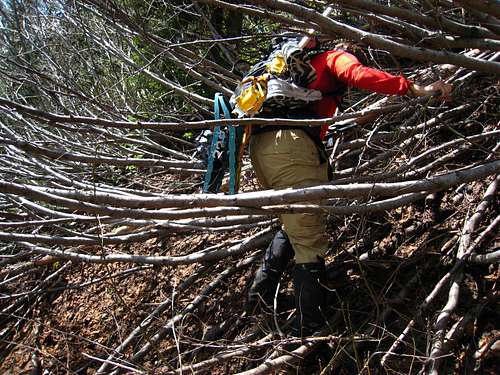
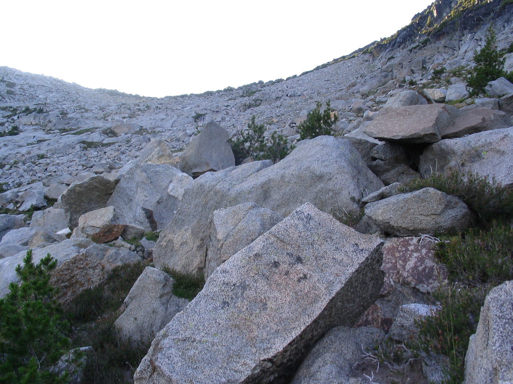
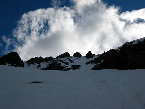
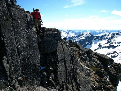
This has been regarded as the standard route up the mountain but by no means the one I recommend. The bushwhacking on this route is terrible and the entire way up is a grungy mess. Nevertheless, if this suits you, by all means give it a go! Hike 1 mile around the north side of Eightmile Lake on a nice boot path passing by three designated camp spots. Cross over a sizable creek coming in from the north right as you reach the west end of the lake and continue up the valley to the west. Almost instantly when you leave the lake-shore the valley bottom becomes a maze of pick-up-sticks with millions of down trees making for slow going. Luckily however there isn't much brush but that will change. Go 0.4 mile up the valley until the slope on the right (north) opens and reveals a huge avalanche swath at 4,800 feet. Turn right and begin ascending this slope in a northwest direction. Be aware though that the next 1,000 feet of elevation gain will test your bushwhacking skills and you may just go insane. The only word of wisdom I can give is to stay as close to the forest line as possible! Do not venture too far into the middle of the avalanche swath and certainly do not get too close to one of the creeks draining down this slope. At 5,800 feet the brush relents and you should veer more westward towards a small tarn at 6,420 feet. Do not go to the tarn directly but bypass it just to the east and continue northward over talus and easy rock slabs to 7,500 feet in elevation. Here skirt below the cliffs just to the east and hit the ridge crest at about 7,700 feet. Once on the ridge it is a short 0.2 mile Class 2+ scramble on blocky terrain northeast along the ridge to the summit. You will have to walk a short ways on the summit plateau to reach the highest point. When snow covered the slopes above the small tarn make for a great mellow (about 30-35 degrees) snow climb.
 Slide alder on the lower avalanche swath Slide alder on the lower avalanche swath |
 Talus above the small tarn...the ridge can be seen! - By Bloated Chipmunk Talus above the small tarn...the ridge can be seen! - By Bloated Chipmunk |
 Looking down to Eightmile Lake - By Bloated Chipmunk Looking down to Eightmile Lake - By Bloated Chipmunk |
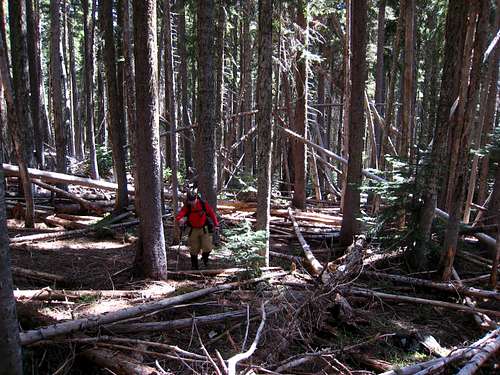 Hiking through the "pick-up-stick" forest along Eightmile Creek Hiking through the "pick-up-stick" forest along Eightmile Creek |
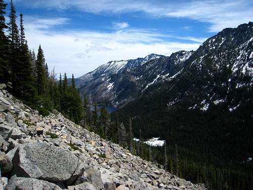 Finally above the brush! Finally above the brush! |
East Face - Class 2+
This is the route I recommend since it has much less bushwhacking and makes for a great snow climb/glissade. From the boot path heading around the north side of Eightmile Lake, begin heading north up the slopes right at the west end of the lake where a sizable stream drains into the lake. This is the same stream you would cross over if continuing up the main valley for doing the south face route. For this route, do not cross this stream but instead ascend through a scarcely forested burn area along the east side of this stream. There are a few other smaller streams in the area but these are easily hiked around. After 800 feet of ascending, the slope will ease considerably and you will enter a broad flat valley with nice meadows (or mud in early season) at 5,700 feet elevation. Continue walking up this valley just east of the stream until you reach orange colored talus. Note there is a rock contact between the orange colored peridotite that makes up the area around Cashmere and Eightmile Lake and the Stuart Range granite right through this valley and the rock color changes dramatically. Once on the peridotite talus, begin hiking up for about 10 minutes until you pass by the cliffs just to the southwest. At the head of the valley around 5,800 feet you will veer left and ascend the east facing slopes which are either snow or talus. Aim for one of the gullies leading up to the southeast ridge coming down Eightmile Mountain. The leftward gullies are shorter and a little less steep while the big one to the right is the steepest. Once you reach the ridge, veer right and walk northwest for about 200 feet or less to the summit.
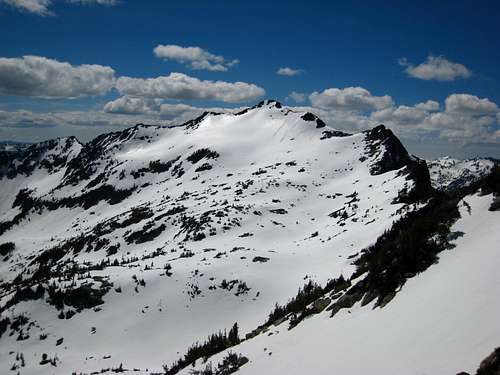
 Looking up the east face of Eightmile Mountain from the flat valley at 5,700 feet. Notice all the talus Looking up the east face of Eightmile Mountain from the flat valley at 5,700 feet. Notice all the talus |
 Looking back to the flat valley Looking back to the flat valley |
 Looking up the east face...notice the different gullies to choose from on the upper face Looking up the east face...notice the different gullies to choose from on the upper face |
Jack Ridge-Eightmile Mountain Direct Traverse - Class 4
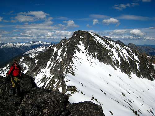
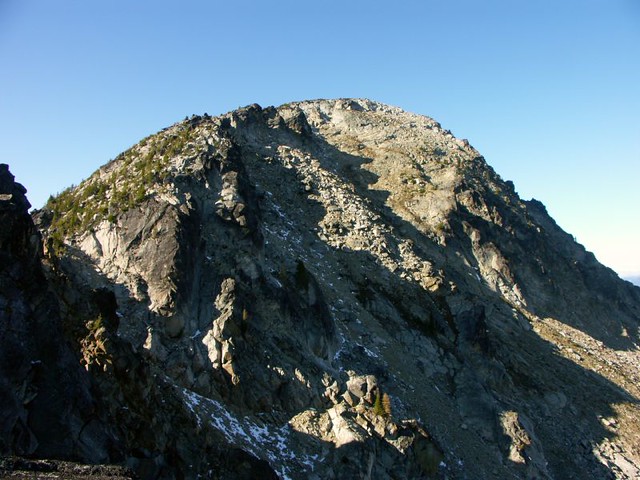
This traverse is done if you are wanting to climb both Eightmile Mountain and Jack Ridge. There are other routes up Jack Ridge with the east slopes being the primary one from the same approach as Eightmile Mountain however you could traverse this route back and forth to tag both summits. I will describe the route from Jack Ridge to Eightmile Mountain. From the summit of Jack Ridge, descend down the east slopes aiming directly for the low 7,000 foot saddle to the east. This part of the route is easy Class 2 rock hopping. Ascend 750 feet east up easy Class 2 terrain to a small notch between the two summits of Point 7,793 (Eightjack Peak). The east peak is slightly higher and is capped with a large boulder you can climb up on where you will find the best views of the area. Since Eightmile Mountain has such a large summit the views are obstructed which makes Eightjack Peak a worthy objective even if it only has about 200 feet of prominence.
So, here comes the tricky part. From the higher east peak, descend northeast a few feet and downclimb an 8 foot crack which cuts through a smooth slab (Class 4). Continue down the next slab by mantling down 5 feet to a good rock where you can then jump off to a large ledge (Class 3). Scramble down a gully towards the southeast (Class 4) to reach easier terrain and finish the traverse to the wide saddle on Class 2-3 rock. From the wide saddle northeast of Eightjack Peak, ascend easily for 400 feet to the summit of Eightmile Mountain.
 The traverse to Jack Ridge from Eightjack Mountain The traverse to Jack Ridge from Eightjack Mountain |
 The Class 4 crack down off Point 7,793 (Eightjack Peak) on the traverse to Eightmile Mountain The Class 4 crack down off Point 7,793 (Eightjack Peak) on the traverse to Eightmile Mountain |
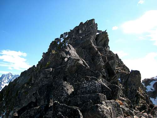 Looking at the Class 4 descent off Eightjack Peak Looking at the Class 4 descent off Eightjack Peak |
 Jack Ridge and Eightjack Peak (Point 7,793) from Eightmile Mountain Jack Ridge and Eightjack Peak (Point 7,793) from Eightmile Mountain |
 The final 400 foot ascent to Eightmile Mountain The final 400 foot ascent to Eightmile Mountain |
Map
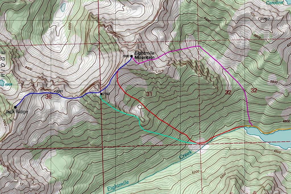 ORANGE: Approach Trail - Class 1 / PURPLE: East Face - Class 2+ / RED: South Face - Class 2+ / LIGHT BLUE: Point 7,793 Southeast Ridge - Class 3 / DARK BLUE: Eightmile Mountain / Jack Ridge Traverse - Class 4
When to Climb
Late Spring/Eary Summer
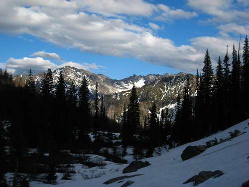
This is the best time to climb Eightmile Peak especially right after the road to the trailhead opens up sometime in May. This time of year you you can take advantage of the snow that covers much of the tedious talus slopes higher up and the amount of time you spend bushwhacking can be mitigated. You can also drive to the trailhead and easily hike the trail to the lake. A moderate to long day would be required.
Late Summer/Early Fall
A late summer ascent of this peak can be done and isn't a complete suffer-fest. The temperatures will be much hotter and buggier with more bushwhacking to deal with but the real killer will be that the talus slopes all around the mountain will be open and both the climb and descent will be more tedious and take much longer. Plan for a very long day if planning to climb it during this time of year.
Late Fall/Early Winter
HA! Forget about it!!
Late Winter/Early Spring
Although the road is closed at this time this is probably when the peak receives the most visitors. Skiers can find heaven on the east face slopes which offer great lines. Just be sure you go when the conditions are favorable and have knowledge about avalanches and how to avoid getting caught. Since the Stuart Range is east of the Cascade crest, fine weather days can be had in winter. Add 6 miles round-trip to the climb if climbing it in early spring and 14 miles round trip if climbing it in mid-late winter (since the Icicle Creek Road isn't plowed all the way to Bridge Creek).
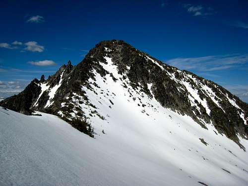
 Eightmile Mountain in summer Eightmile Mountain in summer |
 Eightmile Mountain in spring Eightmile Mountain in spring |
 Eightmile Mountain in fall Eightmile Mountain in fall |
Summit Views
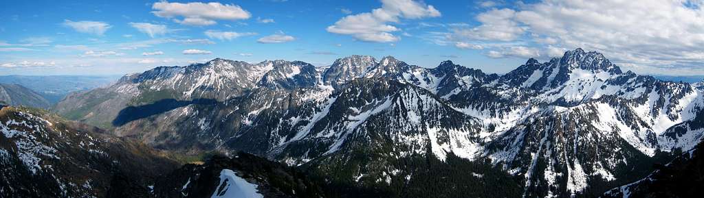 Stuart Range from Point 7,793
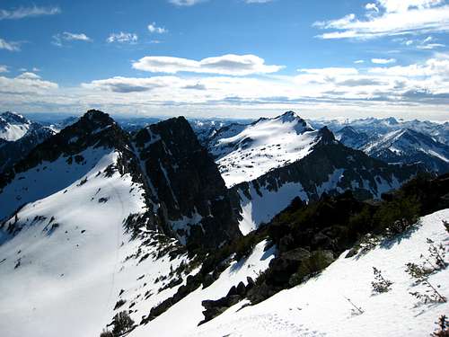
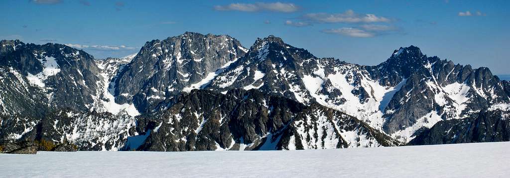 Dragontail and Colchuck Peaks from Eightmile Mountain
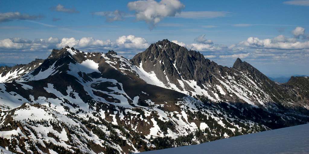 Cashmere Mountain from Eightmile Mountain
Camping/Red Tape
Camping is allowed at Eightmile Lake away from the east edge which is designated as a day use area. A way trail follows around the north shore of the lake and passes by 3 designated sites each having a working privy. A permit is required to camp overnight which is organized through the Enchantments lottery system however the Eightmile/Lake Caroline zone rarely fills up and you can usually get a permit at the Leavenworth Ranger station the day you start your trip. Typically, only the Enchantment Core zone is impossible to get a permit. See the map below for the zone boundaries. For questions about permits, current conditions or logistics information call the Leavenworth rangers. You can also camp at the established Bridge Creek Campground for a $16 fee which is located right at the intersection between the Icicle Creek and Eightmile roads. There is also a nice group site here with room for 50+ people which can be reserved for $85.
600 Sherbourne St
Leavenworth, WA 98826 Remember a NW Forest Service Pass is required to park at the trailhead
(509) 548-6977
 Map of the permit zones in the Enchantments area. Eightmile/Caroline zone is typically the least visited.
External Links
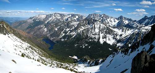
Looking down at Eightmile Lake
Great late season Trip Report on NWHikers
Eightmile Mountain on Lists of John