
-
 14237 Hits
-
 86.51% Score
-
 23 Votes
|
|
Mountain/Rock |
|---|---|
|
|
47.65721°N / 120.91791°W |
|
|
Chelan |
|
|
Hiking |
|
|
Spring, Summer, Fall |
|
|
7316 ft / 2230 m |
|
|
Overview
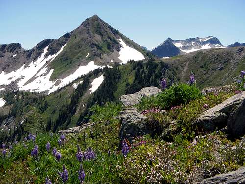
Cape Horn and Wildflowers
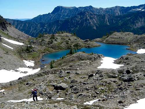
Cape Horn is located at the northwestern end of Icicle Ridge in the Chiwaukum Mountains of the Alpine Lakes Wilderness. A quarter mile east of the summit, Lake Edna is situated in a small scenic basin at 6740 feet. This lovely lake can be a breeding ground for mosquito hordes in the summer months. Some visitors have commented that the general ambiance of the surrounding environs are are not typical to Washington State and more so reminiscent of Colorado terrain. Clusters of small trees are scarce in this alpine environment while grasses and small shrubs cover the rocky ground.
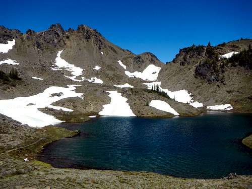
Cape Horn above Lake Edna
The Icicle Ridge trail passes withing 200 vertical feet of the summit on the north face. Round-trip distance from Scatter Creek trailhead is 11.5 miles with an accumulation of 5700 feet of gain. An alternate but longer approach would come from the Whitepine trial head to the north on Highway 2. To reach the summit, follow a boot path above the Icicle creek trail along the north ridge (class 2). Relatively speaking the summit is easily attainable, but excessive elevation gain might make it too much for the average hiker. It is therefore recommended to make this a two day trip with an overnight near Lake Edna or Ladies Pass and then do a combination of Cape Horn along with one or more of the other nearby peaks such as Grindstone Mountain, Ladies Peak, Frosty Mountain, or Snowgrass Mountain.
Route
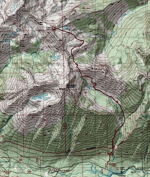
The Route
From the Chatter Creek trailhead follow the trail through forest to 4370 feet. Cross the creek and continue along the trail on the east side of the creek. Break out of the trees at 5000 feet and you will have a view of the east face of Grindstone Mountain. Continue through meadows and then brushy slopes towards the pass at 6660 feet, northeast of Grindstone Mountain.
The pass at 6660 feet
Just before the pass, at 6200 feet, the trail passes near Chatter creek and crosses some rocky slabs. Be careful not to lose the sight of the route here and if in doubt, head straight uphill until the trail is visible again. When you reach the pass at 6660 feet you will have a view of Big Jim Mountain to the northeast and the Index Creek drainage down below.
Hiking above Lake Edna
Follow the trail down 540 feet to a junction at 6140 feet and turn left onto the Icicle Ridge trail. You will have to regain this 540 feet on the trek out. Snow and tarns linger in this area late into the summer. Continue east on the trail and gain another 600 vertical feet to reach Lake Edna with plentiful camping spots. The summit is now visible.
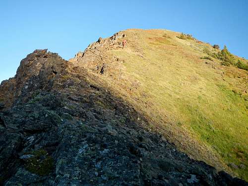
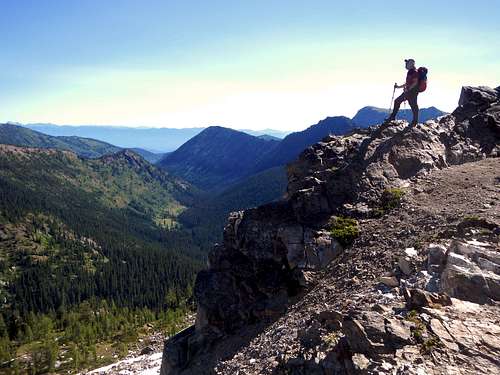
Hiking near the summit
Follow the trail beyond Lake Edna to another pass located at 7000 feet. Continue beyond the pass onto the north face of Cape Horn but cut off the trail onto a boot-path before reaching the north ridge. The booth path joins up with the north ridge and ascends class 2 terrain for 200 feet to the summit. Views of Big Jim Mountain, Big Lou Mountain, Grindstone Mountain, Ladies Peak, and Snowgrass Mountain are especially good.
Getting There
From the town of Leavenworth on Highway 2, take Icicle Creek road 15 miles to the Chatter Creek trailhead located on the right (north) side of the road.Red Tape / Camping
Big Lou Mountain seen from Lake Edna
A northwest Forest pass required to park at the Chatter Creek trailhead. DO NOT camp on the shore of Lake Edna. Regulations require require a distance of at least 500 feet to reduce soil erosion. Also remember to fill out the free Alpine Lakes Wilderness permit at the trailhead and carry it with you.
External Trip Reports
- Our July 2013 trip report including Snowgrass, Ladies, Cape Horn and Grindstone
- Eric Willhite's trip report including Ladies and Cape Horn
- Gil's July 2008 trip report including Ladies and Cape Horn
- Randy's July 2007 trip report including Ladies, Cape Horn and Grindstone
- A September 2006 trip report by b00 including Ladies and Cape Horn