
-
 6853 Hits
-
 85.36% Score
-
 20 Votes
|
|
Mountain/Rock |
|---|---|
|
|
39.91013°N / 9.41015°E |
|
|
Sardinia |
|
|
Trad Climbing |
|
|
Spring, Summer, Fall |
|
|
4242 ft / 1293 m |
|
|
Overview
Geographical classification: Sardegna - Sardinia > Supramonte > Perda 'e Liana
Perda 'e Liana 1293 m
Although smaller and not as famous as the spires of Aguglia di Goloritzè and Pedra Longa, Perda 'e Liana 1293 m is the most imposing "tacco" - a word meaning "heel" - amongst these typical limestone formations in the Ogliastra region. Their name derives from the characteristic shape similar to a shoe heel. Also called "tonneri", they are calcareous-dolomitic outcrops which suddenly rise in the midst of the extensive semi-desert highlands. Consequently, the morphology of this region is distinguished by the alternation and the contrast of steep escarpments with gently sloping areas, which give greater prominence to the "tacchi". Perda 'e Liana is located in one of the wildest territories of Sardinia, namely in the Gairo commune, South of the Flumendosa river, a waterway that separates the "tacchi" region from the Gennargentu Massif.

It is a well-identified cylindrical tower about 50 meters high with a diameter of about 100 meters and a tipically flat summit, perfectly isolated in the middle of an extensive karst plateau. In the upper part Perda 'e Liana is made up of limestone and its vertical walls are divided into regular prismatic blocks, supported by a conical trunk base of sandstone and conglomerate rocks.


Perda 'e Liana is situated in a fascinating landscape and beyond being a mountain symbol and a very important natural monument has the peculiarity of being visible at great distances. Moreover, from the geological point of view, it's one of the most important witness in Ogliastra of the erosion of the ancient limestone cover of the Jurassic period. The base of the tower is approachable by an easy walking, but the Normal route to the summit involves a short climb classifiable IV grade UIAA and therefore the use of mountaineering gear is needed.
Getting There
Access to the island of Sardinia
Sardinia, the Westernmost region of Italy, can be reached by plane or by ferry-boat from Livorno, Civitavecchia and Genova harbors. The most convenient destination in Sardinia to visit the Supramonte di Baunei, one of the wildest region of the island, is the airport of Olbia if you’re getting there by plane; the same Olbia or the near Golfo Aranci harbors if you’re getting there by ferry-boat.
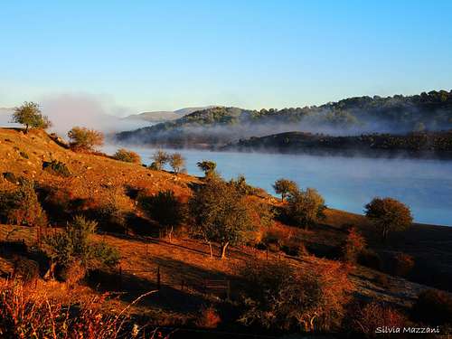
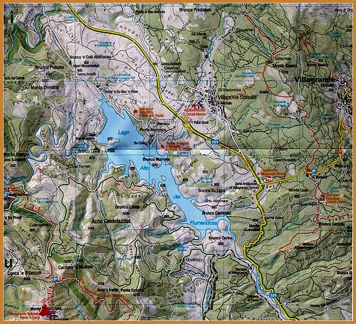
Morning mist on the Lago Alto di Flumendosa |
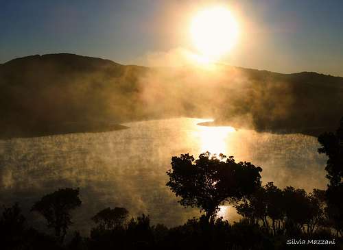
Sunrise over the lake |
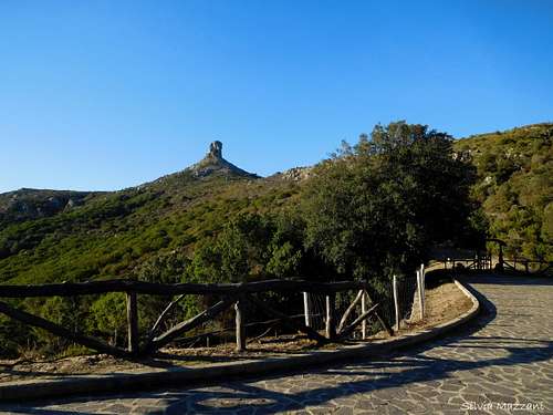
Perda 'e Liana seen from Pinningassu parking lot |
Road approach
Perda 'e Liana is reachable from several points of departure, here is described the access from the town of Lanusei. From Lanusei take the road n. 389 to Nuoro, pass the Arzana rail-station and at the rail-station of Villagrande leave the road 389 and turn to left (signpost "Montarbu") taking the road getting the Lago Alto del Flumendosa. Pass a narrow bridge, ignore a road to the left and continue along the long paved road overlooking the lake. Getting a junction with a monument to the Gennargentu, ignore the right branch and continue on the left. At a later junction, leave the main road and turn left (signpost Perda 'e Liana) and passing under an overpass drive to a place named Pinningassu with a stone paved parking lot, from which the peak is fully visible (info panel Perda 'e Liana).
Perda Liana Normal route
Perda 'e Liana Normal Route
Difficulty: IV UIAA
Climbing length: 50 m.
Exposure: E
Starting point: Pinningassu parking lot
A brief but advising route to get the summit of Perda 'e Liana, a natural monument full of charm
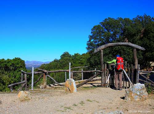
The wooden gate at the start from Pinningassu |
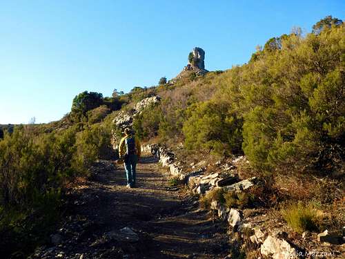
Start of the hike |
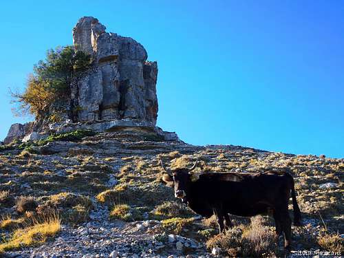
An unexpected encounter along the basal slopes |
Walking approach - From the Pinningassu car park pass a wooden gate and follow the well worn path bordered by several stones, heading from the North towards the superb monolith and reaching for a short while the circular and almost flat path surrounding the base of the tower. Here turn to left (signposts), ignore a right branch with the signpost "Fontana" and continue to lay the base until you reach the South-East side of the monolith, where another path coming from the left intersects the circular path. Here leave the circular path and begin to climb towards the wall along a clear track leading to the rocks and getting a steep yellow wall. Here head to right and overcome briefly a few outcrops, reaching a large flat terrace at the base of the starting chimney of the Normal route (sling on a tree inside the chimney, well visible some meters high from the ground).


Climb description - Climb the chimney by passing a short and small overhang (peg, then lanyard on the tree), IV UIAA. Continue more easily on the right derl chimney spur where the rock is best, reaching a tree with drawstring, then briefly on the topwood shelf (juniper with double ring). From here easily and briefly on steep terrain to the rocky summit blocks. The highest point is located on the left (cairn with a stick).
Descent - return briefly to the juniper equipped with a fixed anchor and from here and with an abseil at the bottom
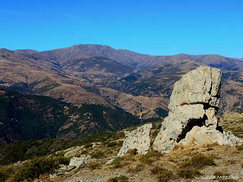
Gennargentu seen from Perda 'e Liana circuit |
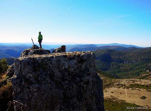
Perda 'e Liana highest summit |
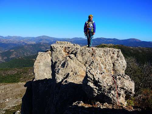
One of the different summit blocks |
Essential gear

Rope, helmet, harness, some quickdraw
Red Tape


No particular restrictions in hiking and climbing inside this area, inserted inside Parco Nazionale del Gennargentu e del Golfo di Orosei. The wild territory of the park belongs to the Nuoro, Ogliastra and Cagliari provinces and had been established in 1998. Its 73.935 hectares' extension includes 18 communes: Aritzo (NU), Arzana (OG), Baunei (OG), Belvi (NU), Desulo (NU), Dorgali (NU), Fonni (NU), Gadoni (NU), Gairo (OG), Oliena (NU), Orgosolo (NU), Seui (OG), Seulo (CA), Talana (OG), Tonara (NU), Urzulei (OG), Ussassai (OG), Villagrande Strisaili (OG).
When to Climb
The best period goes from May to the end of October
Where to stay
B & B and agritourism in the nearest towns (Villagrande and Lanusei)
Meteo
Guidebooks and maps
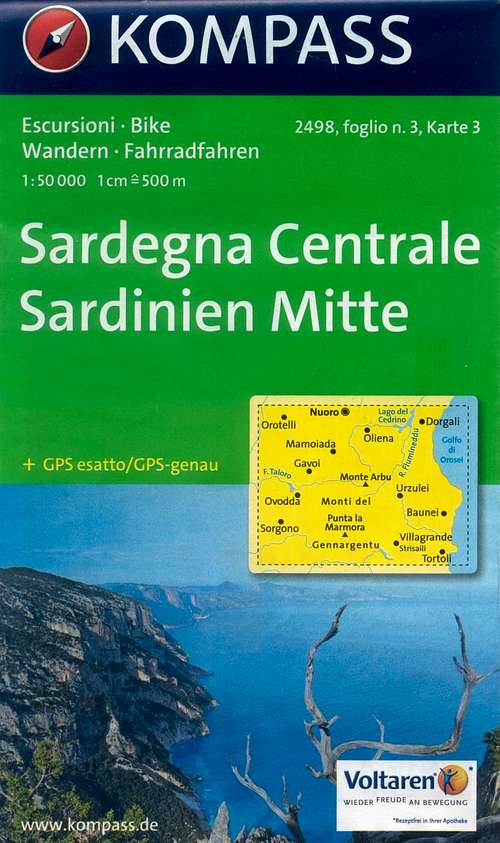 |
Sardegna Centrale
Kompass
Map 2498 sheet 3 - 1:50000
|
 |
Sardegna
Maurizio Oviglia
Guida dei Monti d'Italia
Club Alpino Italiano - Touring Club Italiano 1997
|