
-
 2664 Hits
-
 83.1% Score
-
 16 Votes
|
|
Mountain/Rock |
|---|---|
|
|
39.19179°N / 8.85219°E |
|
|
Sardinia |
|
|
Hiking, Scrambling |
|
|
Spring, Fall |
|
|
3110 ft / 948 m |
|
|
Overview
Monte Arcosu 948 m
Monte Arcosu 948 m is a mountain located in the Northern sector of the Monti del Sulcis, a mountainous area located in Southern Sardinia. The Monti del Sulcis, together with the Massicio del Monte Linas, from which they are separated by the Cixerri plain, form the Sulcis-Iglesiente mountain complex. Monte Arcosu, like most of the mountains located in these two mountain groups, is characterized by a rather modest height (a little less than 1000 meters). Only a few peaks in fact exceed 1000 meters of altitude. Due to its position and its truncated conical shape, it nevertheless assumes a decidedly imposing aspect and is clearly visible from the surrounding plains. On the top it passes the border between the municipalities of Siliqua and Uta, Cagliari province.
The origin of the name Arcosu, as well as that of the Monte Arcuentu, is the Sardinian term "árku" (meaning "arch"), which indicates the particular arched shape of the summit ridge.
Getting There
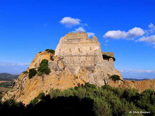
From the town of Siliqua, follow the signposts to Castello di Acquafredda and "Albergo Monte Arcosu" until you reach the hotel entrance. After about 400 meters you leave the main road and take a dirt road (signpost "Sa spindula waterfall") following it for several kilometers until it ends. The itinerary begins at about 200 meters above sea level in the locality Sa Spindula, parking near a house where the gravel road ends.
Monte Arcosu Normal Route
Monte Arcosu Normal route
Difficulty: EE
Difference in level: 750 m from locality Sa Spindula
Fine and profitable itinerary in a wild environment, fairly well-traced (white-red CAI trail signs up to the Sella Paddera). Some short stretches of climbing on easy rocks
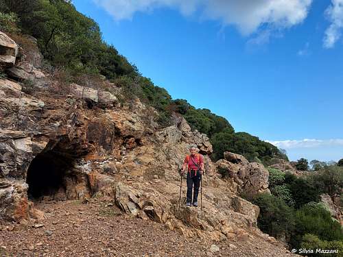
From the parking lot, immediately cross the stream (dry in late summer) to take a track in the SW direction (white-red sign at the start) that follows the fence of a sheepfold. Continue along the stream (the Rio Sa Spindula) on its right bank (left orographical) with a slight ascent, until you cross the river bed to go towards the Sa Spindula waterfall (dry at the end of the season).
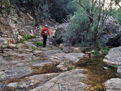
Without reaching the waterfall on the left, cross the stream again to take a gully that now climbs more steeply until you enter a lush valley. Continue to walk alongside the stream on its right side (orographic left) following an old mule track built by charcoal men in 1800, reaching a small old mine on the right at 360 m of altitude.
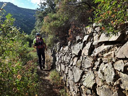
Proceed always along the stream on a well-marked path marked with white-red signs, reaching a short rocky stretch aided with fixed ropes. Just beyond a crossroads with wooden signs indicates to the right the direction to the Sella Paddera, a saddle between Punta Perdu Catta (616 m) on the left and Monte Arcosu (948 m) on the right, located at the base of the ridge that we will climb up to summit Monte Arcosu.
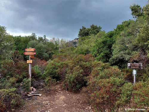
Now proceed in the dense wood, passing two points with wooden signposts, where you will always continue along the main path until you reach the large wooded clearing of the Sella Paddera 610 m, where you find a pole with different wooden signposts (there are no signposts to Monte Arcosu). Here the white-red CAI marks end, but the path to the top remains well worn.
From the saddle bend sharply to the right taking the first track on the right and proceed in the NW direction among thick bushes. Ignore a first junction with signposts on the left and enter a dense and dark wood, at the end of which you meet a second junction, where you again ignore the left direction.
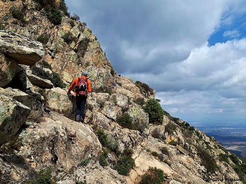
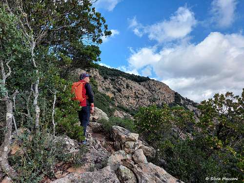
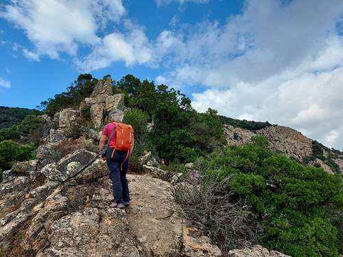
Now proceed on more open terrain with low vegetation, overcome some easy rocky outcrops, reaching a cliff where it starts a traverse on the rocks slanting right and aided with a fixed rope. At the end of the rocks the itinerary heads towards the left, entering the wood again and after a stretch with lower vegetation reaches a wide grassy saddle.
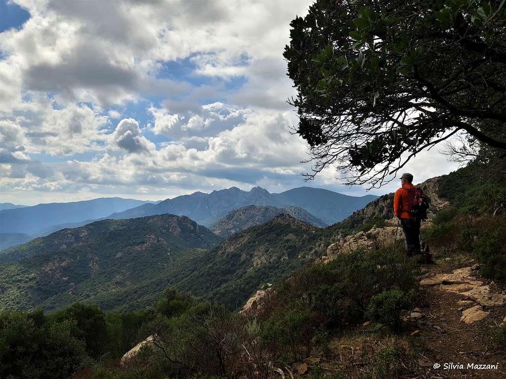
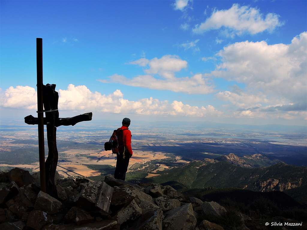
From here take the crest on the right getting to the small summit cross of the mountain in a couple of minutes. From the top, where the scrub is replaced by the prairie, the glance is remarkable; to the north, beyond the Cixerri valley, the Iglesiente and, in the distance, the peaks of Gennargentu; to the south, the whole of Sulcis and the town of Cagliari with the Mediterranean sea.
Descent: there are two alternatives. The simplest is to retrace the path backwards. The most complex is to make a loop. This second possibility requires that you go down the same route to Sella Paddera and from here follow the outward path for another 500 m until you reach a fork on the left. Here begins a track that develops inside the forest, at first flat, then uphill with gradually more uncertain passages.
Red Tape
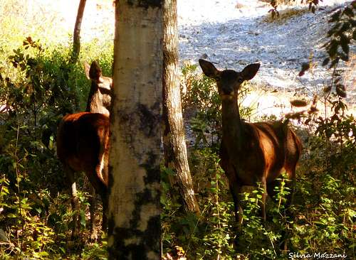
The mountain gives its name to the largest naturalistic oasis of the WWF Italy, the Oasi di Monte Arcosu in which it is located on its northern border. The Reserve is located in the Monte Arcosu-Piscinamanna forest complex which covers about 35,000 hectares. The area is wild and protected, anyhow there are no particular restrictions in hiking and climbing inside. The wilderness of the place favors the presence of a rich fauna, formed by foxes, wild boars, martens and above all by the well-known Sardinian deer.
Nature and climate
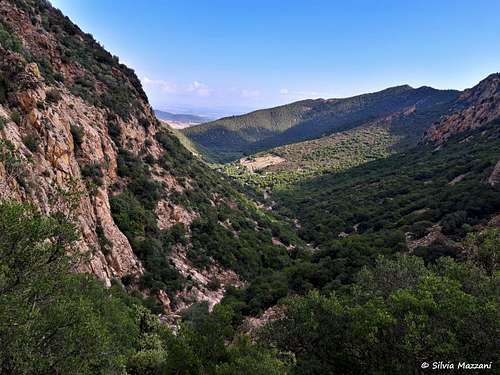
The climate of the area is typical of the Mediterranean, with mild winters and very hot and dry summers. The area has an impervious morphology, with steep and elongated valleys, in which, during the winter and spring, rushing streams flow, which are greatly reduced in the summer. The tall vegetation is composed of holm oaks and cork oaks, then heather, myrtle, strawberry tree and cistus are observed, but there is no lack of particularities, such as a luxuriant yew station and several endemic species.
When to Climb
All year round, except the summer months (too hot). The best season to climb Monte Arcosu goes from September to May.
Accomodation
Farmhouses and B & B in the surroundings
Meteo
Meteoblue Sardinia
Meteo ARPA Sardegna
Guidebooks and maps

- Sardegna - Maurizio Oviglia Guida dei Monti d'Italia Club Alpino Italiano - Touring Club Italiano 1997