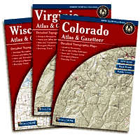
DeLorme Atlas & Gazetteer Series
| Page Type | Gear Review |
|---|---|
| Object Title | DeLorme Atlas & Gazetteer Series |
| Manufacturer | DeLorme |
| Page By | redsplashman23 |
| Page Type | Jan 24, 2007 / Jan 25, 2007 |
| Object ID | 2065 |
| Hits | 4742 |
| Vote |
Product Description
These atlasas are made for outdoor enthusiasts, offroad explorers, or anyone who desires to the the main roads. There is an atlas for each one of the 50 states.DeLorme's maps offer up-to-date detail. These maps show elevation profiles, back-country roads, mountain features, summits, and much more. They are easy to keep in the back seat of your vehicle to take with you on your trip.
Features
Map Details include:- Back roads, dirt roads, and trails
- Boat ramps
- Hidden lakes and streams
- Hunting lands
- Fishing waters
- Public lands
- Forests and wetlands
- Campsites and campgrounds
- Airfields, railroads, and powerlines
Gazetteer categories include:
- Hiking
- Bicycling
- Canoeing
- Hunting/Fishing
- Scenic Drives
- Museums/Historic Sites
- Campgrounds
- Unique Natural Features
- State and National Parks
- Forests

Reviews
Viewing: 1-5 of 5 |

CRiedel2 - Feb 6, 2007 2:51 am - Voted 5/5
Love My Atlas
I've been using my New York Atlas for a a few years now and I love it. I always make sure I have this along with me when I go up there. Great detail, I've never had to use another NY map for traveling around since I got this. Of course, for hiking, climbing, etc., you'll want more detail. But for it's intended purpose, this can't be beat. Highly recommended!

redsplashman23 - Feb 19, 2007 8:59 pm - Hasn't voted
Good Companion
I always have one with me when I venture out. Great source along with other TOPO map programs.

OOG - Nov 14, 2011 6:21 pm - Hasn't voted
Hit and miss
Some atlases are very detailed while others leave much to be desired. The Oregon Atlas has all forest service roads labeled and current, while the Northern California atlas shows dirt roads and trails as the same dashed red line, with no labeling. Best bet is to thumb through one before purchase.

seano - Feb 23, 2012 11:12 am - Voted 5/5
Essential
These are absolutely essential for dirtbag camping (and cost the same as a Forest Service campsite these days), and work in a pinch for hiking and climbing. While they're sometimes outdated, this can be a good thing: the CA gazetteer shows the abandoned but useful Milestone Basin and Marie Lakes trails.
Viewing: 1-5 of 5 |
tarol - Jan 25, 2007 2:23 pm - Hasn't voted
Used them a few times on road trips