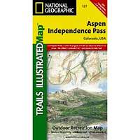
Aspen & Independence Pass Area, Colorado Trails Illustrated Map # 127
| Page Type | Gear Review |
|---|---|
| Object Title | Aspen & Independence Pass Area, Colorado Trails Illustrated Map # 127 |
| Manufacturer | National Geographic Maps |
| Page By | redsplashman23 |
| Page Type | Nov 10, 2011 / Nov 10, 2011 |
| Object ID | 7889 |
| Hits | 2925 |
| Vote |
Product Description
"Series: National Geographic Maps: Trails Illustrated | Publication Date: September 1, 2005Coverage includes White River, San Isabel and Gunnison national forests. Maroon Bells â Snowmass, Hunter â Fryingpan, Mt. Massive, Collegiate Peaks and Spruce Creek wilderness areas. Aspen and Twin lakes. Roaring Fork River, Lake and Lincoln creeks. 14ers: Mt. Elbert, Mt. Massive, Castle and La Plata peaks. Willis, Fryingpan and Evergreen lakes. Taylor, Midway, and Independence passes. Ski Areas: Aspen and Buttermilk. 10th Mountain Huts: Tagert Hut, Wilson Hut, Barnard Hut, Markely Hut, McNamara Hut. Includes UTM grids for use with your GPS unit."
Features
MapPublisher: Natl Geographic Society Maps; 2 edition (September 1, 2005)
Language: English
ISBN-10: 1566953588
ISBN-13: 978-1566953580
Product Dimensions: 7 x 3.9 x 0.7 inches


