Approach
Start from the Iowa Gulch TH. Look south to see the western ridge descending from Sheridan. It hooks around to the north before descending to Leadville. The route I took is basically the Northeast corner of the end of this ridge. It looks fairly steep, and it is in places. Cross the Gulch heading south straight towards this ridgeline ascent. You will cross the creek, and you may have to work your way through some willows. There is a short climb up the hill to the base of the ridge slope.
Route Description
From the base of the ridge, climb straight up the slope, making switchbacks if needed. The scree is very stable most of the way up. It doesn't get too loose until you approach the ridge crest just below "West Sheridan." Once you attain the ridge, enjoy the spectacular views of the Sawatch to the west. Then, hike south along the ridgeline up to the top of "West Sheridan." There is a large cairn here. Follow the ridge east from here down to a small saddle and back up to a high point where you will find a large hole and I believe a cairn. Continue east down to another saddle, then ascend up the Western slope of Sheridan. You may find bits of trail here and there, but until very close to the top, the trail is not very distinct. Once on the summit, you can consider climbing Horseshoe or Sherman and continue over to Gemini and Dyer. Descend either from the Sherman-Sheridan saddle into Iowa Gulch or from the powerlines in the saddle just below Dyer if you hike around to that part of the high ridge.
![]()
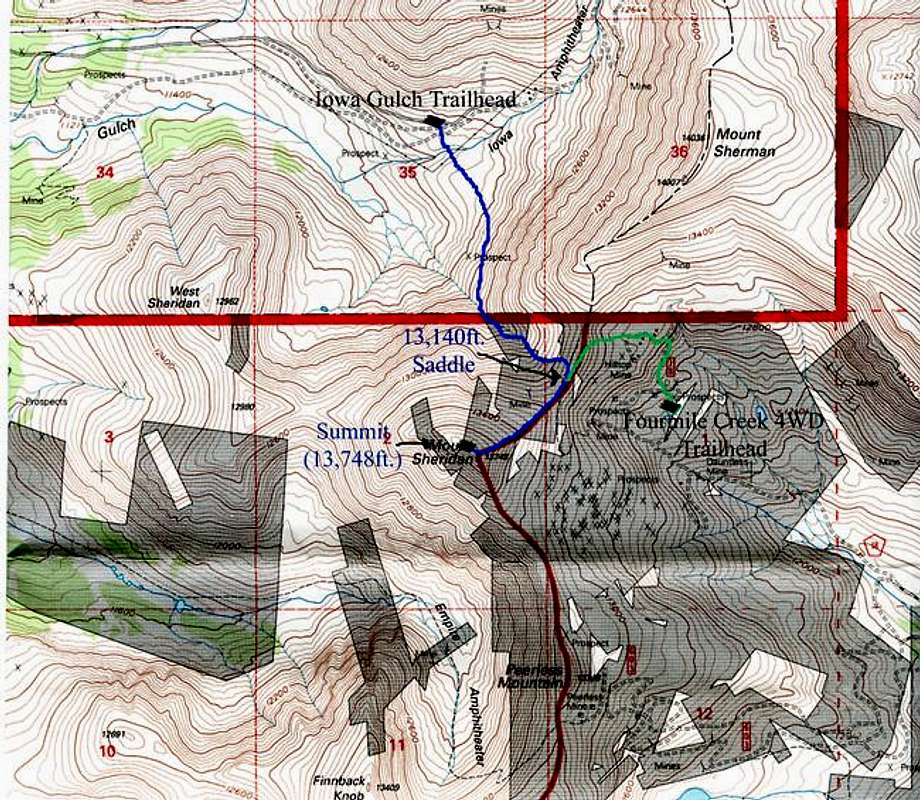
This map does not have the route drawn on it, but make a direct line from the trailhead to the northern end of the summit ridge of West Sheridan, then follow the ridge to West Sheridan then to the Summit of Sheridan. You could descend Sheridan following the Blue Route.
Essential Gear
An ice axe would be nice if snow is present.
Miscellaneous Info
If you have information about this route that doesn't pertain to any of the other sections, please add it here.