
|
|
Route |
|---|---|
|
|
39.20910°N / 106.1847°W |
|
|
Hike / Snow Climb |
|
|
Half a day |
|
|
Class 2 |
|
|
Introduction
This is a more obscure way to summit Mount Sheridan that will avoid the crowds on the Northeast Slopes and the standard route on Mount Sherman. This is also the better option for a ski descent versus the Northeast Slopes. Typically, the NE Slopes develop a large cornice that would prevent a good descent. This side is steeper, and holds good snow late in the year. It's also a great hike for summer months.
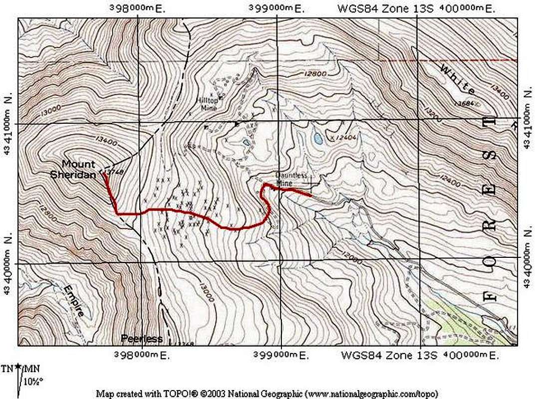
Approach
Leavick TH
From the town of Fairplay: Drive south from the junction of CO 9 and U.S. 285 for one mile to Park County road 18. Drive west on County Road 18 for ten miles until reaching Leavick ghost town at 11,240 ft. 4WD vehicles can continue for an additional 2.5 miles to a gated closure just below the Dauntless Mine.
Snow season closure varies, but is typically near the Leavick site. Plan the closure into your itinerary during snow season.
Route Description
Depending on where you parked based on your vehicle or snow closure, walk the remainder of the road until you reach the Dauntless Mine at 12,300 feet. Instead of continuing on the road, which is the standard route for the 14er Mount Sherman, take a turn to the south on an old mining road through the Dauntless Mine ruins. Stay out of mine buildings. They are on private property and they are dangerous.
Take this road for a short while until it ends. It will drop you off in a wide, shallow drainage that leads to the Southeast slopes of Mount Sheridan.. Follow it to the base of the steeper slopes of Sheridan.
There is a faint trail that follows the Southeast Ridge. This will be your easiest way up when there is no snow. Follow the faint trail to the summit.
Snow Season
This is a great route for snow on Mount Sheridan, and offers a nice ski descent. You will essentially follow the same route as above, but with the variation of climbing the snow that is always present on this aspect of Sheridan. The snow isn't too steep, and makes a nice intro snow climb. The ski descent is also fun, but get an early start due to the east-facing slopes. This ski is typically good until May or June on a good year. If you time it right, you should be able to ski back to your car.
Route Stats
Round Trip Mileage (from gated closure): 2.5 miles
Elevation Gain: 1,600 feet
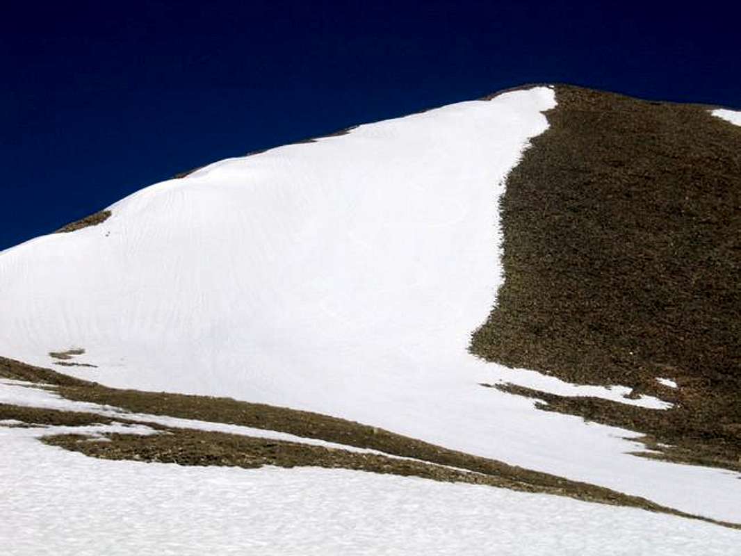
This photo shows the Southeast Slopes of Mount Sheridan. The summer route will follow the ridge proper, but you can climb the snow slope that is visible here during snow months. If you look closely, my ski tracks are visible.
Essential Gear
For summer hiking, nothing more than sturdy shoes and typical hiking stuff.
For snow season, snow gear will be necessary. The snow isn't particularly steep, but an ice axe and/or crampons might be nice when the snow is mature and hard. As always, be observant of avalanche danger. Visit the Colorado Avalanche information Center's Website for current information.
For a ski descent, you will be able to skin up until the steeper portion, but you will have to carry skis from there.