“Far better is it to dare mighty things, to win glorious triumphs, even though checked by failure...than to rank with those poor spirits who neither enjoy much nor suffer much, because they live in a gray twilight that knows not victory nor defeat.” -Theodore Roosevelt
This trip was something I had been wanting to do for years, I would day dream at school wanting to go up. I've had people ask me time and time again "so your a climber... have you climbed Rainier?" and I would always have to tell them I did not. Last year I was finally given "opportunities to climb Rainier, but it never worked out. I had two attempts which one of them was a wrecking experience Broken Dreams (aka Mount Rainier Attempt) which brought me into a major conflict which I called The Cold Conflict. I recovered some after this, and in late August had my Mount Rainier Attempt II which had its ups and downs. After this it was a long before I would have another whirl at it. Bad weather, transportation issues, and avalanche danger made getting the the trip hard to pull off, until came July.
Pre Day 1:
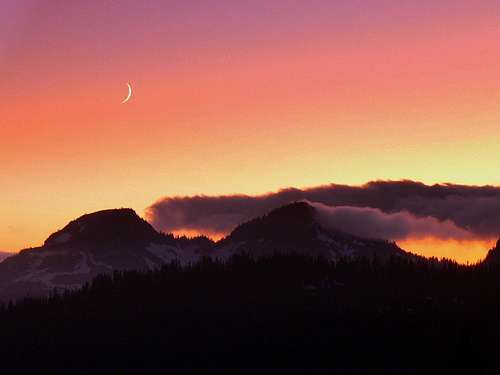
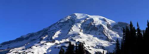
The trip idea sparked when Blueshade from Colorado wanted to climb Rainier and we spoke over the phone about the trip. Bill Rogers wanted to jump in on the trip, plus it would help us with transportation and it's always nice to have an extra person on the rope team. We decided to meet Bill in Tacoma in the late Afternoon, getting there was more of a hassle than I had expected. There was some getting to the bus station drama (I'll spare you the details). From South Lynnwood we took many buses, and it kept stripping our cash because they raised the price and transfers did not work with other buses. (Perhaps it's time I start biking everywhere?). Once we got to Tacoma we met with Bill and headed to Paradise. Mount Rainier still had some clouds swirling around it which gave it a beautiful look, and the sunset was very nice.
Sunset from Paradise on Mount Rainier
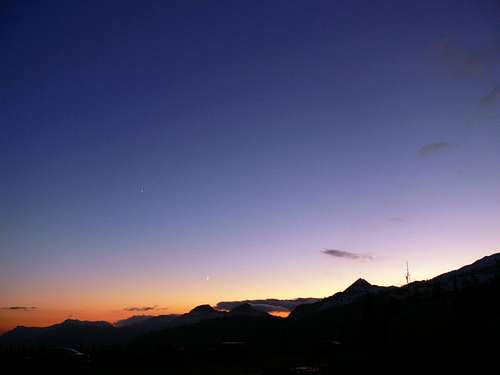
Mount Rainier during Evening
Mount Rainier during Evening
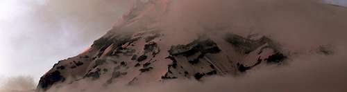
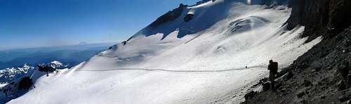
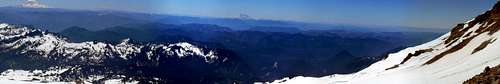
Success Cleaver Panorama
Day 1:
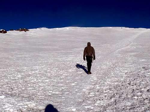
The next morning we woke up around 7 a.m. and wondered "how are we going to find Bleushade?". I told him I would be wearing a orange helmet and blue coat just incase. We saw a car parked right next to us and the license plate said Colorado, and sure enough it was Blueshade. From here we got the permit deal all figured out and we hit the trail.
Mount Rainier from the Trail head
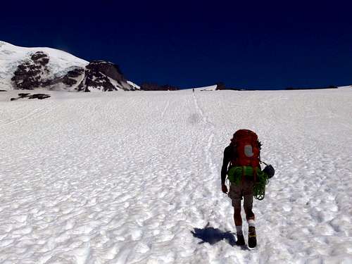
The hike up to Camp Muir was much easier (all those adventures paid off) than in the past. I met the osat while I was up there, which was good to know we had plenty of other people around just in case anything went wrong. At Camp Muir Blueshade and I waited for Bill and Michael to catch up. Once they got to camp, there was a debate on whether we should stay at Camp Muir or go to Ingraham Flats. We stuck to our original plans and headed for the Flats. Once we crossed the Cowlitz Glacier, things started to get more interesting. Just after passing a spot, a few seconds later rocks fell where we just were!
Heading up to Camp Muir
The Cowlitz Glacier
Looking towards Ingraham Flats
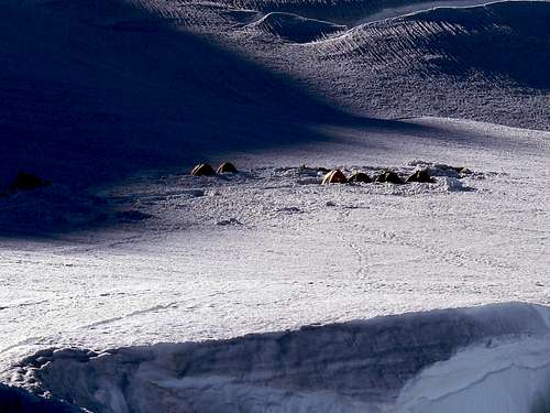
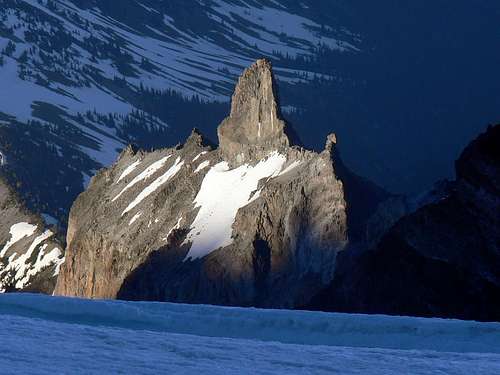
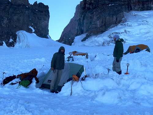
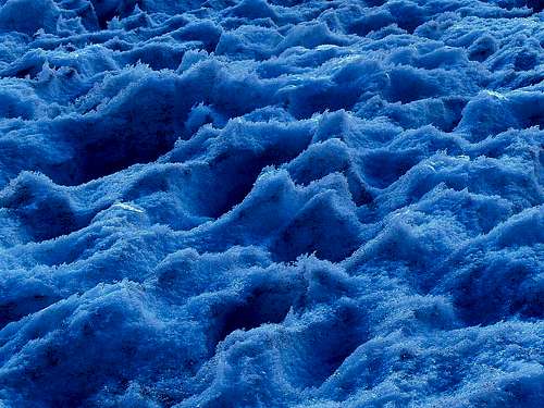
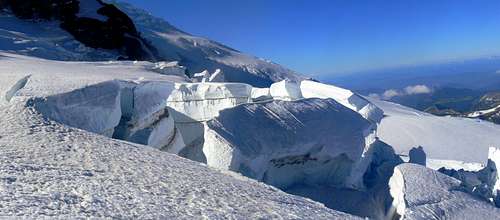
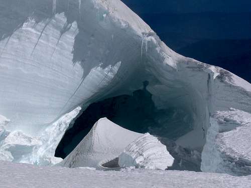
Once past the pass, we could see Little Tahoma and our route up the mountain. Soon we were at Ingraham Flats, and set up camp. I was a little surprised at how cold it was up at 11,000 feet in July. It was now very late in the day, so we had to cook our food, boiled our water, and get to sleep as soon as possible. It was neat seeing crevasse fields a little ways below our camp. To my amazement even though it was cold, I slept quite well.
Ingraham Flats
High Point near Little Tahoma
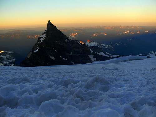
Sunset on Little Tahoma
The Camp
Beautiful Sun Cups
Crevasses near our Camp
(All interest in Photography was lost until near the Summit)
Day 2:
I woke up around 2 or so, which Blueshade now agreed to wake up. Many climbing parties had already passed by us in the night while we slept in a little. "I slept well" I told Blueshade. "Good for you Goldilocks" he replied which I found it amusing. Now it was time to wake up to the problem that was neglected... could Bill summit? Bill had a slow pace going up, Bleushade did not want Bill heading up with us because he worried it might ruin our chances of summiting. He did not want to tell Bill that the could not, and perhaps hoped for another way. I felt like I was in the middle of the tension. "What to do, what do do" I thought to myself as I was walking back and forth trying to make up my mind. Eventually I decided I wanted Bill to at least have a chance, I remembered what it was like myself last year when I was not given a chance, and sure enough I believe I made a good call here.
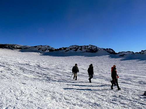
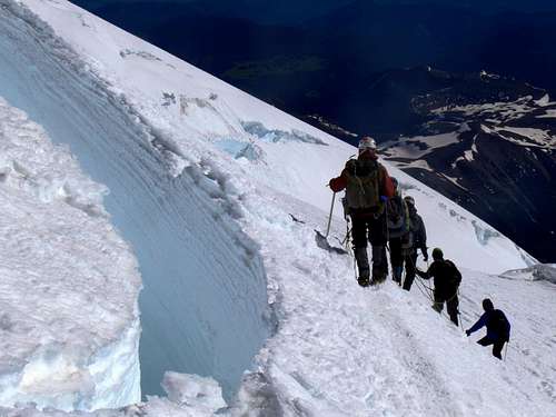
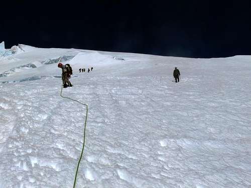
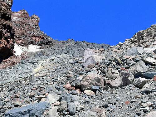
As we headed up onto the Disappointment Cleaver, I believe I hear more rocks fall in the distance which had me a little concerned, suddenly I was hit with a spell of the umpa lumpas, and started rhyming in my head (as seen at the Start of the trip report). Bill was using a flash light which was running low on power, I found out real quick that this was starting to look bad for Bill. I used my headlamp to help him find holds and such as we scrambled up this one rock section. Eventually things got a little nicer for me, until we reached 12,000 feet. There were some issues that went on (don't worry not conflict ) and as I sat there waiting for about 40 or so minutes, I was becoming extremely cold. As I watched the faint glow in the horizon and I kept getting hit with the winds, I was shivering a lot. Eventually Bill had to decide to turn around here, it was a unglaciated spot, and he got associated with another team that was going down, and from here on it was the three of us. We still had communications because we had three radios total.
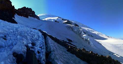
Although the rock fall danger was now out of the way, now we had to traverse around crevasses. The air was starting to feel thinner, although I was still in high spirits that I would be fine on the summit. As the morning colors came on, the sun rose which was red like fire. I was to into the climb to take photographs (plus Blueshade seemed very much not wanting to stop). As the sun got onto us, the temperature rose, and my heat became itchy from the helmet. I went a while with trying to ignore it, but eventually it became too much for me, so I paused, and took it off. This was a big mistake, I some how dropped it, and it went tumbling down the hill, and we all thought it was gone for sure, but I decided for entertainment reasons I would watch it roll away. It just so happen to be rolling in the boot path which I watched with amazement, and then suddenly it stopped! We were all amazed. From here, I had to go back down and get it and go back up.
Blueshade heading up the last part
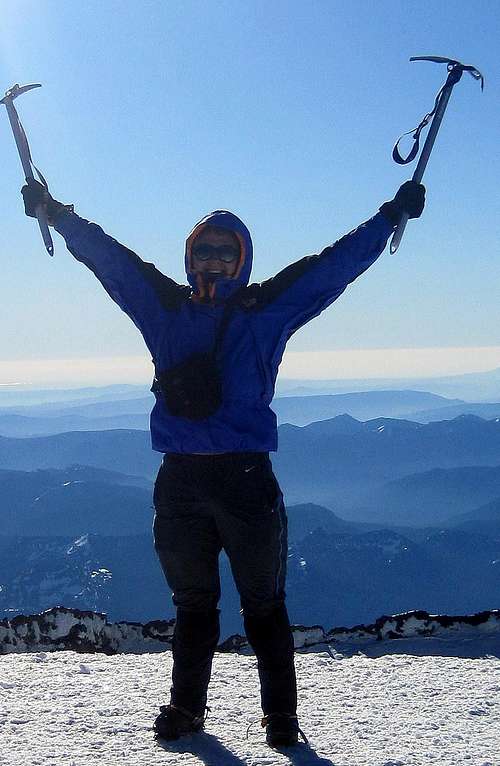
Going to the summit seemed to go on and on, when we got to what Blueshade thought would be the summit, he said "What! There's more?". I laughed in my head because I knew there was still more even after getting to Columbia Crest, but I did not say anything because I did not want to discourage our team. After pushing on up to the Crater, we get shielded from the winds which was a relief, and we take a break. From here I carry only my camera and ice axe for the last 1/3 or so mile to the summit. I was amazed to find out that there was a little slope to the Crater walk, and we had to take a few breaks in the short distance (perhaps the thin air had an effect). When we get near the summit, for the last 20-30 feet Michael and I race to the summit which proved to be a bad idea, immediately I got a headache. Then we stopped on the summit. Victory was Ours!
Victory was finally ours!
Climbers heading down
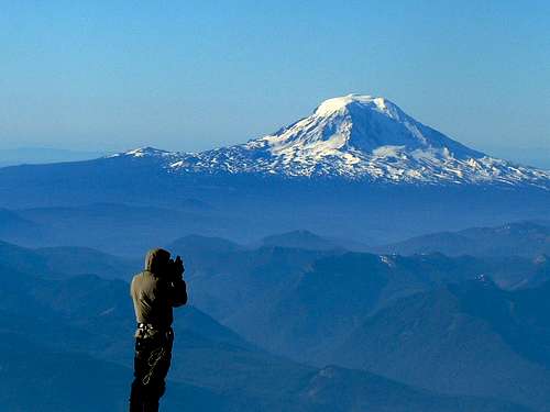
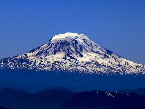
Blueshade taking a picture of Mount Adams
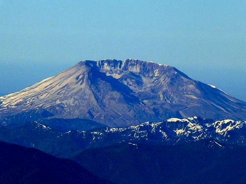
Mount Saint Helens
The winds on the summit would never let up, so we only spent 10-15 minutes on the summit, which part of that time was resting. Blueshade was getting cold, so we had to take a few photos, and get ready for the decent. The way down was easier than I had worried it would be. We would head down 1,000 or so feet in little time, when going up it would take so much longer to go up. It was amazing how much harder the last 3,500 feet of the mountain was compared to below. Blueshade finally confessed that it would not be wise to do it as a single day trip (we earlier talked on the way up Camp Muir and he believed it would be doable in a single day). Once the snow thawed a lot, we got to the usual plunging in the snow.
Near a Crevasse
Looking Back Up
Interesting Crevasse
Once back at camp, we were able to pack up our tent and get ready for the rest of the distance. From Camp I saw major rock fall come off of Gibraltar Rock. When heading towards Camp Muir there was some more rock that fell right in front of me. "The Mountain is out to get me" I thought as I carefully descended through the rock section. Fortunately we made it safe to Camp Muir. It was neat to see how much warmer Camp Muir was compared to Ingraham Flats, now it was actually warm out.
View from Camp Muir
Mount Adams from Camp Muir
Looking back up the Boulders
The rest of the way down there was much slush which was no good for sit glissades, but great for run glissades. Even though the way down took a long time, it was not as bad as I had feared. Soon we reached the parking lot. As I waited for Bill and Michael, I was so tired that I slept on the side walk for perhaps an hour or so until they arrived. From here Bill drove us to Tacoma, which was not the end of our adventure, it was bus time.
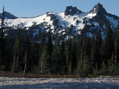
Tatoosh Range from Paradise
As I was riding one of the busses home, there were no more available seats, so the only place for me was standing next to the door. As the bus drove, I would nearly fall on the floor with my heavy pack and would have to hold on to railings. At one point when the bus really jerked, I fell on the door, the door partly opened, and I pulled myself out of there as fast as I could. "Wooo, that was a close one. Is the bus going to create more dangers for me than Rainier?".
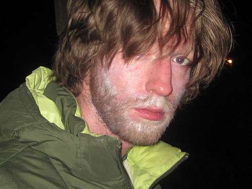
Tired after climbing Rainier and waiting on buses
Then on the way to Lynnwood I happened to meet another guy who I met on Mount Pilchuck on the 4th of July. He was the first person to introduce me to the card game Hearts. Sometimes it's a small world after all. Once we got to East Lynnwood, we had to walk a ways up and down a big hill until we reached the last bus. When we got home it was very late at night. I slept for 14 hours that night. But I made up for it by going on another backpacking trip soon after.
This was a very fun adventure, there were some things learned, and met a new person. Bill seemed pleased that we got him to 12,000 feet, although I could come with him when he retrys this mountain. After this trip I was glad to have made it, someone once told me that I could not make it. That was far from true, I was also told that this would be 10 times harder than the hardest thing I have ever done, which was also not true. Jolly Mountain still kicked my butt more than Rainier. But after all the struggle for Rainier, Victory is Ours!
Special Thanks To Bill for driving, Blueshade for providing the rope, and Michael for carrying the tent. Click Here to see Michael's trip report on this trip.
Parents refers to a larger category under which an object falls. For example, theAconcagua mountain page has the 'Aconcagua Group' and the 'Seven Summits' asparents and is a parent itself to many routes, photos, and Trip Reports.