
Comments
No comments posted yet.
|
|
Trip Report |
|---|---|
|
|
46.83547°N / 121.74875°W |
|
|
Jul 8, 2012 |
|
|
Hiking, Mountaineering |
|
|
Summer, Fall |
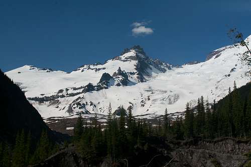
A trifecta you say? Well that means three peaks but not just any three, these peaks are among the biggest in Washington and actually form a huge triangle in the southern part of the state. Can you guess which ones they are? If you said rainier, Adams and Saint Helens you are correct. I did these peaks on different climbs over a three year period (power in threes!) and the growth I have sustained as a mountaineer is clearly seen in these three different trips. I went from a follower clueless as to what to do in the mountains to someone who can lead and organize a safe Rainier climb. Read on to see my progression and hear the stories on three of the five Washington volcanoes.
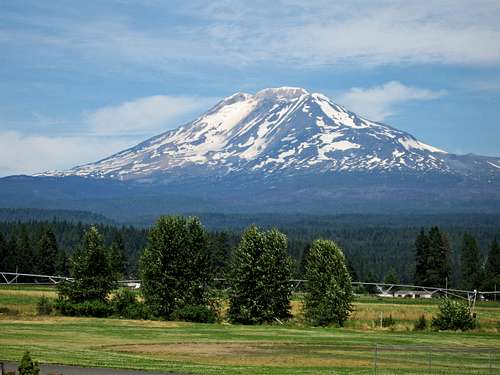 Mount Adams from the highway near Trout Lake | 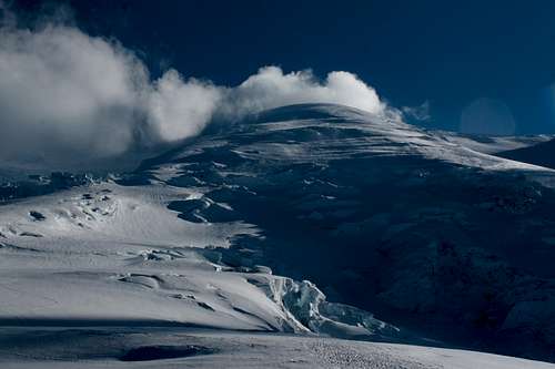 The Emmons glacier route on Mount Rainier | 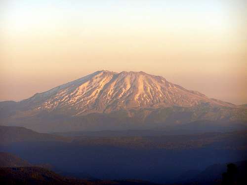 Mount Saint Helens - Photo by Gimpilator |
It was the summer after my first year of college and I was back in Washington. Around mid-June that summer, a friend of mine (Tom) wanted to do something cool for his high school graduation before heading off to college for his first year and told me he wanted to climb Mount Adams and wanted me to come with him. Now this was back in 2009 where the only outdoors experience I had was a few backpacking trips on trails in the Cascades and a couple easy Colorado 14er hikes. The thought of climbing a mountain like Mount Adams was very daunting to me at the time. I had never climbed on snow before and all I knew was that that thing you use to arrest with...well I didn't have one or even knew how to use it so I agreed to Tom I'd think about it and see what I can come up with (I was great at organizing and planning even then...a skill he lacked). So I asked around looking for advice on whether or not this is something we should even do. Obviously my parents said it was a horrible idea but when I realized there was a route on Mount Adams without glacier travelling, I suddenly realized there may be a glimmer of hope we could do this...so I continued to plan.
I eventually found an adult (whose name escapes me) with a decent amount of climbing experience who agreed to go with us as an experienced mentor to make sure my three friends with this crazy idea (Tom, Spencer and Ben) and I didn't do something dumb. He also brought his son so we had a group of six and the idea was becoming more of a reality. We all agreed on a Friday-Saturday climb noted in the dates above. We had a few meetings and a couple training hikes beforehand as a group and I managed to borrow an ice axe and some mini crampons that fit on the boots I had at the time (which were far from ideal). We finally managed to finagle all the gear we would need for each one of us and since I had the only working car I offered to drive the four of us down while our mentor and his son drove down separately. Around 4am the morning of July 19th we all loaded up in my 1987 Camry (my first one!) and were off. Truly a bunch of beginners like the ones I see today and laugh at, headed for an advanced hike. Things always have to start out wrong and halfway down to Portland Tom realized he forgot his boots (you're kidding right?) Nope...not kidding he forgot his boots so we agreed to stop at the REi in Portland for him to rent a pair. Once in Portland, I spent at least an hour driving the streets stopping anywhere for someone to tell me how to get to an REI that we didn't know for sure even existed. We managed to find one on the south end of town only to realize they didn't have a rental department and they referred us BACK to downtown! So we drove another 20 minutes to where we just came from (wishing I had a Garmin about now!) and he managed to find a pair of mountaineering boots to rent for a couple days. Sweet....so off we continued to Hood River where we agreed to meet our Mentor at noon. Well it was noon and we were just leaving Portland! About 1:30 we met up and ate lunch. We crossed the Hood River bridge (sketchiest bridge ever) and finished the drive to Trout Lake and up the steep gravel road to the South Spur trailhead.
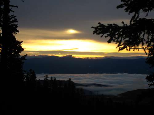
By now I was just about out of gas but I figured I can fill up in town after the climb. We packed up and started up the trail. One thing we really did luck out on was the weather. That whole week was one of the hottest heat waves in Seattle history and it was 85 degrees and sunny at the trailhead...downright hot! We slowly headed up in elevation along the well defined trail to treeline stopping to take photos quite a bit. Just above treeline there was a short but steeper snow section to gain a ridge and there was a section of the hike on the crest of a prominent ridge. We didn't get all the way to Lunch Counter but found some nice rock walls about 600 feet below right at the bottom of the permanent snowfield. We set up camp and watched the perfect sunset and looked up towards the summit to see the long snowfield we had to climb. I was nervous as hell and I kept asking if we would be able to make it up. I saw others with full crampons which i didn't have but our mentor just explained to me if the snow was hard from the night we would just start a little later. So we went to sleep...it only got down to about 50 degrees that night which is very warm for 8000+ feet.
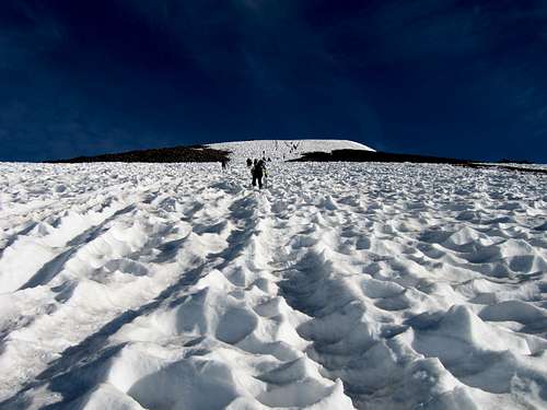
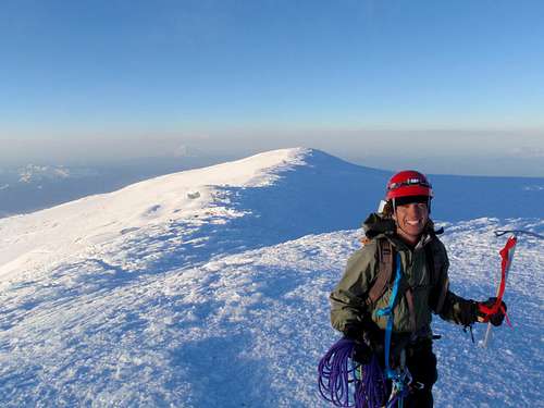
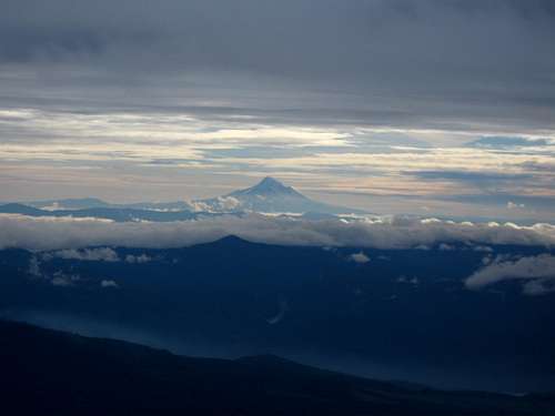
The next morning we got up around 6am and the snow was kind of hard but we were all so excited to get going we skipped breakfast (why....just why did I do that?) and started up the snow which was very gentle at first. We actually made it up to lunch counter in great time shortly after the sun started hitting us. We took a nice break and here we decided to split up since we were clearly going to be going at three different speeds. There were so many other people on the mountain that day it wasn't a big deal. So Spencer and I went on ahead following the massive boot track up the steeper snowfield. It followed right next to the glissade track that looked awesome to slide down! Our mentor and his son were shortly behind and Tom and Ben who carried the beer were in the third group. I actually passed many people on my way up to Pikers Peak and was feeling quite good physically. I never got intimidated being on the snow but the huge flat sun cups made it nothing more than a large staircase. Around 10am I made the summit of Pikers Peak and Spencer and I traversed the flat section towards the final summit climb. That last 600 feet to the summit was very grueling since I didn't eat that morning and my blood sugar was ultra low. But we made it and I was very happy to have climbed my first Bulger (not that I even knew what a Bulger even was LOL) and I cooked my breakfast on the summit. We had some nice conversations with others and enjoyed the views of Rainier, St. Helens and Hood. We were so high above everything else it was hard to comprehend.
Our mentor summitted just as we were about to start down and he gave us the 1 minute crash course on how to glissade. As we headed down towards Pikers Peak we saw Tom and Ben heading up. They were probably going to drink on the summit so I asked them to make sure they remember the way down. For my first glissade, I just happened to be on one of the longest and best glissades in Washington. I think i did quite well as I never went out of control. Spencer and I made it down 2,500 feet of snow in about 15 minutes and waited for our mentor to finish the hike back down to camp with. We finished the hike down the soft mellow snow to our tents where I thought it would be an awesome idea to slip and fall...however scared I might stab myself with the axe I threw it fifty feet in the air causing a hazard to society. After that I quickly learned how to fall with the axe on flat terrain from about 10 people surrounding me. Once back at the tents we waited for Tom and Ben while we filtered some water and ate some food. It was about noon when we returned to camp and we waited....and waited...and waited some more. We began to worry and it wasn't until 3pm until they got down. Low and behold...they got lost and burned precious time. We needed to be back to Portland by 10pm to return Tom's rented boots. So we hurried up and threw everything in the packs and started down the trail. I managed to get on ahead and lost the trail (followed the ridge too long). Luckily I had my map and realized I would soon hit the trail circumnavigating the mountain which I could get to and follow it east to meet up with the south spur trail. I did that and met up with everyone else at the junction. We finished the hike out all together and once back at the cars we were relieved we all made it back in one piece! We even managed to get back to Portland just in time and after returning the boots it was off for some huge pizza at the first pizza place we could find. I made the rest of the drive back to Renton while they all slept on me...thanks guys :)
 Ascending the south route of Mt. Adams | 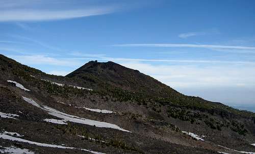 Small cinder cone on the slopes of Mt. Adams | 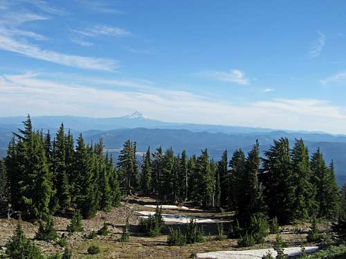 Distant Mount Hood to the south |
 Ancient lava flows seen from camp | 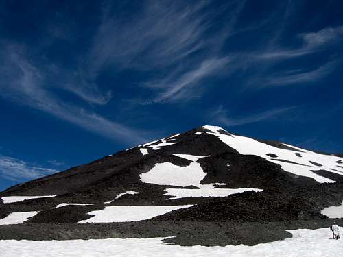 Looking up at Mt. Adams summit from camp | 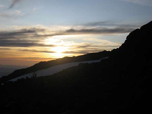 Sunset from camp |
 Ascending the steep slope to Pikers Peak | 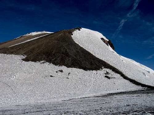 The final push to the summit | 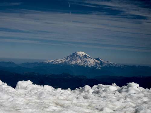 Rainier from the summit of Adams |
Three years after my Mount Adams climb, I am a different person, a different climber and have a completely different perspective on both life itself and climbing. A friend from Colorado (Andrew) asked me if I would do Mount Rainier with him to which point I quickly thought about my summer plans and realized that would work perfectly. Josh was getting a bus ride down to Colorado and this would be a perfect way for him to get back home. He would also be able to join us on Rainier. My roommate (Stephan) joined as well and later on a fifth joined our team (Eric) who met us at the trailhead. Andrew agreed to drive the four of us from Colorado in his car. Josh, Stephan and I met up at his house on the third of July and on the 4th we all headed out early in the morning. We alternated driving and went straight through to Mount Rainier and arrived at the White River trailhead at about 3am on the 5th where we all napped in the car for a few hours. That morning we went to the ranger station to get the permits (where we saw a huge line). We hit the first perfect weather window of the entire year and it was the 4th of July weekend so we expected MANY people. After waiting a half hour we got the permits (which cost $30!) and parked at the trailhead. We all geared up and started up the trail which very quickly became covered in snow and we were hiking on firm snow to treeline at glacier basin. I took one look at the inter-glacier and realized we didn't have to rope up for it since it was clearly no longer a glacier. So we slowly made our way up the snow following the well worn path through the snow. We were all feeling well and made it to Camp Schurman in great time. We were all pretty tired but not completely exhausted. We found a few open platforms to use to set up the tents. It was neither cold or windy at camp which was awesome. It was a beautiful afternoon and we saw climbers coming down the mountain. To my surprise I saw three other people I knew from Colorado (one of which is SP's own Monster5) at camp and spoke with them quite a bit about climbing and the route itself. We spoke with the climbing rangers a bit too who were awesome to talk to. Turns out the day before my friend Matt just passed through camp on his way down Liberty Ridge...we just missed ya man!
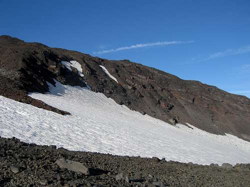
 Our first views of Little Tahoma | 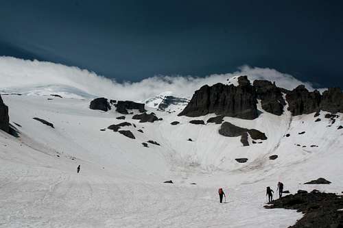 Hiking up Glacier basin | 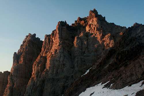 Loose crap above Camp Schurman |
 Nice views of Little Tahoma from Camp | 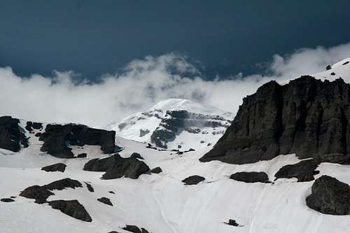 Our first unobstructed views of the summit | 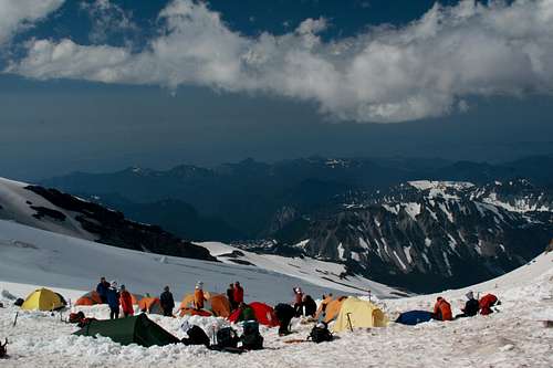 Crowded Camp Schurman |
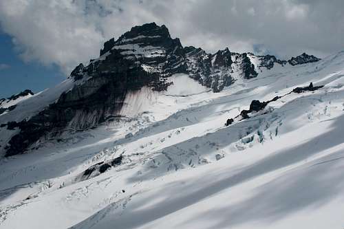
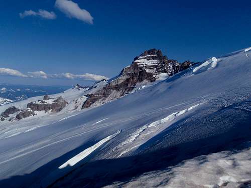
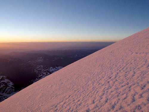
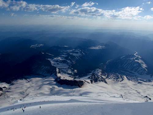
As the sun was setting the views across the Emmons Glacier to Little Tahoma were breathtaking and looking up at the route left us in awe. The crevasses were huge...just incredible to look at. We planned to spend the second day relaxing at camp and practicing ice axe arrest and crevasse rescue and Z-pulley since we all needed a refresher and a couple of the guys on our team had never been on snow or glacier before. We had a nice warm day going over the crevasse rescue process. I spoke with more climbers on who came down about the route and we heard there is a very thin snow bridge to cross which got us a little worried. We easily saw where it was as there was an area where there were huge seracs about halfway up the route. Later that afternoon we saw skiers coming down the route and all I could think of was craziness! I thought that was insane...one wrong turn and you'd probably die. We agreed to be up at 11pm and start moving by midnight to try and be ahead of the 15 other rope teams at camp. It was a busy place at Camp Schurman the whole time we were there but the people were cool. By 7pm I was asleep with 5 alarms in the tent. What felt like 5 minutes was 4 hours and we had to get going. I made a quick breakfast and we roped up. Stephan, Andrew and I on a team of three with Josh and Eric on a team of two. We started up the route right at midnight and quickly passes Emmons flats where we saw even more people camped! We soon found ourselves passing a number of rope teams who started just before us. There was a backup at the seracs where people had to cross one at a time over the small snowbridge which wasn't a problem at night when it was frozen. Shortly after we crossed over we passed the remaining teams and we began leading the charge up the Emmons Route pulling further ahead of everyone else. The upper mountain we had to ourselves and the sunrise was nothing short of spectacular! I noticed we were slowing a bit but only as we reached the crater rim. The final 5 minute walk to the summit was very memorable albeit windy as hell. I was amazed how we went from calm winds to 50 MPH just by reaching the crater rim. We reached the summit and literally cheered, grabbed some photos and quickly headed off the rim to take a break just below where the wind was less. We were all very excited to have summitted but we had the descent still to come.
 Little Tahoma sunset | 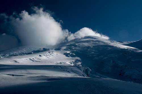 A look up towards the summit | 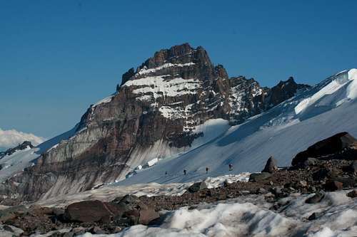 A team of skiers traversing the Emmons Glacier |
 Climbing the upper Emmons Glacier at sunrise | 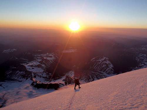 Sunrise from 13,300 feet on the Emmons Glacier | 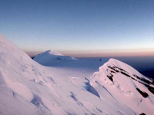 Liberty Cap |
So we began slowly hiking down the glacier following the same path we took up. The winds whirling off the crater made for some very interesting cloud formations. We took our time going down since we had to navigate our way through many rope teams who were still going up. We also started to have the snow ball up in our crampons as the sun warmed the snow slightly. It really wasn't too bad though. We were passed by a team of two who just got off Liberty Ridge right as we bot back to the thin snow bridge at the seracs. They ran across just before us and we decided to send Andrew across and put a directional picket just in case the bridge broke on either of us. One of his feet punched through but he made it across. I made it safely across and Stephan, who is the lightest made it easily across but more in this later. The rest of the slog down wasn't bad and we made it back to camp around 1pm at which point we took a nice long rest and once again spoke with our friends at camp. It was an all around beautiful day and the summit stayed clear all day. We broke camp and parted with Eric who was going to head down later. So the four of us continued back down the inter-glacier which was an awesome glissade which is much better than walking. I managed to call my parents to say we were on our way down and to let them know when we would be back. From the bottom of our glissade, the hike out the trail seemed to take days! I hear it always does but we sure were glad to get back to the car to head to my house for dinner.
 Stephan on the summit | 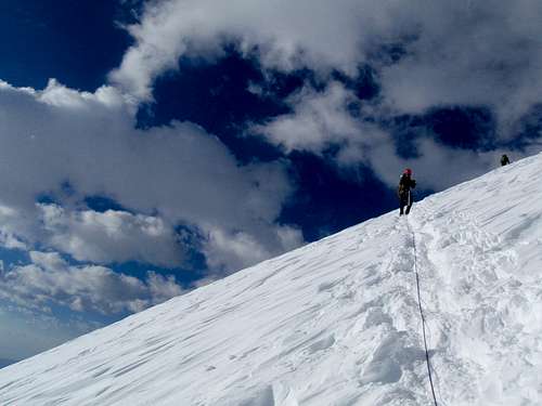 Beginning the descent | 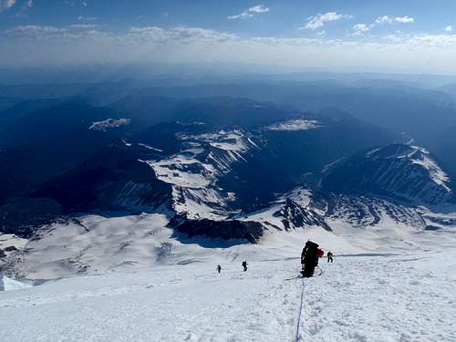 Looking down the abyss |
 Long ways down! Look at the line of climbers... | 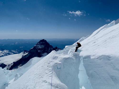 Crossing the sketchy snow bridge | 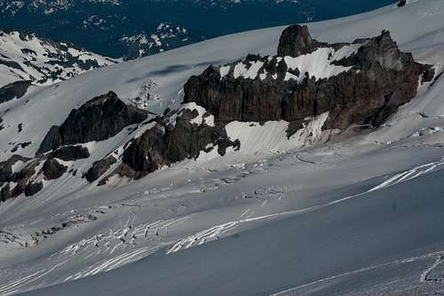 BIG crevasses on the Emmons |
So that sketchy snow bridge I was talking about...turns out that when we returned to camp, as we were packing up we heard that merely 20 minutes after we crossed it it gave way when a woman sat down to start across. She didn't fall but just about everyone behind us headed up that morning were not trapped and had to locate a different way down. Everyone eventually made it down but the moral of the story is that had we been 20-30 minutes later it could have failed with one of us on it!
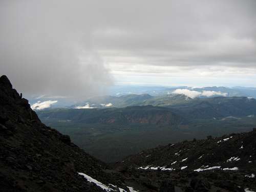
This climb really doesn't fit well with the mood of this trip report but where else am I going to put it...figured I'll just throw it on the end here. The weather called for semi-decency to I called out on NWHikers to see if anyone was interested in a Friday jaunt up Saint Helens. Pat responded and we agreed to give it a go. I met him at a hotel about halfway down and we carpooled from there early that morning. We got to the trailhead without any problems but we could easily see it was going to be a cloudy climb. At first we had an amazing sunrise from the trail and views to Mount Adams were incredible with all the fresh snow on it. We broke treeline and started up Monitor Ridge. Only 1000 feet above treeline however we entered clouds, then patchy snow, then eventually continuous snow. At times there was 6-10 inches of fresh snow covering rock which was tedious but I led through and we broke out on the upper slopes which was a simple hike up somewhat ice snow. Pat didn't have traction so I gave him my microspikes to use while I used the crampons. That probably saved his day and we continued up in a whiteout. We kept looking at the altimeter knowing we had to hit a huge cliff soon. We finally got to the crater rim where the winds tripled in speed. We avoided the cornice and turned left, followed the rim a ways to the true summit and were greeted with some peak-a-boo views...but that was all we got. Since the winds were not showing any signs of relenting we quickly headed back down. Once we got below the clouds we could see once again and some of the photos actually came out nice. We were back at the car well before dark.
 Sunrise from the trail | 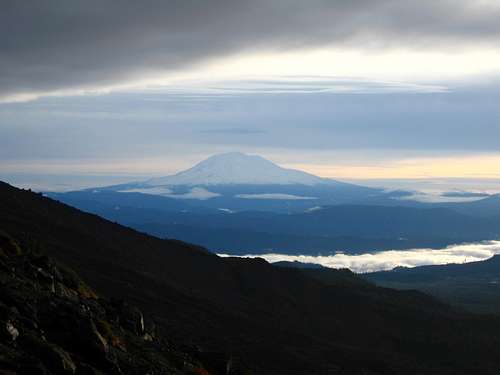 View of Adams from Monitor Ridge | 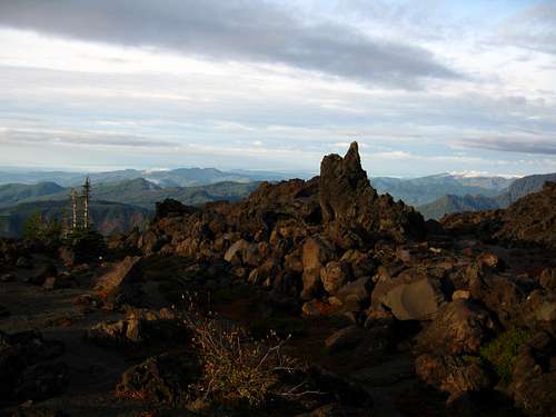 Cresting Monitor Ridge |
 Reaching the clouds | 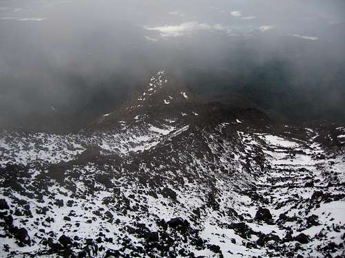 Looking down the ridge as clouds move in | 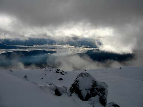 Looking southeast in a peak-a-boo view |
 Mount Hood from St. Helens | 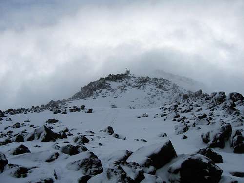 Looking up in a brief clearing | 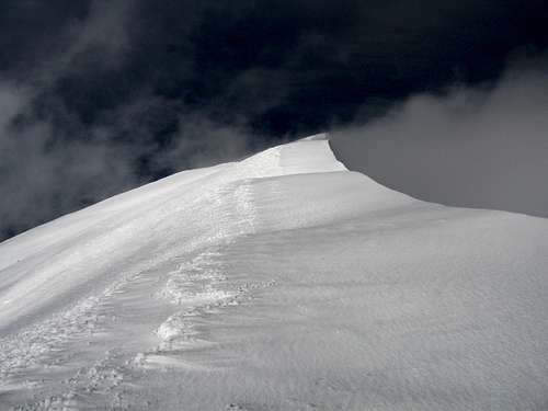 Looking west along the crater rim |
 Can't see a thing! | 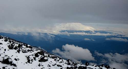 Mount Adams on the way down | 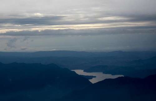 Yale Lake on the Lewis River |