
Comments
No comments posted yet.
|
|
Trip Report |
|---|---|
|
|
18.66063°N / 73.46276°E |
|
|
May 31, 2018 |
|
|
Hiking |
|
|
Summer |
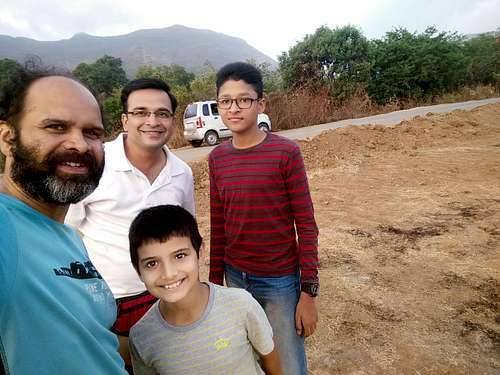
It had been a whlile since I and Saket (my colleague from MIT) did our first trek together, which was Sudhagad. We hit it off quite well, and decided that we should be doing this more often. And, that too - with our respective kids!
Time was ripe to go on a trek, and I and Saket decided to go somewhere. Our first option was Kalavantindurg, which is known for its sheer vertical faces, and steep drops,
on which - one slip and you are hurling down the face! I was not at all scared but was scared for our kids, as I felt that we should go to this fort when we are fully equipped with a rope etc., although it is not a rock climb. So, the next target that I spelt out was Fort Tung, which is on the other side of Pavana Dam.
I and Yuvaan had gone to fort Tikona, which is on this side, and had decided to go to Tung someday. However, its had been almost more than a year that we didn’t get a chance.
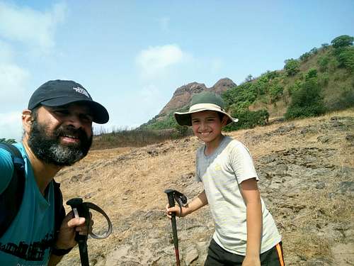
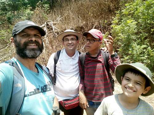
So, here we were - Saket and his son, with me and Yuvaan in a car going towards Tungwadi, at the base of Fort Tung.
We had to ask around a bit, but eventually we reached there. Saket was reminded of his memory of having climbed Tung a couple of years back, when he climbed it, descended, crossed the Pavana Dam by foot, as the water had receded due to extreme summer, and they had gone ahead and climbed Tikona after that!
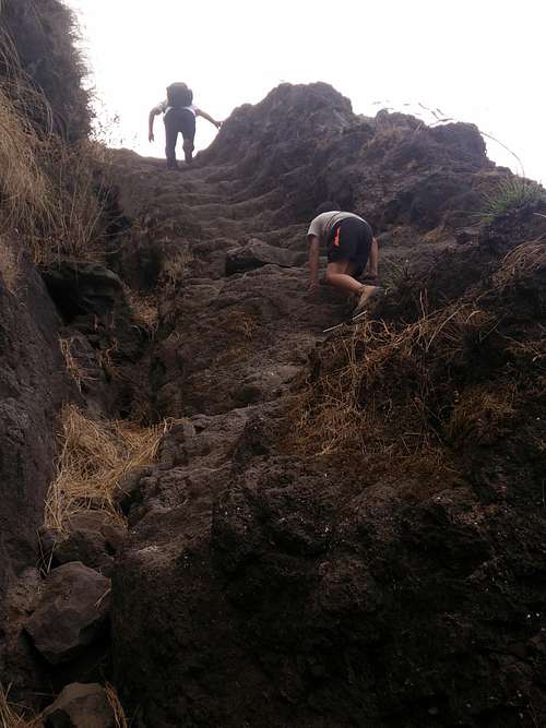
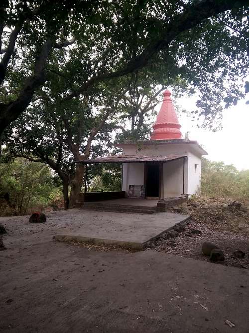
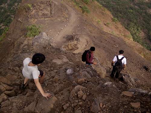
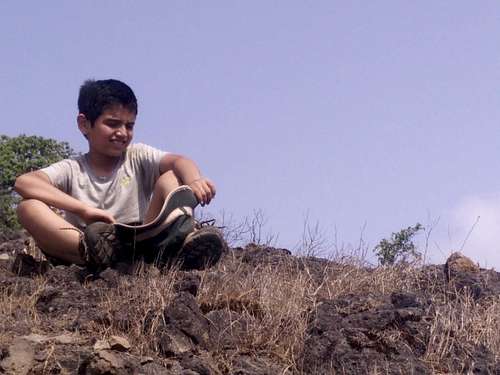
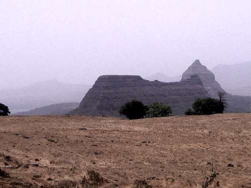
The temple at the base is quite an old one, from the look of it. We took the blessings from the deity, and proceeded with our climb. The initial patch was a bit rocky, but once we were done with that - we were on a trail, which was a narrow one with ever-increasing exposure on one side - all the time.
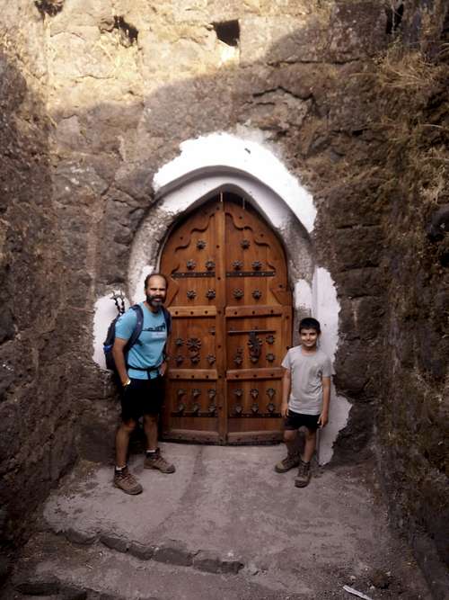
While climbing the exposure was on the right hand side, whereas while descending, it was on the left hand side. We all had to be extremely careful while climbing up, as recently there was a piece of news where it was reported that a 18-year old girl slipped and fell to her death, while climbing Tung. We made sure that we held hands of both our boys both while going up as well as down. The trail traversed around the conical fort, and came up to a door which was intricately carved out of wood. It was made to resemble doors during those times, 400 years ago, but was recently built, to give visitors a sense of feeling of how it was, back in the day!
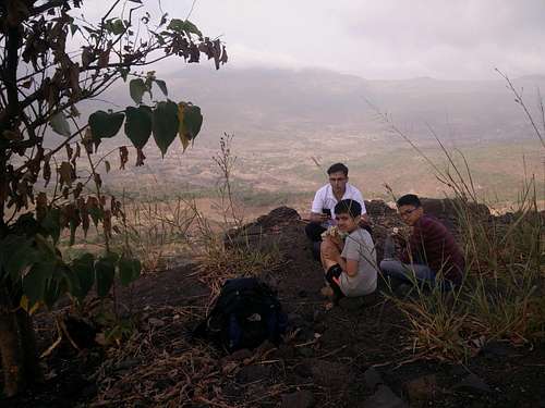
Once we crossed that door, we took a break, when we had water and some snacks. Saket told us that he usually gets coleslaw sandwiches on treks, which were actually quite yummy. This was supplemented with lots of water, and we were ready to go and climb much further, to the top of Tung.
We went past a few ruins which had a board which said - old palace, as well as a temple from those times. The temple was situated close to a water cistern, around which we had to be a little careful in walking as the trail was slippery. Once past the cistern, we headed up the fort.
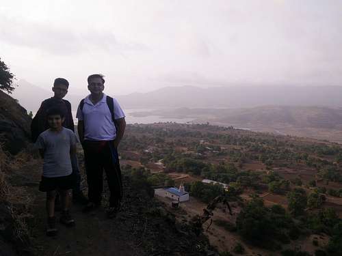
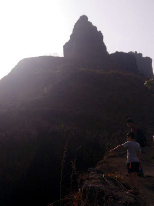
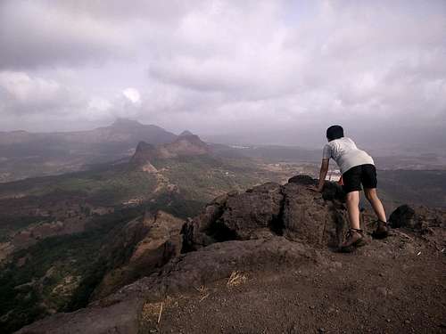
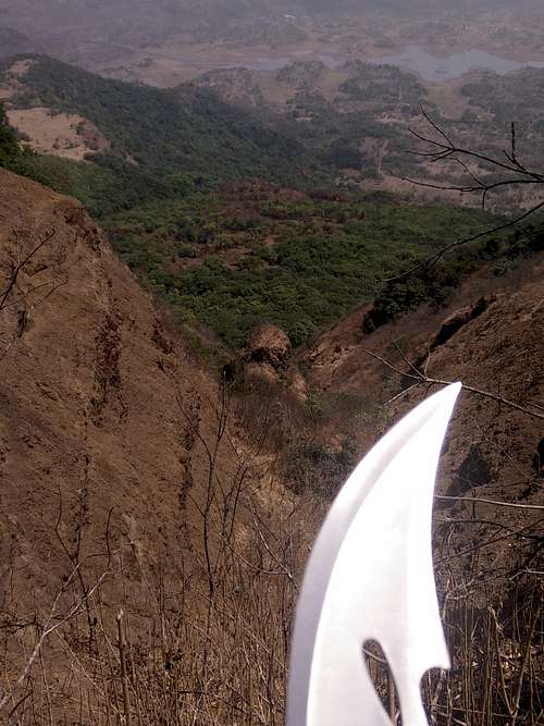
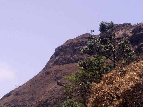
A narrow trail, with about 500 - 800 ft of drop on one side, and mountain on the other side, took us to the top. The top was a relatively small area with not much to see except the panoramic vistas of the Pavna dam that we could take in, and the steep drops on all sides. We could see Tikona on the other side of the dam, and the multiple resorts that line-up at the base of the fort.
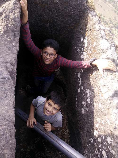
Mahindra resorts has a huge property at the base where at least there are more than a hundred rooms for guests to stay in. Right next to the Tungi-devi temple, there was a hollow balcony kind of a thing, in which one had to jump in, in order to see whats inside.
We could see that it was like a man-made cave, which could be utilized for sleeping 5-6 people easily.
One could be protected from the elements, and at the same time - have a good night’s sleep. We did spend some time in there, before we had to climb out, in order to begin our descent to the base of the fort.
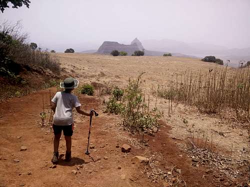
When we were looking at the topography of the area, we noticed that there was another fort called Morgiri on the other side of Tung.
This fort was something we had never heard of before, so we decided to check it out, as we had time with us. Looking at the map on Saket’s phone, we drove in the direction of Morgiri, and saw that we were quite close to it.
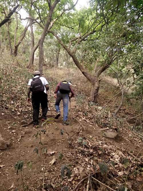
We asked a local person from a nearby village about the route, and he told me that it just passed by around his house. He gladly showed us the route, and told us that the trail ends at a col, from where we have to take a right, in order to go to Morgiri. We all bushwacked through the jungle with the ascending trail, and reached a col - from where we took a right - to head on to Morgiri. Ònce we were on our way to Morgiri, we were pretty sure that we knew the path, which would lead us straight to the top, where we could see a temple and a saffron flag. It was only towards the end of the day that we realized how wrong we were about the whole trail thing.
We headed straight to the mountain, and the trail went left. We thought - there must be a traverse going around the mountain, which would take us to the top. However, we realized that the traverse didn’t go up - but was going down to a village. We abandoned our plan of going on that route, and retreated our steps. We again went around the mountain, this time from the right hand side. The trail was treacherous with a few places where one slip could’ve meant a fall of a couple of hundred feet.
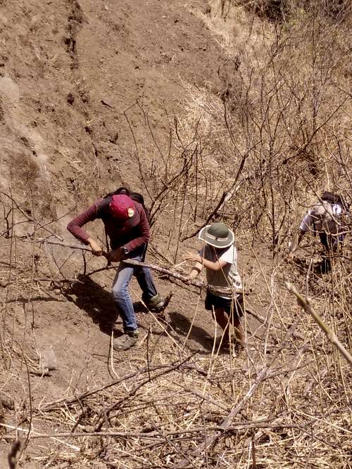
We treaded along the trail, and went into a narrow gully coming from top. This must’ve been a way for the water to come down the mountain, we thought. The shrubs had all dried up, and we couldn’t see any way we could navigate that way. I volunteered to take a lead, and go through the shrubs, to make way for the others. It was a little difficult, as the dry soil gave way to each step we were trying to keep, and our feet slipped all the way. Holding on to the hiking stick as well as to good, solid branches of the dried shrubs, I tried to reach the top of the gully I could see from where I was.
I told all the other three to stay at their respective locations. It was quite a bit of struggle for me to reach the top of the gully, with whatever strength was left in me, to pull myself up. Once on top, I had some water, and I immediately realized that we were short on water. With the scorching sun, I was wondering how could we survive the heat with less water? I had to guide all three of them step-by-step, by giving them directions on where to place their foot, and which branch to hold, so that the branches don’t come off / break.
It was commendable that both Yuvaan and Mihir, Saket’s son - came up without much issues, and I had to go and give a hand to Saket, as his foot was slipping, ad he couldn’t get a good hold on any of the branches.
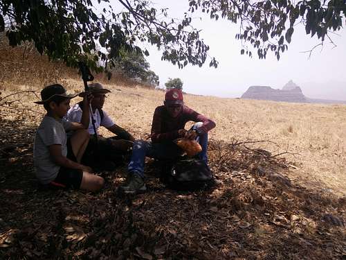
Once we were on top - we saw that a trail went up the mountain, and disappeared! We were disheartened, thinking that we wouldn’t be able to go to the top of this fort. Still, we tried, but couldn’t make it beyond a certain point. Saket and I discussed - the kids were tired, and we were running out of water due to the heat. So, we decided to take a call whether to proceed or not, and decided to go down. But, there was no way we could go down the way we had come up, through the bushes, from the gully. We decided to take a direct route through the trees, which we were sure - would take us to the earlier trail we had abandoned.
We slowly but steadily descended through the trees, and towards the end, had to jump over a fallen tree to join back on the same trail we had quit on - going down to a village. We felt happy that we didn’t go further, as it would have created more problems - it would’ve gotten dark, and we would’ve had no water. We went back to the gully, after taking a break to munch on some more snacks we had, and gulped it down with whatever water we had remaining with us.
A left turn in the gully made us head straight to the hut where the old man stayed with his family, who had given us directions. He and his family, along with his pets (dog, cow) greeted us, and we told him that we couldn’t make it to the top. He told us that the earlier trail we had abandoned, which indeed goes down to a village breaks off in the middle, and heads up the mountain, to the top. We knew we could see a trail going up, but we thought that to be too steep, even for the kids. So, we had discarded the idea of going up that trail.
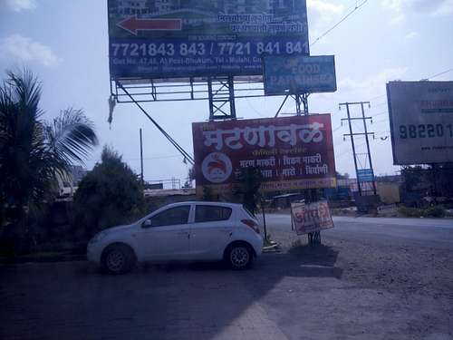
We headed on the return journey to Pune. As nobody had had a proper lunch, everyone was hungry. Being a weekday, we couldn’t find any restaurants open on our way, in a village called Paud. So we had to come up all the way to near Pirangut, where we could find a place called “Matnaaval”, which specializes in cooking mutton dishes.
It was close to 3.30 pm, and with growling stomachs, we hogged on the mutton thali and other items. Yuvaan hogged on the chicken thali and with satisfied souls, we returned back to our homes.