When we climbed Ghangad, we met a guy on top of the fort, who asked us - if you have time, why don’t you also give Kailasgad a try. It is nearby, and I live at the village, which is at the base of the fort. We had wondered if we could try it, but due to time constraint, we had to give it a miss, and decided to come back to it sometime later.
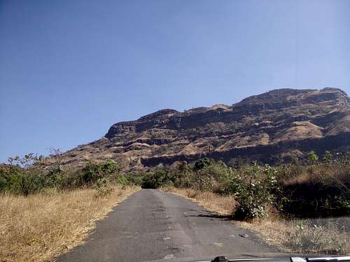
Going towards Kailasgad
About a month later, all of a sudden a plan was charted where I, Amit and Yuvaan decided to go and climb up Kailasgad.
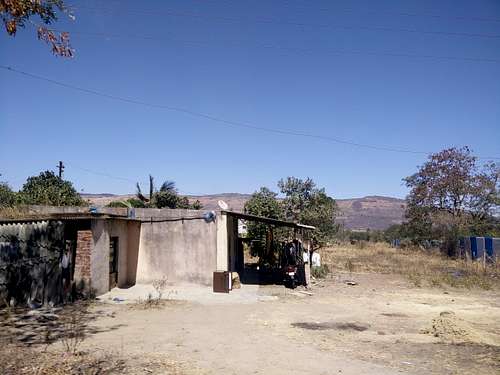
Vaduste Village, at the base
So, we drove up in Tamhini Ghat, took the turn towards Lonavla, and as per the instructions from the guy on Ghangad, drove towards Ghangad. We could see Tel-Baila, and the pinnacles of Navra, Navri and Karavli from there. On the bifurcation of the trail to Ghangad (way towards Ekole village), we asked around, if there is any fort called Kailasgad, and to our surprise nobody knew anything about it!
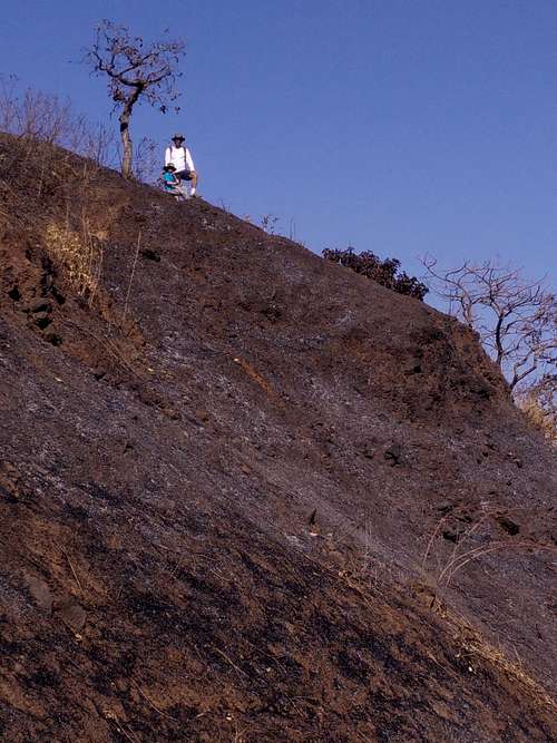
Kailasgad
The villagers told us that they have been staying in those villages for the past 50 years, and had never ever heard about such a fort nearby!
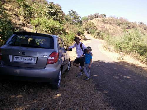
After having parked the car
We were shocked, and we didn’t know what to do. But, one thing they told us was - if you go towards Tel-Baila, you will see Tel-Baila, and then you will go towards Lonavla with Korigad on the way. But, there is no other fort on this route.
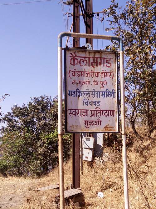
Kailasgad Info
So, we decided to go in the direction in which we came, and thought of asking somebody around. It had gotten late, and losing our way another time was not an option anymore, as we had to climb the fort. On the way back towards Tamhini, we saw a road going in a different direction than towards Tamhini.
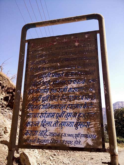
Kailasgad History
We decided to take that road, and to our surprise, we found Kailasgad on this road. It was funny that this is a relatively lesser known fort, but is on a road which is parallel to the main Tamhini Ghat road. In fact, we took the same route to join the Tamhini Ghat road at a village called Nivhe, after having crossed villages like Bhadaskond etc.
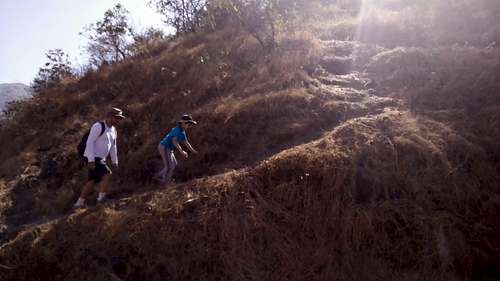
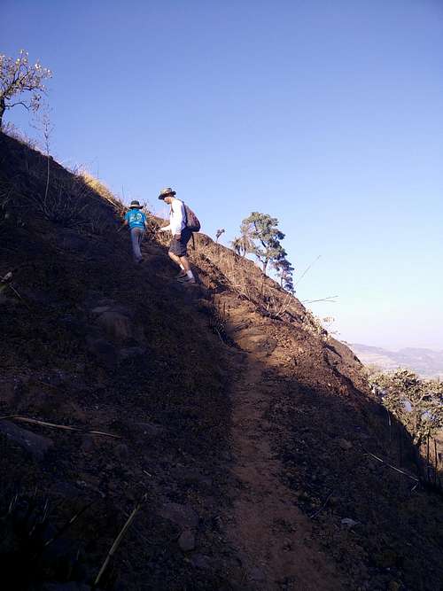
Trail Begins
Once we were at the base of the fort, we asked around for the trail, as it was not very clearly visible.
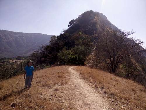
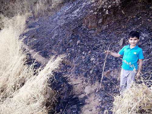
Yuvaan on the trail
A villager pointed us in a direction, and we saw a small trail going up from the pass between the two valleys. We parked our car at a place where it would be visible for us to monitor, and we started climbing. At first, the trail was small, and we thought - it might get widened later. The trail went up a shoulder, and we could it going past a rock patch.
Two of us on the trail.
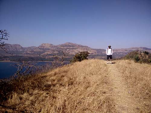
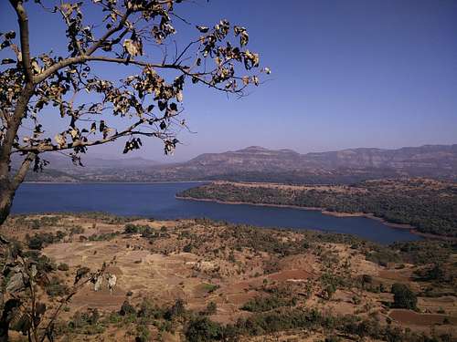
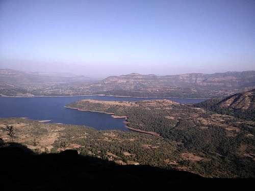
We wondered as to where the fort was, as there was no fortification in sight - anywhere at all! We just followed the trail to the top of that rock patch like structure. And BOY - what a view we got from that place...The entire Mulshi dam backwaters was visible in front of us, and in a distance we saw Tel-Baila!
Amit with Mulshi waters behind him
It was an awesome view, but we two (I and Amit) were confused - is this the end of the fort?
Mulshi Dam
Because, there wasn’t any trace of any trail going forward. We looked around, and saw a small trail going towards a small gulch, and then climbed up, on a mountain in front of us. We wondered if this is the way, as it was already around 345 pm, and we had probably 3 more hours to explore this fort.
One good thought came to our mind, and Amit called up Gharya (Vivek Marathe), an avid explorer, and climber in the Sahyadris. He was the one who had told me about Kailasgad at one of the friend’s parties, and further on - he and his buddies had explored the area around Bhadaskond and found an old cave with some scriptures inside!
Amit and Yuvaan, with Exposure on the right!
It was an amazing story of exploration. He calmly told us that the trail looks to be stopping but you can carry on the trail going towards the gulch, and further a climb of about 45 minutes - and you should be able to reach the top of the fort. So, I went ahead, leaving Yuvaan and Amit behind, to see if the trail indeed went forward or not.
The trail
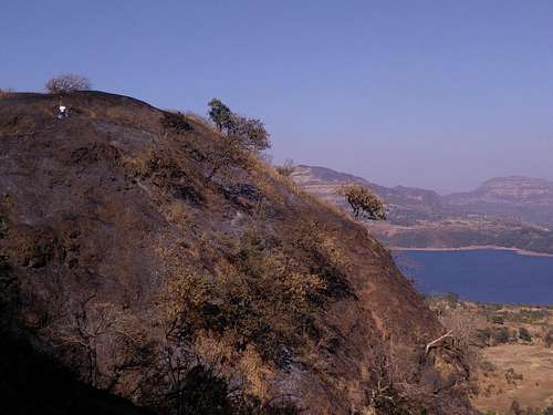
I came back telling them to come towards me, but one thing was for sure - the shrubs had been burnt down (which is the practice in Sahyadri), for the new ones to come when rain arrives. So, this had exposed the entire face of the mountain to the main road below, with a direct drop of around 500 - 600 feet below! And, the trail was nothing but a HUGE traverse on the side of this mountain.
Yuvaan on the trail.
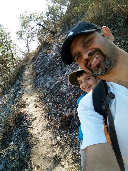
So, we had to be extra careful while walking, as a slip of foot meant - going down 600 feet below! On one occasion, one of the villagers at the base had also told us to not take the kid (Yuvaan) along, as it was treacherous. But, Yuvaan being Yuvaan, who is fond of thrills on the mountains insisted that he wanted to go and see it! And, at the end we were glad we went - because to this date Yuvaan recalls Kailasgad as one of the toughest and scariest forts he has climbed up!
So, we marched on the trail very cautiously - trying not to slip.
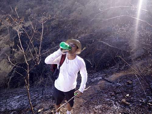
Rehydrating on the trek
I had held Yuvaan’s hand in my hand, with the tight-most grip, so that in case he slips, I can hold on to him, no matter what! There were many places / junctures where we had a little bit of doubt - whether to proceed or not. But, we listened to our hearts, trusted our capabilities and went forward.
After a few switchbacks, we reached the top of the fort, where there was a flag hoisted, just like on any Shivaji Maharaj’s fort.
Yuvaan and Amit, topping out
It was already past 5, and we were worried if we would make it down on time, as it would be difficult to climb down on such a trail with hand-held torches (we had forgotten to get our headlamps). But, we proceeded towards the end of the fort, which connected with the mountain range behind which could be traversed on foot. It would be great to do that traverse someday - is what I thought. Behind us - the entire expanse of Mulshi dam backwaters lay - opening its arms around mountain landmasses which enter the backwaters like fingers.
Shivling
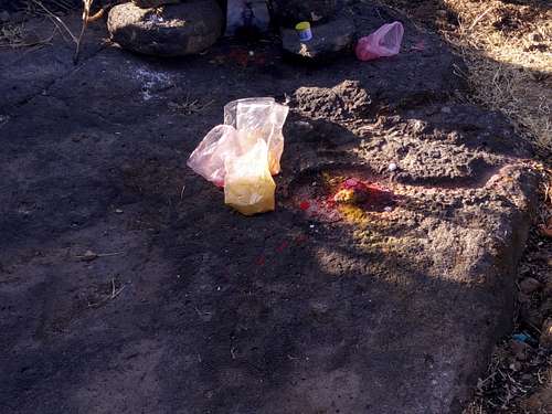
Once we reached the end of the fort, we saw a small open-air temple where a Shivling was carved out in stone.
Beautiful Backwaters
This must have been at least a hundred years old, but somebody had recently paid their tributes on it with color and flowers. This was also the first shivling I was seeing which was not below the normal level. Whenever a shiva temple is built - it is built a couple of feet below the normal level, where it is cooler. It is said that Shiva is an angry god, and hence to keep him cool and calm, the temples are always built in such a way that the devotees have to climb down a stair or two to go and pay their respects to the Shivling.
The view towards both Mulshi dam (towards Lonavla) and also towards Tamhini was spellbinding. Also, we could see the road coming from Tamhini, and going past Kailasgad in a serpentine motion towards Bhadaskond and further to Nivhe.
Munching on an apple
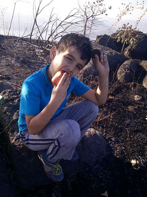
As it was an 11th hour plan to come and climb this fort, we weren’t equipped with enough food to eat, and we had gotten a few biscuits and some fruits.
Dusk...
Yuvaan was hungry and so were we. So, we munched on whatever we had, and started climbing down. It was gong to get dark early, and we just HAD to get down before it became dark. The descent was tricky, but we managed. In the middle of the descent, Gharya called us again, and asked us - whether we reached the Shivling or not, or retreated mid-way?
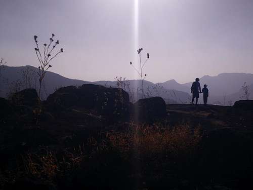
Perfect Silhouette
We assured him that we had seen the entire fort, and there was nothing much to see. But, he surprised us by telling us that on the way down, near a particular landmark - there was a huge water cistern, which was worth seeing. We spent about 20 minutes looking for this cistern, but couldn’t find it anywhere. So, we decided to quit looking and picked up our pace of going down. I had to be extra careful, as it was very slippery due to the scree. Once we crossed the gulch, and made it to the shoulder, I was assured that we would reach safe!
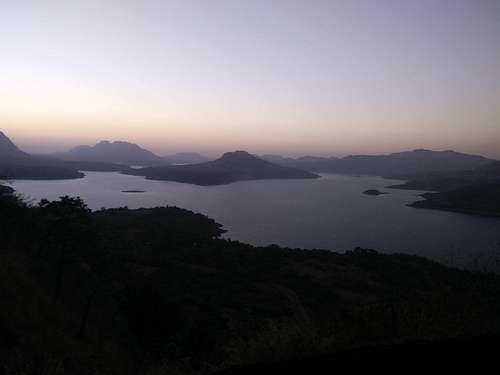
We safely made it down, but it had almost clocked 7 pm, and the last of the sunlight was on the mountains nearby. We decided to take the route of Bhadaskond, which ended up being an amazing route, through dense forest - dotted with small huts in small villages, one every 15 minutes. The lights from these villages shone brightly in the pitch dark that was outside. We guessed that this pitch dark road would be a pleasure to drive through, even at daytime. On the way, we picked up a few locals, who wanted a lift to the next village. And, once we hit the main Tamhini Ghat road, we stopped at Basho’s to have a hearty meal (Butter Chicken and Garlic Naan) for celebrating the excellent trek we had had.
Parents refers to a larger category under which an object falls. For example, theAconcagua mountain page has the 'Aconcagua Group' and the 'Seven Summits' asparents and is a parent itself to many routes, photos, and Trip Reports.