
-
 111065 Hits
-
 95.97% Score
-
 56 Votes
|
|
Mountain/Rock |
|---|---|
|
|
16.26187°S / 68.15198°W |
|
|
Mountaineering |
|
|
Spring, Summer, Fall, Winter |
|
|
19974 ft / 6088 m |
|
|
Overview
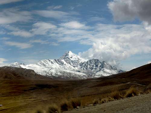
Huayna Potosi seen from the road to Zongo pass
In fact, Huayna Potosi is the most climbed mountain in the Cordillera Real and around La Paz. Its proximity to La Paz, its PD normal route, the presence of refuges and, most importantly, the huge amount of advertisement in tour agencies in La Paz initiate plenty of outdoor enthusiasts into mountaineering, while its other routes including its West face will offer different environments for more experienced mountaineers.
It is often written on the Internet that Huayna Potosi is the easiest 6000 meters peak in the world. In my experience, Chachani, in Southern Peru, is quite easier (see my trip report Oh my guides). From a friend of mine’s experience, Acotango, on the Bolivia-Chile border, is probably even easier.
Getting there
 |
 |
 |
 |
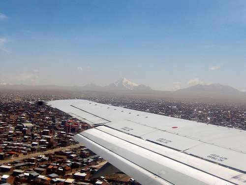
From the airport, taxi to downtown is 70 Bs (October 2016) and public transport by minibus is 4 Bs (head right as you leave the terminal, past the taxis). Buses arrive in La Paz at various terminals depending on their origin, so check on general travel guides for details.
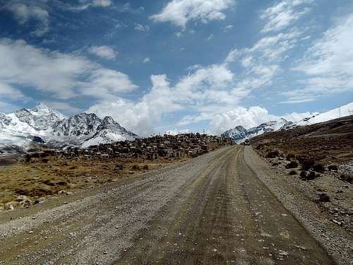
Cemetery on the road to Zongo
From La Paz, public transport to Zongo pass where the eastern routes originate is possible. Buses depart daily from Bavillián Plaza in El Alto at 5 and 6 am and ask to be dropped at the hydroelectric dam (please double-check the schedule beforehand). Any taxi can also be hired for this trip. Make sure to arrange for your return too as the road is very infrequently traveled. Since there are many guided tours on Huayna Potosi, you can also buy a seat in one of their transport.
On private transport, do make a quick stop at a cemetery on the road to Zongo pass. There is also a police checkpoint slightly further (near the soccer field on the map below), but there is nothing special there except perhaps to take a picture.
Routes
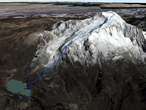
Satellite map of the normal route
The normal route, advertised as nauseam in downtown La Paz, can and will get crowded during high season. But it is crowded for a reason: it is touted to be accessible to people with no previous mountaineering experience (but see the section on advertisements, guides and safety below).
The French route shares the same approach as the normal route, with its benefits and problems, but aims for a more technical direct slope higher up.
The mountain’s West face provides the American route. You may well be alone on this route.
Other more challenging routes are also cited in the external links.
 |
 |
 |
 |
 |
Red tape
Pay here
There is a 20 Bs (as of October 2016) fee to enter the mountain area. It is paid about halfway into the approach on the eastern routes. West face climbers may have no way to pay the fee. The money goes to the community of Llaullini according to the ticket.
When to climb
June, July and August are the best months to climb, and the season is from May to September. This is the Bolivian winter, which is dry, and normally the weather is quite stable. From November to March, the temperature is higher and potential rain will make any climb unpleasant and dangerous, but should the weather be cooperative, it will still be a great experience.
Since it is so much advertised in La Paz, the mountain is climbed all year long. Simply allow extra foul-weather days outside of the optimal season.
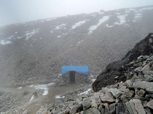
Camping
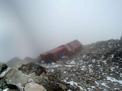
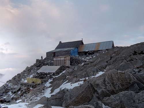
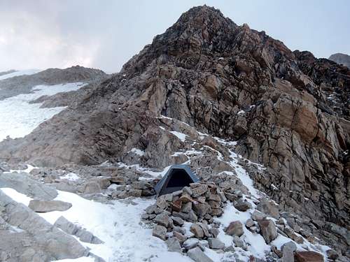
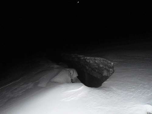
First and second high refuge, and a tent site nearby
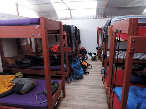
Inside a refuge
Both base camps are fairly similar, though the one closer to La Paz is a negligible few meters higher and closer (4740m on my map, 4760m on my GPS; the other is at 4760m on my map, 4780 on my GPS).
Campo Argentino (credit lizrdboy)
A few camping spots are available near the high camps and tents can be pitched pretty much anywhere around the base camps (but get their permission). Four-season tents should be used around high camps, but you can always bail out to a refuge if wind or snow wins over a three-season tent.
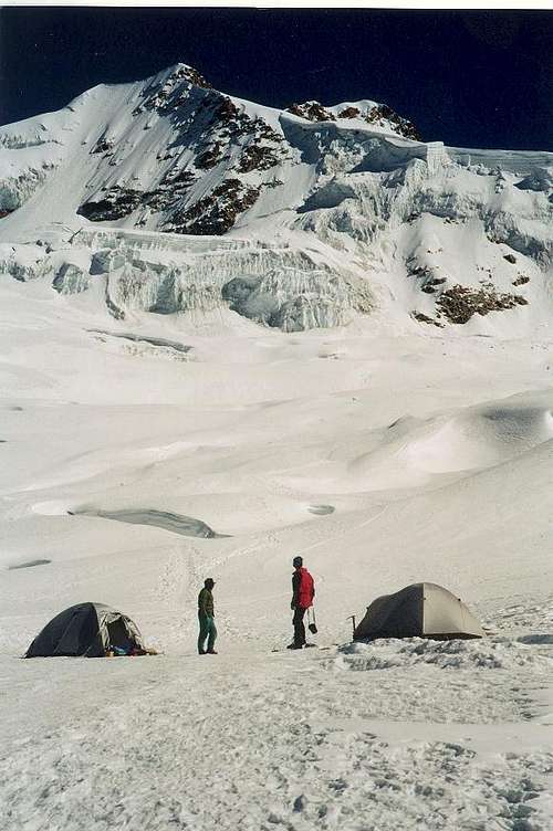
Campo Argentino is an even higher camp between 5450 and 5600 meters, about 1 hour into the glacier. It is actually a flat to low-slope area on the glacier, and there will be wind and crevasses around. Camping there is not needed for the normal route, but it may be useful for more time-consuming routes or used simply for the experience by purists.
There is no refuge on western routes.
On advertisements, guides and safety (for first time mountaineers)
Avalanche and crevasse, they do exist.
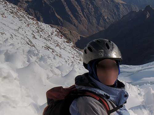
This client was rented a bicycle helmet.
If this mountain was in Colorado or the Alps, it would not be a beginner’s mountain, and it should not be in my opinion. See the external links for the proper preparation, skills and knowledge that was standard for climbing this mountain before it became a tourist trap. But in Bolivia, money, not safety, drives people around. And I am not talking about these minibuses in La Paz.
So, despite what the agencies will tell you, you are taking more risks than you would climbing in North America, Europe or even Peru. But you are also taking minibuses in La Paz, so you know what risk you are willing to take. I do not want to scare people out of climbing, and accidents are rare on Huayna Potosi, but do your research, know what you are getting into, and be safe.
Other information for unguided climbers
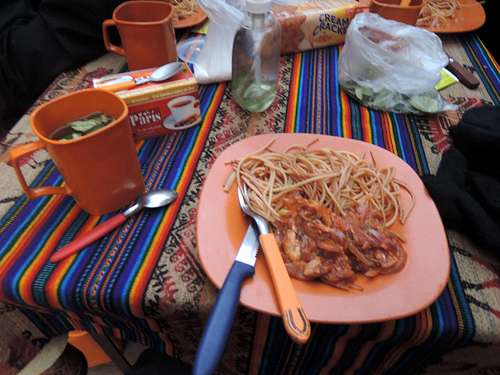
Meal in refuge
To buy equipment, there are some gear shops on Illampu and a horde of clothing shops around downtown. Real branded gear will not be cheap, but you may get lucky with unbranded outdoor clothing. Isobutane/propane canister was found at Sampaya Outdoor Equipment on Illampu corner Santa Cruz at 40 Bs for 227g. I did not try to find white gas. 95% alcohol can be found in pharmacies. I did not find solid fuel tablets. Alternatively, the same meals that guided climbers get can be bought at the base camps and high camps. The same goes for water, but there are streams or ice all along the route.
There is phone reception on the Altiplano side of the mountain and none on the Yungas side, and the normal route straddles the ridge in between, which translates into fair coverage according to local topography.
Other information for guided climbers
Walk on Sagarnaga and you will find many agencies offering many departures daily in high and shoulder season. There is no need to plan things from overseas unless you have a large group that needs to climb on a specific day during high season.
The packages are almost the same everywhere: normal route for 2 or 3 days with transport, meals and equipment included and sleep in refuges. The only real decision you have to take is the trip duration; the rest may be a matter of luck. See the route description for details as it is specific for the normal route.
There are too many agencies to list them all here. I will not vouch for any specific agency here. See my trip report for more about the guides and my personal opinion about them on Huayna Potosi.
Acclimatization options
After a few days in La Paz (3500m) or other Altiplano tourism destinations, one can do day hikes to Charquini (trail head also at Zongo pass, 5392m) or Chacaltaya (taxi-able almost to the summit, 5395m) nearby, and then do Huayna Potosi in 2 days.
Alternatively, on an unguided 3-day trip up Huayna Potosi, one can spend two nights in high camp, route finding in daylight on day 2 (climb high sleep low) before summiting on day 3. This also has the advantage of leaving a two-day window for summiting in case of foul weather.
Any of these will be better for acclimatization than the 3-day option tour agencies offer (1 night at base camp and 1 night at high camp). Most failures on Huayna Potosi are due to inadequate fitness or acclimatization and not lack of technique, but you can argue that a lack of technique is more dangerous.
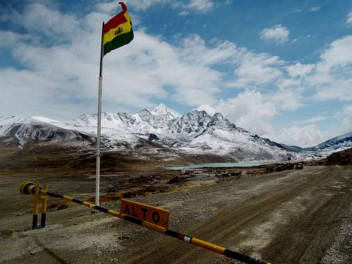 Huayna Potosi seen from the police checkpoint on the road to Zongo
Maps
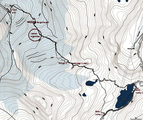
Annotated topo map
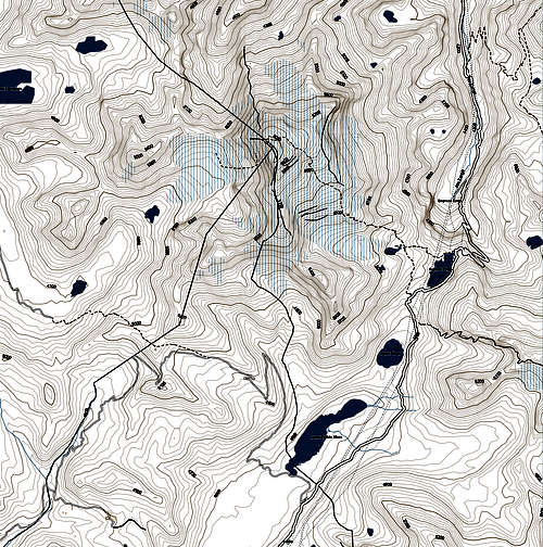
Topo map of Huayna Potosi area
External Links
For route drawings and other routes : http://www.huayna-potosi.com/routes.html , http://www.boliviaclimbinginfo.org/cordillera-real/southern/huayna-potosi-area/huayna-potosi/
For maps: 50k topographical map, look for 5945 II Milluni, http://www.lib.utexas.edu/maps/topo/bolivia/index-50k.html . For GPS and Basecamp, http://mapas.alternativaslibres.es/downloads.php
This shows the kind of preparation, skills and knowledge that was made before the mountain became a tourist trap: http://www.climbingwithbob.com/bolivia2001/bolivia2.html
brankoi - Sep 27, 2002 6:32 am - Hasn't voted
Untitled CommentOn the Zongo Pass (start of the Normal Route on Huayna Potosi) was investigated in winter 1998 by Branko Ivanek for its water ice potential. On the 23rd July, Ivanek and Bolivian guide, Marco Soria, climbed an 80m icefall on the flanks of Pico Milluni (5,400m and home to the excellent French route up the Central Couloir: 440m: D). The route, which was christened Amistad, began at an altitude of 4,940m and involved two pitches on ice that was five to 10cm thick and up to 90°.
On the 27th August, Ivanek returned to solo two icefalls on the right-hand side of the lower part of the Huayna Potosi Glacier. Zongo Light was 80m high with a maximum angle of 80° and graded (USA/French) III/3+, while Cha'qui was 140m in height with a maximum angle of 70° and graded II/2+. However, prior to this exploration British climber, Neil Brodie and Patrick Berthet from France had climbed two icefalls on the 13th June. Located to the right of Amistad, Branko Blues was graded III/5, while Bolivian Journeys received a grade of III/4+.
keimbeggra - Dec 31, 2005 8:40 pm - Hasn't voted
Untitled Commentpublic bus: 1 a day, 5 am from Plaza Ballivan/El Alto but very packed and area not safe in darkness
taxi:
shop around , you should get a taxi from downtown to Paso de Zongo for about 15-18 US $ (haggle hard) -
you can agree with the driver that he picks you up again,but don´t count on it - almost no public transport going back from Paso de Zongo after midday (no pt on sunday) - you can ask at the COBEE (electrical company) at Paso de Zongo if they could contact their collegues further down in the valley, sometimes they drive you to El Alto in one of their pickups
Haliku - Jun 11, 2008 9:15 pm - Hasn't voted
Current transportCosts from Bolivian Mountains for roundtrip transport to the pass was $100 USD. Cheers, Haliku
cyclista - Oct 20, 2013 8:56 am - Hasn't voted
Re: Current transportSomebody is making easy money in "Bolivian Mountains". Round trip on a public rural bus from El Alto is about $5 USD:)
Magiosa - Mar 6, 2024 4:12 am - Hasn't voted
Re: Current transportAs long as there are rich tourists willing to pay the thieves, it will not reduce the market price intended for rich tourists from the West.
Haliku - Jun 11, 2008 9:18 pm - Hasn't voted
2nd refugeThere is second refuge at ~17k. Details at http://www.summitpost.org/phpBB2/viewtopic.php?t=35739 Cheers, Haliku
matthias.pabst - Apr 14, 2014 5:42 pm - Hasn't voted
Climbing Seasonit can be possible to climb Huayna Potosi all year round depending on how lucky one gets with the weather. I climbed it with a tour in January 2014 without big problems. The nice thing is that there's not as much traffic on the mountain and it doesn't get as cold. Weather on the other side is less stable and higher probability of summiting in a cloud and not seeing anything...
richardpattison - Jul 29, 2014 2:33 pm - Hasn't voted
5 min videoYou can watch a 5 minute video here: https://www.youtube.com/watch?v=3-tF76IZE4s