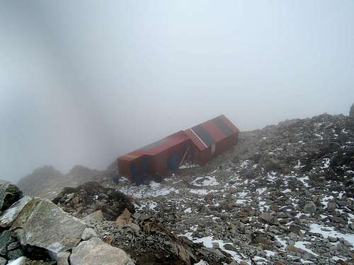
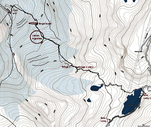
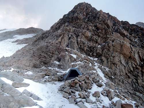
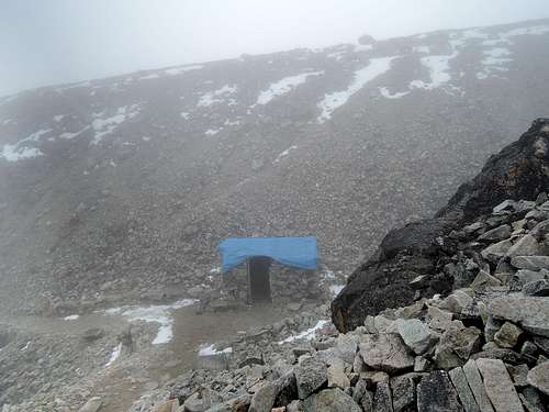
After 30 minutes, we stopped at a nondescript place where the path split. The guide told me that he would go do a mountaineering intro with the other customers and I could either sit and wait for 2 hours (in the rain and fog…) or go to the first refuge by myself and wait for him there to go to Campo Argentino. I took the second option since he assured me that the path was easy to follow. Indeed, even in the fog it would be hard to get lost, but finding the exact way to rock hop was not always obvious. So much for the private guide… (Retrospectively, I could have tried to go with him and get a free refresh on mountaineering techniques.)
The 20 Bs fee to enter the mountain was supposed to be included in the package I bought, but since the guide was not with me to testify, I had to pay it again.
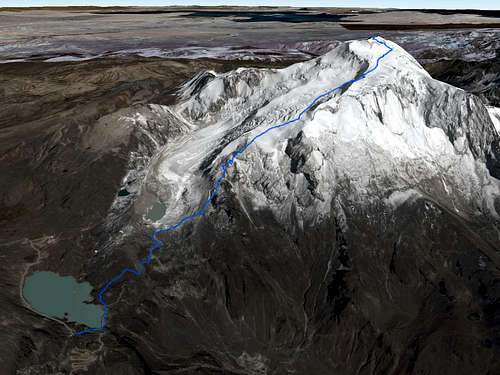
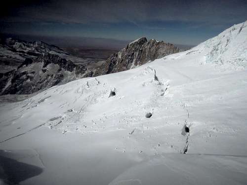
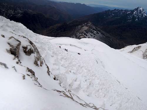
![Lower glacier]() Lower glacier
Lower glacierEvery team at the lower two refuges had the same plan of waking up at midnight and being on the road at 1 am, with an estimated time of arrival at the summit at 7 am. Wind and snow stopped as we left.
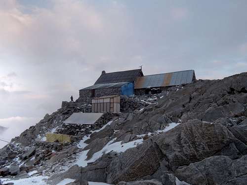
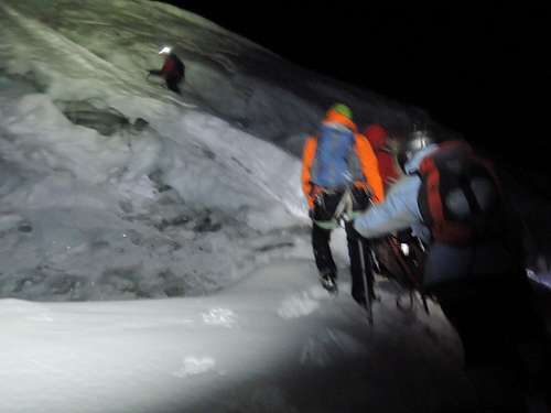
It took 20 minutes of hiking and scrambling to get the third refuge and the entry point to the glacier. There, I realized I forgot my crampons in the first refuge, so we lost 30 minutes as my guide went back down to get them for me, which was very nice of him. During these 30 minutes, I witnessed other guides put gaiters and crampons on customers who had no idea how to put them on, give them an ice ax without a word on how to hold it or how to self-arrest, and tie them into their rope. It made me glad I had a private guide, but at the same time, this is a PD normal route, not the North face of the Eiger.
![Unnamed Image]()
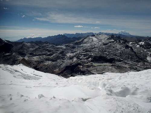
Bergschrund crossing
The walk up to Campo Argentino and the base of the bergschrund was fairly straightforward. Some teams used hiking poles, ignoring the possibility of a crevasse fall. We started last from the base of the glacier and were first to the bergschrund. There we waited 15 minutes to take a member from another other rope team from the same agency since three of their customers wanted to give up. I agreed out of sympathy for that fourth climber even if I paid for a private guide service…
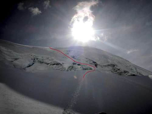
![Upper glacier]() Upper glacier
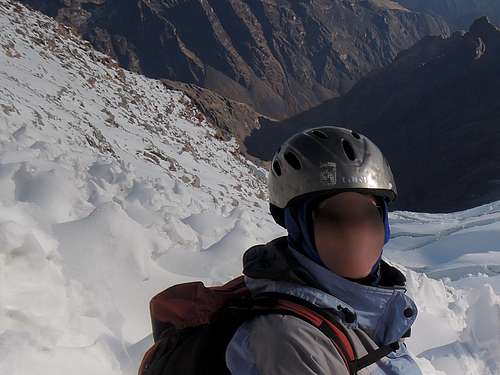
Upper glacierEveryone crossed the bergschrund at the same spot. From the pictures I took and my GPS track, I would say it was 45° snow on 25 meters, but it seemed steeper during the climb. As we went up, we heard and saw a small avalanche less than 500 meters from us. It did not reach Campo Argentino, where I wanted to camp, but was not so far neither. After the bergschrund it was again an easy walk up around crevasses.
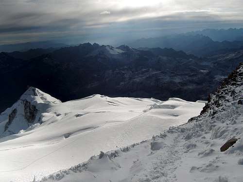
![Final wall]() Final wall
Final wallWhen faced to the final wall, our guide decided head straight up instead of to the climber’s right as on the map I had. At one point the guide and my newly found partner tried to haul me up with the rope. I frowned on them, meaning I want to climb the mountain by myself, but I don’t think they saw anything.
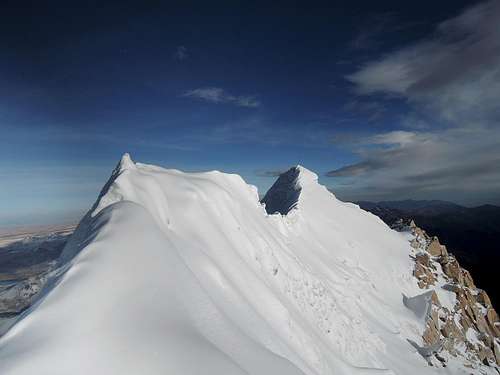
![Unnamed Image]()
Final arete
My guide never explained why we took that route, but we stopped short of the summit since the final arête was "too dangerous". Perhaps he knew it since there was a snowstorm the evening before and the usual route would not have got us as high? I did not ask, but I would have done the last part if I was the leader. It did not look so bad. My watch read 6022m (calibrated at 5130 from the second refuge, which I believe is too low), my GPS read 6080m, and my map was within one contour line (20m) from the summit.
It took us 5 hours 45 minutes in total in very good weather and dry snow conditions for the 3.2 km ascent, which would have been 5 hours if it was not the two unplanned breaks from forgetting crampons and adding a team member, and we were the first party on top.
On the way down, I guess that I met about two thirds of the people I saw from the base of the glacier. I do not know if they will all make it to the summit, but I would guess that the success rate was between 50 and 70% for the day.
Descent
We took the same route for the descent. Twice we had to down-climb, once on the final wall and once at the bergschrund. I did not feel the need for placing protection as long as the team members protect each other, but it was funny seeing the guide start building an anchor only after my teammate and I have started down-climbing the bergschrund. That would not have passed a North American mountaineering exam…
It took 2 hours 45 minutes down to the refuge with taking many pictures.
Packing at the high camp was delayed as my tent was frozen in the ground. I descended with another guide and the teammate we picked up. I could not follow them since my pack was way heavier, so I lost sight of them. I found my way by myself to the base camp from which I started, only to learn that they headed to the other one where the transport was. So I had to walk to that other base camp. Again, so much for the private guide I was supposed to have…
Walking down to base camp took 1.5 hours. Most people will take less since they will have lighter packs.
Aftermath
Complaining in the office back in La Paz about not having had a private guide and therefore not getting to Campo Argentino and getting lost on the way down did not yield any refund, which was expected in a country like Bolivia. At least he took back the gas canister that I bought and did not use. The agency I used was Adolfo Andino. I would not recommend them since I did not get the service that was promised.
Total 12.1km, plus 1.3km on road between the two base camps at the end. +1348/-29 meters. 8.25 hours up, 4.25 hours down.
In retrospect, soloing would probably have been safer than being tied to some rope teams.
It is not about stopping short of the summit. It is not about having been unnecessarily pulled up at one point by teammates. It is not about not having camped on the glacier. It is not about getting ripped off by the guiding agency. I even did two 6000 summits in my trip while I only planned for one. And the guide was nice, at least when he was there. However, going with a guide, it was missing some sense of adventure.
My friend with whom I was supposed to climb with told me later on in Lima : “next time, find a more responsible friend who does not lose his passport when he travels”.


Comments
Post a Comment