
-
 14517 Hits
-
 77.48% Score
-
 8 Votes
|
|
Route |
|---|---|
|
|
47.56465°N / 120.85147°W |
|
|
Download GPX » View Route on Map |
|
|
Hiking, Mountaineering, Scrambling, Skiing |
|
|
Spring, Winter |
|
|
Most of a day |
|
|
I |
|
|
Overview of Victoria's Secret
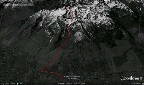 Cashmere Lake Victoria Route Shh! Don't tell anybody but there's a secret, easy, permit-less and direct route up Cashmere. In Summer and Fall most people climb Cashmere from Lake Caroline spiraling up Cashmere's West shoulder and weaving through class 3+ gendarmes making it a 2 day venture or very long day. But in Winter and Spring when the bridge to the Stuart Lake TH is gated and you're still destined for the summit, Victoria's Secret might be the right choice provided you hit that with the right conditions when the mountain has enough snow cover. It gains 6,500' but in only 4.6 miles making it a much shorter climb. An abandoned trail shoots to Lake Victoria but is very over grown, braided and littered with downed trees and burn areas. This route is best done with plenty of snow so it is kind of a seasonal route, although summer may be possible, there will be much more loose rock and cataracts to deal with. The final slopes up the NW Face are a fun snow climb that cut all the scrambling out of the equation. This route is also very popular for ski touring although attaining the summit beyond the 8,000' col will depend upon avalanche conditions. On dry years the first few thousand feet will be brushy and the brush is full of ticks and mites so after doing Victoria's Secret you may need to strip your clothes and check yourself out. Otherwise, the route is simply fabulous! |

Getting There
If coming from the Puget Sound for this long ride, don't be afraid to take in the views as you go.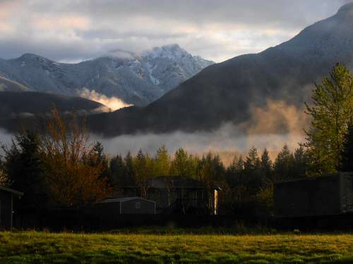 Misty Stickney from US 2 in Goldbar | 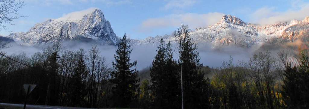 Index and Persis from Index Road off US 2 |
Trail head driving directions from Seattle
Route Description
From the pink flagging tape marking the old trail where you leave the service road, head moderately steeply uphill through trees and thickets. You will probably lose the trail a few times but as long as you stick to the spine of the Southward trending North ridge you'll find it again. After 2,000' or so a burn area will provide some views and logs will make travel through the brush less obnoxious (although possibly more hazardous). From experience, I can say this part of the ascent closely resembles the Northeast ridge of Cannon Mountain to the East.
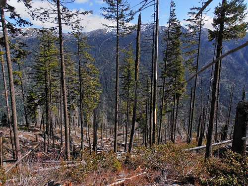 Brushy views | 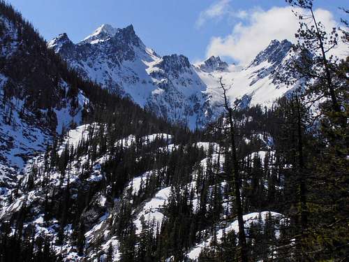 Snowy drainage into Lake Victoria | 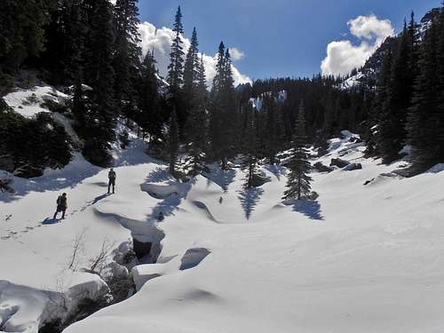 April snow |
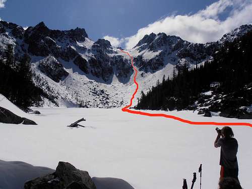 Lake Victoria route to upper basin | 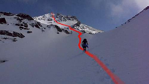 Cashmere NW face |
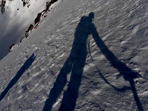 Shadow ax |  Matt Lemke on the 45° snow ramp | 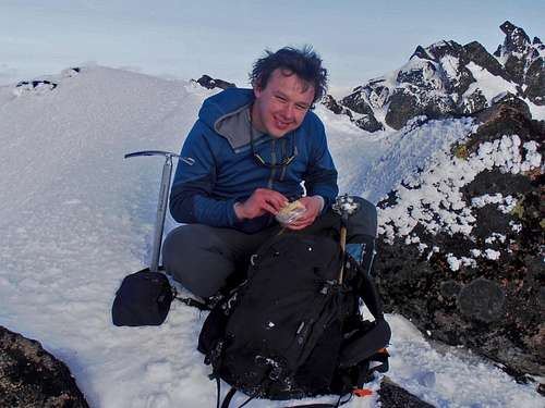 Josh Lewis has a snack near the summit |
It's possible to join the West Ridge route from the 8,000' col, but not recommended in Winter or Spring due to the rime covered nature of the rock. There are some mixed options on the South and NE Face but I'll leave that up to someone else. The final rocks are an easy walk, though some ice may inspire a little caution. If desired, following the Standard West Ridge route back down from the 8,000' col is fairly easy with snow-cover.
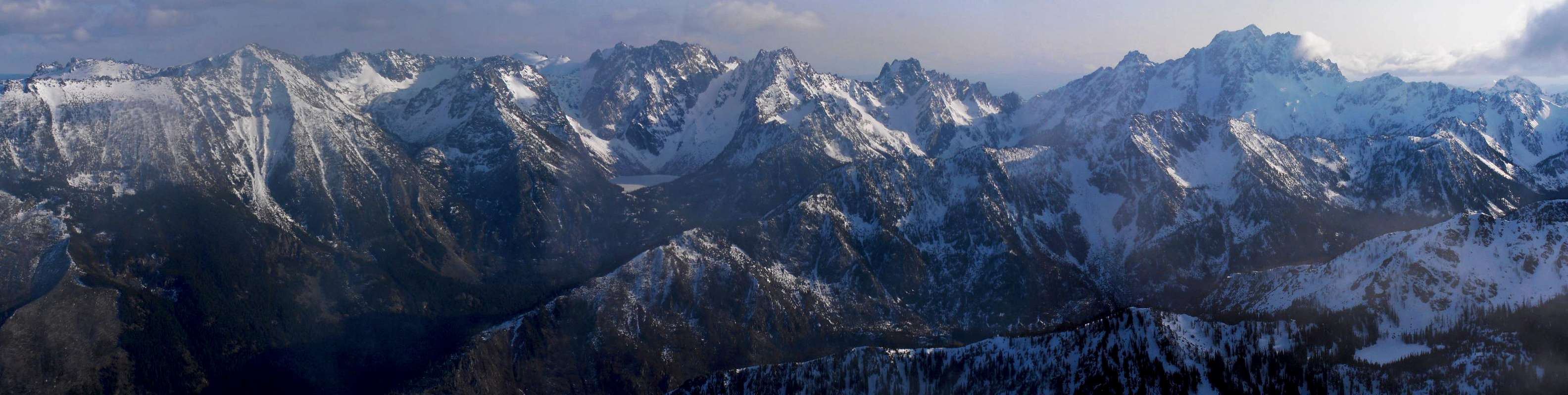
Cashmere Summit Panorama
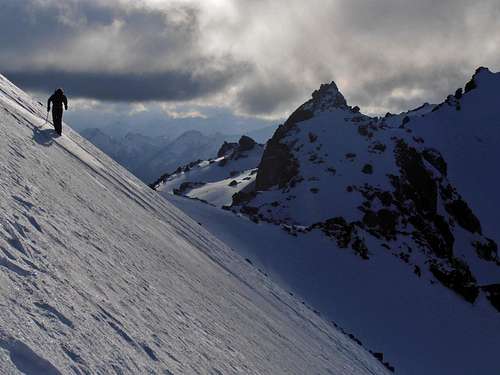 Matt Lemke approaches the 8,000' col near West Cashmere | 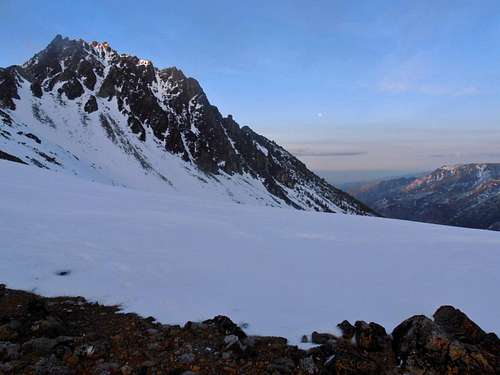 Cashmere SW face and moon rise |
Camping
Ida Creek Campground is only a mile away to the West if you need an early start or come back late and too tired to drive. This may or may not be an option depending on how far the Icicle Creek Road is drivable. Bridge Creek campground itself is usually accessible year-round but that would require a 4 mile walk in addition to the 4.6 of the route (still a few miles shorter than the standard route). Camping there requires a day use fee of $5 per vehicle/day pass or a Recreation Pass.
Essential Gear
Ice-ax and crampons. Snowshoes if heavy snow or skis for some prime touring. Have a map and compass or GPS handy with the navigation skills to use them.External Links
Wenatchee River Ranger District:600 Sherbourne
Leavenworth, WA 98826
(509) 548-2550
Original Route Beta from local Outdoor org
NOAA forecast
Northwest Avalanche Center
Wenatchee NFS road conditions