
-
 1051 Hits
-
 77.48% Score
-
 8 Votes
|
|
Route |
|---|---|
|
|
46.43402°N / 14.17390°E |
|
|
Download GPX » View Route on Map |
|
|
Skiing |
|
|
Spring |
|
|
Most of a day |
|
|
medium demanding ski tour |
|
|
Overview
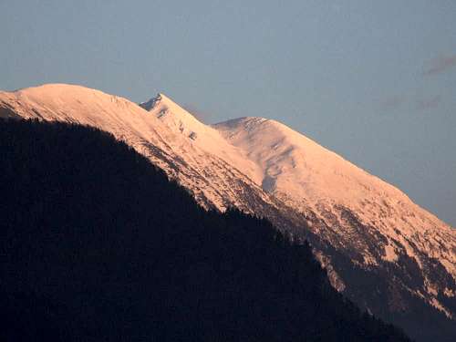
While the best ski tours on Stol / Hochstuhl, with 2236 m the highest summit of Karawanks, are coming from the N or E, this one uses the normal southwestern approach route from Valvasorjev dom (hut). The road till there is closed in winter, but when it's cleaned in spring this tour becomes attractive also due to its half-day character. Only a steep passage in the lower part is spoiling its highest attractiveness grade.
Getting There
To the Moste village (just SE of Jecenice) we can drive by the good local road (No. 452), it also has a bus connection. If we have own car, we continue from the Moste into the Završnica valley (1.6 km), where we find near the lake a big, free parking place, 634 m.
From Završnica, a macadam mountain road ascends northwards to the Valvasor hut (2.95 km). If this road is not cleaned (or is closed for other reasons), that stretch becomes the lowest part of your ski tour.
Tour Characteristics
Best day time
The slopes are oriented mostly towards the S and W, so any time during the day can be fine. In a hot, sunny day, be early, of course.
Maps
Online map on this page is sufficient. The classical map is: Karavanke, 1:20000. Planinska zveza Slovenije.
Mountain Huts
- Valvasorjev dom, 1181 m. Open from mid May til the end of September, outside this time window also on some nice weekends. No winter room.
- Prešernova koča, 2177 m. Open from June til September. No winter room.
Route Description
Ascent. From the Valvasor hut we go first towards the E-SE, on Žirovniška planina (meadow), either by the marked trail (red marks) or by the cart-road, going a bit lower. In any case we must reach the trails branching 1212 m, which is above the 2 huts on that meadow.
|
|
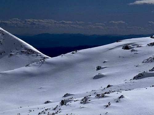
From there, we continue up, in the NE direction. We follow the summer trail, which starts ascending in switchbacks through the steep forest. Higher, after it exits the forest, we find ourselves on the E slopes above the distinct valley/ravine, which higher in a long arc turns right. Also these E slopes are still steep and due to their W orientation snow on them is usually hard. Where the valley goes already towards the E-NE, there's on ca. 1935 m a branching, where we can either ascend right on the W ridge of Mali Stol (if we want to continue ascending on foot), or we can continue (also on skis) by the valley on the saddle between the Mali Stol and the main summit. Then left on the highest point.
|
|
|
Skiing down. It goes first by the short summit slope (we can choose its steepness), then by the valley between the two summits of Stol. We follow it as long as possible, only when it starts turning southwards, we cross on the left (eastern) slopes and continue there down (we ascended there). So, below the ravine ends with an almost vertical, rocky step, make sure to detour it by the left side, where the summer route goes. The next stretch goes down by steep forest, not the best for skiing. Below is then easier, especially if there's enough snow.
This ski route can not be well combined with other nearby ski routes, unless if we decide to ski down by one of the two very steep ravines below the Prešernova koča..
Essential Gear
Normal tour skiing equipment can be enough, if snow is not hard or even icy. In any case ice axe is recommended.