
-
 4315 Hits
-
 73.06% Score
-
 3 Votes
|
|
Route |
|---|---|
|
|
46.94480°N / 12.69760°E |
|
|
Download GPX » View Route on Map |
|
|
Mountaineering, Mixed |
|
|
Summer, Fall |
|
|
Most of a day |
|
|
Difficult, quite exposed walk-up, snow ridge |
|
|
Approach
The ascent starts at Hochschober Huette, 2322 m. See the parent page of Hochschober how to get there!On the interactive map below, our route is the violet one.
View Hochschober SE Route in a larger map
Route Description
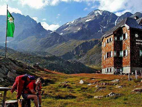
Hochschober Huette and the summit of Hochschober. The ascent goes over the saddle on the left and then by the left skyline.
On Staniska Scharte you turn right (towards the East). You scramble up over the rocky ridge, approaching to the Point 3185 m. Before reaching it, the path traverses its south slopes. In hard snow or ice it can be tricky, because the traverse is exposed. But in normal conditions there are no problems and you continue by the beautiful snowy summit ridge of Hochschober. On your left you can see the whole North slope, covered with glacier. Soon the ridge becomes steep again. You scramble over rocks, one rock slab can be slippery in snow or ice, so it is again secured by a steel rope, which is unfortunately hanging much towards the right. But soon the ridge becomes harmless again and you reach the summit (in a good one hour from Staniska Scharte).
For a descent the same route is possible, but of course it is much more awarding to use one of other routes, for example the south-east ridge and slope.