
|
|
Route |
|---|---|
|
|
46.94480°N / 12.69760°E |
|
|
Mountaineering, Ice Climbing, Skiing |
|
|
Spring, Summer |
|
|
Most of a day |
|
|
4 of 5 Austrian ski difficulty grades |
|
|
Approach
With the car to Kals an der Glocknerstraße. Then drive towards Lesachalm-hut (look for the hut here). At the end of the village there is a parking lot, walk from here 2.5 hours to the hut. Or call the hut and ask if they authorize you to drive up to the point were the road is closed (parking lot for 2 to 3 cars maximum). From here approximately 1.5 hour walk to the hut.Route Description
The in earlier times famous iceclimb can now only be recommended as a skitour. The glacier is broken and large parts melted away in the last years. During summer it can be seen that the face is no longer completely ice covered, there is a small rocky belt in the middle.However, as a ski tour it is still a fantastic route, the best time is between mid of march until end of may, possibly even later into june if snowconditions allow it.
From the hut pass a tiny stream at the south side. From here the summer trail leads steeply up into the wood. Though it is possible to ascend and downhill here, it's by far nicer to use the other approach with ski's, which I describe below. However, the summer trail is less endangered by avalanches, so you may want to use it dependent on conditions. It is marked, and the marks can be seen on the trees even when there is deep snow, so I don't describe it.
Here is my preferred ascent (again: take special care of avalanches here):
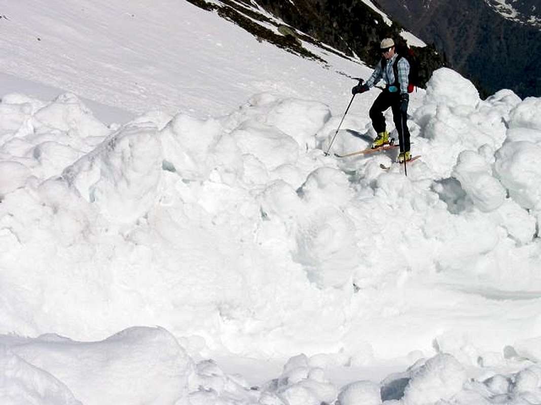
Pass the entry to the summer trail and go west, only slightly ascending, until you reach a stream. Follow the stream into the Ralf-Tal (Ralf valley) in a curve to the south. You may need to cross the stream several times on snowbridges, but if you go early enough in the year, it is almost completely snowcovered. Take special care of avalanches from Wasserfallspitzen and from Winkelegg:
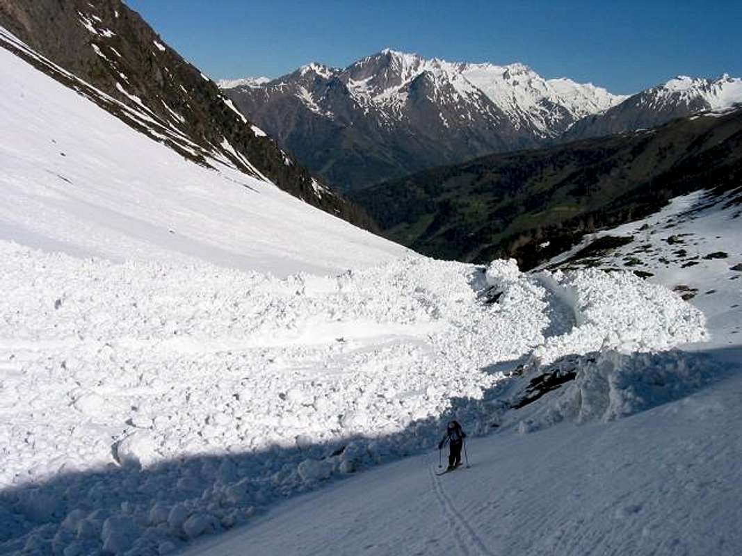
Follow the Ralf-Tal up to 2600m, where you will reach the summer trail again (this point is from now on referred to as "junction").
From Lesachalm-hut to here 1.5 to 2.5 hours (all times are given under the assumption of good conditions).
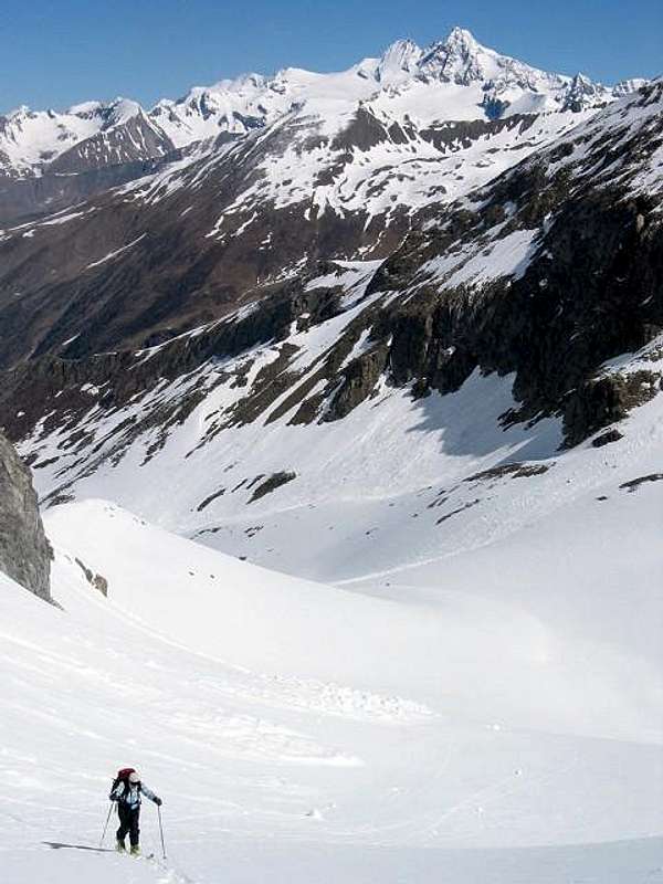
Shortly after the junction you'll have great views:
From here 2 possibilities:
1) If you are in good shape it's possible to climb another 3000er from here before Hochschober, the Ganot (3102m), a very nice ski summit, too. Just ascend in a wide curve to the left below Ralfkopf to the summit. From the summit it's best to ski down only to approximately 2700m and then ascend to the "Schobertörl" (2898m). If you intend to downhill then from here into the Ralftal, then leave your ski's here and climb via the northeast ridge and via Kleinschober to Hochschober (3242m). If you want to downhill the northface, you need to carry your ski's with you.
Time from junction via Ganot and Schobertörl to Hochschober: 3 to 4.5 hours.
Time from junction directly to Schobertörl and Hochschober: 2 to 3 hours.
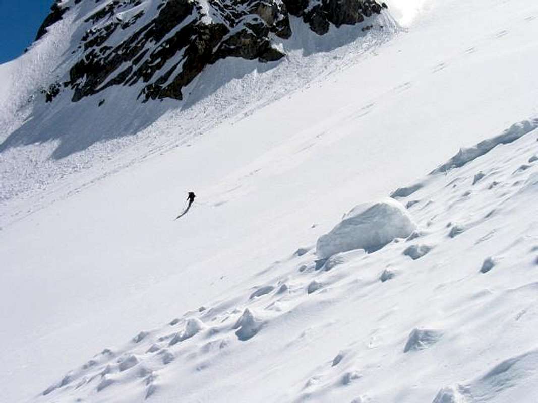
2) Directly ascend from the junction through the northface. Under normal circumstances (e.g. like in may 2004) direct exit to the summit-cross is possible without touching a rock.
Time from junction to summit: 1.5 to 2.5 hours.
Northface downhill: The northface has a maximum steepness of 45 degrees.
It is a very good route for extreme skiing beginners because it is relatively wide, not too high (approx. 1200 feet) and flattens slowly at the end.
However, if it has a frozen surface or to less snowcoverage, it should be set aside as a ski downhill and tried at better conditions.
From my point of view the most difficult thing is to find a good entry with enough snow coverage. Later in the year it may not be possible to enter directly from the summit without touching rocks. In this case I recommend to climb down to the saddle between Kleinschober and Hochschober. From here an entry with ski's from the beginning should be always possible.
Tip: If you want to go at both Ganot and Hochschober, go to Ganot first. Because of the orientation of the slopes towards the sun you will have better snow conditions on the entire way along the route.
Essential Gear
Normal ski mountaineering equipment, including avalanche tracker and shovel.Crampons and ice axes should be with you. We never use a rope here, because we only go there to enjoy the route at best conditions, and the small crevasse areas can be avoided. However, I never recommend in the public to walk on a glacier without a rope, it's your decision.
You may also want to use a rope if you go at bad conditions (but then you can't ski down).