
-
 944 Hits
-
 77.48% Score
-
 8 Votes
|
|
Route |
|---|---|
|
|
46.36012°N / 13.80774°E |
|
|
Skiing |
|
|
Spring |
|
|
One to two days |
|
|
Medium difficult skiing |
|
|
Overview
Even if the slopes from the summit of Kanjavec down to the Valley of Triglav Lakes are ideal for skiing, this tour was never described on SP. The reason is that from the lower parts of the valley you can't ski directly down into Bohinj valley. Walking down 660 m of altitude (over the Komarča) with skis does not make much sense, so this tour is almost always done as a part of multi-days ski treks. The options are the following:
- The classical Eastern Julian Alps trek. (Vogel) - Komna - Triglav Lakes - Kanjavec - Krma (so, skiing down on the other side).
- The descent from Kanjavec into Bohinj via the Triglav Lakes and Komna.
- The descent from Kanjavec into Bohinj via the Triglav Lakes and Bohinj Alpine Meadows.
There are some other options as well. All these are longer treks, requiring good logistic.
Regardless the direction you are going to, finding yourself with skis in the Valley of Triglav Lakes in combination with the ascent on Kanjavec, is a wonderful experience. The scenery, the slopes for skiing and the panoramas are all great. Skiing is medium difficult, nowhere too steep.
Despite the title, the tour will be described in the reverse direction - from the hut in the Valley of Triglav Lakes (winter room there), 1685 m, up to the summit of Kanjavec. If you then really ski down by this route, see the next chapter to learn how to get down in Bohinj.
Winter ascent to the hut
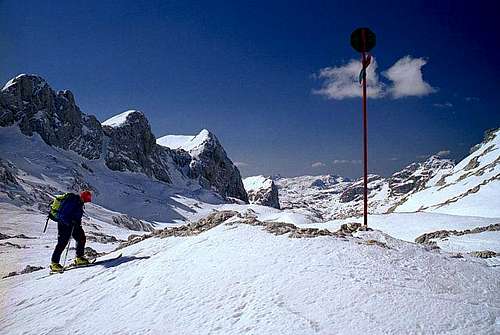
1. Via Komarča wall
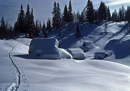
It's a steep, partly rocky end of Bohinj valley, this Komarča. The marked trail is narrow, partly exposed and on a few places secured with pegs and cables. From the parking place at Savica hut, 654 m, you cross the stream of Savica and then start climbing by a steep trail. In several turns you climb northwards, until the trail exits the steep slope at the bench on some 1300 m. When on a ski tour, you must carefully judge if this ascent is doable in winter conditions. On one hand, the slopes are oriented towards the south, so they may be free of snow even if the mountains around are still perfect ski touring goals. On the other hand, steep and exposed passages may even then require winter equipment - ice pick and crampons. And in deep snow it is very likely that the trail is not trudged at all. Generally, in winter conditions the Komarča route should be avoided and the route via Komna is preferred.
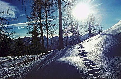
From the top of Komarča, you continue towards the west. The terrain is easy, forested, you can go on skis. In some 15 minutes you reach the Črno jezero (Black lake), which will be under ice and snow. The route detours it by the northern side. Then you continue through dense woods westwards and north-westwards, ascending gently by the valley bottom. In less than an hour you reach the characteristic Bela skala (White rock), nice limestone cliffs on the right. Immediately after passing them, you ascend steeply towards the north, gaining some 200 m of altitude. When above the valley step, you are already in the real Valley of Triglav Lakes. Towards the north you continue gently to the hut. Before the hut, be careful - do detour the Dvojno jezero (Double Lake) by the right (eastern) side. Good 3 hours.
2. Via Komna
The broad plateau of Komna is a paradise for ski touring. There are two mountain huts, so you can also sleep there, or you can ascend to Dom na Komni (hut), 1510 m, from Savica parking place, 654 m, in less than three hours.
Crossing the Komna plateau towards the Valley of Triglav Lakes can be an orientation challenge, but due to the popularity of the area in ski touring times the ski tracks are often beaten. The whole stretch is also marked by long poles of "Triglavska Transverzala". But still, don't attempt this crossing in poor visibility!
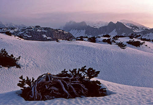
From Dom na Komni you continue northwards (and not towards the north-west, towards Koča (hut) pod Bogatinom). You ascend a bit and then continue across the plateau in the NW direction. After some 30 minutes from the left also the track from Bogatin hut may join. Then you continue ascending across Lepa Komna towards the NW, ahead of you is the summit of Kraj Kala. Before reaching its foothills the track turns slightly to the right (northwards) and soon starts descending into the basin of Na Kalu, 1610 m. The descent is short, then a much longer, albeit very gentle ascent follows. In a long left turn we go mostly towards the north, finally slightly descending again into the basin of Lopučnica. There, the direction turns right, towards the east (the sharp summit of Tičarica can be your guide point). Till the Valley of Triglav Lakes we must overcome a 170 m high ridge, overgrown with the last larches. On the altitude of some 1700 m we detour it by the southern side and slide gently down to the hut. 3 hours from Komna.
3. Via Planina pri Jezeru
This is the long route via the High Bohinj Alpine Meadows and can serve also as a descent route in Bohinj valley. If ascending by it, we start in the valley of Suha (reachable from Stara Fužina). From there, Kanjavec is reachable also directly; see the routes around Debeli vrh! But if going into the Valley of Triglav Lakes, we ascend first to Blato meadow (in summer end of the road there), then continue westwards to Planina pri Jezeru (1 hour), further westwards to Planina Ovčarija (1 h 30 min), further to the NW on Štapce notch (45 min) and finally steeply down into the Valley of Triglav Lakes (30 min). Altogether count on 4-5 hours to the hut. The descent from Štapce notch can be very difficult - over the upper rocky part a short ferrata stretch goes.
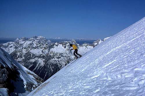
Kanjavec ascent
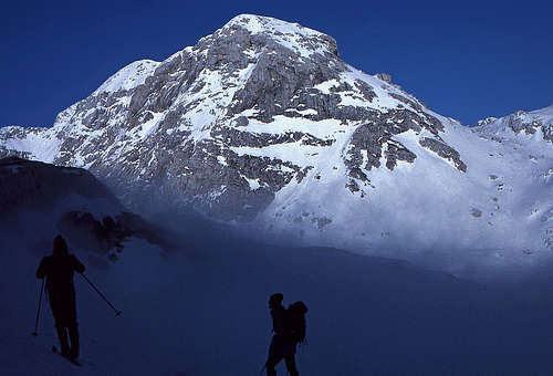
From the hut we continue by the valley up in the northern direction. If we start in the morning, the slopes below the walls of Tičarica, Kopica and Zelnarica will be in shadow and the snow very hard. Going below, by the valley bottom is not advisable, because there are some lakes (at least the Big Lake) and you know nothing about the ice thickness. So, the ascent track usually crosses the slopes a bih higher, making sure of avoiding unnecessary ups and downs.
|
|
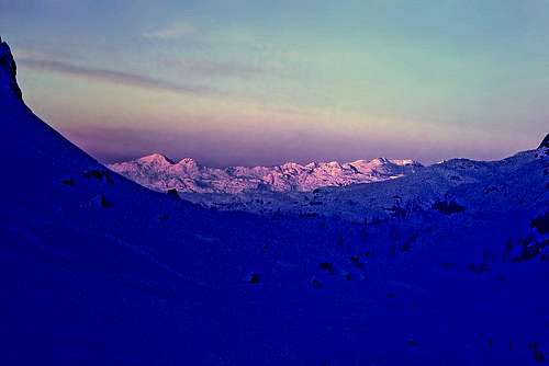
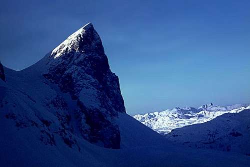
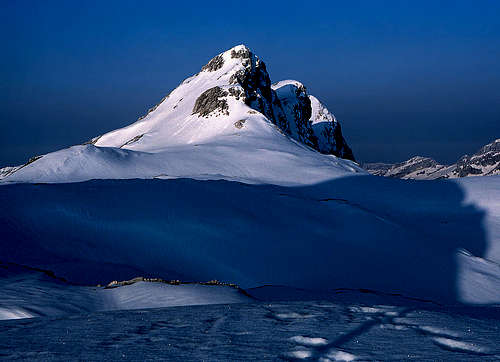
In good one hour we pass the Big Lake, where the valley narrows a bit. There we continue by the valley bottom, the route starts turning slightly right, in the NE direction. On some 2000 m (at Zeleno jezero / Green Lake) we reach the branching (see the long poles with marks). Left is the Prehodavci pass and its hut (also winter room there), right, towards the NE is the steeper passage to Hribarice plateau. So, we ascend right, going straight or in long turns below the southern slopes of Poprovec, 2496 m, until reaching the Hribarice plateau on some 2330 m. The two summits of Kanjavec are just north of us. We can ascend wherever we wish, choosing the least inclined slopes. At the end, let's go on the western summit, 2569 m, which offers the greatest panorama. 3 h from the hut.
|
|
|
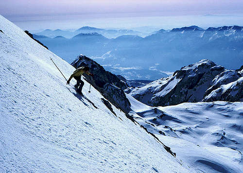
Descent
| As described on the main page of Kanjavec, we can ski down in many directions. See also other route descriptions! If skiing down by the Valley of Triglav Lakes, the slopes are wonderful till the hut in the lower part of the valley. There decide where to descend in Bohinj. |
|

|
Essential gear
Usual ski touring equipment.
If you ascend over the Komarča wall, consider the use of ice pick and crampons (if still under snow).
If coming from Komna or Blato meadow, have a good navigation equipment.