
-
 13187 Hits
-
 73.78% Score
-
 4 Votes
|
|
Route |
|---|---|
|
|
36.08704°N / 115.48071°W |
|
|
Scrambling |
|
|
Spring, Fall |
|
|
Most of a day |
|
|
Class 4 |
|
|
Overview
Most of the text on this page is by the original author of it, Branch Whitney. His description is perfectly adequate; in adopting this page, I have made some edits for grammar and clarity and have added some beta photos that hopefully will be useful to people.Mt. Wilson is a massive mountain located in the center of Red Rock Canyon.
This is not your typical desert peak. The rock is sandstone. The approach into Oak Creek is all trail. There's virtually no loose rock on the entire route. At first glance many of the dryfalls (sometimes wet) in Oak Creek look technical, but they are not! This route, like most routes in Red Rock, is like a maze. There's always a way, and you just have to persist and find it.
The route is very scenic with water normally present through Oak Creek.
It's a long route. Make sure to bring lots of water. Once you leave the canyon, the route is dry.
Getting There
From Summerlin, follow Charleston Boulevard (SR 159) west to the entrance to the Scenic Loop through Red Rock Canyon National Conservation Area ($7 per vehicle entry fee as of Summer 2013). Drive 10-11 miles to the large, signed parking area for Pine Creek Canyon.
159 is also accessible from the west via SR 160.
There is a parking area for Oak Creek Canyon off SR 160 shortly after the exit of the Scenic Loop. Although the approach is slightly longer this way, there is no entrance fee.
Route Description
RT distance is 10-12 miles with around 3000' of elevation gain. The going in Oak Creek canyon can be slow both ways, so plan time and provisions accordingly.Follow the trail SW about one mile to the mouth of Oak Creek Canyon. Go west in the wash and boulder to where the canyon divides. There’s some easy class 3 bouldering in this first part of the canyon. At the divide continue in the main canyon; do not go into the north (right) fork. Technically, you are in the middle fork of Oak Creek Canyon. Continue up the canyon, passing a south-heading fork.
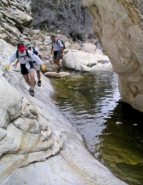
Hikers in Oak Creek
The next part of the canyon feautes numerous dry/wet falls. Look for the easiest route up the falls. Many are cairned. The climbing ranges from easy class 3 to moderate class 4.
Waterfall in Oak Creek Canyon
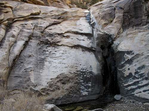
The last fall looks technical but isn't. Climb the right side.
Last fall-- the Crux?
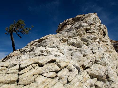
Once up, veer south into a small canyon and exit by the pinnacle high up.
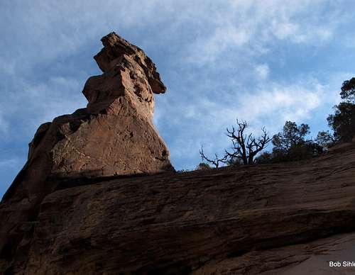
A Closer View of the Pinnacle
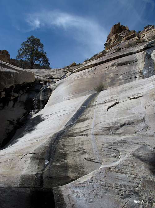
Once out of the canyon, head up the backside of the mountain aiming for the crag seen in the photo below.
Route once out of the Canyon
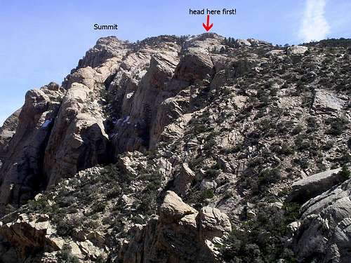
Descend the crag and head NE. Soon the red-tipped summit comes into view.
Nothing other than good hiking boots. Some might want a rope for some of the dryfall pitches. 60 feet should do the trick.