
|
|
Mountain/Rock |
|---|---|
|
|
48.21007°N / 121.36739°W |
|
|
Snohomish |
|
|
5420 ft / 1652 m |
|
|
Overview
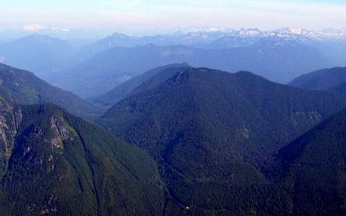
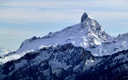
Rat Trap Mountain from Mount Pugh
Getting There
From Darrington, follow State Route 530 north for 7.5 miles. Here, make a right hand turn onto the Suiattle River Road (immediately after crossing the Sauk River). Follow the Suiattle River Road for 9.8 miles, then make a right hand turn onto FR25 (you will cross the Suiattle River immediately after making this turn). Follow FR25 for three miles, then turn right onto FR27. Follow FR27 for two miles, then turn right on FR2703. (At this point, a sign informed us that the road was closed at 1.7 miles, and until recently, this was the case.) Follow FR2703 for seven miles, until reaching the end of the road (N48 12.628 W121 20.103 Elev. 4100'). Now turn around, and backtrack for approximately 0.2 miles, looking for the short side trail that will lead to the Circle Peak trail on the southwest side of the road (I gave the directions this way because the trail is much easier to see driving northwest on FR2703). As of this writing (October 2013), I would recommend a high clearance vehicle for this road (My Subaru made it through just fine - be careful if you're driving anything lower).Note: It may be advantageous to park at the end of FR2703 and walk back to the "trailhead", as there is really not much room to park at that location.
![Rat Trap Mountain route map]()
Rat Trap Mountain route map. A small portion of the Circle Peak and Crystal Lake trails have been added for reference.
From here, the ridge leading to the summit is very well defined and obvious. There is very little brush, and very few blowdowns to deal with. Unlike most of my offtrail scrambling, this ridge almost bordered on "pleasant". At times, you will come across various colors of survey tape, which should just be ignored. Some of the survey tape trails will lead off of the ridge crest, which is completely unnecessary, as the ridge crest will be no harder than class 2 at any point.
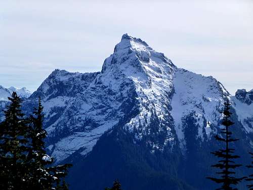
![Rat Trap Mountain east ridge]()
Rat Trap Mountain east ridge. It's hard to believe such an easy scrambling route can be found on a low elevation peak in Western Washington.
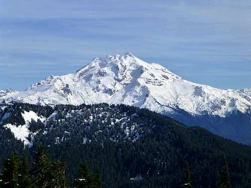
![White Chuck Mountain from Rat Trap Mountain]()
White Chuck Mountain from Rat Trap Mountain. A small part of Thornton Lake can be seen in the photo.
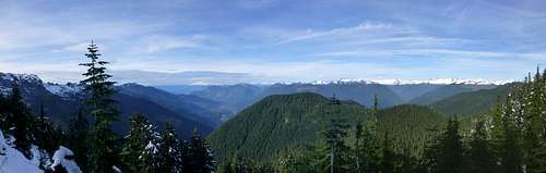
![Rat Trap Mountain summit view facing north]()
Rat Trap Mountain summit view facing north
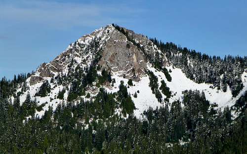
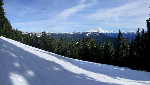
![Rat Trap Mountain summit view facing southeast]()
Rat Trap Mountain summit view facing southeast
Route
From the "trailhead", hike uphill a few hundred feet, until reaching the well-defined Circle Peak trail. Turn right (left will take you to Circle Peak), and follow this trail a short distance, until reaching a very obvious saddle (N48 12.550 W121 20.370 Elev. 4250'). Here is where you will begin your scramble up Rat Trap Mountain's east ridge. (If you were to continue on the main trail from this point, you would eventually arrive at Crystal Lake.)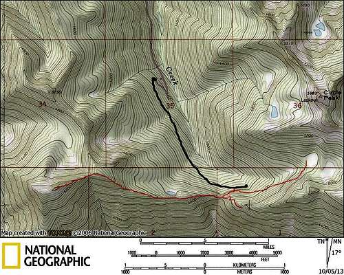
Rat Trap Mountain route map. A small portion of the Circle Peak and Crystal Lake trails have been added for reference.
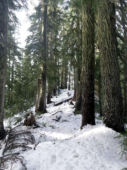
Rat Trap Mountain east ridge. It's hard to believe such an easy scrambling route can be found on a low elevation peak in Western Washington.
After approximately one mile, you will arrive at Rat Trap Mountain's false east summit (5180'). From here, drop down about 100' in elevation, and continue west for one-third of a mile to the main summit ridge. Rat Trap Mountain does not have a well defined summit, so just wander around until you are satisfied that you have found the highest point. This is also advantageous for picture taking, as there is no one spot to get a 360 degree view. By visiting about four different spots on the summit, you will be able to take in views in most directions.
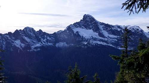
White Chuck Mountain from Rat Trap Mountain. A small part of Thornton Lake can be seen in the photo.
Rat Trap Mountain summit view facing north
Rat Trap Mountain summit view facing southeast