
|
|
Mountain/Rock |
|---|---|
|
|
38.29388°N / 119.63382°W |
|
|
Mono |
|
|
Scrambling |
|
|
Summer, Fall |
|
|
11000 ft / 3353 m |
|
|
Overview
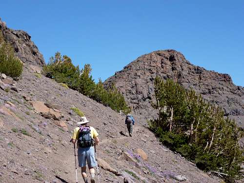
South side of Point 11000 - "Little Latopie" rising above the PCT
Point 11,000’ is the smaller pyramid-shaped neighbor immediately east of Latopie Peak 11,265’, and northeast of Leavitt Peak 11,570’. I am referring to it as “Little Latopie” given that it shares features with its higher neighbor and is directly across the Pacific Crest Trail (PCT) from it. It is not officially a peak, since it only has a prominence of 236’ between it and Latopie Peak, but it deserves its own page given it is a worthwhile destination when hiking in this area, and if wanting a great view and fun challenge off the PCT. It is a great add-on to hiking Leavitt Peak.
As with its neighbors, views are spectacular, with the high peaks of the Hoover Wilderness and Yosemite to the south. There are mountains for miles around.
Typically the PCT from Sonora Pass is hiked in late July through late September. Snowpack is heavy the rest of the year.
Getting There
Getting to the trailheadTo get to Sonora Pass from the east or west, the only way is to get to Highway 108, Sonora Pass Road. The Sonora Pass is a little over 65 miles east of Sonora, California. It is about 108 miles from Reno, Nevada via Highway 395. At the Sonora Pass Junction with 395, it is about 15 miles to the trailhead.
It takes about 25-30 minutes once on 108, due to the twists and turns as the road switchbacks up to Sonora Pass, cresting at 9624’. There is a parking area above the north side of the highway. There is also parking along the highway on the immediate north and south of the PCT, although the north parking lot is preferred. Hikers heading to Leavitt Peak, or its neighbors will head south on the PCT.
Route
Take the PCT for about 3 ½ miles from the south side of Highway 108 at Sonora Pass. The trail crests in between Latopie Peak and Point 11,000 before dropping down along the south side of Latopie Peak and heading towards the east side of Leavitt Peak. Once at the crest, a sandy use trail heads east for 100 yards towards the base of Point 11,000. It is recommended you leave your pack at the base, and climb straight up to the summit. It is easy Class 3 climbing with some loose rock that eases into Class 2. There are mostly good hand holds and foot holds.
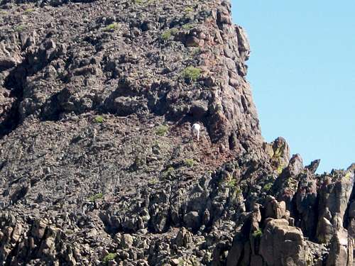
Attacking the hillside up to Point 11,000 - "Little Latopie"
Once near the summit, the terrain gets more forgiving, and it is a light scramble to the top. On the way down, there are alternate routes down scree that are not too dangerous. Just stay focused and be careful and the down climb will take several minutes back to the base. All told, this is a 12 to 20 minute off-shoot from the PCT. If hiking from Sonora Pass, Point 11000 is about 3 3/4 miles from the trailhead on the south side of the road, gaining about 1700'.
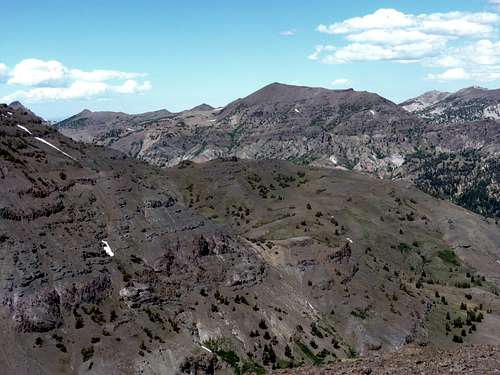
Sonora Peak 11,459' seen from the summit
Red Tape
There are no permits required for day hiking in the Emigrant Wilderness or Stanlislaus National Forest, nor any fees for parking at the trailhead. Sonora Pass is closed during winter months. A Wilderness Permit is needed if camping in the Emigrant Wilderness. There are several campsites along Highway 108. See the External Links section below to find camping information.External Links
External LinksStanlislaus National Forest
Emigrant Wilderness