Intro/Stats
Pikes Peak (14115')
"Little Pikes Peak" (13363')
Devil's Playground (13070')
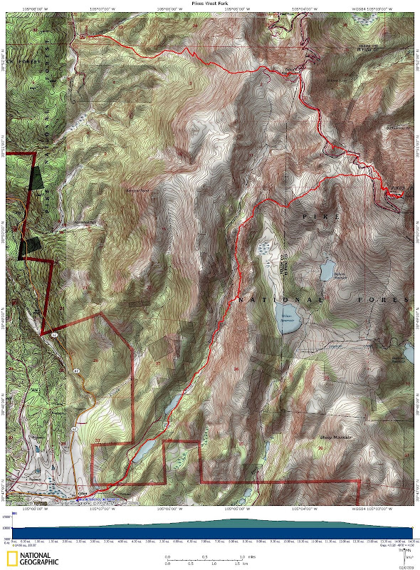
14.7 miles RT, 5130' gain
via West Fork/descend Crags route
Participants: Jim Ohl, Rodney Keaney, Dave "Hoot" Gibson, and Kevin Baker
Slideshow
Jim and I have a goal of climbing Pikes in every month since it's in our backyard. We also would like to come up with as many route possibilities as we can. The West Fork is a seldom traveled route on the s.w. side of Pikes that in my opinion ranks right behind the Bottomless Pit as the most scenic side of Pikes. A route description exists on summitpost, but there is a private property issue to deal with at the beginning of the route. We hoped for a nice Sat in Feb, and were blessed with one on the first weekend! It seems like old man winter has taken a break of late, but I'm sure it will awake from its slumber soon.
We were originally thinking of making this a backpack with the long approach, but the lack of snow in the area convinced us this would be a feasible dayhike. I recruited Hoot who is always up for new routes on Pikes and Jim recruited Rodney from his church. To cut off some distance, we parked Jim's Jeep at the Crags trailhead. This was a great loop, because we would have been wallowing in the dark for hours if we had to return via the West Fork.
Where's That Trail?
We set out from CO-67 and 81 at the old townsite of Gillette at 6:15am under clear skies and a temp of 17. I had been up the lower part of the West Fork drainage back in '07 for a climb of 12er McReynolds, but things have changed since then. We went up a steep, washed out road before coming to a tall fence surrounding some houses that weren't there before. We got around this problem by hiking north a few hundred yards and contouring back to the road beyond what we thought was the eastern boundary of the property. Back on the road, we followed it to the first Cripple Creek Reservoir and bushwacked along the western shore. We then followed the creek to the 2nd reservoir, where Jim and Rodney wisely elected to walk on the solid reservoir while Hoot and I wallowed in snow on the eastern shore. I think Hoot still thought he was snowboarding, as he took us down a steep, slick slope of sugar snow!
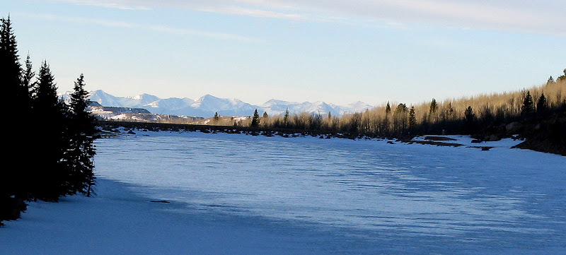
The 2nd reservoir and the Sangres:
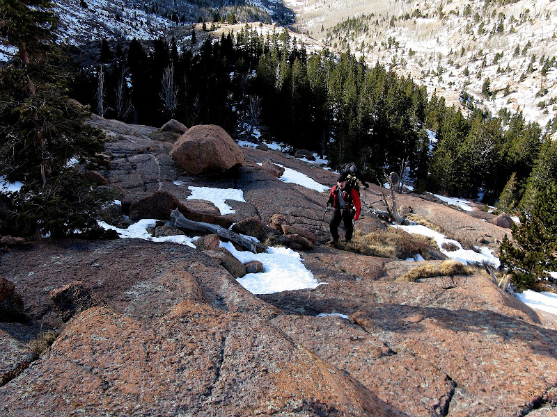
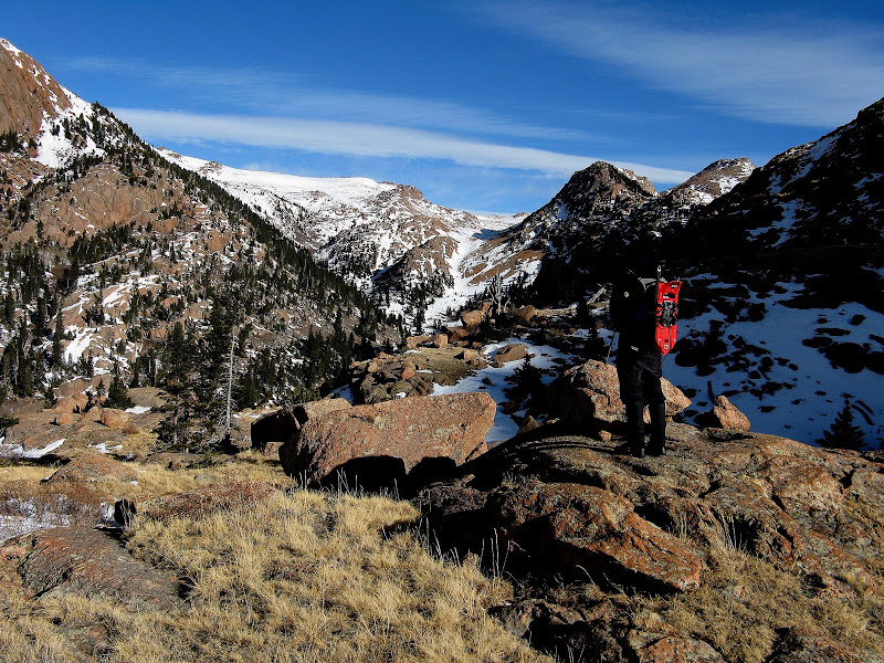
The snow wasn't more than a foot deep in most spots with dry patchs, but it was tough to find the seldom used trail and the snow was much deeper in the willows. We crossed the West Fork a few times and had a few brief willow bashing episodes, but nothing too bad. At around 11400', we decided to climb some fun low angle slabs in hopes of avoiding anymore willow wallowing.
Jim and Rodney on enjoyable low angle granite slabs:
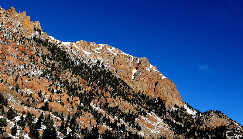
We really began to soak up the views in the drainage as steep granite walls ringed both sides.
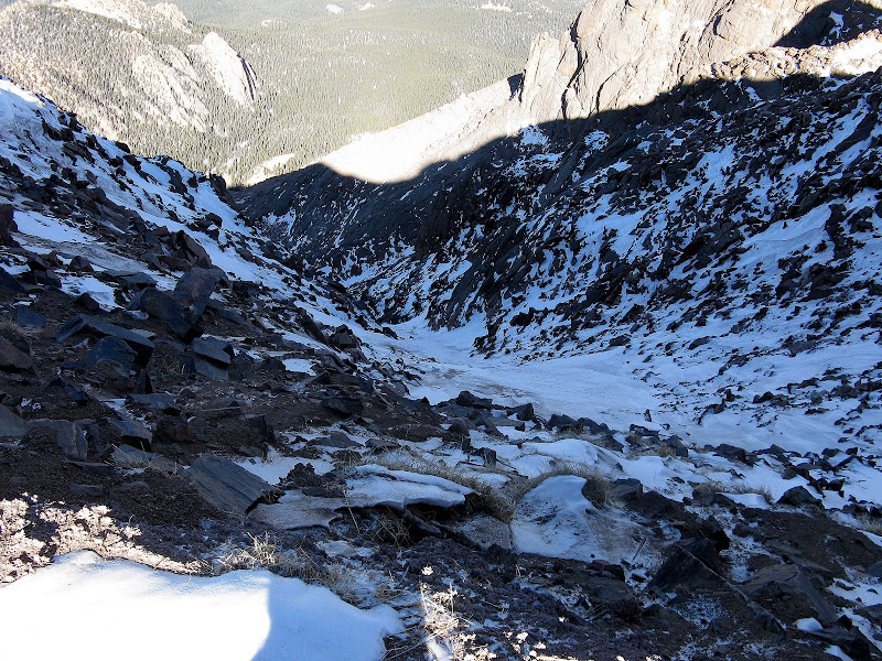
Looking down the drainage:
Hoot looking up the drainage:
The slabs gave way to steep, grassy slopes, which we traversed until it looked like there was a possibility we would cliff out. We were forced to downclimb a short but steep gully filled with snow down to easier terrain below.
We lost a couple hundred feet of elevation gain, but it still may have been faster than staying low in the valley where the willows were ready to swallow us up! It was now becoming apparent that this was going to be a huger effort than anticipated, but that's the name of the game in winter. Finally above treeline for good, we made good time up a mellow gully. I gambled and decided to not bring snowshoes on the hike, and it paid off. The snowshoes would have been good for traction up this gully, but I was rarely postholing.
Will the Summit Ever Come
We could now finally see the trail just to the right of us. We arrived at a small saddle at 12030' as the route now began to curve to the east towards Pikes. We still had a long ways to go as we could finally see the upper slopes. The trail headed steeply up the slope and then traversed across a few snowfields. We lost it again, and decided to beeline it up to a flatter area.
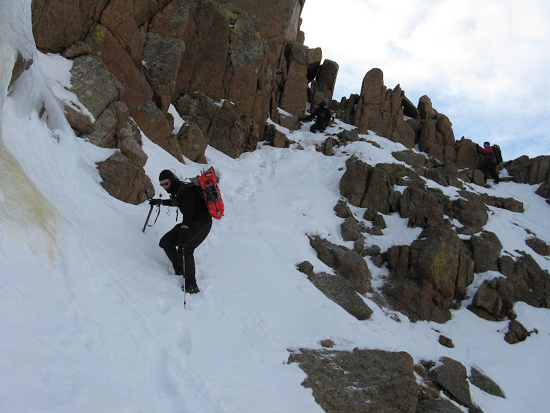
We pretty much headed directly to the finish of the Crags route up the n.w. ridge, but this involved losing some additional elevation. Hoot and I intersected the toll road at 13440', and joined the Crags trail as it switchbacked up the ridge. I donned a shell for the first time today as the wind picked up a bit, but it wasn't bad at all. The summit weather station recorded a high of 17.6 on the day. Rodney and Jim elected to follow the road and then up the final stretch of the cog. Up the ridge we slogged and it was here where the bonk monsters jumped on my pack and I hit the wall. I got a nice look down the far right branch of the Y couloir and it is looking mighty thin and icy. Hope it fills in this spring!
We finally topped out at around 2:30 and were happy to see the summit house open. I downed a chicken sandwich and a donut, which rejuvenated me enough for the descent. The last train had left, but a few motorists were still up there. Jim and Rodney elected to ride down with a tourist and catch a ride with Jim's wife Karen. They kindly moved my car over to the Crags TH. What service!
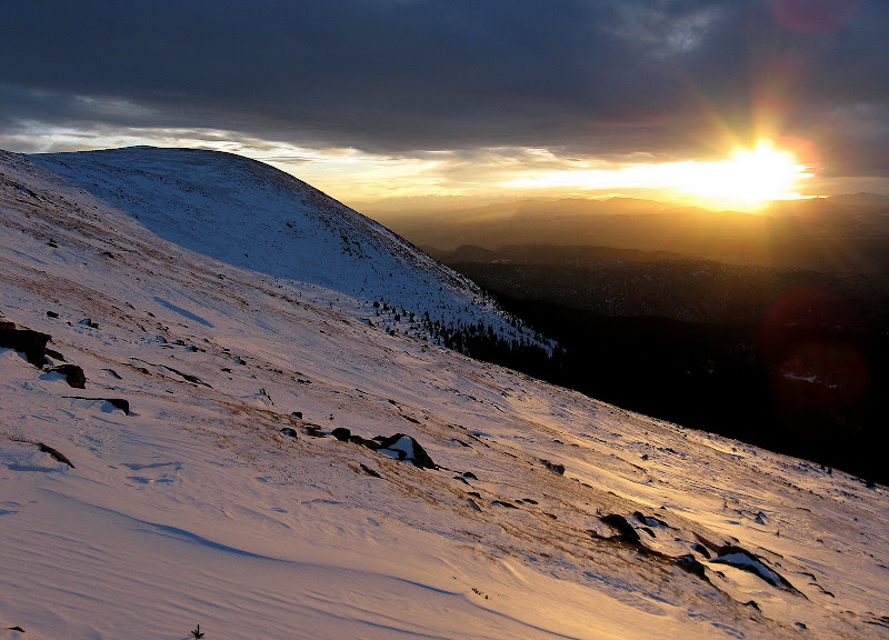
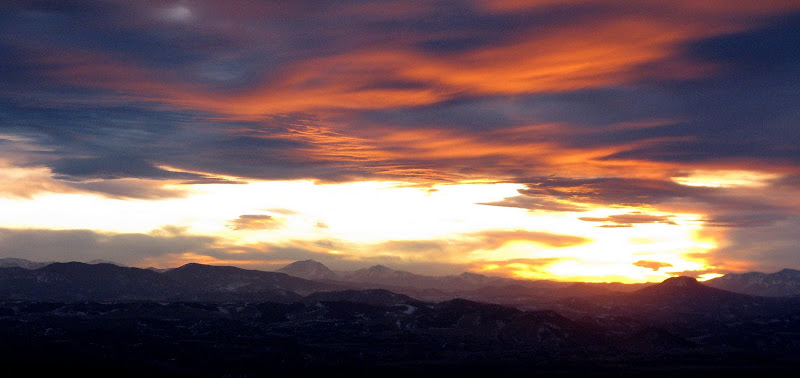
A Sunset Descent
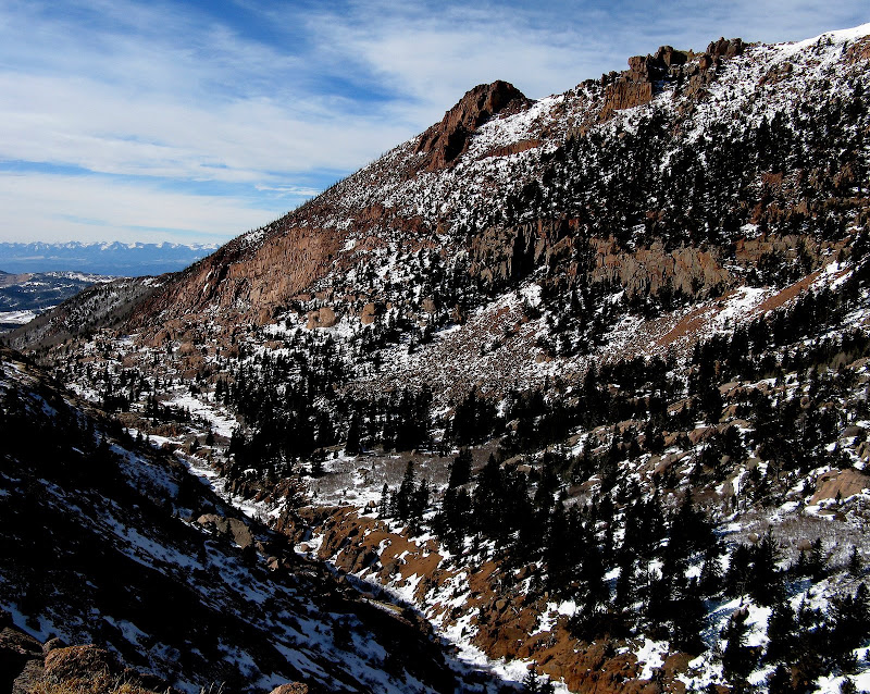
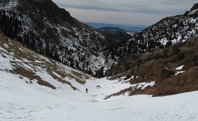
I was dreading going back down, but I knew the Crags route would go quick. After a 50 minute break, we headed down. The chicken sandwich gave me just enough energy to go over Little Pikes and Devil's Playground on the descent. I hadn't been up those since 2003, so that was a nice treat.
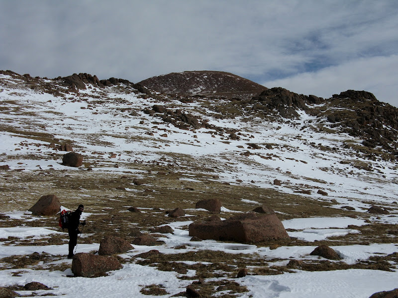
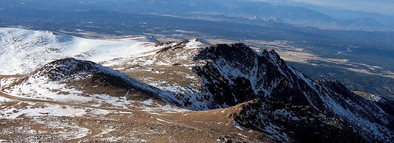
Little Pikes and Devil's Playground:
I met back up with Hoot where the Crags route traverses below Devil's Playground and we caught a gorgeous winter sunset. I've enjoyed a few sunrises on Pikes, but this was my first sunset!
We caught a few short glissades down the moderate slopes and found the trail, arriving back at treeline by sunset. The trail was a surprisingly enjoyable cruise, as it was well packed and soft. There were a few patches of ice to deal with though, and Hoot put on his snowshoes. We made it down to the trailhead at around 6:30 as the moon greeted us again. I would highly recommend this unique perspective on Pikes!


Comments
Post a Comment