-
 3477 Hits
-
 82.48% Score
-
 15 Votes
|
|
Mountain/Rock |
|---|---|
|
|
46.98286°N / 11.30008°E |
|
|
Trentino Alto-Adige |
|
|
Mountaineering |
|
|
Summer |
|
|
9895 ft / 3016 m |
|
|
What's new on this page?
PAGINA COMPLETA DI TRADUZIONE IN LINGUA ITALIANA - THE ITALIAN TRANSLATION ADDED TO THE PAGE (2023, January)
Overview
Parete Bianca/Weisswandspitze 3016 m
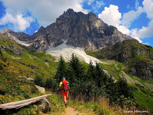
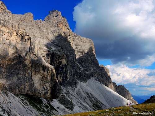
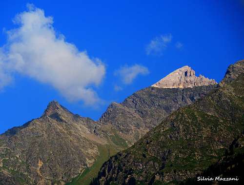
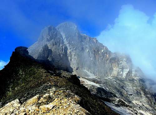
In the upper Valle Isarco, near the Brennero pass, there are two mountains that irresistibly attract the mountaineer's eye because of their particularity: the imposing dolomite wall of the Tribulaun di Fleres and to its left a peak rising with a triangular wall of white dolomia seeming a white cap of snow above a steep base of volcanic dark rocks: the Parete Bianca/Weisswandspitze 3016 m. As all the mountains belonging to the region South Tyrol/Alto Adige, located near the boundaries between Italy and Austria, this peak has two names: Parete Bianca, the italian name, and Weisswandspitze, the original tyrolese place-name. The mountain is situated inside the Eastern Breonie Alps (Stubaier Alpen according to the Tyrolean nomenclature) on the boundary ridge between Italy (Bolzano province) on the Southern side and Austria (Tyrol) on the Northern side. The small group of the Tribulaun of Fleres located to the East counts a handful of high peaks which, unlike the nearby mountains, consist of dolomite rock. It was just here at the base of the Tribulaun di Fleres that the French geologist Déodat de Dolomieu discovered this kind of rock, afterwards called "dolomia" in his honor. Later the name "Dolomites" was attributed to all the mountain groups constituted by this kind of rock located to the south-east of the Tribulaun group, which curiously nowadays is not part of the Dolomites.
|
|
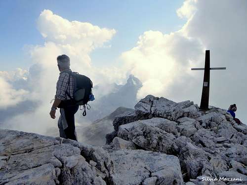
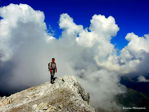
The Parete Bianca, fascinating with its curious structure and clearly visible from the valley floor, is climbed by means of a fine crossing route that connects two huts, the Rifugio Calciati / Tribulaunhütte and the Rifugio Cremona / Magdeburger Hütte. The itinerary can be indifferently done in both directions; here it will be described the route starting from the Rifugio Calciati. Just in the stretch where it occurs the change between the two different types of rock of the Parete Bianca wall, black below and white above, it runs along the entire wall a large gravel ledge, exposed, but not difficult, which can become delicate in the presence of snow or ice. It is the passage that allows you to do the crossing between the two sides of the mountain. Just after tackling this stretch, a short detour along the Southern ridge of the peak leads to the beautiful summit.
Nell'alta Valle Isarco, nei pressi del passo del Brennero, ci sono due montagne che attirano irresistibilmente l'occhio dell'alpinista per la loro particolarità: l'imponente parete dolomitica del Tribulaun di Fleres e alla sua sinistra una vetta che si erge con una parete triangolare di bianca dolomia che sembra una bianca calotta di neve sopra un ripido basamento di rocce vulcaniche scure: la Parete Bianca/Weisswandspitze 3016 m. Come tutte le montagne situate in Alto Adige, vicino ai confini tra Italia e Austria, questa vetta ha due nomi: Parete Bianca, il nome italiano, e Weisswandspitze, l'originario toponimo tirolese. La montagna si trova nel gruppo delle Alpi Breonie Orientali (Stubaier Alpen secondo la nomenclatura tirolese) sulla cresta di confine tra l'Italia ( provincia di Bolzano) a sud e l'Austria (Tirolo a nord). Il piccolo gruppo del Tribulaun di Fleres situato ad est conta una manciata di alte vette che, a differenza delle vicine montagne, sono costituite da roccia dolomitica. Fu proprio qui alla base del Tribulaun di Fleres che il geologo francese Déodat de Dolomieu scoprì questo tipo di roccia, in seguito chiamata "dolomia" in suo onore. Successivamente il nome "Dolomiti" fu attribuito a tutti i gruppi montuosi costituiti da questo tipo di roccia situati a sud-est del gruppo del Tribulaun, che oggi curiosamente non fa parte delle Dolomiti. La Parete Bianca, affascinante per la sua curiosa struttura e ben visibile dal fondovalle, si sale attraverso un bel percorso di traversata che collega due rifugi, il Rifugio Calciati / Tribulaunhütte e il Rifugio Cremona / Magdeburger Hütte. L'itinerario si può fare indifferentemente in entrambe le direzioni; qui verrà descritto il percorso partendo dal Rifugio Calciati. Proprio nel tratto in cui avviene il cambio tra i due diversi tipi di roccia della Parete Bianca, nera sotto e bianca sopra, tutta la parete è percorsa da una larga cengia ghiaiosa, esposta, ma non difficile, che può diventare delicata con la presenza di neve o ghiaccio. È il passaggio che permette di fare la traversata tra i due versanti della montagna. Subito dopo aver affrontato questo tratto, una breve deviazione lungo la cresta sud della montagna conduce alla bella vetta.
Getting There
The starting point to climb the Parete Bianca is the Val di Fleres/Pflerschtal.
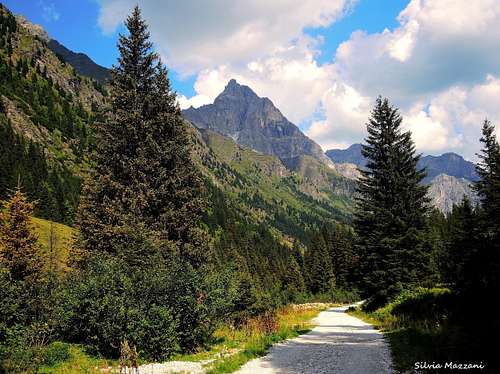
Road access
From the A22 Brennero motorway, exit Vipiteno, continue on the SS12 state road towards Brennero up to Colle Isarco/Gossensass 1110 m, town located 3 kilometers North to Vipiteno/Sterzing. At the entrance of the town, immediately after the second tunnel on the left, leave the state road and turn to left entering the Val de Fleres, the last valley before the Brennero Pass. Continue to Sant'Antonio-Fleres di Dentro, 1245 m. From here following the signpost to Sasso/Stein, take the road to the left towards Sasso / Stein, cross a first bridge and contine up to a large parking lot. From here it's possible to continue on a dirt road and park about 1,5 km further on another higher parking with regulated access (ban from 10 to 16). Public bus service from Vipiteno to Sant'Antonio in Flerés - St. Anton in Pflersch is available.
Il punto di partenza per salire la Parete Bianca è la Val di Fleres.
Accesso stradale
Dall'autostrada del Brennero A22, uscita Vipiteno, proseguire sulla statale SS12 in direzione Brennero fino a Colle Isarco/Gossensass 1110 m, paese situato 3 chilometri a nord di Vipiteno/Sterzing. All'ingresso del paese, subito dopo la seconda galleria a sinistra, si lascia la statale e si svolta a sinistra entrando in Val de Fleres, l'ultima valle prima del Brennero. Si prosegue per Sant'Antonio-Fleres di Dentro, 1245 m. Da qui seguendo la segnaletica per Sasso/Stein, si prende la strada a sinistra in direzione Sasso/Stein, si attraversa un primo ponte e si prosegue fino ad un ampio parcheggio. Da qui è possibile proseguire su strada sterrata e parcheggiare circa 1,5 km più avanti su un altro parcheggio più in alto con accesso regolamentato (divieto dalle 10 alle 16).
È disponibile un servizio di autobus pubblico da Vipiteno a Sant'Antonio in Flerés - St. Anton in Pflersch.
Parete Bianca/Weisswandspitze crossing from Rif. Calciati
Parete Bianca/Weisswandspitze crossing from Rifugio Calciati
Summit: 3016 m
Difficulty: Alpine F
Difference in level: 650 from Rifugio Calciati - 1600 m from the parking lot
Starting point: Rifugio Calciati
Spectacular mountain itinerary across the mountains of the main Alpine Divide, including peak ascent, rock ledge crossing and gorgeous panoramic views of the summits of the South Tyrolean Alps and Ötztaler Alps.
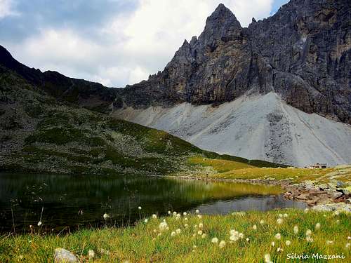
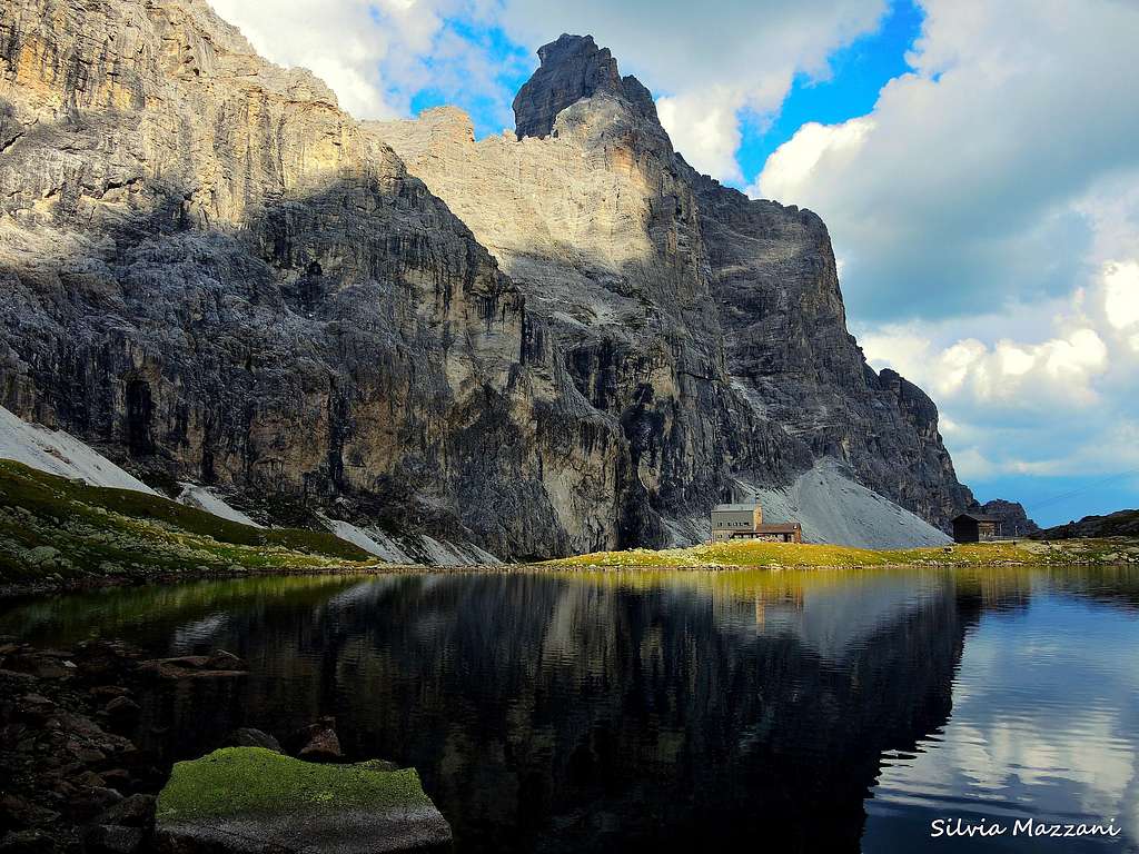
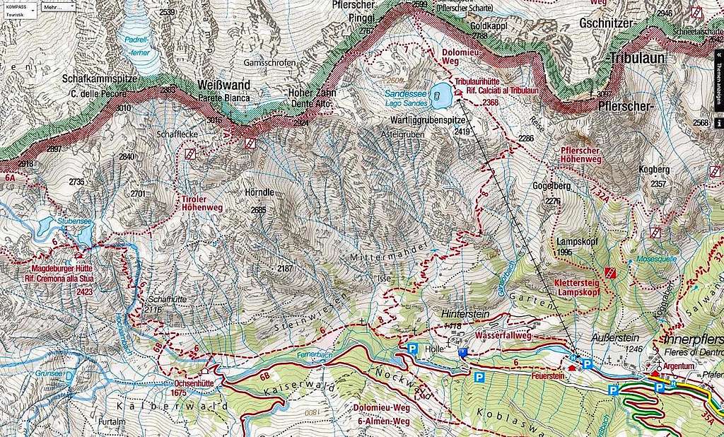
From the last parking lot near the waterfall "in der Hölle" 1465 m take the path n. 6 in the direction of Rifugio Cremona, descend slightly to the right to cross the wooden bridge over the stream Fleres and up on the opposite side in the woods until a signposted fork. Ignore the path n. 6 which proceeds to the left to the Ref. Cremona and continue to the right in the beautiful forest following the path n. 8. Continue along the path with numerous hairpins until you exit the woods. Alternatively it's possible to take a very steep variant on the right which quickly gains altitude along a grassy ridge and higher up joins the main path. Once out of the woods, you continue to climb uphill past the avalanche protection on the steep slope. You arrive at a beautiful waterfall and continue uphill until you reach a paoramic clearing with a Crucifix. The path continues to the left dominated by the spectacular and majestic wall of the Tribulaun of Fleres. We proceed uphill along the well-marked path, until we reach almost the base of the Tribulaun. From this point you continue past a fork on an almost level path for about 15 minutes until you reach the Rifugio Calciati 2369 (3 hours) in a magnificent location just under the majestic Tribulaun wall and on the shores of Lake Sanes.
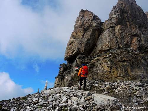
From the Rifugio Calciati take the path that connects the hut to the Rifugio Cremona (n. 7). Near the lake it begins to rise up towards the border ridge which is reached at the altitude of 2753 m, at first slightly uphill then along some steeper grassy slopes and large boulders. The trail runs along the ridge almost to the summit of the Dente Alto/Hoher Zahn 2925 m. Follow the ridge with incomparable views, then descend to a fork bounded by the eastern wall of the Parete Bianca. Climb up to the base of a pinnacle, then descend a bit and finally climb the last wall that reaches at 2870 m the beginning of the aerial horizontal rocky ledge cutting the wall just along the line of contact between the lower black schists (metamorphic rock) and the white dolomia above.
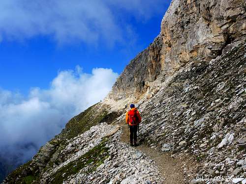
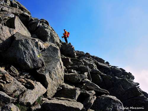
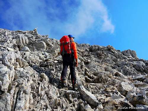
Follow the ledge, exposed but not difficult, then turn an edge to get the base of the Southern side of the peak. Near an arrow and a cairn leave the ledge and begin to climb on the right along not difficult rocks, steps and debris (cairns) that in about half an hour lead to the top of the superb peak at 3016 m of altitude. Reversing the summit rocky stretch gain the ledge again. Once on the ledge continue to the right taking the long path that descends steeply with several hairpins along a grassy and rocky slope to reach the bottom of a valley. Some sections are equipped by a fixed rope. After a horizontal stretch, the path briefly rises to reach the Rifugio Cremona 2423 m. It's possibile to follow a short variant which joins the path n. 6 without reach the refuge. Follow the path n. 6 which descends decisively and then crosses to reach the Malga Buoi / Ochsenhutte 1690 m. Always downhill you reach the valley floor and the starting point, where the ring closes.
Traversata della Parete Bianca/Weisswandspitze dal Rifugio Calciati
Quota: 3016 m
Difficoltà: F
Dislivello: 650 dal Rifugio Calciati - 1600 m dal parcheggio
Punto di partenza: Rifugio Calciati
Dall'ultimo parcheggio nei pressi della cascata "in der Hölle" 1465 m si imbocca il sentiero n. 6 per il Rifugio Cremona, si scende leggermente a destra per attraversare il ponte di legno sul torrente Fleres e si sale sul versante opposto nel bosco fino ad un bivio segnalato. Ignorare il sentiero n. 6 che procede a sinistra fino al Rif. Cremona e proseguire a destra nel bel bosco seguendo il sentiero n. 8. Si segue il sentiero con numerosi tornanti fino ad uscire dal bosco. In alternativa è possibile percorrere a destra una variante molto ripida che guadagna rapidamente quota lungo un costone erboso e più in alto si ricongiunge al sentiero principale. Usciti dal bosco si continua a salire lungo il ripido pendio superando il paravalanghe. Si arriva ad una bella cascata e si prosegue in salita fino a raggiungere una radura panoramica con un crocifisso. Il sentiero prosegue verso sinistra dominato dalla spettacolare e maestosa parete del Tribulaun di Fleres. Procediamo in salita lungo il sentiero ben segnalato, fino a raggiungere quasi la base del Tribulaun. Da questo punto si prosegue superando un bivio su un sentiero quasi pianeggiante per circa 15 minuti fino a raggiungere il Rifugio Calciati 2369 (3 ore) in magnifica posizione proprio sotto la maestosa parete del Tribulaun e sulle sponde del Lago Sanes.
Dal Rifugio Calciati si imbocca il sentiero che collega il rifugio al Rifugio Cremona (n. 7). In prossimità del lago si inizia a salire verso la cresta di confine che si raggiunge a quota 2753 m, dapprima in leggera salita, poi lungo alcuni pendii erbosi più ripidi e grossi massi. Il sentiero si snoda lungo la cresta fin quasi sulla vetta del Dente Alto/Hoher Zahn 2925 m. Si segue la cresta con panorami impareggiabili, quindi si scende fino ad un bivio delimitato dal versante est della Parete Bianca. Si sale alla base di un pinnacolo, quindi si scende un po' e si risalgono infine le ultime rocce che raggiungono a 2780 m l'inizio dell'aerea cengia rocciosa orizzontale che taglia la parete proprio lungo la linea di contatto tra gli scisti neri inferiori (roccia metamorfica) e la bianca dolomia al di sopra.
Si segue la cengia, esposta ma non difficile, quindi si gira uno spigolo per raggiungere la base del versante meridionale della vetta. In prossimità di una freccia e di un ometto si lascia la cengia e si inizia a salire sulla destra lungo roccette, gradoni e detriti (ometti) non difficili che in circa mezz'ora portano alla sommità della superba vetta a 3016 m di quota. Ripercorrendo a ritroso il tratto roccioso sommitale si ritorna alla cengia. Giunti sulla cengia si prosegue verso destra imboccando il lungo sentiero che scende ripido con diversi tornanti lungo un pendio erboso e roccioso fino a raggiungere il fondovalle. Alcuni tratti sono attrezzati con corda fissa. Dopo un tratto orizzontale il sentiero sale brevemente per raggiungere il Rifugio Cremona 2423 m. E' possibile seguire una breve variante che si ricongiunge al sentiero n. 6 senza raggiungere il rifugio. Seguire il sentiero n. 6 che scende decisamente e poi traversa per raggiungere la Malga Buoi/Ochsenhutte 1690 m. Sempre in discesa si raggiunge il fondovalle e il punto di partenza, dove si chiude l'anello.
Si segue la cengia, esposta ma non difficile, quindi si gira uno spigolo per raggiungere la base del versante meridionale della vetta. In prossimità di una freccia e di un ometto si lascia la cengia e si inizia a salire sulla destra lungo roccette, gradoni e detriti (ometti) non difficili che in circa mezz'ora portano alla sommità della superba vetta a 3016 m di quota. Invertendo il tratto roccioso sommitale si guadagna nuovamente la cengia. Giunti sulla cengia si prosegue verso destra imboccando il lungo sentiero che scende ripido con diversi tornanti lungo un pendio erboso e roccioso fino a raggiungere il fondovalle. Alcuni tratti sono attrezzati con corda fissa. Dopo un tratto orizzontale il sentiero sale brevemente per raggiungere il Rifugio Cremona 2423 m. E' possibile seguire una breve variante che si ricongiunge al sentiero n. 6 senza raggiungere il rifugio. Seguire il sentiero n. 6 che scende deciso e poi traversa per raggiungere la Malga Buoi/Ochsenhutte 1690 m. Sempre in discesa si raggiunge il fondovalle e il punto di partenza, dove si chiude l'anello.
Red Tape
No fees no permits required.
Nessuna restrizione particolare per l'arrampicata e l'escursionismo.
Huts
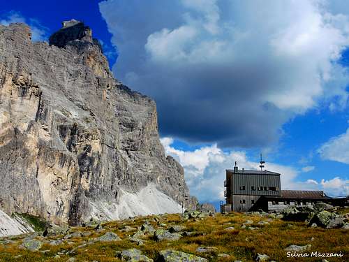
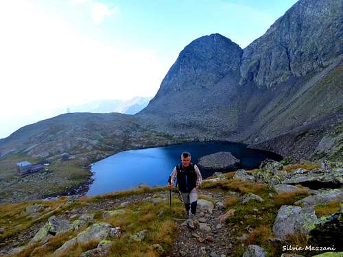
- Rifugio Calciati/Tribulaun Hütte 2369 m
Situation: beneath Tribulaun di Fleres, next to the lake of Sanes
Access: from Fleres di Dentro last parking 1465 m 3 hours E
Owner: CAI Vipiteno
Phone: +390472632470
Places: 37
Open: from the 1st of July 1st to September 30th
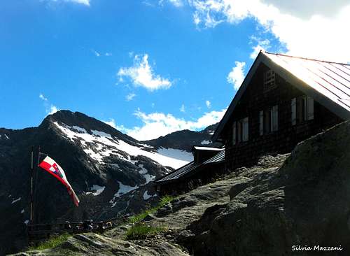
- Rifugio Cremona alla Stua/ Magdeburger-Hutte 2423 m
Situation: Stua lakes in front of the Vedretta del Montarso
Access: from Fleres di Dentro last parking 1465 m 3,30 hours E Owner: CAI Vipiteno
Phone: +390472632472 Mobile: +393401687200
Places: 55
Open: from the end of June to the end of September
- Rifugio Calciati/Tribulaun Hütte 2369 m
Posizione: sotto il Tribulaun di Fleres, vicino al lago di Sanes
Accesso: da Fleres di Dentro ultimo parcheggio 1465 m 3 ore E
Proprietario: CAI Vipiteno
Telefono: +390472632470
Luoghi: 37
Apertura: dal 1° luglio al 30 settembre
- Rifugio Cremona alla Stua/ Magdeburger-Hutte 2423 m
Situazione: Laghi della Stua davanti alla Vedretta del Montarso
Accesso: da Fleres di Dentro ultimo parcheggio 1465 m 3,30 ore E Proprietario: CAI Vipiteno
Telefono: +390472632472 Cellulare: +393401687200
Posti: 55
Apertura: da fine giugno a fine settembre
Other accomodation
When to Climb
The best period goes from July to September.
Il periodo migliore va da Luglio a Settembre.
Meteo
Guidebooks and maps


- Prestigiosi 3000 del Sudtirolo - Hans Paul Menara
- Guida alpinistica e escursionistica dell’Alto Adige Occidentale - Achille Gadler
- Tabacco Foglio n.038 1:25.000


