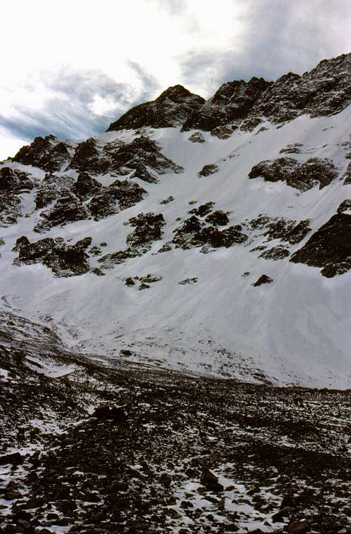
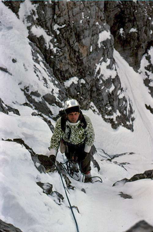
During late September, 1976 Frank Florence and I attempted this face but were turned back by a torrential rain storm that lasted for most of our trip. On the way out we were lucky to find a way across Rock Creek because the creek had risen nearly 3 feet overnight. Due to the cloud cover we never got a good look above the first cliff band: all we saw was snow so we figured this face would be no more challenging than a Sawtooth snow climb. Four weeks later Mike Weber and I went back with a 50' piece of salvaged rope, a couple of biners and a few nuts figuring this climb was going to be a piece of cake. We hiked up Rock Creek and set our camp in the trees well below the first rock band. Early the next morning we took off for the face. We were above the cliff and on to the lower morraine before we saw that the entire face was glistening with hard ice and a dusting of new snow. The heavy rain in September had stripped away all of the past winter's snow leaving a totally buffed out 2000' face of pure alpine ice. At the top of the moraine we stepped on to hard ice and didn't get off our points until we got into the sun just below the summit. Although it was hard ice, we didn't rope until the ice steepened to around 55 degrees at the bottom of the final couloir. At that point, we finally admitted to ourselves that a slip up here was going to be unstoppable with an arrest. We were happy to make the summit, but then we realized our mistake: we had left our gear at Rock Creek. Now we had to go back down to where we started and it was getting late. Descending the standard route, Chicken-Out-ridge and walking back up Rock Creek in the dark didn't sound appealing at all so we descended the east ridge until we found a ledge that runs across the top of the East Face to the Northeast Ridge. As we were poking around the top of the steep couloirs looking for the shortest way down, I stepped on a patch of snow covered ice and took off (standing) like a ski jumper on a ramp and slid maybe 20 feet to a quick stop on a tiny patch of bare rock. We both froze in our respective spots and immediately put our crampons back on. (It was one of those moments as a climber that you don't think about much at the time, but you will later, trust me.) From there, we turned down the hidden, upper most couloir of the north face and front-pointed down ice that was steeper than anything we found on the main face. We eventually made it out to the sweeping slope that descends to the morraine. The ice was so hard that even the lowest angled ice was impossible to walk on, so we had to wear crampons until we reached bare rock. Just as we got off the moraine and down the big cliff band it turned pitch dark. In the dark we were "temporarily misdirected" (totally lost but not willing to admit it). We wandered up and down the valley for almost 3 hours before we finally found our camp and belatedly celebrated our first ascent.
On January 7-8, 1977 Frank Florence, Art Troutner, Mike Weber and I came back and did a single push (no camp) winter ascent of this face. We started around 1:00 AM and didn't get back until 4:30 AM the next day. Since we had left our car and camp at Rock Creek we descended the West Face by moonlight (all of our flashlights crapped out in the sub-zero conditions) to avoid walking back from Birch Springs. A few weeks after our climb Mike and Vaughn Howard climbed the Northwest Ridge. Over the next few years Curt Olson, Mike and I made 5 more ascents of this face (typically on a new line) through 1990 when on that last trip together we observed that the average freezing level had moved up to nearly 12,000 feet. The glacier and all of the lower ice fields were nearly gone.
Oct 1976
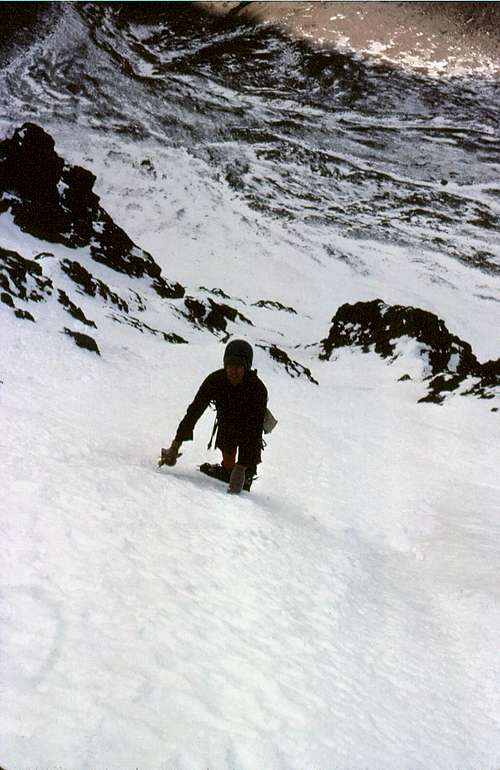
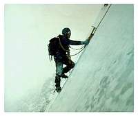
Mike "frenching" on hard ice
High on the North Face
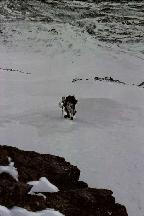
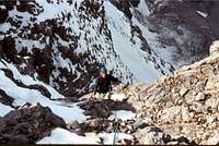
Mike in the main couloir
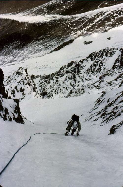
On belay in the left (Direct) couloir
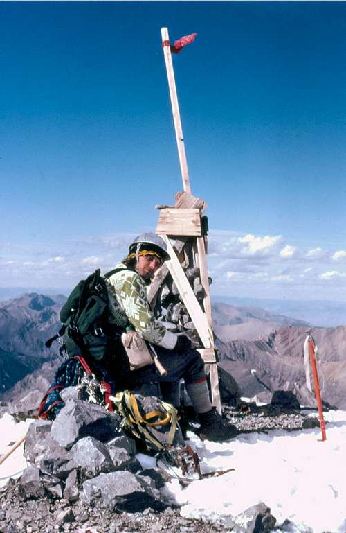
Mike on the summit of Mt Borah
First Ascent
January 1977 North Face Winter Ascent
October 1976 North Face Direct
The story we heard in the early 70s was that the first winter ascent of Mt Borah was done by Lyman Dye and party sometime in the 60s. In 2014 Lyman confirmed this was indeed true. There is also an account of a north face ascent by H. Hilbert and G. Grady in 1971* but no details of their climb have been documented. During June, 1973 Lyman Dye made a solo first ascent of what is now known as the North Face traverse using the steep, summit couloir to finish. In January 1977 Mike and Vaughn Howard climbed the northwest ridge. Later that same year over Thanksgiving weekend a tragedy occurred involving Vaughn and Guy Campbell: Avalanche on Borah.
This is a shorter hiking approach to the North Face. Drive over Doublespring Pass to the headwaters of Mahogany Creek on the east side of Mt Borah. From there you can hike over the saddle and drop in to the Rock Creek drainage from the east. Although this a much shorter walking approach, the road into Mahogany Creek from Doublespring Pass requires a high clearance, 4x vehicle (preferred) and a descent of the north face.
Note: There are 2 Rock Creeks on this mountain, one is on the western side of the range and the other on the more remote, eastern side of the range. Both are accessed from Highway 93 and the Doublespring Pass road. The description below is for the western branch of Rock Creek. This is the most commonly used and shortest driving approach to the North Face of Mt Borah.
Rock Creek (West) Approach
Rock Creek Approach Map
Rock CreekRock Creek
Over the past 35 years I have made eight climbing trips up or down this drainage. This past October I finally had the opportunity to go on a non-climbing trip where I could take the time to explore the incredibly beautiful canyon and cirque that lies below the north side of Mt Borah, and also seek the easiest way in or out. The objective of this approach is to avoid getting cliffed out on the way in and to avoid the massive scree field in the upper canyon.If you use Chicken Out Ridge for your descent, you can start at two places, Rock Creek or Birch Springs (the Mt Borah trailhead). If you start at Rock Creek and finish at Birch Springs you can take a shortcut back into Rock Creek from the last saddle that sits around 8700' on the regular Mt Borah trail instead of walking to the campground.Here's my suggestion for the easiest hike in to the face when Rock Creek is low enough to cross without difficulty. The road to Rock Creek is well described so I'll start at the upper parking spot above the small diversion dam. Park where the road makes a sharp bend and starts climbing a very steep hill (this is a hill that you do not want to drive). You will be on the left side of Rock Creek at this point. From here, folks tend to drop down to the dam and muck around in the Aspen looking for the creek crossing and trail. Instead, follow the contour (game trail) a short distance along the bare south-facing side of the canyon until you meet Rock Creek. Cross Rock Creek and then stay on the right side of the creek following a light boot trail up the canyon. A short ways up you will cross the debris from the west face drainage. The boot trail dissappears from time-to-time in the scree and on the benches but if you keep your eyes open it is fairly easy to follow. The old (and much rumored) single track road that used to run up the canyon has either eroded away or is now covered with mature trees so don't bother looking for it. When the right side of the canyon starts to steepen, cross Rock Creek and stay on the left side of the canyon until it's obvious that you can go back to the right side of the canyon. The trail traverses the fairly steep (right) side of the canyon and soon climbs to more open ground where you will get a spectacular view of the mountain. Keep your ear on Rock Creek because around the three-mile mark it disappears underground and you may not see water again until you get to the cliff band at 9800'. Be aware that during the dry season or when the face is frozen up this may be the last place to find running water.If this sounds confusing, I'll break it down. Here's where you want to be: (mileage is approximate, total mileage to bottom of NF = +-5 miles)Left side of canyon - .25 miRight side of canyon - 1.75 miLeft side of canyon - .25 miRight side of canyon - .75 mi
North Face Cirque
Biv Site
At this point you should be close to where Rock Creek goes underground and the huge cirque above becomes visible. Climb another mile or so through the trees or follow the dry bottom of Rock Creek to the cliff band that blocks access to the morraine above. If dry, the cliff band can be climbed by way of the secret passage - the narrow Class 2 gully on the left or on the 3rd class+ steps just to the right of the gully. Directly above the cliff band there is a great biv site (when dry). It includes a big rectangular rock with a number of good boulder problems. Drinking water may not be available at this site during certain times of the year. When it's wet, it's best to avoid the drainages altogether, they are delicate and can flood very rapidly on this side of the mountain.If this approach sounds too confusing then just stay on the right side of Rock Creek for the entire approach by climbing the ascending benches up the canyon. It is a steeper climb, holds snow later and leads to cliffs if you stray too high or low. If you're feeling adventurous you can try the short-cut into the cirque by following the Mike Howard Traverse.
Parents refers to a larger category under which an object falls. For example, theAconcagua mountain page has the 'Aconcagua Group' and the 'Seven Summits' asparents and is a parent itself to many routes, photos, and Trip Reports.


Comments
Post a Comment