Page Type Page Type: Trip Report
Location Lat/Lon: 
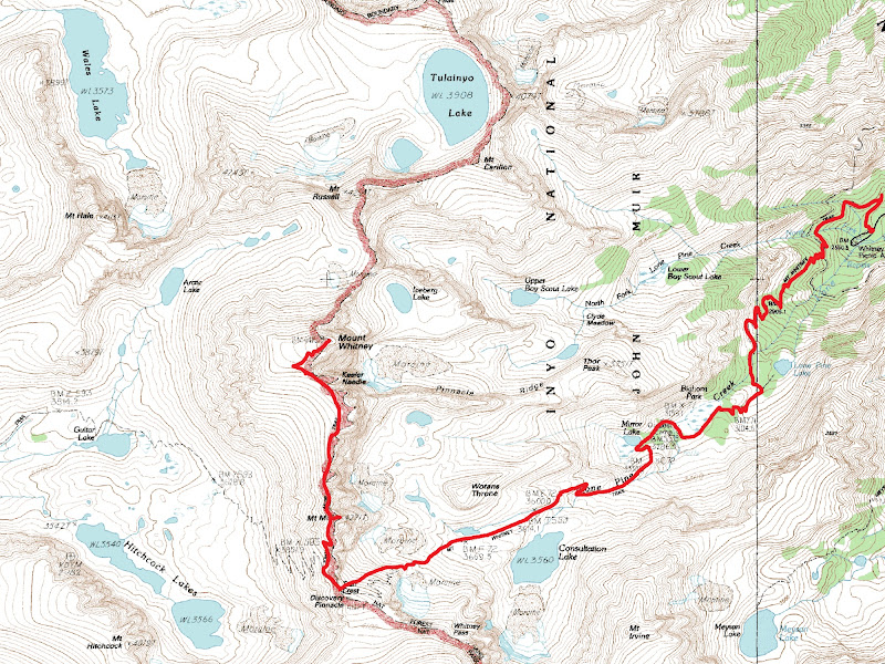
36.56390°N / 118.2911°W
Date Date Climbed/Hiked: May 28, 2005
Activities Activities: Hiking, Skiing
Seasons Season: Spring

Access from Lone Pine, CA

Take Whitney Portal Road W from 395.
Park at Whitney Portal (8365').

Run

I hiked up Whitney Trail to Trail Crest (13600') and dropped my skis because there was no consistent snow from there to either summit. Mount Whitney (14497') was straightforward, but Mount Muir (14012') was a difficult third class scramble. I then hiked back to Trail Crest and skied down to ~9600. The top of Trail Crest has a slope angle of about 40 degrees and stays near that for ~1000 vertical feet. The snow was really nice up top, but got very soft down low as expected.

Total Elevation

6,300'

Skied Elevation

~4,000'

Map


Comments

No comments posted yet.


Parents 

Parents

Parents refers to a larger category under which an object falls. For example, theAconcagua mountain page has the 'Aconcagua Group' and the 'Seven Summits' asparents and is a parent itself to many routes, photos, and Trip Reports.

Mount WhitneyTrip Reports
 
Mount MuirTrip Reports