Mount Muir & Mount Whitney 2014 Day Hike
After my first hike to the top of Mount Whitney in 2013 I found out that there is such a "club" of the 14ers. On one hand, I liked the idea of having an added purpose to my hikes but, on the other hand, I was sorry I did not get to the top of Mount Muir while going up or down from Whitney. I knew Mount Muir was in the vicinity of Whitney, but I had no clear idea where.
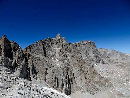
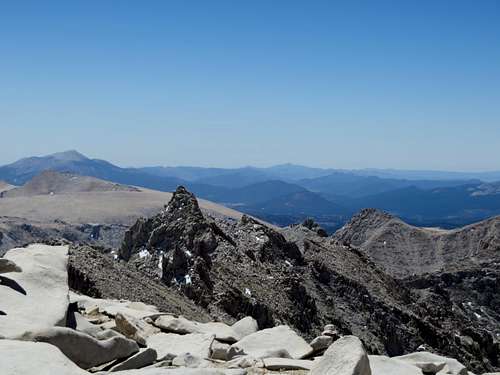
![Mount Muir]() Mount Muir - the pointy one. Whitney to the right.
Mount Muir - the pointy one. Whitney to the right.
Therefore, I decided to do my research and hike Mount Muir as a designated hike, rather than adding it to my bag as a nice, minimal effort addition to the Mount Whitney hike - which many hikers rightly do. I have to admit that, in retrospect, I am very surprised that - given the location of Mount Muir - every hiker who tops Whitney passes by it and yet, not many have any idea where it is. There is not even a small sign to tell folks "to your right - Mt. Muir." As a matter of fact, if I did not have my phone to locate me and to show me on the map the location of the summit, I would not have been able to climb it. None of the hikers I met (all of us with the maps in our hands) were able to precisely point to it.
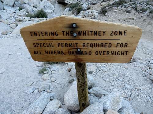
![Permit Required]() Permit Required
Permit Required
I will give my best description here. Hopefully I can make life easier for someone.
When going to Mount Muir, one has to use the same Whitney Trail that goes to the top of Mt. Whitney. Similarly, there is a day hiking permit requirement in order to go to Muir since it is situated in the Whitney Zone. The same permit rules apply, as when hiking Whitney. In other words, if one wants to hike Whitney or Muir or both in the same trip, one has to be part of the 60 day-hike permits quota, or the 40 overnight camping quota, issued by the Eastern Sierra visitor center.
My hike to Muir and Whitney was uneventful, so I will not spend time describing it. There are a million trip reports of everybody and their mama hiking this mountain, some having fun, some being miserable. I had fun and I loved every minute of it, especially having perfect weather and knowing the trail from my previous hike to Whitney in 2013.
Mount Muir is located right on the trail that goes to Mt Whitney. It is right there, hidden in plain sight. Every hiker that goes to Whitney using the Whitney Trail goes by it. In fact, it is so close to the trail, that one doesn’t have a good perspective of heights to realize that Muir is the highest of the peaks in that very vicinity. Mount Muir is located a quarter of a mile from the intersection of Whitney Trail and John Muir Trail, in the direction of Mount Whitney.
One will have to hike from Whitney Portal to the Trail Crest (9 miles), follow the trail down a bit to the intersection with John Muir Trail where there is a sign that says Mt Whitney is 1.9 miles away. From there, it is a ¼ mile going up. Now, that is tricky. Like I said, Mt Muir is so close to the trail, one can pass by it easily. I will show pictures to help with the location. Anyway, if one finds oneself approaching the Keeler’s Needles, one passed it.
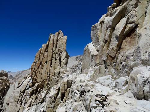
![Trail to Muir]() Trail to Muir - when this comes into view pass through this notch and Mt Muir is on the right, the peak to the left
Trail to Muir - when this comes into view pass through this notch and Mt Muir is on the right, the peak to the left
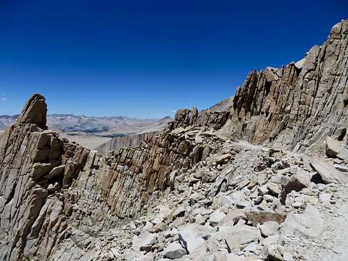
| ![Trail to Muir]() Trail to Muir - after passing through the notch above this comes into view. Stop and turn to the right. Mt Muir is the peak on the left.
Trail to Muir - after passing through the notch above this comes into view. Stop and turn to the right. Mt Muir is the peak on the left.
| ![Mount Muir from Mt Whitney]() Mount Muir from Mt Whitney
Mount Muir from Mt Whitney
| ![Trail to Muir]() Trail to Muir - coming down from Whitney, when this comes into view STOP and turn left. Mt Muir is the peak on the left.
Trail to Muir - coming down from Whitney, when this comes into view STOP and turn left. Mt Muir is the peak on the left.
|
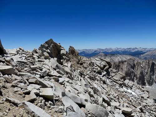
![Peak next to Muir]() Peak next to Muir
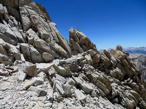
Peak next to MuirWhen I was finally sure I was close to Muir I started climbing up. It starts with a small scree hill for maybe 50 yards and then continue on a very interesting class 3 climb that requires attention more that anything else. Unfortunately, I thought Mt Muir was the summit to my right. That seemed taller looking up from the trail and the GPS seemed to indicate to it. It was only when I got up on this summit that I realized the summit to my left was higher. The distance in between these two summits, in a straight line, is no more than 100 yards. So it is not a big deal or waste of time due to hiking in the wrong direction for 2 hours. It is just there.
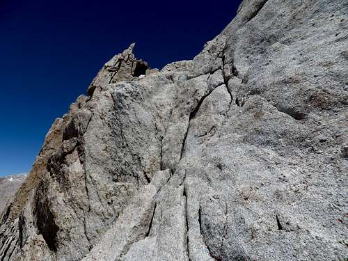
I came down this summit and made my way to Muir. The technical part was in front of me and although I never climbed a class 3 before, the route seemed straight forward. In other words, even if I was going to make a wrong move, there was only a single reasonable way of going up. At one point, I got to this vertical rock with not much to grab on to, in order to get above it. It had a vertical crack in it on the left side and the only way I went up was to jam my foot in the crack and grab the vertical part of the rock with my hands and push myself up. I did that twice and I was on top of the rock. Not a complicated move, but one that requires strong hands and agility.
![Vertical rock with crack]() Vertical rock with crack
Vertical rock with crack
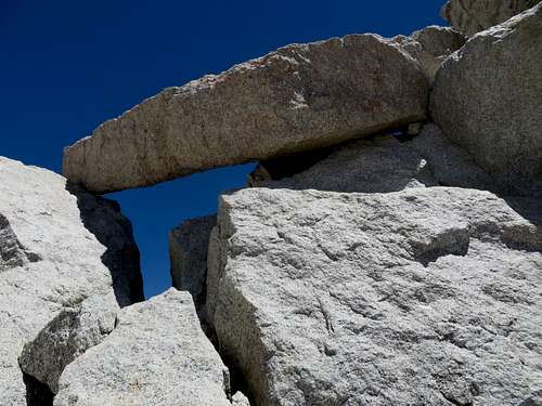
Continuing up I came across this massive suspended rock that seemed as if it would slip down from its position and obliterate me. Probably the rock had been suspended like this and dangerously looking for a thousand years. However, I was afraid to go anywhere near it or touch it. I went to the right of it.
![Suspended rock]() Suspended rock
Suspended rock
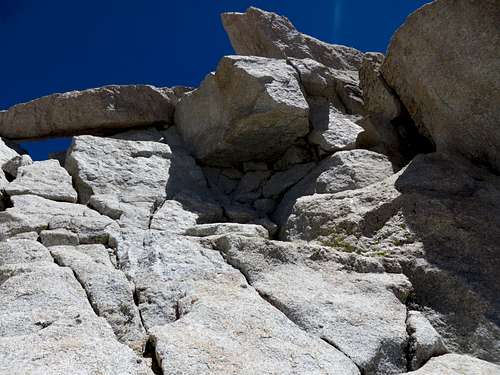
After going to the right I had to go under this other suspended rock.
![Another scary rock]() Another scary rock
Another scary rock
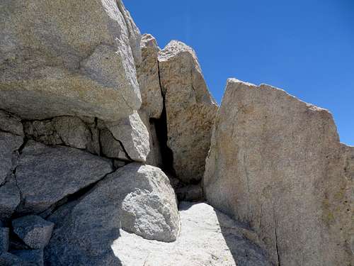
The last part of the ascent is going up this massive bolder that has a mostly smooth surface. It has, however, a few small rocks sticking out of it, which permit one to grab with the tip of the fingers and pull up.
![Up to the summit. The last climb]() Up to the summit. The last climb. I got in between these two rocks and turned to the left. I pulled myself up carefully.
Up to the summit. The last climb. I got in between these two rocks and turned to the left. I pulled myself up carefully.
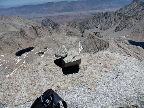
Once up, I was on top.
![Top of Muir]() Top of Muir
Top of Muir
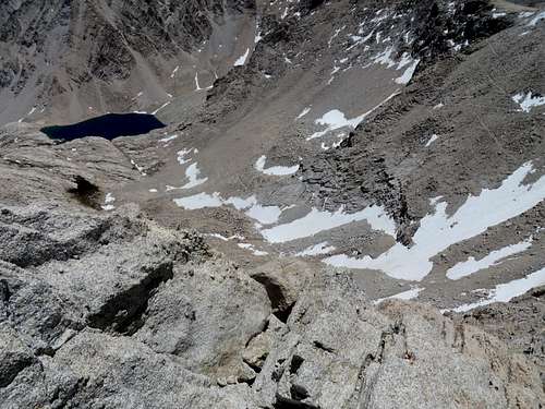
The registry is there, the views are different than from Whitney, the 99 switchbacks make for a great picture.
![the 99 switchbacks]() Consolation Lake and the 97 switchbacks
Consolation Lake and the 97 switchbacks
The top of Muir is so small; I don’t think three people would be comfortable there. I was alone and had a tough time positioning the camera to get a few pictures of myself so people will believe I was up there. I signed the registry too (the book was totally full. Yet I found a small place to write my name) since there is really nothing much to do than worry about making the wrong move and having problems. I tried to relax and take it all in but I couldn’t. It is very quiet but there were also many flies. The exposure on the East side of the mountain is no joke. On the side I climbed, it is not a big deal. Given that fact that climbing the summit is a little technical, I felt that if I slipped, there was not a whole lot of distance I would have fallen. Maybe a few feet before stopping into the scree. The best part is that Muir had a direct view of Lone Pine, just like Whitney, so I got reception on my phone. I was able to send some pics.
That’s it. From there one can go up Whitney which is a mile and a half away or go back down. And that was my 3rd 14er. Mount Muir is number 12 of the 13 forteeners.


Comments
Post a Comment